Category:Auerbach (Inn)
Jump to navigation
Jump to search
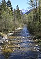
Deutsch: Der Auerbach, ein etwa 16 km langer Zufluss des Inns im Landkreis Rosenheim, Bayern.
| Object location | | View all coordinates using: OpenStreetMap |
|---|
This is the category of the protected area listed at WDPA under the ID 395477
|
This is the category of the protected area listed at WDPA under the ID 396144
|
river in Germany  | |||||
| Upload media | |||||
| Instance of | |||||
|---|---|---|---|---|---|
| Location | Bavaria, Germany | ||||
| Length |
| ||||
| Mouth of the watercourse | |||||
| Drainage basin | |||||
 | |||||
Subcategories
This category has the following 3 subcategories, out of 3 total.
A
- Auerbach at Trissl (Oberaudorf) (40 F)
T
- Tatzelwurm (waterfall) (23 F)
Media in category "Auerbach (Inn)"
The following 81 files are in this category, out of 81 total.
-
 Arzbach-Bruecke.jpg 5,184 × 3,456; 9.65 MB
-
 Auerbach - 01.jpg 4,000 × 3,000; 3.68 MB
-
 Auerbach - 02.jpg 4,000 × 3,000; 4.38 MB
-
 Auerbach - 03.jpg 4,000 × 3,000; 4.41 MB
-
 Auerbach - 04.jpg 4,000 × 3,000; 4.4 MB
-
 Auerbach - 05.jpg 4,000 × 3,000; 6.12 MB
-
 Auerbach - 06.jpg 4,000 × 3,000; 7.41 MB
-
 Auerbach - 07.jpg 4,000 × 3,000; 7.44 MB
-
 Auerbach - 08.jpg 3,264 × 2,448; 4.1 MB
-
 Auerbach - 09.jpg 3,264 × 2,448; 4.13 MB
-
 Auerbach - 10.jpg 3,264 × 2,448; 4.3 MB
-
 Auerbach - 11.jpg 3,264 × 2,448; 4.27 MB
-
 Auerbach - 12.jpg 4,000 × 3,000; 5.5 MB
-
 Auerbach - 13.jpg 4,000 × 3,000; 6.96 MB
-
 Auerbach - 14.jpg 4,000 × 3,000; 6.96 MB
-
 Auerbach - 15.jpg 3,264 × 2,448; 3.69 MB
-
 Auerbach - 16.jpg 3,264 × 2,448; 3.64 MB
-
 Auerbach - 17.jpg 3,264 × 2,448; 3.66 MB
-
 Auerbach - 18.jpg 4,000 × 3,000; 7.14 MB
-
 Auerbach - 19.jpg 4,000 × 3,000; 7.43 MB
-
 Auerbach - 20.jpg 4,000 × 3,000; 7.39 MB
-
 Auerbach - 21.jpg 3,264 × 2,448; 4.39 MB
-
 Auerbach - 22.jpg 3,264 × 2,448; 4.35 MB
-
 Auerbach - 23.jpg 4,000 × 3,000; 5.41 MB
-
 Auerbach - 24.jpg 4,000 × 3,000; 6.6 MB
-
 Auerbach - 25.jpg 4,000 × 3,000; 6.62 MB
-
 Auerbach - 26.jpg 4,000 × 3,000; 6.63 MB
-
 Auerbach - 27.jpg 4,000 × 3,000; 7.17 MB
-
 Auerbach - 28.jpg 4,000 × 3,000; 7.3 MB
-
 Auerbach - 29.jpg 4,000 × 3,000; 7.28 MB
-
 Auerbach - 30.jpg 4,000 × 3,000; 5.4 MB
-
 Auerbach - 31.jpg 3,264 × 2,448; 4.42 MB
-
 Auerbach - 32.jpg 3,264 × 2,448; 4.33 MB
-
 Auerbach - 33.jpg 3,264 × 2,448; 4.33 MB
-
 Auerbach - 37.jpg 4,000 × 3,000; 5.37 MB
-
 Auerbach - 38.jpg 4,000 × 3,000; 5.27 MB
-
 Auerbach - 39.jpg 4,000 × 3,000; 5.29 MB
-
 Auerbach - 40.jpg 4,000 × 3,000; 5.26 MB
-
 Auerbach - 41.jpg 4,000 × 3,000; 6.23 MB
-
 Auerbach - 42.jpg 4,000 × 3,000; 6.29 MB
-
 Auerbach - 43.jpg 3,264 × 2,448; 3.71 MB
-
 Auerbach - 44.jpg 3,264 × 2,448; 3.9 MB
-
 Auerbach - 45.jpg 3,264 × 2,448; 3.93 MB
-
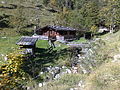 Auerbach - Almhütte am Oberlauf.jpg 2,592 × 1,944; 1.75 MB
-
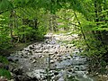
 Auerbach - Klamm im Mittellauf.jpg 2,592 × 1,944; 1.45 MB
-
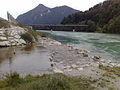
 Auerbach - Mündung in den Inn.jpg 2,592 × 1,944; 1.35 MB
-
 Auerbach - Mündung.jpg 2,592 × 1,944; 1.04 MB
-
 Auerbach - Nähe Alpenstraße.jpg 2,592 × 1,944; 1.75 MB
-
 Auerbach - Quelle 1.jpg 2,592 × 1,944; 1.08 MB
-
 Auerbach - Quelle 2.jpg 1,944 × 2,592; 1.14 MB
-
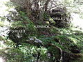 Auerbach - Quellen.jpg 2,592 × 1,944; 1.41 MB
-
 Auerbach - Unterlauf mit Sohlschwellen.jpg 2,592 × 1,944; 1.2 MB
-
 Auerbach GO-1.jpg 2,592 × 1,944; 1.8 MB
-
 Auerbach in Niederaudorf in 2016 (2).JPG 4,752 × 3,168; 7.1 MB
-
 Auerbach Inn Kranzhorn Oberaudorf-1.jpg 4,790 × 3,620; 3.68 MB
-
 Auerbach Inn Kranzhorn Oberaudorf-2.jpg 5,195 × 3,530; 4.25 MB
-
 Auerbach Naehe Tatzelwurmwinterstube Oberaudorf-1.jpg 5,472 × 3,648; 5.63 MB
-
 Auerbach Naehe Tatzelwurmwinterstube Oberaudorf-2.jpg 5,472 × 3,648; 5.45 MB
-
 Auerbach Oberaudorf-1.jpg 5,472 × 3,648; 6.33 MB
-
 Auerbach Oberaudorf-2.jpg 5,472 × 3,648; 5.45 MB
-
 Auerbach Oberaudorf-26.jpg 5,472 × 3,648; 5.84 MB
-
 Auerbach Oberaudorf-27.jpg 5,472 × 3,648; 5.65 MB
-
 Auerbach Oberaudorf-28.jpg 3,640 × 4,613; 3.6 MB
-
 Auerbach Oberaudorf-29.jpg 5,472 × 3,648; 4.12 MB
-
 Auerbach Oberaudorf-3.jpg 5,472 × 3,648; 4.48 MB
-
 Auerbach Oberaudorf-30.jpg 3,648 × 5,472; 4.6 MB
-
 Auerbach Oberaudorf-4.jpg 5,472 × 3,648; 5.65 MB
-
 Auerbach Oberaudorf-5.jpg 5,472 × 3,648; 5.98 MB
-
 Auerbach Oberaudorf-6.jpg 5,345 × 3,565; 6.33 MB
-
 Auerbach Oberaudorf-7.jpg 5,472 × 3,648; 5.73 MB
-
 Auerbach Oberaudorf-8.jpg 3,626 × 4,984; 5.01 MB
-
 Auerbach oberhalb Tatzelwurm Wasserfall Oberaudorf-1.jpg 5,115 × 3,475; 3.9 MB
-
 Auerbach oberhalb Tatzelwurm Wasserfall Oberaudorf-2.jpg 4,225 × 3,525; 3.4 MB
-
 Auerbach oberhalb Tatzelwurm Wasserfall Oberaudorf-3.jpg 4,950 × 3,470; 3.78 MB
-
 Auerbach oberhalb Tatzelwurm Wasserfall Oberaudorf-4.jpg 5,225 × 3,495; 5.16 MB
-
 Auerbach oberhalb Tatzelwurm Wasserfall Oberaudorf-5.jpg 3,619 × 4,417; 4.29 MB
-
 Auerbach Trissl Oberaudorf-1.jpg 3,640 × 5,194; 5.03 MB
-
 Auerbach Trissl Oberaudorf-2.jpg 3,648 × 5,472; 6.04 MB
-
 Auerbach Trissl Oberaudorf-3.jpg 3,648 × 5,472; 5.15 MB
-
 Auerbach.png 3,708 × 1,755; 264 KB
-
 Jackelberg Arzmoos.jpg 5,184 × 3,456; 5.97 MB


.JPG)


