Category:Atlas of World Maps
Jump to navigation
Jump to search
Media in category "Atlas of World Maps"
The following 28 files are in this category, out of 28 total.
-
 Atlantic Ocean currents (Ocean currents 1943, cropped).png 416 × 246; 127 KB
-
 Climate 4.jpg 5,485 × 2,641; 1.71 MB
-
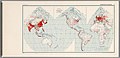 Distribution of Population 8.jpg 5,494 × 2,650; 1.77 MB
-
 Drainage Basins 7.jpg 5,488 × 2,640; 1.6 MB
-
 France 1938, 28.jpg 5,503 × 2,648; 1.65 MB
-
 General Reference Map 1.jpg 5,491 × 2,641; 1.77 MB
-
 Italy, Netherlands and Belgium 1934, 30.jpg 5,519 × 2,651; 1.67 MB
-
 Japan, Portugal and Spain 1930, 29.jpg 5,506 × 2,658; 1.69 MB
-
 Land Forms 2.jpg 5,493 × 2,660; 1.81 MB
-
 Languages 9.jpg 5,485 × 2,650; 1.68 MB
-
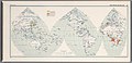
 Major Agricultural Regions 12.jpg 5,494 × 2,640; 1.74 MB
-
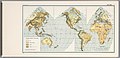
 Natural Vegetation 5.jpg 5,486 × 2,640; 1.76 MB
-
 Ocean Current and Sea Ice 3 (cropped).jpg 4,512 × 2,397; 2.11 MB
-
 Ocean Current and Sea Ice 3.jpg 5,485 × 2,653; 2.43 MB
-
 Ocean currents 1943 (borderless).png 2,577 × 1,306; 2.75 MB
-
 Ocean currents 1943 (borderless)3.png 2,577 × 1,306; 2.41 MB
-
 Ocean currents 1943 for colorblind users.png 2,577 × 1,306; 3.15 MB
-
 Ocean currents 1943.jpg 2,639 × 1,406; 5.14 MB
-
 Overseas Shipping Routes 24.jpg 5,502 × 2,653; 2.05 MB
-
 Predominant Economies 11.jpg 5,479 × 2,647; 1.69 MB
-
 Railroads and Population 25.jpg 5,484 × 2,643; 1.77 MB
-
 Religions 10.jpg 5,494 × 2,637; 1.78 MB
-
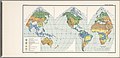
 Soils 6.jpg 5,475 × 2,644; 1.71 MB
-
 Surface Transport Facilities 22.jpg 5,507 × 2,642; 1.71 MB
-
 The British Commonwealth of Nations 27 (cropped).jpg 5,120 × 2,400; 1.47 MB
-
 The British Commonwealth of Nations 27.jpg 5,519 × 2,651; 1.73 MB
-
 The United States of America 26 (cropped).jpg 5,120 × 2,400; 1.41 MB
-
 The United States of America 26.jpg 5,504 × 2,649; 1.67 MB
.png)


.jpg)

.png)
3.png)


.jpg)

.jpg)
