Category:Atherstone
Jump to navigation
Jump to search
town in Warwickshire, England, UK  | |||||
| Upload media | |||||
| Instance of | |||||
|---|---|---|---|---|---|
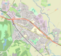
| Location | Atherstone, North Warwickshire, Warwickshire, West Midlands, England | ||||
| Population |
| ||||
| Area |
| ||||
| official website | |||||
 | |||||
Deutsch: Atherstone ist eine Stadt in Warwickshire in England mit rund 12.000 Einwohnern. Der Ort liegt an der Nordspitze der Grafschaft und ist der Verwaltungssitz des Bezirks North Warwickshire.
English: Atherstone is a town and civil parish in the English county of Warwickshire. Located in the far north of the county, Atherstone forms part of the border with Leicestershire along the A5 national route, and is only 4.5 miles from Staffordshire. It lies midway between the larger towns of Tamworth and Nuneaton and contains the administrative offices of North Warwickshire Borough Council.
Español: Atherstone es una parroquia civil y una villa del distrito de North Warwickshire, en el condado de Warwickshire (Inglaterra).
Suomi: Atherstone on kaupunki Warwickshiressa Englannissa. Se sijaitsee lähellä Warwickshiren pohjoiskärkeä, Staffordshiren Leicestershiren rajan tuntumassa ja on North Warwickshiren hallinnollinen keskus.
Nederlands: Atherstone is een plaats in het bestuurlijke gebied North Warwickshire, in het Engelse graafschap Warwickshire. De plaats telt 8293 inwoners.
Norsk nynorsk: Atherstone er ein by heilt nord i grevskapet Warwickshire i England. Han har kring 8500 innbyggjarar og ligg nær grensa til Staffordshire og Leicestershire.
Polski: Atherstone - miasto w Wielkiej Brytanii, w Anglii, w regionie West Midlands, w hrabstwie Warwickshire. W 2001 r. miasto to zamieszkiwało 8 293 osób.
Română: Atherstone este un oraș în comitatul Warwickshire, regiunea West Midlands, Anglia. Orașul se află în districtul North Warwickshire.
Srpskohrvatski / српскохрватски: Atherstone je grad u engleskoj grofoviji Warwickshire. Smješten je na krajnjem sjeveru Warwickshirea, blizu granice sa Staffordshireom i Leicestershireom te predstavlja upravno sjedište North Warwickshirea.
Simple English: Atherstone is a town near the A5 road, in Warwickshire, England. In 2001, there were 8,338 people living in Atherstone.
Svenska: Atherstone är en civil parish i North Warwickshire, Warwickshire, England. Orten har 8338 invånare (2001). Byn nämndes i Domedagsboken (Domesday Book) år 1086, och kallades då Aderestone.

Subcategories
This category has the following 8 subcategories, out of 8 total.
A
- Atherstone Locks (47 F)
- Atherstone Market Place (6 F)
- Atherstone railway station (33 F)
B
M
- St. Mary's Church, Atherstone (11 F)
P
S
Media in category "Atherstone"
The following 195 files are in this category, out of 195 total.
-
 A5 footbridge at Atherstone - geograph.org.uk - 4876101.jpg 640 × 480; 62 KB
-

-
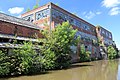
 Alder Mill - geograph.org.uk - 5971252.jpg 640 × 480; 118 KB
-
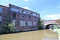
 Alder Mill on the River Anker in Atherstone, Warwickshire.jpg 640 × 480; 126 KB
-
 Alder Mill, Pinwall, Atherstone - geograph.org.uk - 6023688.jpg 640 × 480; 100 KB
-
 Allotments and flags - geograph.org.uk - 6023728.jpg 640 × 480; 63 KB
-
 Approach to Atherstone - geograph.org.uk - 5265617.jpg 4,128 × 2,322; 4.41 MB
-
 Atherstone & Mancetter map.png 1,077 × 987; 1.31 MB
-
 Atherstone - Low railway bridge - geograph.org.uk - 1608985.jpg 640 × 480; 187 KB
-
 Atherstone - Merevale House - geograph.org.uk - 1142552.jpg 640 × 480; 84 KB
-
 Atherstone - Park View - geograph.org.uk - 1142558.jpg 640 × 480; 99 KB
-
 Atherstone - The Clock - geograph.org.uk - 1142572.jpg 640 × 480; 78 KB
-
 Atherstone 11 & 13 Market Street.JPG 4,000 × 3,000; 1.27 MB
-
 Atherstone 14 &18 Market Street.JPG 4,000 × 3,000; 1.13 MB
-
 Atherstone 14 Church Street.JPG 4,000 × 3,000; 1.65 MB
-
 Atherstone 16 Coleshill Road.JPG 3,000 × 4,000; 1.71 MB
-
 Atherstone 22 Coleshill Road.JPG 3,000 × 4,000; 1.26 MB
-
 Atherstone 28-30 Coleshill Road.JPG 3,000 × 4,000; 1.35 MB
-
 Atherstone 5&7 Witherley Road.jpg 4,000 × 3,000; 1.77 MB
-
 Atherstone 6 & 8 Church Street.JPG 4,000 × 3,000; 1.16 MB
-
 Atherstone 6&8 Church Street (2).jpg 4,000 × 3,000; 1.35 MB
-
 Atherstone Ball game 2012.jpg 2,576 × 1,932; 1.23 MB
-
 Atherstone Beech House.JPG 4,000 × 3,000; 1.18 MB
-
 Atherstone Britannia Works.JPG 4,000 × 3,000; 1.84 MB
-
 Atherstone bus station - geograph.org.uk - 3355087.jpg 1,024 × 768; 205 KB
-
 Atherstone Chapel House.JPG 4,000 × 3,000; 1.57 MB
-
 Atherstone Church Street.JPG 4,000 × 3,000; 1.7 MB
-
 Atherstone Clinic - geograph.org.uk - 2376319.jpg 1,280 × 960; 334 KB
-
 Atherstone Colville House.JPG 4,000 × 3,000; 1.3 MB
-
 Atherstone CV9, UK - panoramio (1).jpg 5,472 × 3,648; 6.24 MB
-
 Atherstone CV9, UK - panoramio (2).jpg 5,472 × 3,648; 6.74 MB
-
 Atherstone CV9, UK - panoramio (7).jpg 5,472 × 3,648; 8.42 MB
-
 Atherstone CV9, UK - panoramio.jpg 5,472 × 3,648; 9.15 MB
-
 Atherstone fire station - geograph.org.uk - 288307.jpg 640 × 427; 207 KB
-
 Atherstone Friars Gate.JPG 4,000 × 3,000; 1.1 MB
-
 Atherstone Grendon House.JPG 4,000 × 3,000; 949 KB
-
 Atherstone Grendon Lodge.JPG 4,000 × 3,000; 1.85 MB
-
 Atherstone Hilton House.JPG 4,000 × 3,000; 1.22 MB
-
 Atherstone Independent Chapel.JPG 4,000 × 3,000; 1.22 MB
-
 Atherstone K6.JPG 4,000 × 3,000; 1.27 MB
-
 Atherstone Leisure Centre - geograph.org.uk - 2376220.jpg 1,280 × 853; 257 KB
-
 Atherstone Library - geograph.org.uk - 2376224.jpg 1,280 × 960; 298 KB
-

-

-

-

-
 Atherstone Locks Bridge No 42 - geograph.org.uk - 4834333.jpg 800 × 600; 167 KB
-
 Atherstone Locks No 3 in Warwickshire - geograph.org.uk - 5711999.jpg 1,280 × 960; 1.67 MB
-
 Atherstone Locks No 4 in Warwickshire - geograph.org.uk - 5711973.jpg 1,280 × 960; 1.49 MB
-
 Atherstone Market Street (the Solarium).JPG 4,000 × 3,000; 1.25 MB
-
 Atherstone Market Tavern.JPG 4,000 × 3,000; 1.29 MB
-
 Atherstone Milestone.JPG 3,000 × 4,000; 1.16 MB
-
 Atherstone Old Bank House.JPG 4,000 × 3,000; 1.38 MB
-
 Atherstone Phoenix House.JPG 4,000 × 3,000; 1.57 MB
-
 Atherstone St Mary's House.JPG 4,000 × 3,000; 1.35 MB
-
 Atherstone The Legion.JPG 4,000 × 3,000; 1.03 MB
-
 Atherstone The Mews.JPG 4,000 × 3,000; 1.33 MB
-
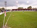
 Atherstone Town FC - geograph.org.uk - 1280328.jpg 640 × 480; 58 KB
-
 Atherstone Town FC 2009.jpg 640 × 480; 70 KB
-
 Atherstone Trinity Church.JPG 4,000 × 3,000; 1.53 MB
-
 Atherstone Upper School.JPG 4,000 × 3,000; 1.68 MB
-
 Atherstone-Derelict Factory - geograph.org.uk - 6251321.jpg 1,600 × 1,067; 619 KB
-
 Baddesley Collieries, Atherstone.png 799 × 481; 682 KB
-
 Bluebells in Purley Woods - geograph.org.uk - 7913.jpg 480 × 640; 162 KB
-
 Bottom Lodges - geograph.org.uk - 1609071.jpg 640 × 340; 182 KB
-
 Bridge No 42 at Atherstone in Warwickshire - geograph.org.uk - 5712019.jpg 1,280 × 960; 1.68 MB
-
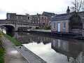
 Canal lock and bridge in Atherstone, Warwickshire - geograph.org.uk - 5711850.jpg 1,280 × 960; 1.67 MB
-
 Canalside allotments near Atherstone in Warwickshire - geograph.org.uk - 5712033.jpg 1,600 × 915; 1.29 MB
-
 Coleshill Road - geograph.org.uk - 619977.jpg 640 × 480; 70 KB
-
 Coleshill Road Bridge No 41 - geograph.org.uk - 4834190.jpg 800 × 637; 127 KB
-
 Coventry Canal - circular overflow weir - geograph.org.uk - 6024622.jpg 640 × 480; 126 KB
-

-
 Coventry Canal - the Atherstone flight - geograph.org.uk - 6024630.jpg 640 × 480; 148 KB
-

-
 Coventry Canal at Atherstone in Warwickshire - geograph.org.uk - 5711846.jpg 960 × 1,280; 1.83 MB
-
 Coventry Canal at Atherstone in Warwickshire - geograph.org.uk - 5712008.jpg 1,280 × 851; 1.62 MB
-
 Coventry Canal at Atherstone Lock No 5, Warwickshire - geograph.org.uk - 5711952.jpg 960 × 1,280; 1.69 MB
-
 Coventry Canal at Atherstone locks - geograph.org.uk - 5047701.jpg 640 × 427; 119 KB
-
 Coventry Canal Atherstone - panoramio (1).jpg 2,048 × 1,536; 1.27 MB
-
 Coventry Canal Atherstone - panoramio.jpg 2,048 × 1,536; 1.19 MB
-

-
 Coventry Canal in Atherstone - geograph.org.uk - 4834181.jpg 800 × 600; 145 KB
-
 Coventry Canal in Atherstone, Warwickshire - geograph.org.uk - 5711453.jpg 1,280 × 960; 1.68 MB
-
 Coventry Canal in Atherstone, Warwickshire - geograph.org.uk - 5712996.jpg 1,280 × 858; 1.29 MB
-
 Coventry Canal near Atherstone in Warwickshire - geograph.org.uk - 5711448.jpg 1,280 × 837; 1.25 MB
-
 Coventry Canal, Atherstone - geograph.org.uk - 6024606.jpg 640 × 480; 118 KB
-
 Coventry Canal, Atherstone - geograph.org.uk - 6025480.jpg 640 × 480; 111 KB
-

-

-

-

-

-
 Coventry Canal, Reach in Atherstone - geograph.org.uk - 3143581.jpg 640 × 480; 77 KB
-
 Coventry Canal, Reach near Rawn Hill - geograph.org.uk - 3144404.jpg 640 × 480; 83 KB
-

-
 Derelict buildings north of Long Street - geograph.org.uk - 2376342.jpg 1,280 × 853; 373 KB
-

-

-
 Former hat factory - geograph.org.uk - 6042615.jpg 640 × 480; 85 KB
-
 Former hat factory - geograph.org.uk - 6042624.jpg 640 × 480; 80 KB
-
 Former hat factory, Atherstone - geograph.org.uk - 6026942.jpg 640 × 480; 94 KB
-
 Former hat factory, Atherstone - geograph.org.uk - 6026958.jpg 640 × 480; 62 KB
-
 Former printing works - geograph.org.uk - 2376337.jpg 1,280 × 960; 355 KB
-
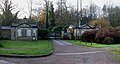
 Gatehouses to Merevale Hall - geograph.org.uk - 3836800.jpg 2,727 × 1,646; 2.13 MB
-
 Grendon, UK - panoramio (1).jpg 5,472 × 3,648; 5.44 MB
-
 Grendon, UK - panoramio (2).jpg 5,472 × 3,648; 6.46 MB
-
 Grendon, UK - panoramio (3).jpg 5,472 × 3,648; 8.03 MB
-
 Grendon, UK - panoramio.jpg 5,472 × 3,648; 7.07 MB
-
 Holly Lane near Atherstone in Warwickshire - geograph.org.uk - 5711358.jpg 1,280 × 883; 1.15 MB
-
 Holly Lane near Atherstone in Warwickshire - geograph.org.uk - 5711362.jpg 1,280 × 878; 1.08 MB
-
 Josh Pugh headshot.jpg 512 × 634; 82 KB
-
 Layby on the A5 - geograph.org.uk - 3855509.jpg 3,229 × 1,657; 2.16 MB
-
 Leicestershire ahead - geograph.org.uk - 6023693.jpg 640 × 480; 91 KB
-
 Lock No 4 at Atherstone in Warwickshire - geograph.org.uk - 5711948.jpg 1,280 × 960; 1.67 MB
-
 Lock No 4 at Atherstone in Warwickshire - geograph.org.uk - 5711956.jpg 1,280 × 960; 1.54 MB
-
 Lock No 4 at Atherstone in Warwickshire - geograph.org.uk - 5711958.jpg 960 × 1,280; 1.59 MB
-
 Lock No 6 near Atherstone in Warwickshire - geograph.org.uk - 5711302.jpg 1,280 × 960; 1.36 MB
-
 Lock No. 2 Atherstone flight - geograph.org.uk - 6025471.jpg 640 × 480; 82 KB
-
 Lock No. 2 on the Atherstone flight - geograph.org.uk - 6025468.jpg 640 × 473; 116 KB
-
 Lock No. 3 on the Atherstone flight - geograph.org.uk - 6025461.jpg 640 × 480; 147 KB
-
 Lock sidepond north-west of Atherstone, Warwickshire - geograph.org.uk - 5711946.jpg 1,280 × 960; 1.87 MB
-
 Looking down the Atherstone flight - geograph.org.uk - 6024632.jpg 640 × 480; 135 KB
-
 Looking down the Atherstone flight - geograph.org.uk - 6025453.jpg 640 × 480; 147 KB
-
 Low bridge on Old Watling Street - geograph.org.uk - 1608982.jpg 640 × 480; 179 KB
-
 Merevale Road, Atherstone - geograph.org.uk - 6023727.jpg 640 × 480; 79 KB
-
 Milestone - geograph.org.uk - 5190603.jpg 1,024 × 683; 159 KB
-
 Minion's Wharf - geograph.org.uk - 6026933.jpg 640 × 480; 84 KB
-
 Minion's Wharf and former coal yard - geograph.org.uk - 6026953.jpg 640 × 480; 97 KB
-
 Minion's Wharf from Top Lock - geograph.org.uk - 6025489.jpg 640 × 479; 87 KB
-
 Minion's Wharf, Atherstone - geograph.org.uk - 6042628.jpg 640 × 480; 68 KB
-
 Minion's Wharf, Atherstone - geograph.org.uk - 6042639.jpg 640 × 480; 66 KB
-
 Minions Wharfe - geograph.org.uk - 1591850.jpg 640 × 480; 58 KB
-
 Moored narrowboats at Atherstone - geograph.org.uk - 5047686.jpg 640 × 427; 101 KB
-

-

-

-
 Narrowboats at Atherstone Lock No 5, Warwickshire - geograph.org.uk - 5711454.jpg 960 × 1,280; 1.61 MB
-
 Narrowboats at Atherstone Lock No 5, Warwickshire - geograph.org.uk - 5711843.jpg 1,280 × 837; 1.38 MB
-
 Old Milestone - geograph.org.uk - 5190594.jpg 683 × 1,024; 189 KB
-
 Old pumps at Alder Mill - geograph.org.uk - 6023705.jpg 640 × 480; 207 KB
-
 Ordnance Survey Drawings - Sutton Coldfield (OSD 257).jpg 4,000 × 2,666; 3.52 MB
-
 Outwoods Bridge near Atherstone, Warwickshire - geograph.org.uk - 5713007.jpg 1,280 × 875; 1.6 MB
-
 Outwoods Bridge No 38 - geograph.org.uk - 4834149.jpg 800 × 554; 178 KB
-
 Queen Elizabeth School, Atherstone. - geograph.org.uk - 367029.jpg 640 × 480; 136 KB
-
 Railway near Atherstone, Warwickshire - geograph.org.uk - 1149449.jpg 640 × 436; 136 KB
-

-
 Ratcliffe Road overbridge - geograph.org.uk - 3855508.jpg 3,208 × 2,087; 3.26 MB
-
 Ratcliffe Road, Atherstone - geograph.org.uk - 683374.jpg 640 × 543; 102 KB
-
 Atherstone by Alfred C. Rodriguez, 1887.jpg 2,498 × 1,716; 859 KB
-
 Rothen's Wharf, Atherstone - geograph.org.uk - 211541.jpg 640 × 480; 72 KB
-
 Rowlands Way - geograph.org.uk - 1414050.jpg 610 × 360; 98 KB
-
 Sheepy Road car park - geograph.org.uk - 2376352.jpg 1,280 × 960; 349 KB
-
 Side of The Clock with CCTV camera. - geograph.org.uk - 2376299.jpg 1,024 × 1,280; 345 KB
-
 Sir William Dugdale Portrait Bronze.jpg 1,451 × 2,066; 1.4 MB
-
 Stream near Mythe Lane - geograph.org.uk - 3621687.jpg 2,925 × 2,843; 2.92 MB
-
 Sub-station, Atherstone - geograph.org.uk - 4761418.jpg 640 × 426; 70 KB
-

-

-

-
 The Coventry Canal at Atherstone, Warwickshire - geograph.org.uk - 5280119.jpg 1,024 × 1,024; 866 KB
-
 The Coventry Canal, Atherstone - geograph.org.uk - 5974299.jpg 480 × 640; 110 KB
-
 The former Alder Mill - geograph.org.uk - 6023698.jpg 640 × 480; 139 KB
-
 The former Alder Mill near Atherstone - geograph.org.uk - 6023702.jpg 640 × 480; 145 KB
-
 The River Anker, Atherstone - geograph.org.uk - 683376.jpg 640 × 433; 75 KB
-
 TNT (UK) Distribution Centre - geograph.org.uk - 3657620.jpg 640 × 279; 43 KB
-
 TNT (UK) Ltd Distribution Centre - geograph.org.uk - 2838181.jpg 640 × 294; 40 KB
-
 TNT Articulated Solo Trucks - geograph.org.uk - 1768655.jpg 1,600 × 1,147; 309 KB
-
 TNT Depot - geograph.org.uk - 3856429.jpg 640 × 380; 39 KB
-
 TNT Depot - geograph.org.uk - 3856432.jpg 640 × 350; 43 KB
-
 TNT depot at Atherstone - geograph.org.uk - 4199874.jpg 1,024 × 768; 105 KB
-
 TNT Distribution Centre - geograph.org.uk - 4894931.jpg 640 × 426; 56 KB
-
 TNT Distribution Centre - geograph.org.uk - 4902499.jpg 640 × 426; 46 KB
-
 TNT Parked Solo Lorry Units - geograph.org.uk - 1768682.jpg 1,978 × 1,197; 1.01 MB
-
 TNT Solo Lorry Units - geograph.org.uk - 1768671.jpg 3,885 × 2,048; 2.88 MB
-
 TNT Trailers - geograph.org.uk - 1363489.jpg 640 × 258; 33 KB
-
 TNT UK (Ltd) Distribution Centre - geograph.org.uk - 3652444.jpg 640 × 393; 38 KB
-
 Top Lock and Minion's Wharf - geograph.org.uk - 6026966.jpg 640 × 480; 89 KB
-
 Top Lock House at Atherstone - geograph.org.uk - 5047693.jpg 640 × 427; 91 KB
-

-

-
 Warning notice by low bridge, Atherstone - geograph.org.uk - 1609023.jpg 640 × 458; 154 KB
-

-
 Welcome to Atherstone - geograph.org.uk - 683366.jpg 640 × 414; 71 KB
-
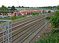
 West Coast Main Line (Trent Valley) near Atherstone - geograph.org.uk - 5711342.jpg 1,280 × 960; 1.56 MB
-
 West Coast Main Line (Trent Valley) near Atherstone - geograph.org.uk - 5711350.jpg 1,600 × 1,006; 1.88 MB
-
 West Coast Main Line (Trent Valley) near Atherstone - geograph.org.uk - 5711353.jpg 1,440 × 1,001; 1.74 MB
-
 West Coast Main Line (Trent Valley) near Atherstone - geograph.org.uk - 5711367.jpg 1,280 × 934; 1.54 MB
-
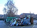 What a mess^ - geograph.org.uk - 1640562.jpg 640 × 483; 90 KB
-
 Wilson and Stafford Hat Factory - geograph.org.uk - 619986.jpg 640 × 480; 62 KB
-
 Atherstone By-Pass - geograph.org.uk - 260657.jpg 640 × 480; 88 KB
-
 Bee Hive Cottage - geograph.org.uk - 8014.jpg 640 × 480; 148 KB
-
 Croft Road, Atherstone - geograph.org.uk - 260498.jpg 640 × 480; 98 KB
-

-
 Ratcliffe Road Bridge, Atherstone - geograph.org.uk - 683375.jpg 640 × 473; 77 KB
-
 Sandpaper factory - geograph.org.uk - 8019.jpg 640 × 480; 117 KB


.jpg)


.jpg)
.jpg)
.jpg)


.JPG)


.jpg)


.jpg)
.jpg)
.jpg)


.jpg)


_Distribution_Centre_-_geograph.org.uk_-_3657620.jpg)
_Ltd_Distribution_Centre_-_geograph.org.uk_-_2838181.jpg)


_Distribution_Centre_-_geograph.org.uk_-_3652444.jpg)


_near_Atherstone_-_geograph.org.uk_-_5711342.jpg)
_near_Atherstone_-_geograph.org.uk_-_5711350.jpg)
_near_Atherstone_-_geograph.org.uk_-_5711353.jpg)
_near_Atherstone_-_geograph.org.uk_-_5711367.jpg)


