Category:Athelington
Jump to navigation
Jump to search
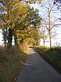
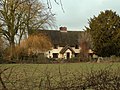
English: Athelington is a village and civil parish in the Mid Suffolk district of Suffolk, England, about south-east from Diss.
village in United Kingdom  | |||||
| Upload media | |||||
| Instance of | |||||
|---|---|---|---|---|---|
| Location | Mid Suffolk, Suffolk, East of England, England | ||||
 | |||||
Subcategories
This category has only the following subcategory.
S
- St Peter's Church, Athelington (15 F)
Media in category "Athelington"
The following 75 files are in this category, out of 75 total.
-
 A stile on Southolt Road - geograph.org.uk - 353207.jpg 640 × 474; 122 KB
-
 Athelington Farm Building Water Lane - geograph.org.uk - 5321244.jpg 1,920 × 1,469; 678 KB
-
 Athelington Hall Log Cabins - geograph.org.uk - 3494623.jpg 1,024 × 768; 237 KB
-
 Athelington Hall sign - geograph.org.uk - 2697977.jpg 2,304 × 3,072; 1.4 MB
-
 Athelington Hall sign - geograph.org.uk - 2697979.jpg 2,304 × 3,072; 1.56 MB
-
 Athelington Hall signs - geograph.org.uk - 2697974.jpg 2,304 × 3,072; 1.3 MB
-
 Athelington Road, Athelington - geograph.org.uk - 2697995.jpg 3,072 × 2,304; 1.36 MB
-
 Athelington Road, Athelington - geograph.org.uk - 2697997.jpg 2,304 × 3,072; 1.18 MB
-
 Athelington sign - geograph.org.uk - 2697481.jpg 3,072 × 2,304; 1.55 MB
-
 Brick Kiln Farm - geograph.org.uk - 3494687.jpg 1,024 × 768; 274 KB
-
 Church Farm - geograph.org.uk - 3494646.jpg 1,024 × 768; 214 KB
-
 Cottage in Athelington, Suffolk - geograph.org.uk - 2041632.jpg 640 × 480; 74 KB
-
 Country Road - geograph.org.uk - 3780032.jpg 1,024 × 768; 273 KB
-
 Entering Athelington ^ Horham - geograph.org.uk - 2697254.jpg 3,072 × 2,304; 1.43 MB
-
 Farm House And Signs - geograph.org.uk - 3494654.jpg 1,024 × 768; 232 KB
-
 Footbridge of footpath off Water Lane - geograph.org.uk - 2694635.jpg 2,304 × 3,072; 1.45 MB
-
 Footpath amendment notice on the footpath - geograph.org.uk - 2694643.jpg 2,304 × 3,072; 1.68 MB
-
 Footpath Junction - geograph.org.uk - 3494617.jpg 1,024 × 768; 195 KB
-
 Footpath off Water Lane (U5606) - geograph.org.uk - 2694623.jpg 3,072 × 2,304; 1.67 MB
-
 Footpath off Water Lane (U5606) - geograph.org.uk - 2694628.jpg 2,304 × 3,072; 1.6 MB
-
 Footpath off Water Lane - geograph.org.uk - 2694638.jpg 3,072 × 2,304; 1.36 MB
-
 Footpath to Athelington Church - geograph.org.uk - 2695166.jpg 3,072 × 2,304; 1.28 MB
-
 Footpath to Athelington Church - geograph.org.uk - 2695168.jpg 2,304 × 3,072; 1.39 MB
-
 Footpath to Athelington Hall - geograph.org.uk - 2697173.jpg 2,304 × 3,072; 1.65 MB
-
 Footpath to Athelington Hall - geograph.org.uk - 2697178.jpg 2,304 × 3,072; 1.54 MB
-
 Footpath to Athelington Hall - geograph.org.uk - 2697182.jpg 2,304 × 3,072; 1.63 MB
-
 Footpath to Brick Kiln Farm ^ Fingal Street - geograph.org.uk - 2695169.jpg 3,072 × 2,304; 1.37 MB
-
 Footpath to Brick Kiln Farm ^ Fingal Street - geograph.org.uk - 2695170.jpg 3,072 × 2,304; 1.29 MB
-
 Footpath to Southolt Hall - geograph.org.uk - 2697249.jpg 3,072 × 2,304; 1.3 MB
-
 Footpath to Southolt Road - geograph.org.uk - 2697483.jpg 3,072 × 2,304; 1.52 MB
-
 Footpath to Worlingworth Road - geograph.org.uk - 2697988.jpg 2,304 × 3,072; 1.55 MB
-
 Green Footpath - geograph.org.uk - 3494692.jpg 768 × 1,024; 253 KB
-
 Grove Farm Postbox - geograph.org.uk - 2697113.jpg 3,072 × 2,304; 1.67 MB
-
 Grove Farm Postbox - geograph.org.uk - 2697119.jpg 2,304 × 3,072; 1.67 MB
-
 Grove Farm Postbox - geograph.org.uk - 2697126.jpg 2,304 × 3,072; 1.68 MB
-
 Grove Farm, Athelington, Suffolk - geograph.org.uk - 2041663.jpg 640 × 480; 71 KB
-
 Horam Road - geograph.org.uk - 2697151.jpg 2,304 × 3,072; 1.49 MB
-
 Horham Road ^ The entrance to Athelington Hall - geograph.org.uk - 2697970.jpg 3,072 × 2,304; 1.42 MB
-
 Horham Road ^ The entrance to Athelington Hall - geograph.org.uk - 2697971.jpg 3,072 × 2,304; 1.37 MB
-
 Horham Road, Athelington - geograph.org.uk - 2697954.jpg 2,304 × 3,072; 1.33 MB
-
 Horham Road, Athelington - geograph.org.uk - 2697981.jpg 3,072 × 2,304; 1.32 MB
-
 Horham Road, Athelington - geograph.org.uk - 2697993.jpg 2,304 × 3,072; 1.42 MB
-

-
 In the grounds of Athelington Hall - geograph.org.uk - 858206.jpg 640 × 294; 36 KB
-
 Map of Footpath amendment notice - geograph.org.uk - 2694647.jpg 2,304 × 3,072; 1.38 MB
-
 Pargetted cottage at Athelington - geograph.org.uk - 2041630.jpg 640 × 480; 97 KB
-
 Rivet Athelington Culvert Southolt Road - geograph.org.uk - 5321238.jpg 2,231 × 2,231; 3.47 MB
-
 Road Junction - geograph.org.uk - 3494643.jpg 1,024 × 768; 308 KB
-
 Road Junction - geograph.org.uk - 3494694.jpg 1,024 × 768; 244 KB
-
 Roadsign at Worlingham Road junction - geograph.org.uk - 2699503.jpg 1,980 × 2,640; 1.66 MB
-
 Roadsign on Southolt Road - geograph.org.uk - 2697123.jpg 2,304 × 3,072; 1.6 MB
-
 Roadsign on Worlingworth Road - geograph.org.uk - 2695172.jpg 2,304 × 3,072; 1.31 MB
-
 Roadsign on Worlingworth Road - geograph.org.uk - 2699482.jpg 2,304 × 3,072; 1.45 MB
-
 Southolt Road - geograph.org.uk - 2695167.jpg 2,304 × 3,072; 1.61 MB
-
 Southolt Road - geograph.org.uk - 2695171.jpg 3,072 × 2,304; 1.29 MB
-
 Southolt Road - geograph.org.uk - 2697138.jpg 3,072 × 2,304; 1.52 MB
-
 Southolt Road - geograph.org.uk - 2697141.jpg 2,304 × 3,072; 1.44 MB
-
 Southolt Road - geograph.org.uk - 2697189.jpg 2,304 × 3,072; 1.39 MB
-
 Southolt Road - geograph.org.uk - 2697193.jpg 2,304 × 3,072; 1.46 MB
-
 Southolt Road - geograph.org.uk - 2699492.jpg 2,304 × 3,072; 1.31 MB
-
 Southolt Road - geograph.org.uk - 3494658.jpg 768 × 1,024; 352 KB
-
 Southolt Road ^ footpath - geograph.org.uk - 2694669.jpg 3,072 × 2,304; 1.62 MB
-
 Southolt Road ^ Grove Farm Postbox - geograph.org.uk - 2697104.jpg 3,072 × 2,304; 1.41 MB
-
 Southolt Road ^ Grove Farm Postbox - geograph.org.uk - 2697109.jpg 3,072 × 2,304; 1.53 MB
-
 Text of Footpath amendment notice - geograph.org.uk - 2694651.jpg 2,304 × 3,072; 1.45 MB
-
 The entrance to Athelington Hall - geograph.org.uk - 2697973.jpg 2,304 × 3,072; 1.32 MB
-
 The Leaning Pole Of Athelington - geograph.org.uk - 3494675.jpg 768 × 1,024; 230 KB
-
 Tudor Rose on the gable end - geograph.org.uk - 2041645.jpg 640 × 480; 83 KB
-
 Water Lane sign - geograph.org.uk - 2694665.jpg 3,072 × 2,304; 1.51 MB
-
 Water Lane, Worlingworth - geograph.org.uk - 2694664.jpg 3,072 × 2,304; 1.63 MB
-
 Worlingworth Road - geograph.org.uk - 2699481.jpg 3,072 × 2,304; 1.35 MB
-
 Farmhouse at Yew Tree Farm - geograph.org.uk - 342472.jpg 640 × 465; 115 KB
-
 Footpath to Worlingworth - geograph.org.uk - 353193.jpg 640 × 480; 96 KB
-
 Looking down Horham Road - geograph.org.uk - 353198.jpg 640 × 456; 77 KB
-
 Thatched cottage at White Hall Farm - geograph.org.uk - 325613.jpg 640 × 480; 88 KB


_-_geograph.org.uk_-_2694623.jpg)
_-_geograph.org.uk_-_2694628.jpg)


