Category:Aston-on-Trent
Jump to navigation
Jump to search
village in Derbyshire, UK  | |||||
| Upload media | |||||
| Instance of | |||||
|---|---|---|---|---|---|
| Location | Aston upon Trent, South Derbyshire, Derbyshire, East Midlands, England | ||||
 | |||||
Subcategories
This category has the following 3 subcategories, out of 3 total.
A
- Aston Hall, South Derbyshire (2 F)
L
- Harry Linacre (8 F)
Media in category "Aston-on-Trent"
The following 51 files are in this category, out of 51 total.
-
 100 Yards to Go - geograph.org.uk - 1369258.jpg 480 × 640; 82 KB
-
 10Weston Road.jpg 1,944 × 2,592; 1.26 MB
-
 16 The Green, Aston-on-Trent.jpg 1,280 × 905; 320 KB
-
 16 Weston Road, Aston-on-Trent.jpg 1,280 × 879; 314 KB
-
 2 and 4 Weston Road, Aston-on-Trent.jpg 1,280 × 939; 340 KB
-
 6 The Green, Aston-on-Trent.jpg 1,280 × 960; 448 KB
-
 A50Services225.JPG 737 × 486; 283 KB
-
 A50Services24.JPG 1,280 × 960; 614 KB
-
 Acrelane Bridge - geograph.org.uk - 1542310.jpg 640 × 428; 75 KB
-

-
 Aston flood.jpg 2,448 × 3,264; 2.57 MB
-
 Aston Lock.jpg 1,600 × 1,200; 169 KB
-
 Aston north along main st.jpg 640 × 364; 101 KB
-
 Aston on Trent important building 2.jpg 3,264 × 2,448; 1,010 KB
-
 Aston on Trent important building.jpg 3,264 × 2,448; 636 KB
-
 Aston on Trent Post Office.JPG 1,280 × 960; 257 KB
-
 Aston on Trent Primary School - geograph.org.uk - 58741.jpg 640 × 480; 91 KB
-
 Aston shop.jpg 2,592 × 1,944; 1.44 MB
-
 Aston view.jpg 3,264 × 2,448; 1.6 MB
-
 Aston water.jpg 3,264 × 2,448; 2.83 MB
-
 Aston-on-Trent - geograph.org.uk - 6410.jpg 640 × 480; 157 KB
-
 Between aston and shardlow.jpg 3,264 × 2,448; 1.06 MB
-
 Burial ground, Aston-on-Trent - geograph.org.uk - 6411.jpg 640 × 480; 169 KB
-
 Bus Shelter, Aston-on-Trent.jpg 960 × 1,280; 350 KB
-
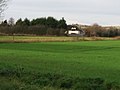
 Field track west of Aston-on-Trent - geograph.org.uk - 679211.jpg 640 × 429; 78 KB
-
 Fields west of Aston-on-Trent - geograph.org.uk - 679203.jpg 640 × 429; 74 KB
-
 Former gravel pits south of Shardlow - geograph.org.uk - 655300.jpg 640 × 419; 85 KB
-
 Gravel Pit, Aston Upon Trent - geograph.org.uk - 5289.jpg 640 × 258; 26 KB
-
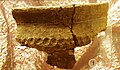 Iron Age Pot from Aston on Trent.jpg 1,622 × 948; 383 KB
-
 Led more Listed building in Aston on Trent.jpg 3,264 × 2,448; 1.03 MB
-
 Ledmore Listed building in Aston 2017.jpg 3,264 × 2,448; 1.03 MB
-
 Ledmore Listed building's in Aston 2017.jpg 3,264 × 2,448; 857 KB
-
 Ledmore, Aston-on-Trent.jpg 1,280 × 975; 306 KB
-
 Longcroft Farmhouse, Aston-on-Trent.jpg 1,280 × 960; 283 KB
-
 Looking towards Aston on Trent - geograph.org.uk - 132748.jpg 640 × 479; 138 KB
-
 Posey Lane, Aston-on-Trent - geograph.org.uk - 369784.jpg 640 × 480; 96 KB
-
 Shardlow Road, Aston-on-Trent - geograph.org.uk - 714590.jpg 640 × 442; 83 KB
-
 Sky over Aston-on-Trent - geograph.org.uk - 655477.jpg 640 × 435; 83 KB
-
 Swan and ducks near Weston on Trent - geograph.org.uk - 575642.jpg 482 × 640; 93 KB
-
 The aston malt.jpg 3,264 × 2,448; 2.51 MB
-

-

-

-

-

-

-

-

-
-
 Well dressing at Aston-on-Trent - geograph.org.uk - 373978.jpg 480 × 640; 96 KB
-
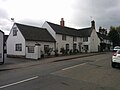
 White hart aston.jpg 3,264 × 2,448; 2.42 MB


