Category:Askham, Cumbria
Jump to navigation
Jump to search

village and civil parish in the Eden District of Cumbria, England  | |||||
| Upload media | |||||
| Instance of | |||||
|---|---|---|---|---|---|
| Location | Eden, Cumbria, North West England, England | ||||
| Said to be the same as | Askham (Wikimedia duplicated page, civil parish) | ||||
 | |||||
English: Askham is a village and civil parish in the Eden district of Cumbria, England. According to the 2001 census the parish had a population of 360. It is situated in the eastern edge of the Lake District National Park, about five miles south of Penrith.
Subcategories
This category has the following 5 subcategories, out of 5 total.
A
- Askham Hall (8 F)
H
- Helton, Cumbria (8 F)
P
- Punchbowl Inn, Askham (2 F)
Q
- The Queens Head, Askham (4 F)
S
- St Peter's church, Askham (8 F)
Media in category "Askham, Cumbria"
The following 200 files are in this category, out of 286 total.
(previous page) (next page)-
 1819 JH house Askham - panoramio.jpg 3,072 × 1,728; 2.29 MB
-
 A "royal" signpost near Askham - geograph.org.uk - 1240400.jpg 640 × 487; 392 KB
-
 A lizard on Heughscar Hill - geograph.org.uk - 3193123.jpg 539 × 640; 153 KB
-
 A scene in Askham - geograph.org.uk - 5899291.jpg 4,000 × 3,000; 4.9 MB
-
 A splendid tree - geograph.org.uk - 6120469.jpg 640 × 480; 252 KB
-
 A Wofa Hole, Moor Divock - geograph.org.uk - 74039.jpg 640 × 480; 56 KB
-
 Access to the moor - geograph.org.uk - 5794095.jpg 3,239 × 3,595; 2.58 MB
-
 Afternoon sun on a cottage above Askham - geograph.org.uk - 3191378.jpg 640 × 480; 103 KB
-

-
 Anna's Sike - geograph.org.uk - 4029746.jpg 640 × 480; 116 KB
-
 Askham - geograph.org.uk - 2670733.jpg 4,592 × 3,056; 5.58 MB
-
 Askham Bridge - Countess Stone - panoramio.jpg 4,224 × 2,376; 3.11 MB
-
 Askham Bridge - geograph.org.uk - 2913853.jpg 1,024 × 708; 400 KB
-
 Askham Bridge - panoramio.jpg 4,224 × 2,376; 3.44 MB
-

-
 Askham Bridge from riverside track - geograph.org.uk - 3150004.jpg 3,264 × 2,448; 3.05 MB
-
 Askham Bridge, River Lowther.JPG 1,712 × 2,288; 1.31 MB
-
 Askham Bridge.jpg 640 × 441; 188 KB
-
 Askham Church - geograph.org.uk - 5176490.jpg 640 × 427; 368 KB
-
 Askham Fell - geograph.org.uk - 3003562.jpg 2,592 × 1,944; 1.93 MB
-
 Askham Fell Cairn stone row - geograph.org.uk - 5681247.jpg 1,600 × 1,151; 1.08 MB
-
 Askham Fell stone row - geograph.org.uk - 5681238.jpg 1,600 × 1,040; 970 KB
-
 Askham Hall - geograph.org.uk - 3191933.jpg 628 × 640; 144 KB
-
 Askham Hall - geograph.org.uk - 3999570.jpg 1,000 × 712; 186 KB
-
 Askham Hall Farmhouse - geograph.org.uk - 5794982.jpg 3,868 × 2,466; 1.89 MB
-
 Askham Stores - geograph.org.uk - 4024251.jpg 640 × 480; 449 KB
-
 Askham swimming pool - geograph.org.uk - 3045393.jpg 640 × 480; 87 KB
-
 Askham Village (34264493613).jpg 5,217 × 2,797; 8.66 MB
-
 Askham village - geograph.org.uk - 5836234.jpg 2,048 × 1,536; 1.36 MB
-
 Askham village centre - geograph.org.uk - 2645153.jpg 1,600 × 767; 361 KB
-
 Askham Village Green - geograph.org.uk - 3877860.jpg 4,320 × 3,240; 4.85 MB
-
 Askham village green - geograph.org.uk - 5026516.jpg 1,024 × 683; 920 KB
-

-
 Barn - geograph.org.uk - 175656.jpg 640 × 480; 224 KB
-
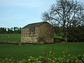 Barn - geograph.org.uk - 175657.jpg 640 × 480; 198 KB
-
 Barn, Haber Hill - geograph.org.uk - 5177779.jpg 640 × 426; 421 KB
-
 Beckfoot Bridge - geograph.org.uk - 2670700.jpg 4,592 × 3,056; 7.64 MB
-
 Boundary Post at Wartches - geograph.org.uk - 3275338.jpg 3,456 × 4,608; 3.19 MB
-

-
 Bracken Bales - geograph.org.uk - 3203544.jpg 2,560 × 1,920; 1.22 MB
-
 Bracken covered slopes - geograph.org.uk - 5087177.jpg 1,500 × 835; 1.1 MB
-
 Bracken on Tarn Moor - geograph.org.uk - 3050616.jpg 2,560 × 1,920; 2 MB
-
 Bridge over the Lowther - geograph.org.uk - 5794344.jpg 4,320 × 3,240; 4.67 MB
-
 Bridleway near Askham - geograph.org.uk - 3045419.jpg 640 × 480; 66 KB
-
 Brown Beck - geograph.org.uk - 4029729.jpg 640 × 480; 104 KB
-
 Brown Beck - geograph.org.uk - 5068052.jpg 1,500 × 1,000; 1.37 MB
-
 Brown Beck Gill - geograph.org.uk - 4629164.jpg 800 × 600; 136 KB
-
 Brown Beck Gill - geograph.org.uk - 4630057.jpg 800 × 600; 130 KB
-
 Buttercup meadow south of Askham - geograph.org.uk - 4023492.jpg 640 × 480; 549 KB
-
 Cairn Circle on Moor Divock - geograph.org.uk - 3190902.jpg 640 × 480; 90 KB
-
 Cairn Circle, Askham Fell - geograph.org.uk - 5794076.jpg 4,320 × 3,240; 3.93 MB
-
 Cairn Circle, Askham Fell - geograph.org.uk - 5794083.jpg 4,320 × 3,240; 2.76 MB
-
 Cairn Circle, Moor Divock - geograph.org.uk - 2852172.jpg 2,560 × 1,920; 2.05 MB
-
 Cairn Circle, Moor Divock - geograph.org.uk - 5512412.jpg 640 × 480; 73 KB
-
 Cairn, Loadpot Hill - geograph.org.uk - 4112216.jpg 4,608 × 3,456; 3.48 MB
-
 Carefully-laid drystone wall, above Askham - geograph.org.uk - 4692545.jpg 1,024 × 768; 163 KB
-
 Cattle grid and end of public road - geograph.org.uk - 5155666.jpg 1,024 × 683; 925 KB
-
 Clark Hill Askham - panoramio.jpg 1,728 × 3,072; 2.3 MB
-
 Confluence of Dodd and Heltondale Becks - geograph.org.uk - 4400640.jpg 800 × 600; 164 KB
-
 Cop Stone - geograph.org.uk - 2852168.jpg 2,560 × 1,920; 2.1 MB
-
 Cop Stone - geograph.org.uk - 5177728.jpg 640 × 426; 495 KB
-
 Cop Stone - geograph.org.uk - 863728.jpg 640 × 480; 76 KB
-
 Cop Stone, Moor Divock - geograph.org.uk - 5512425.jpg 640 × 480; 85 KB
-
 Cop Stone, Moor Divock - geograph.org.uk - 72986.jpg 640 × 480; 66 KB
-
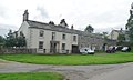
 Cottages in Askham - geograph.org.uk - 3920315.jpg 640 × 425; 208 KB
-
 Cottages in Askham - geograph.org.uk - 3920317.jpg 640 × 425; 160 KB
-
 Cottages in Askham - geograph.org.uk - 3920324.jpg 640 × 425; 181 KB
-
 Cottages in Askham - geograph.org.uk - 3920325.jpg 640 × 425; 224 KB
-
 Cottages in Askham - geograph.org.uk - 5794985.jpg 4,048 × 2,575; 2.09 MB
-
 Croft House, Askham - geograph.org.uk - 5794988.jpg 3,774 × 2,805; 2.27 MB
-
 Croft House, Askham.jpg 1,024 × 615; 112 KB
-
 Crookwath Bridge - geograph.org.uk - 3590565.jpg 2,592 × 1,944; 2.06 MB
-
 Crookwath Bridge - geograph.org.uk - 4023495.jpg 640 × 480; 516 KB
-
 Cup and Ring Marking - geograph.org.uk - 3050597.jpg 2,560 × 1,920; 2.03 MB
-
 Daffodils surrounding green with pub sign - geograph.org.uk - 4914267.jpg 1,500 × 1,000; 2.12 MB
-

-
 Dodd Beck - geograph.org.uk - 3203554.jpg 2,560 × 1,920; 1.98 MB
-
 Door and Gateway at Askham - geograph.org.uk - 5021699.jpg 2,448 × 3,264; 3.95 MB
-
 Downstream from Askham Bridge - geograph.org.uk - 5794992.jpg 3,239 × 4,319; 3.19 MB
-
 Driveway to Lowclose - geograph.org.uk - 6120518.jpg 640 × 480; 379 KB
-
 Dry stone wall - geograph.org.uk - 4916059.jpg 1,500 × 1,000; 1.34 MB
-
 Entering Askham - geograph.org.uk - 1308966.jpg 640 × 480; 68 KB
-
 Entering Helton from the west - geograph.org.uk - 3938808.jpg 2,592 × 1,944; 1.52 MB
-
 Entrance to walled garden, Askham Hall - geograph.org.uk - 3999597.jpg 1,000 × 750; 171 KB
-
 Erratic at Askham - geograph.org.uk - 5792784.jpg 4,320 × 3,240; 3.87 MB
-
 Farm buildings at Isla Park - geograph.org.uk - 5933779.jpg 1,024 × 768; 172 KB
-
 Farm track crossing Askham Fell - geograph.org.uk - 4918827.jpg 1,500 × 793; 1.06 MB
-
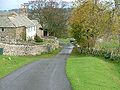
 Farm track near Askham - geograph.org.uk - 3045400.jpg 640 × 480; 109 KB
-
 Farmland above Askham - geograph.org.uk - 1885094.jpg 1,600 × 1,068; 276 KB
-
 Farmland above Askham - geograph.org.uk - 1885102.jpg 1,600 × 1,068; 279 KB
-
 Farmland alongside Heltondale Beck - geograph.org.uk - 5933789.jpg 1,024 × 768; 220 KB
-
 Farmland near Heltonhead - geograph.org.uk - 3938797.jpg 2,592 × 1,944; 1.49 MB
-
 Field and gate by Gillriggs Cover - geograph.org.uk - 5156933.jpg 1,024 × 683; 862 KB
-
 Field at the mouth of Heltondale - geograph.org.uk - 6118405.jpg 640 × 480; 307 KB
-
 Field boundaries old and new above Askham - geograph.org.uk - 4692541.jpg 1,024 × 768; 154 KB
-
 Field north of Askham - geograph.org.uk - 6120505.jpg 640 × 480; 305 KB
-
 Field with barn - geograph.org.uk - 2670720.jpg 4,186 × 2,786; 6.91 MB
-
 Field with old plough strips - geograph.org.uk - 5794325.jpg 4,320 × 3,240; 5.96 MB
-
 Field with sheep - geograph.org.uk - 6120463.jpg 640 × 480; 291 KB
-
 Fields and stone walls near Helton - geograph.org.uk - 6118414.jpg 640 × 480; 240 KB
-
 Fields near Askham - geograph.org.uk - 3045415.jpg 640 × 480; 73 KB
-
 Fields near Helton - geograph.org.uk - 3590555.jpg 2,592 × 1,944; 1.86 MB
-
 Fields north of Askham - geograph.org.uk - 4024254.jpg 640 × 480; 443 KB
-
 Footbridge across the Heltondale Beck - geograph.org.uk - 5155528.jpg 1,024 × 768; 1,017 KB
-
 Footbridge over Heltondale Beck - geograph.org.uk - 6118408.jpg 640 × 480; 319 KB
-
 Footbridge over the River Lowther - geograph.org.uk - 3190484.jpg 640 × 480; 89 KB
-
 Footpath near Highfield Farm - geograph.org.uk - 6120510.jpg 640 × 480; 359 KB
-
 Footpath near Highfield Farm - geograph.org.uk - 6120514.jpg 480 × 640; 368 KB
-
 Footpath to Heltondale Common - geograph.org.uk - 6118412.jpg 480 × 640; 339 KB
-
 Goat - geograph.org.uk - 175661.jpg 640 × 480; 183 KB
-
 Grass and gorse near to Askham - geograph.org.uk - 4916043.jpg 1,500 × 1,000; 1.29 MB
-

-
 Grit bin on the road up to Celleron - geograph.org.uk - 4692533.jpg 1,024 × 768; 151 KB
-
 Gypsy caravan in the grounds of Askham Hall - geograph.org.uk - 3999581.jpg 1,000 × 750; 302 KB
-
 Gypsy caravan in the grounds of Askham Hall - geograph.org.uk - 3999590.jpg 1,000 × 750; 206 KB
-
 Haber Hill - geograph.org.uk - 5177772.jpg 640 × 427; 506 KB
-
 Heading down Dodd Beck - geograph.org.uk - 4400646.jpg 640 × 480; 77 KB
-
 Heading for the hills - geograph.org.uk - 4633014.jpg 800 × 600; 120 KB
-
 Heltondale - geograph.org.uk - 3939003.jpg 2,592 × 1,944; 1.68 MB
-
 Heltonhead - geograph.org.uk - 5068067.jpg 1,500 × 846; 1.27 MB
-
 Heltonhead - geograph.org.uk - 73004.jpg 640 × 480; 84 KB
-
 Herbaceous border, Askham Hall - geograph.org.uk - 3999576.jpg 750 × 1,000; 205 KB
-
 Heughscar Hill - geograph.org.uk - 5177741.jpg 640 × 427; 530 KB
-
 Highfield Farm - geograph.org.uk - 4024256.jpg 640 × 480; 505 KB
-
 Hill Top Cottage, Askham.jpg 3,264 × 2,448; 4.09 MB
-
 Hillside below Burtree Scar - geograph.org.uk - 4023501.jpg 640 × 480; 531 KB
-
 House beyond weir on River Lowther - geograph.org.uk - 5466389.jpg 1,499 × 999; 1.81 MB
-
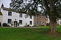
 Houses in Askham - geograph.org.uk - 5899278.jpg 4,000 × 3,000; 4.54 MB
-
 Houses in Askham - geograph.org.uk - 5899282.jpg 4,000 × 3,000; 5.13 MB
-
 Houses on The Green, Askham (geograph 6937123).jpg 1,280 × 850; 949 KB
-
 Houses on The Green, Askham - geograph.org.uk - 2645159.jpg 1,600 × 752; 313 KB
-
 Keldhead - geograph.org.uk - 4029710.jpg 640 × 480; 77 KB
-
 Lane down into Askham - geograph.org.uk - 3150032.jpg 3,264 × 2,448; 1.74 MB
-
 Last bit of the Tarn Moor public road - geograph.org.uk - 5155664.jpg 1,024 × 683; 920 KB
-
 Lime kiln across field - geograph.org.uk - 4919269.jpg 1,500 × 692; 1.05 MB
-
 Limekiln Plantation - geograph.org.uk - 5026527.jpg 1,024 × 683; 849 KB
-
 Limekiln Plantation and Quarry Disused - geograph.org.uk - 3150058.jpg 3,264 × 2,448; 1.82 MB
-
 Limestone dry stone wall near Helton - geograph.org.uk - 5177751.jpg 640 × 427; 554 KB
-
 Limestone outcrops, Heughscar Hill - geograph.org.uk - 5177745.jpg 640 × 427; 557 KB
-
 Little Mossy Beck - geograph.org.uk - 3050618.jpg 2,560 × 1,920; 2.1 MB
-
 Lonely Heltondale - geograph.org.uk - 4402134.jpg 800 × 600; 127 KB
-
 Looking across Tarn Moor - geograph.org.uk - 5155691.jpg 1,024 × 683; 1.05 MB
-
 Low Donald Wood, between Askham and Helton - geograph.org.uk - 5933783.jpg 1,024 × 768; 167 KB
-
 Low heath beside road near Mossy Beck - geograph.org.uk - 5066379.jpg 1,500 × 740; 1,016 KB
-
 Lowclose Farm - geograph.org.uk - 4024255.jpg 640 × 480; 580 KB
-
 Lower Green, Askham - geograph.org.uk - 4024253.jpg 640 × 480; 520 KB
-
 Lowther Castle - geograph.org.uk - 6120475.jpg 640 × 480; 311 KB
-
 Lynchets in a field near Helton - geograph.org.uk - 3190497.jpg 640 × 336; 64 KB
-
 Millkeld Sike - geograph.org.uk - 5794336.jpg 3,239 × 4,319; 4.64 MB
-
 Moorland of Whitestone Moor - geograph.org.uk - 4918811.jpg 1,500 × 1,000; 1.46 MB
-
 Moorland on north side of Nesgillhow Beck - geograph.org.uk - 4918815.jpg 1,500 × 701; 698 KB
-
 Moss domes on moorland - geograph.org.uk - 4917401.jpg 1,500 × 1,000; 1.36 MB
-
 Moss, Tarn Moor - geograph.org.uk - 3986365.jpg 2,560 × 1,920; 2.09 MB
-
 Mossy Beck - geograph.org.uk - 3986369.jpg 2,560 × 1,920; 2.05 MB
-
 Mossy Beck - geograph.org.uk - 4629154.jpg 640 × 480; 104 KB
-
 Mr Blue. (Unsplash).jpg 2,564 × 1,704; 3.39 MB
-
 Near Askham - geograph.org.uk - 5836173.jpg 2,048 × 1,536; 910 KB
-

-

-
 Old houses in Askham - geograph.org.uk - 5899303.jpg 4,000 × 3,000; 4.43 MB
-
 Old houses in Askham - geograph.org.uk - 5899308.jpg 4,000 × 3,000; 4.87 MB
-
 On Askham Fell - geograph.org.uk - 3003568.jpg 2,592 × 1,944; 1.54 MB
-
 On Helton Fell - geograph.org.uk - 1563519.jpg 640 × 480; 50 KB
-
 On Helton Fell - geograph.org.uk - 2346488.jpg 640 × 480; 105 KB
-
 On Knotts - geograph.org.uk - 1564969.jpg 640 × 480; 80 KB
-
 On Loadpot Hill - geograph.org.uk - 3203559.jpg 2,560 × 1,920; 877 KB
-
 On Lord's Seat - geograph.org.uk - 2351588.jpg 640 × 480; 115 KB
-
 On Moor Divock - geograph.org.uk - 3050594.jpg 2,560 × 1,920; 799 KB
-
 On Moor Divock - geograph.org.uk - 864521.jpg 640 × 480; 27 KB
-
 On Tarn Moor - geograph.org.uk - 1563396.jpg 640 × 480; 70 KB
-
 On Tarn Moor - geograph.org.uk - 863763.jpg 640 × 480; 74 KB
-
 On Whitestone Moor - geograph.org.uk - 4112467.jpg 4,608 × 3,456; 3.55 MB
-
 Open access fell, drained by Setterah Sike - geograph.org.uk - 5933786.jpg 1,024 × 768; 270 KB
-
 Ordnance Survey Cut Mark - geograph.org.uk - 5906244.jpg 1,024 × 831; 225 KB
-
 Ordnance Survey Cut Mark - geograph.org.uk - 5906245.jpg 1,024 × 604; 299 KB
-
 Ordnance Survey Cut Mark - geograph.org.uk - 5906246.jpg 997 × 1,024; 468 KB
-
 Out Barn - geograph.org.uk - 175654.jpg 640 × 480; 236 KB
-
 Outgang Farm, Helton - geograph.org.uk - 6118420.jpg 640 × 480; 304 KB
-
 Parish church of St. Peter's, Askham - geograph.org.uk - 5026511.jpg 1,024 × 683; 892 KB
-
 Partial Stone Circle - geograph.org.uk - 5177737.jpg 640 × 427; 522 KB
-
 Partly dried-out tarn on Moor Divock - geograph.org.uk - 1171678.jpg 640 × 480; 73 KB
-
 Path into Askham - geograph.org.uk - 3045554.jpg 640 × 480; 84 KB
-
 Pond, Loadpot Hole - geograph.org.uk - 4112223.jpg 4,608 × 3,456; 3.56 MB
-
 Ponies above Askham - geograph.org.uk - 904929.jpg 640 × 459; 67 KB
-
 Ponies on Rough Land - geograph.org.uk - 112326.jpg 640 × 427; 104 KB
-
 Public footpath to Askham - geograph.org.uk - 5933776.jpg 1,024 × 768; 211 KB
-
 Pulpit Holes, Moor Divock - geograph.org.uk - 1171680.jpg 640 × 480; 99 KB
-
 Remnant limestone pavement on Heughscar Hill - geograph.org.uk - 5794023.jpg 4,320 × 3,240; 4.18 MB
-
 Retired tractors - geograph.org.uk - 5794098.jpg 4,320 × 3,240; 4.27 MB
-
 Ridge descending eastwards from The Dodd - geograph.org.uk - 5068023.jpg 1,500 × 1,000; 1.46 MB
-
 Riggingleys Top - geograph.org.uk - 3045541.jpg 640 × 480; 53 KB
-
 River Lowther - geograph.org.uk - 4023505.jpg 640 × 480; 463 KB
-
 River Lowther - geograph.org.uk - 5177796.jpg 640 × 427; 531 KB
-
 River Lowther at Askham Bridge - geograph.org.uk - 5794976.jpg 4,320 × 3,240; 4.51 MB
-
 Ruined fold, upper Heltondale - geograph.org.uk - 4401615.jpg 640 × 480; 115 KB
-
 Ruined limekiln alongside Limekiln Plantation - geograph.org.uk - 4692392.jpg 1,024 × 768; 135 KB
-

-
 School Hill, Askham.jpg 1,024 × 768; 128 KB
-
 Shake Holes - geograph.org.uk - 864518.jpg 640 × 480; 79 KB
-
 Sheep alongside Heltondale Beck - geograph.org.uk - 5933792.jpg 1,024 × 768; 178 KB


.jpg)


.jpg)


.jpg)


