Category:Ashurst, West Sussex
Jump to navigation
Jump to search
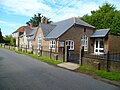
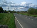
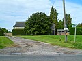
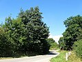
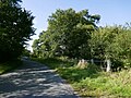
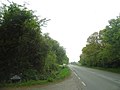
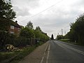
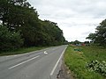
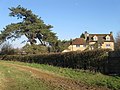
English: Ashurst is a village and civil parish in the Horsham District of West Sussex, England, about south of Horsham on the B2135 road. The village is about one kilometre west of the River Adur. There is a twelfth century parish church dedicated to St James, a C of E primary school and a pub, the Fountain Inn.
village in West Sussex, England, UK  | |||||
| Upload media | |||||
| Instance of | |||||
|---|---|---|---|---|---|
| Location | Horsham, West Sussex, South East England, England | ||||
| Area |
| ||||
| Said to be the same as | Ashurst (Wikimedia duplicated page, civil parish) | ||||
 | |||||
Subcategories
This category has the following 5 subcategories, out of 5 total.
Media in category "Ashurst, West Sussex"
The following 200 files are in this category, out of 416 total.
(previous page) (next page)-
 Acre Plat-Large Meadow - geograph.org.uk - 5098001.jpg 640 × 480; 75 KB
-

-
 Allens Croft - geograph.org.uk - 3343117.jpg 640 × 480; 76 KB
-
 Approaching Gate - geograph.org.uk - 3847407.jpg 640 × 480; 130 KB
-
 Approaching high tide on the River Adur - geograph.org.uk - 2082534.jpg 640 × 428; 118 KB
-
 Approaching Jessops Farm - geograph.org.uk - 3847330.jpg 4,000 × 3,000; 4.35 MB
-
 Ashurst church - geograph.org.uk - 4663538.jpg 800 × 600; 172 KB
-
 Ashurst church from the north - geograph.org.uk - 4904840.jpg 1,024 × 768; 225 KB
-

-
 Ashurst Recreation Ground - geograph.org.uk - 3339154.jpg 640 × 478; 63 KB
-
 Ashurst School - geograph.org.uk - 4664368.jpg 800 × 600; 140 KB
-
 Ashurst Village Hall - geograph.org.uk - 2978307.jpg 4,320 × 3,240; 4.66 MB
-

-
 B2135 Through Bines Green - geograph.org.uk - 2936927.jpg 1,024 × 768; 113 KB
-
 B2135, Bines Green - geograph.org.uk - 5072114.jpg 640 × 480; 62 KB
-
 Barn at field edge - geograph.org.uk - 4655039.jpg 800 × 600; 157 KB
-
 Barn Field - geograph.org.uk - 3343158.jpg 640 × 480; 84 KB
-
 Barn Field - geograph.org.uk - 5098004.jpg 640 × 480; 82 KB
-
 Barn Field-Clapper Field - geograph.org.uk - 5096699.jpg 640 × 480; 92 KB
-
 Barn Field-Garden Field - geograph.org.uk - 3340715.jpg 640 × 480; 84 KB
-

-
 Barns, New Wharf Farm - geograph.org.uk - 3339319.jpg 640 × 478; 91 KB
-
 Batts - geograph.org.uk - 3339169.jpg 640 × 479; 70 KB
-
 Bavens Wood - geograph.org.uk - 3341342.jpg 480 × 640; 143 KB
-
 Beggars Bush Kennels - geograph.org.uk - 3340692.jpg 640 × 480; 156 KB
-
 Bets Field-House Field-Three Acres - geograph.org.uk - 3341347.jpg 640 × 480; 101 KB
-
 Bineham Bridge - geograph.org.uk - 3339243.jpg 480 × 640; 65 KB
-
 Bineham Bridge - geograph.org.uk - 5413814.jpg 640 × 621; 116 KB
-
 Bineham bridge over the river Adur - geograph.org.uk - 571165.jpg 640 × 480; 77 KB
-
 Bines Bridge - geograph.org.uk - 5072147.jpg 640 × 480; 112 KB
-
 Bines Bridge - geograph.org.uk - 5113633.jpg 640 × 480; 111 KB
-
 Bines Bridge - geograph.org.uk - 5113666.jpg 640 × 480; 59 KB
-
 Bines Green - geograph.org.uk - 268353.jpg 640 × 479; 154 KB
-
 Bines Green - geograph.org.uk - 4663600.jpg 800 × 600; 108 KB
-
 Bines Green - geograph.org.uk - 5072131.jpg 640 × 480; 91 KB
-
 Bines Green looking North - geograph.org.uk - 570436.jpg 640 × 424; 71 KB
-
 Bishops Brook - geograph.org.uk - 5019377.jpg 640 × 480; 59 KB
-
 Blackberry bush - geograph.org.uk - 2082732.jpg 640 × 428; 221 KB
-
 Blakes Farm - geograph.org.uk - 3339191.jpg 640 × 480; 57 KB
-
 Body on the Footpath - geograph.org.uk - 3440407.jpg 480 × 640; 146 KB
-
-
 Bridge closed over the River Adur - geograph.org.uk - 4663637.jpg 800 × 600; 144 KB
-

-
 Bridleway BW1871 - geograph.org.uk - 3230304.jpg 4,000 × 3,000; 2.92 MB
-
 Bridleway enters Jack o'Lantern Wood - geograph.org.uk - 4664464.jpg 600 × 800; 212 KB
-
-

-
 Bridleway going southwards to woodland - geograph.org.uk - 4664452.jpg 800 × 600; 187 KB
-
 Bridleway junction - geograph.org.uk - 3230311.jpg 4,000 × 3,000; 3.86 MB
-
 Bridleway junction in Calcot Wood - geograph.org.uk - 4655025.jpg 800 × 600; 232 KB
-
 Bridleway near College Wood Farm - geograph.org.uk - 3341176.jpg 493 × 640; 77 KB
-

-
 Bridleway turns into stream - geograph.org.uk - 3845453.jpg 4,000 × 3,000; 4.85 MB
-

-
 Bridleway, Felbridge Rough - geograph.org.uk - 3340726.jpg 640 × 480; 134 KB
-
 Broken Stile - geograph.org.uk - 3847410.jpg 4,000 × 3,000; 4.55 MB
-
 Brook Meadow - geograph.org.uk - 5096681.jpg 640 × 480; 74 KB
-
 Brown Six Acres - geograph.org.uk - 3343151.jpg 640 × 508; 64 KB
-

-
 Burnetts Field-The Paddock - geograph.org.uk - 3341373.jpg 640 × 480; 99 KB
-
 Calcot Field - geograph.org.uk - 3340716.jpg 640 × 480; 81 KB
-
 Calcot Wood - geograph.org.uk - 2082309.jpg 640 × 428; 177 KB
-
 Calcot Wood - geograph.org.uk - 3340678.jpg 640 × 482; 123 KB
-
 Cart House Field - geograph.org.uk - 5096712.jpg 640 × 480; 141 KB
-
 Cattle on the move by Godmarks Farm - geograph.org.uk - 4663576.jpg 800 × 600; 136 KB
-
 Church Field - geograph.org.uk - 5072084.jpg 640 × 480; 82 KB
-
 Church Lane looking north - geograph.org.uk - 4663541.jpg 640 × 480; 121 KB
-
 Church Meadow - geograph.org.uk - 3342691.jpg 640 × 480; 67 KB
-
 Cistern - geograph.org.uk - 571185.jpg 640 × 480; 116 KB
-
 Clapper Mead - geograph.org.uk - 5096690.jpg 640 × 480; 93 KB
-
 College Wood Farm - geograph.org.uk - 3340765.jpg 640 × 480; 79 KB
-
 Common Columbine - geograph.org.uk - 1338168.jpg 640 × 480; 168 KB
-
 Common copse - geograph.org.uk - 2804755.jpg 4,000 × 3,000; 3.59 MB
-
 Common Copse - geograph.org.uk - 3421559.jpg 640 × 480; 152 KB
-
 Common Field - geograph.org.uk - 3341182.jpg 640 × 492; 68 KB
-
 Common Meadow-Old Furze Field - geograph.org.uk - 3341159.jpg 640 × 480; 80 KB
-
 Confluence of the two River Adurs - geograph.org.uk - 268297.jpg 640 × 479; 110 KB
-
 Conifer by bridleway 1868 - geograph.org.uk - 2804735.jpg 3,252 × 2,128; 1.76 MB
-
 Copse Field - geograph.org.uk - 5072067.jpg 640 × 480; 76 KB
-

-
 Corner of Footpath FP2518 - geograph.org.uk - 3230298.jpg 4,000 × 3,000; 4.01 MB
-
 Cor^ What a Pair... - geograph.org.uk - 3341428.jpg 591 × 640; 165 KB
-
 Cottage Field - geograph.org.uk - 3339172.jpg 640 × 480; 81 KB
-

-
 Cricketing Field-Long Field - geograph.org.uk - 3339215.jpg 640 × 480; 62 KB
-
 Crop path - geograph.org.uk - 1550851.jpg 640 × 480; 133 KB
-
 Cut in Calcot Wood - geograph.org.uk - 2191753.jpg 3,264 × 2,448; 4.55 MB
-
 Dayland Field - geograph.org.uk - 3425748.jpg 640 × 480; 82 KB
-
 Daylands Farm - geograph.org.uk - 2155442.jpg 2,517 × 1,857; 1.42 MB
-
 Daylands farmhouse - geograph.org.uk - 2420388.jpg 640 × 480; 129 KB
-

-
 Drive to College Wood Farm - geograph.org.uk - 3341185.jpg 640 × 480; 95 KB
-
 Drive to Doves Farm - geograph.org.uk - 3340704.jpg 480 × 640; 109 KB
-
 Drive to Jessops Farm - geograph.org.uk - 3440457.jpg 480 × 640; 91 KB
-
 Dwelling at Daylands Farm - geograph.org.uk - 4664534.jpg 800 × 600; 170 KB
-
 East along Spithandle Lane - geograph.org.uk - 2188151.jpg 3,264 × 2,448; 5.84 MB
-
 East Lag - geograph.org.uk - 3339201.jpg 640 × 480; 54 KB
-
 Eatons Cottages - geograph.org.uk - 5413795.jpg 640 × 480; 45 KB
-
 Eatons Farm - geograph.org.uk - 268309.jpg 640 × 479; 127 KB
-
 Eatons Pump - geograph.org.uk - 3866311.jpg 2,048 × 3,072; 4.23 MB
-
 Edge of Common Copse - geograph.org.uk - 3845625.jpg 4,000 × 3,000; 4.86 MB
-
 Eight Acres - geograph.org.uk - 3340674.jpg 640 × 480; 73 KB
-
 Eight Acres - geograph.org.uk - 3440411.jpg 640 × 480; 78 KB
-
 End of Bridleway BW2370-1 - geograph.org.uk - 3230284.jpg 4,000 × 3,000; 2.35 MB
-
 Entrance to Godmarks Farm - geograph.org.uk - 4663580.jpg 800 × 600; 206 KB
-
 Entrance to Peppers - geograph.org.uk - 1318073.jpg 640 × 480; 113 KB
-
 Farmland near Claylands Farm - geograph.org.uk - 268336.jpg 640 × 479; 143 KB
-
 Felbridge Rough - geograph.org.uk - 3340722.jpg 640 × 480; 132 KB
-
 Field boundary by west bank of the Adur - geograph.org.uk - 4664296.jpg 800 × 600; 213 KB
-
 Field near Dalesdown School - geograph.org.uk - 149427.jpg 640 × 479; 110 KB
-

-
 Five Acres - geograph.org.uk - 3340723.jpg 640 × 480; 95 KB
-
 Five Acres - geograph.org.uk - 3421509.jpg 640 × 480; 73 KB
-
 Flat Field - geograph.org.uk - 5096704.jpg 640 × 480; 81 KB
-
 Foals and Horses - geograph.org.uk - 2082345.jpg 640 × 428; 139 KB
-
 Footbridge closed for repair - geograph.org.uk - 4663639.jpg 800 × 600; 150 KB
-
 Footbridge near Pepper's Pond - geograph.org.uk - 3341359.jpg 480 × 640; 196 KB
-
 Footbridge over a brook - geograph.org.uk - 2420250.jpg 640 × 480; 167 KB
-
 Footbridge south east of Daylands Farm - geograph.org.uk - 4664432.jpg 800 × 600; 206 KB
-
 Footbridge, Honeybridge Stream - geograph.org.uk - 3425733.jpg 480 × 640; 157 KB
-
 Footpath 2510 to Jessops Farm - geograph.org.uk - 2804752.jpg 4,000 × 3,000; 3.52 MB
-
-
 Footpath and drive to King's Barn Farm - geograph.org.uk - 2804731.jpg 4,000 × 3,000; 3.64 MB
-
 Footpath crosses field from wood - geograph.org.uk - 4655055.jpg 800 × 600; 91 KB
-
 Footpath crosses field south of Ashurst - geograph.org.uk - 4664363.jpg 800 × 600; 181 KB
-

-
 Footpath FP1867 - geograph.org.uk - 3230276.jpg 4,000 × 3,000; 4.95 MB
-
 Footpath FP2521 - geograph.org.uk - 3230290.jpg 4,000 × 3,000; 4.39 MB
-
 Footpath from Ashurst reaches the B2135 - geograph.org.uk - 4664359.jpg 800 × 600; 176 KB
-
 Footpath on Bines Green - geograph.org.uk - 4663605.jpg 800 × 600; 135 KB
-

-
 Footpath through the maize - geograph.org.uk - 4663555.jpg 600 × 800; 152 KB
-
 Footpath with notice at Bines Green - geograph.org.uk - 4663614.jpg 600 × 800; 127 KB
-
 Footpath, Jack O'Lantern Wood - geograph.org.uk - 3343135.jpg 472 × 640; 148 KB
-
 Ford Clappers - geograph.org.uk - 268331.jpg 640 × 479; 204 KB
-
 Ford Clappers - geograph.org.uk - 5072054.jpg 480 × 640; 96 KB
-
 Ford Farm - geograph.org.uk - 5072080.jpg 640 × 480; 73 KB
-
 Ford Field - geograph.org.uk - 5072061.jpg 640 × 480; 88 KB
-
 Ford Lane - geograph.org.uk - 268334.jpg 479 × 640; 129 KB
-
 Ford Solar Farm (1) - geograph.org.uk - 5096692.jpg 640 × 480; 79 KB
-
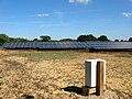 Ford Solar Farm (2) - geograph.org.uk - 5096697.jpg 640 × 480; 90 KB
-
 Ford Solar Farm (3) - geograph.org.uk - 5096700.jpg 640 × 480; 81 KB
-
 Four Acre Brook-Common Brook - geograph.org.uk - 5113681.jpg 640 × 480; 51 KB
-
 Further Ten Acres - geograph.org.uk - 3341253.jpg 640 × 480; 98 KB
-
 Furze by Cottage - geograph.org.uk - 3341331.jpg 640 × 480; 83 KB
-
 Gated footbridge over Lancing Brook at Daylands Farm - geograph.org.uk - 2155439.jpg 2,592 × 1,944; 2.11 MB
-
 Gates at Ashurst Village Nursery and Farm Shop - geograph.org.uk - 2590653.jpg 3,264 × 2,448; 1.57 MB
-
 Gathering clouds near Daylands Farm - geograph.org.uk - 2155432.jpg 2,390 × 1,721; 983 KB
-
 Granary Plat - geograph.org.uk - 3342683.jpg 640 × 480; 90 KB
-
 Great Gores - geograph.org.uk - 5072088.jpg 480 × 640; 96 KB
-
 Great Wood Field - geograph.org.uk - 3440431.jpg 640 × 480; 100 KB
-
 Gun emplacement overlooking Bines Bridge - geograph.org.uk - 2090879.jpg 640 × 428; 160 KB
-
 Hawking Sopers - geograph.org.uk - 3343168.jpg 640 × 496; 84 KB
-
 Hawking Sopers from footpath 2514 - geograph.org.uk - 2805452.jpg 4,000 × 3,000; 3.48 MB
-
 Hay sale at Honeybridge Farm - geograph.org.uk - 1551852.jpg 640 × 480; 131 KB
-
 Hill's Farm.JPG 4,608 × 3,456; 5.7 MB
-
 Hog Brook - geograph.org.uk - 5412971.jpg 640 × 414; 46 KB
-
 Honey Bridge - geograph.org.uk - 5098056.jpg 640 × 480; 101 KB
-
 Honey Bridge - geograph.org.uk - 6247112.jpg 1,024 × 768; 281 KB
-
 Honey Bridge Mead - geograph.org.uk - 5098046.jpg 640 × 480; 102 KB
-
 Honey Bridge on Honeybridge Lane - geograph.org.uk - 2154483.jpg 2,592 × 1,944; 2 MB
-
 Honeybridge Lane - geograph.org.uk - 3421659.jpg 640 × 480; 111 KB
-
 Honeybridge on Honeybridge Lane - geograph.org.uk - 1318237.jpg 640 × 480; 118 KB
-
 Honeybridge Stream in flood - geograph.org.uk - 4997223.jpg 1,683 × 2,380; 583 KB
-
 Horsebridge Common - geograph.org.uk - 3339324.jpg 640 × 480; 103 KB
-
-
-
 Horsham Road near Ashurst - geograph.org.uk - 3467071.jpg 2,048 × 1,536; 1.51 MB
-
 Horsham Road the B2135 south to Steyning - geograph.org.uk - 2590665.jpg 3,264 × 2,448; 1.32 MB
-
 Horsham Road, Ashurst - geograph.org.uk - 2978320.jpg 4,320 × 3,240; 4.01 MB
-
 Horsham Road, Ashurst - geograph.org.uk - 3467239.jpg 2,048 × 1,536; 1.38 MB
-
 Horsham Road, Ashurst - geograph.org.uk - 3467335.jpg 2,048 × 1,536; 1.4 MB
-
 Horsham Road, Horsebridge Common - geograph.org.uk - 2978273.jpg 4,320 × 3,240; 3.86 MB
-

-
 House at Eatons Farm - geograph.org.uk - 4663630.jpg 800 × 600; 130 KB
-
 House Field - geograph.org.uk - 3421582.jpg 640 × 480; 91 KB
-
 House Field - geograph.org.uk - 3425702.jpg 640 × 480; 83 KB
-
 House Field-Wood Field - geograph.org.uk - 3340708.jpg 640 × 468; 84 KB
-
 Hovel Meadow - geograph.org.uk - 3340717.jpg 640 × 480; 87 KB
-
 Hovel Meadow-Orchard Meadow - geograph.org.uk - 3340753.jpg 640 × 480; 81 KB
-
 Inquisitive Calves, Yokenclose Farm - geograph.org.uk - 268314.jpg 640 × 479; 154 KB
-
 Jack O'Lantern Wood - geograph.org.uk - 3343126.jpg 640 × 480; 140 KB
-
 Jessops Farm - geograph.org.uk - 3342672.jpg 640 × 480; 91 KB
-

-

-

-
 Kings Barn Farm - geograph.org.uk - 3343121.jpg 640 × 480; 115 KB
-
 Limekiln Brook - geograph.org.uk - 3339233.jpg 640 × 480; 77 KB
-
 Limekiln Field - geograph.org.uk - 3343161.jpg 640 × 480; 89 KB
-

-
 Little Pepper Hill-Great Pepper Hill - geograph.org.uk - 3421609.jpg 640 × 480; 100 KB
-
 Little Pepper's Wood - geograph.org.uk - 3341323.jpg 640 × 480; 138 KB
-
 Log piles in South Copse off Spithandle Lane - geograph.org.uk - 2188169.jpg 3,264 × 2,448; 5.1 MB
-
 Long Croft - geograph.org.uk - 3339178.jpg 480 × 640; 102 KB
-
 Long Field - geograph.org.uk - 3342698.jpg 640 × 480; 71 KB
-
 Long Field - geograph.org.uk - 3440439.jpg 640 × 480; 76 KB
-
 Long Field - geograph.org.uk - 5072064.jpg 640 × 507; 60 KB
-
 Long Field - geograph.org.uk - 5072092.jpg 640 × 480; 68 KB
-
 Long Four Acres-Flat Six Acres - geograph.org.uk - 3341180.jpg 640 × 480; 87 KB
-
 Long Four Acres-Trips Furze Field - geograph.org.uk - 3340706.jpg 640 × 480; 89 KB


_-_geograph.org.uk_-_5096694.jpg)


_-_geograph.org.uk_-_5096692.jpg)
_-_geograph.org.uk_-_5096697.jpg)
_-_geograph.org.uk_-_5096700.jpg)


