Category:Ashperton
Jump to navigation
Jump to search
village in the United Kingdom  Eglwys Sant Bartholomeus, Ashperton | |||||
| Upload media | |||||
| Instance of | |||||
|---|---|---|---|---|---|
| Location | Herefordshire, West Midlands, England | ||||
 | |||||
Cymraeg: Pentref yn Swydd Henffordd, Gorllewin Canolbarth Lloegr, Lloegr ydy Ashperton. (→Ashperton)
English: Ashperton is a small village about twelve miles east of Hereford, in Herefordshire, England. (→Ashperton)
Nederlands: Ashperton is een plaats en civil parish in het Engelse graafschap Herefordshire. (→Ashperton)

Subcategories
This category has the following 3 subcategories, out of 3 total.
Media in category "Ashperton"
The following 166 files are in this category, out of 166 total.
-

-

-

-
 A417 junction south of Blacklands - geograph.org.uk - 5890481.jpg 3,480 × 2,321; 2.72 MB
-
 A417 near Ashperton - geograph.org.uk - 2963254.jpg 2,256 × 1,496; 918 KB
-
 A417 passing through Ashperton - geograph.org.uk - 3106596.jpg 4,000 × 3,000; 3.76 MB
-
 A417, a straight Roman Road - geograph.org.uk - 4454345.jpg 1,600 × 1,200; 1.39 MB
-
 A417, Ashperton - geograph.org.uk - 5222118.jpg 1,024 × 768; 278 KB
-
-
 An old house with a modern hedge - geograph.org.uk - 4454348.jpg 1,600 × 1,200; 1.41 MB
-
 Apple orchard, near Walsopthorne Farm - geograph.org.uk - 3071377.jpg 1,024 × 680; 298 KB
-
 Apple orchard, near Walsopthorne Farm - geograph.org.uk - 3071379.jpg 1,024 × 680; 252 KB
-
 Ashperton Castle (Moat) - geograph.org.uk - 6027858.jpg 3,648 × 2,736; 3.83 MB
-
 Ashperton Castle (Moat) - geograph.org.uk - 6027870.jpg 3,648 × 2,736; 3.9 MB
-
 Ashperton Castle - geograph.org.uk - 6027849.jpg 3,648 × 2,736; 3.94 MB
-
 Ashperton Castle - geograph.org.uk - 6027857.jpg 3,648 × 2,736; 4.49 MB
-
 Ashperton Castle - geograph.org.uk - 6027863.jpg 3,648 × 2,736; 4.31 MB
-
 Ashperton church - geograph.org.uk - 5275445.jpg 1,024 × 768; 260 KB
-
 Ashperton church - geograph.org.uk - 6040649.jpg 1,024 × 768; 275 KB
-
 Ashperton primary school - geograph.org.uk - 5890471.jpg 1,600 × 1,200; 750 KB
-
 Ashperton village - geograph.org.uk - 948680.jpg 640 × 480; 66 KB
-
 Ashperton Village Hall - geograph.org.uk - 2723213.jpg 640 × 480; 48 KB
-
 Ashperton Village Hall - geograph.org.uk - 3109744.jpg 4,000 × 3,000; 4.22 MB
-
 Ashperton War Memorial - geograph.org.uk - 4238686.jpg 1,600 × 779; 257 KB
-
 Ashperton war memorial - geograph.org.uk - 6040678.jpg 1,024 × 768; 226 KB
-
 AshpertonStn.jpg 640 × 480; 114 KB
-
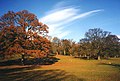 Autumn colour in Homend Park - geograph.org.uk - 638065.jpg 640 × 433; 80 KB
-
 Bend in Little Tarrington Lane - geograph.org.uk - 6018049.jpg 1,600 × 900; 526 KB
-
 Blacklands Garage - geograph.org.uk - 1349651.jpg 640 × 480; 164 KB
-

-

-
 Bucklands Farm - geograph.org.uk - 570186.jpg 640 × 334; 222 KB
-
 Building work in Ashperton church - geograph.org.uk - 5275450.jpg 800 × 600; 82 KB
-
 Canal bridge at Moorend Farm - geograph.org.uk - 948723.jpg 640 × 480; 94 KB
-
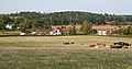
 Cattle grazing near Upleadon Court - geograph.org.uk - 948750.jpg 640 × 480; 91 KB
-
 Churchyard at St. Bartholomew's Church (Chancel ^ Ashperton) - geograph.org.uk - 6027457.jpg 3,648 × 2,736; 3.91 MB
-
 Construction work at Ashperton Primary School - geograph.org.uk - 4454286.jpg 1,600 × 1,296; 530 KB
-

-
 Cricket ground near Ashperton - geograph.org.uk - 3106620.jpg 4,000 × 3,000; 3.65 MB
-
 Cricket pavilion - geograph.org.uk - 6040720.jpg 1,024 × 768; 244 KB
-
 Crop field West of Ashperton - geograph.org.uk - 4635958.jpg 1,200 × 800; 760 KB
-
 Crops Near Ashperton Park - geograph.org.uk - 1349671.jpg 640 × 480; 188 KB
-
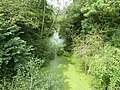
 Disused Hereford and Gloucester Canal - geograph.org.uk - 3109720.jpg 4,000 × 3,000; 3.21 MB
-
 Ditch through fields - geograph.org.uk - 6040668.jpg 1,024 × 768; 318 KB
-
 Drive to The Moorend (geograph 6693048).jpg 1,024 × 768; 272 KB
-
 Driveway to Walsopthorne house and farm - geograph.org.uk - 3106629.jpg 4,000 × 3,000; 3.43 MB
-
 East window and altar - geograph.org.uk - 5275454.jpg 768 × 1,024; 215 KB
-
 Entering Ashperton, A417 - geograph.org.uk - 2284879.jpg 640 × 431; 45 KB
-
 Entrance to Ashperton - geograph.org.uk - 3240461.jpg 640 × 460; 77 KB
-
 Entrance to Ashperton - geograph.org.uk - 3780875.jpg 640 × 480; 97 KB
-
 Entrance to The Castle - geograph.org.uk - 895200.jpg 640 × 480; 84 KB
-
 Field by Ashperton Castle - geograph.org.uk - 6027876.jpg 1,920 × 1,080; 1.03 MB
-
 Field by Ashperton Castle - geograph.org.uk - 6027948.jpg 1,920 × 1,080; 1.02 MB
-
 Field by Ashperton Castle - geograph.org.uk - 6029812.jpg 1,920 × 1,080; 1.02 MB
-
 Fields of Ashperton - geograph.org.uk - 948686.jpg 640 × 480; 71 KB
-
 Fishing lake at Ashperton - geograph.org.uk - 6040659.jpg 1,024 × 768; 268 KB
-
 Fishponds by Ashperton Castle - geograph.org.uk - 6027897.jpg 1,920 × 1,080; 1.01 MB
-
 Fishponds by Ashperton Castle - geograph.org.uk - 6027899.jpg 1,920 × 1,080; 1.09 MB
-
 Fishponds by Ashperton Castle - geograph.org.uk - 6027955.jpg 1,920 × 1,080; 1.05 MB
-
 Fishponds by Ashperton Castle - geograph.org.uk - 6028015.jpg 1,920 × 1,080; 1 MB
-
 Fishponds by Ashperton Castle - geograph.org.uk - 6029810.jpg 1,920 × 1,080; 1.08 MB
-
 Flytipping into Canal - geograph.org.uk - 103004.jpg 479 × 640; 129 KB
-
 Footpath from Haywood Lane - geograph.org.uk - 4308192.jpg 800 × 451; 209 KB
-
 Footpath south to Ashperton - geograph.org.uk - 3109738.jpg 4,000 × 3,000; 3.44 MB
-
 Footpath through a wheat field - geograph.org.uk - 3071374.jpg 1,024 × 680; 276 KB
-
 Footpath to Walsopthorne - geograph.org.uk - 3106610.jpg 4,000 × 3,000; 3.78 MB
-
 Former Hereford ^ Gloucester Canal by Moorend Farm - geograph.org.uk - 4639364.jpg 4,000 × 3,000; 5.37 MB
-
 Former telephone box - geograph.org.uk - 5276520.jpg 1,024 × 768; 414 KB
-
 Former telephone box - geograph.org.uk - 5276559.jpg 768 × 1,024; 386 KB
-
 Grand entrance to Canon Frome Court - geograph.org.uk - 4305066.jpg 800 × 451; 202 KB
-
 Hansnett Wood From The Footpath Stile - geograph.org.uk - 1349667.jpg 480 × 640; 254 KB
-
 Hansnett Wood panorama - geograph.org.uk - 948694.jpg 640 × 480; 65 KB
-
 Haywood Lane canal bridge - geograph.org.uk - 4308183.jpg 800 × 451; 186 KB
-

-
 Heywood Lane heading for Ashperton - geograph.org.uk - 3106653.jpg 4,000 × 3,000; 3.42 MB
-
 Hillside Crops Near Hansnett Wood - geograph.org.uk - 1349669.jpg 640 × 480; 171 KB
-
 Hop field by Heywood lane - geograph.org.uk - 4639339.jpg 4,962 × 3,308; 6.93 MB
-
 Land towards Wood End - geograph.org.uk - 4639353.jpg 1,500 × 1,000; 932 KB
-
 Lane past Moorend Farm - geograph.org.uk - 4635952.jpg 1,200 × 800; 590 KB
-
 Lane to Tarrington - geograph.org.uk - 4305055.jpg 800 × 451; 205 KB
-
 Little Tarrington Lane - geograph.org.uk - 3313613.jpg 800 × 600; 247 KB
-
 Lower Town, near Ashperton - geograph.org.uk - 66664.jpg 640 × 426; 107 KB
-
 Mainstone Court, The Trumpet - geograph.org.uk - 116420.jpg 640 × 426; 117 KB
-
 Memorial in Ashperton church - geograph.org.uk - 5275467.jpg 1,024 × 768; 147 KB
-
 Memorial in Ashperton church - geograph.org.uk - 5275471.jpg 1,024 × 768; 142 KB
-
 Moat, Ashperton Castle - geograph.org.uk - 5276709.jpg 1,024 × 768; 334 KB
-
 Model of Ashperton Castle - geograph.org.uk - 6029841.jpg 1,920 × 1,080; 771 KB
-
 Model of Grandson Castle - geograph.org.uk - 6030067.jpg 3,648 × 2,736; 2.26 MB
-
 Moorend Farm - geograph.org.uk - 4639350.jpg 5,184 × 3,456; 6.43 MB
-
 Moorend Farm - geograph.org.uk - 4639361.jpg 4,000 × 3,000; 4.13 MB
-
 NE on Church Lane Ashperton - geograph.org.uk - 3106478.jpg 4,000 × 3,000; 3.56 MB
-
 New houses in Ashperton - geograph.org.uk - 6040690.jpg 1,024 × 768; 340 KB
-
 Oak tree - geograph.org.uk - 6040714.jpg 1,024 × 768; 315 KB
-
 Oak tree - geograph.org.uk - 6040717.jpg 1,024 × 768; 287 KB
-
 Oak tree, Canon Frome - geograph.org.uk - 4305060.jpg 800 × 800; 475 KB
-
 Orchard by the Hereford and Gloucester Canal - geograph.org.uk - 3109725.jpg 4,000 × 3,000; 3.64 MB
-
 Parish notices, Ashperton - geograph.org.uk - 2284883.jpg 640 × 475; 52 KB
-
 Path beside site of Ashperton Castle - geograph.org.uk - 5276715.jpg 1,024 × 768; 375 KB
-
 Path by Ashperton Castle - geograph.org.uk - 6027852.jpg 3,648 × 2,736; 4.95 MB
-
 Path by St. Bartholomew's Church (Ashperton) - geograph.org.uk - 6030070.jpg 3,648 × 2,736; 4.37 MB
-
 Ploughed field - geograph.org.uk - 1277804.jpg 640 × 384; 199 KB
-
 Power lines crossing the valley of River Frome - geograph.org.uk - 5890485.jpg 4,598 × 2,629; 2.95 MB
-
 Pylon in the Frome valley - geograph.org.uk - 2284871.jpg 640 × 430; 37 KB
-
 Quiet Back Lane Near Ashperton - geograph.org.uk - 1349681.jpg 640 × 480; 188 KB
-

-

-
 Rutted track to Walsopthorne - geograph.org.uk - 4308190.jpg 800 × 451; 166 KB
-
 Scene near Eastwood Farm - geograph.org.uk - 876884.jpg 640 × 357; 76 KB
-
 Small stream south of The Homend - geograph.org.uk - 546553.jpg 640 × 480; 99 KB
-
 Snowy lane junction - geograph.org.uk - 3313617.jpg 600 × 800; 223 KB
-
 St. Bartholomew's Church (Altar ^ Ashperton) - geograph.org.uk - 6030056.jpg 3,648 × 2,736; 3.31 MB
-
 St. Bartholomew's Church (Ashperton) - geograph.org.uk - 6029830.jpg 1,920 × 1,080; 813 KB
-
 St. Bartholomew's Church (Ashperton) - geograph.org.uk - 6030074.jpg 3,648 × 2,736; 3.47 MB
-
 St. Bartholomew's Church (Ashperton) - geograph.org.uk - 6030081.jpg 3,648 × 2,736; 3.82 MB
-
 St. Bartholomew's Church (Bell Tower ^ Ashperton) - geograph.org.uk - 6027805.jpg 3,648 × 2,736; 3.87 MB
-
 St. Bartholomew's Church (Bell Tower ^ Ashperton) - geograph.org.uk - 6027810.jpg 2,736 × 3,648; 4.14 MB
-
 St. Bartholomew's Church (Bell Tower ^ Porch ^ Ashperton) - geograph.org.uk - 6027509.jpg 2,736 × 3,648; 4.04 MB
-
 St. Bartholomew's Church (Chancel ^ Ashperton) - geograph.org.uk - 6030047.jpg 3,648 × 2,736; 2.48 MB
-

-
 St. Bartholomew's Church (Font ^1 ^ Ashperton) - geograph.org.uk - 6030025.jpg 3,648 × 2,736; 2.63 MB
-
 St. Bartholomew's Church (Font ^2 ^ Ashperton) - geograph.org.uk - 6030036.jpg 3,648 × 2,736; 2.7 MB
-
 St. Bartholomew's Church (Nave ^ Ashperton) - geograph.org.uk - 6030038.jpg 3,648 × 2,736; 2.46 MB
-

-
 St. Bartholomew's Church (Organ ^ Ashperton) - geograph.org.uk - 6029818.jpg 3,648 × 2,736; 2.53 MB
-
 St. Bartholomew's Church (Organ ^1 ^ Ashperton) - geograph.org.uk - 6029821.jpg 2,736 × 3,648; 2.39 MB
-
 St. Bartholomew's Church (Organ ^2 ^ Ashperton) - geograph.org.uk - 6029825.jpg 3,648 × 2,736; 2.5 MB
-
 St. Bartholomew's Church (Porch ^ Ashperton) - geograph.org.uk - 6027535.jpg 3,648 × 2,736; 4.49 MB
-
 St. Bartholomew's Church (Porch ^ Ashperton) - geograph.org.uk - 6030064.jpg 2,736 × 3,648; 2.53 MB
-
 St. Bartholomew's Church (Pulpit ^ Ashperton) - geograph.org.uk - 6030019.jpg 3,648 × 2,736; 2.36 MB
-
 St. Bartholomew's Church (South Transept ^ Ashperton) - geograph.org.uk - 6029998.jpg 3,648 × 2,736; 3.07 MB
-
 St. Bartholomew's Church (War Memorial ^ Ashperton) - geograph.org.uk - 6029992.jpg 3,648 × 2,736; 2.64 MB
-

-
 Stained glass window, Ashperton church - geograph.org.uk - 5275460.jpg 576 × 1,024; 166 KB
-
 Start of the footpath in Ashperton - geograph.org.uk - 525010.jpg 640 × 477; 331 KB
-
 Telephone Box at Ashperton - geograph.org.uk - 6027449.jpg 3,648 × 2,736; 4.65 MB
-
 Thatched cottage at Ashperton - geograph.org.uk - 525005.jpg 640 × 495; 305 KB
-
 The Castle - geograph.org.uk - 4040911.jpg 800 × 531; 119 KB
-
 The gateway to Canon Frome Court - geograph.org.uk - 3123190.jpg 4,752 × 3,168; 3.4 MB
-
 The Traitors' Arms, Ashperton church - geograph.org.uk - 5276598.jpg 768 × 1,024; 175 KB
-
 The war memorial at Ashperton - geograph.org.uk - 6293264.jpg 640 × 480; 42 KB
-
 Timber-framed thatched cottage - geograph.org.uk - 6040650.jpg 1,024 × 768; 233 KB
-
 Track to Upper House - geograph.org.uk - 4304473.jpg 800 × 451; 190 KB
-
 Tree at St. Bartholomew's Church (Ashperton) - geograph.org.uk - 6030080.jpg 2,736 × 3,648; 3.8 MB
-
 Trees near Hansnett Farm - geograph.org.uk - 3071388.jpg 1,024 × 680; 229 KB
-
 Tunnel House, Munsley - geograph.org.uk - 948700.jpg 640 × 480; 76 KB
-
 Tuston Farm, Ashperton - geograph.org.uk - 4635070.jpg 1,200 × 800; 601 KB
-
 Upleadon Court near Ashperton - geograph.org.uk - 67753.jpg 640 × 426; 106 KB
-
 View to Hansnett Wood - geograph.org.uk - 4308188.jpg 800 × 451; 171 KB
-
 View to the west from near Walsopthorne Farm - geograph.org.uk - 3071384.jpg 1,024 × 680; 236 KB
-
 Village Hall at Ashperton - geograph.org.uk - 525008.jpg 640 × 498; 313 KB
-
 Walsopthorne - geograph.org.uk - 102939.jpg 640 × 479; 79 KB
-
 Wheatfield to the south of Walsopthorne - geograph.org.uk - 3106640.jpg 4,000 × 3,000; 3.64 MB
-

-
 Window inside St. Bartholomew's Church (Chancel ^ Ashperton) - geograph.org.uk - 6030051.jpg 2,736 × 3,648; 2.33 MB
-
 Window inside St. Bartholomew's Church (Chancel ^ Ashperton) - geograph.org.uk - 6030058.jpg 2,736 × 3,648; 3.49 MB
-
 Window inside St. Bartholomew's Church (Nave ^ Ashperton) - geograph.org.uk - 6030062.jpg 2,736 × 3,648; 3.06 MB
-

-
 Winter cereals - geograph.org.uk - 6040674.jpg 768 × 1,024; 333 KB
-
 Woodmans Cottage - geograph.org.uk - 2700636.jpg 2,256 × 1,496; 966 KB
-
 Canon Frome CC Pitch, Ashperton - geograph.org.uk - 103001.jpg 640 × 479; 95 KB
-
 Edge of Ashperton Park Woods - geograph.org.uk - 100897.jpg 640 × 479; 122 KB
-
 Hansnett Wood - geograph.org.uk - 103007.jpg 640 × 479; 77 KB
-
 Moat at Ashperton - geograph.org.uk - 66661.jpg 426 × 640; 130 KB
-
 Orchard at Wood End near Ashperton - geograph.org.uk - 66665.jpg 640 × 426; 136 KB
-
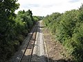
 Railway Bridge, near Wood End - geograph.org.uk - 570300.jpg 640 × 427; 272 KB
-


_-_geograph.org.uk_-_6027824.jpg)


_-_geograph.org.uk_-_6027858.jpg)
_-_geograph.org.uk_-_6027870.jpg)


_-_geograph.org.uk_-_6027457.jpg)


.jpg)


_-_geograph.org.uk_-_6030070.jpg)


_-_geograph.org.uk_-_6030056.jpg)
_-_geograph.org.uk_-_6029830.jpg)
_-_geograph.org.uk_-_6030074.jpg)
_-_geograph.org.uk_-_6030081.jpg)
_-_geograph.org.uk_-_6027805.jpg)
_-_geograph.org.uk_-_6027810.jpg)
_-_geograph.org.uk_-_6027509.jpg)
_-_geograph.org.uk_-_6030047.jpg)
_-_geograph.org.uk_-_6027802.jpg)
_-_geograph.org.uk_-_6030025.jpg)
_-_geograph.org.uk_-_6030036.jpg)
_-_geograph.org.uk_-_6030038.jpg)
_-_geograph.org.uk_-_6029818.jpg)
_-_geograph.org.uk_-_6029821.jpg)
_-_geograph.org.uk_-_6029825.jpg)
_-_geograph.org.uk_-_6027535.jpg)
_-_geograph.org.uk_-_6030064.jpg)
_-_geograph.org.uk_-_6030019.jpg)
_-_geograph.org.uk_-_6029992.jpg)


_-_geograph.org.uk_-_6030080.jpg)


_-_geograph.org.uk_-_6030049.jpg)
_-_geograph.org.uk_-_6030051.jpg)
_-_geograph.org.uk_-_6030058.jpg)
_-_geograph.org.uk_-_6030062.jpg)
_-_geograph.org.uk_-_6027453.jpg)


_-_geograph.org.uk_-_6030028.jpg)
_-_geograph.org.uk_-_6029998.jpg)