Category:Ashfield District
Jump to navigation
Jump to search
district in Nottinghamshire, United Kingdom  | |||||
| Upload media | |||||
| Instance of | |||||
|---|---|---|---|---|---|
| Location | Nottinghamshire, East Midlands, England | ||||
| Capital | |||||
| Legislative body |
| ||||
| Inception |
| ||||
| Population |
| ||||
| Area |
| ||||
| Different from | |||||
| official website | |||||
 | |||||
Subcategories
This category has the following 7 subcategories, out of 7 total.
Media in category "Ashfield District"
The following 181 files are in this category, out of 181 total.
-
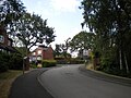
 2 Church Hill, Kirkby in Ashfield - geograph.org.uk - 6354083.jpg 1,024 × 768; 231 KB
-
 A distant view of St Wilfrid's Church, Kirkby - geograph.org.uk - 5758832.jpg 3,583 × 4,793; 4.62 MB
-
 A spur of Rise Hill - geograph.org.uk - 6354091.jpg 1,024 × 768; 139 KB
-
 A view of Shire Carr Farm - geograph.org.uk - 5758803.jpg 5,068 × 3,619; 3.96 MB
-
 Arrow Centre - geograph.org.uk - 5604172.jpg 2,204 × 1,653; 1.03 MB
-
 Ascending Oak View Rise, Harlow Wood - geograph.org.uk - 5864223.jpg 1,024 × 768; 210 KB
-
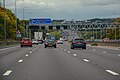
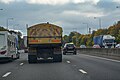
 Ashfield , M1 Motorway - geograph.org.uk - 5951677.jpg 6,000 × 4,000; 6.18 MB
-
 Ashfield , M1 Motorway - geograph.org.uk - 5951678.jpg 6,000 × 4,000; 7.58 MB
-
 Ashfield , M1 Motorway - geograph.org.uk - 5951679.jpg 6,000 × 4,000; 7.33 MB
-
 Ashfield , M1 Motorway - geograph.org.uk - 5976316.jpg 6,000 × 4,000; 6.64 MB
-
 Ashfield , M1 Motorway - geograph.org.uk - 5976317.jpg 6,000 × 4,000; 6.18 MB
-
 Ashfield District Council election 2015.svg 799 × 1,192; 216 KB
-
 Ashfield District Council election, 2019.svg 799 × 1,192; 212 KB
-
 Ashfield District Council election, 2023.svg 799 × 1,192; 214 KB
-
 Ashfield District Council Offices - geograph.org.uk - 6354115.jpg 1,024 × 768; 151 KB
-
 Ashfield District Council.svg 360 × 185; 3 KB
-
 Ashfield Fire Station - geograph.org.uk - 6021097.jpg 5,233 × 3,592; 3.28 MB
-
 Ashfield School Skills Centre - geograph.org.uk - 5758674.jpg 5,017 × 3,664; 3.48 MB
-
 Back lane behind Clumber Street, Kirkby - geograph.org.uk - 5621537.jpg 1,024 × 768; 150 KB
-
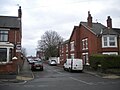 Balfour Street, Kirkby - geograph.org.uk - 5621536.jpg 1,024 × 768; 138 KB
-
 Boardwalk, footbridge and stream in Dobpark - geograph.org.uk - 5604176.jpg 2,227 × 1,670; 1.34 MB
-
 Bolsover District , M1 Motorway - geograph.org.uk - 5976315.jpg 6,000 × 4,000; 6.24 MB
-
 Brett Close, Ruffs estate - geograph.org.uk - 5603866.jpg 1,024 × 768; 130 KB
-
 Bridleway across a field east of Silo Farm - geograph.org.uk - 5603270.jpg 1,024 × 768; 185 KB
-
 Bridleway up Beacon Hill west of Beauvale - geograph.org.uk - 5603309.jpg 1,024 × 768; 139 KB
-
 Brigadier Tom Bewick OBE and Vice-Chairman Cllr Anthony Brewer.jpg 5,123 × 2,244; 5.71 MB
-
 Bungalows on Manor House Court - geograph.org.uk - 5758716.jpg 5,097 × 3,663; 3.59 MB
-
 Butlers Hill Nottingham - geograph.org.uk - 5662991.jpg 640 × 480; 130 KB
-
 Chapel Street Farm, Chapel Street, Kirkby - geograph.org.uk - 5702286.jpg 1,024 × 768; 144 KB
-
 Closing time at "The Waggon and Horses" - geograph.org.uk - 5758695.jpg 5,081 × 3,667; 3.94 MB
-
 Clumber Street, Kirkby - geograph.org.uk - 5621542.jpg 1,024 × 768; 106 KB
-
 Commercial premises, Nuncargate Road - geograph.org.uk - 6354094.jpg 1,024 × 768; 152 KB
-
 Common Lane, Beauvale - geograph.org.uk - 5603315.jpg 1,024 × 768; 124 KB
-
 Cottages at Whyburn House Farm - geograph.org.uk - 5604300.jpg 2,204 × 1,653; 1.05 MB
-
 Covered reservoir south of Silo Farm - geograph.org.uk - 5603265.jpg 1,024 × 768; 111 KB
-
 Curious footpath sign embedded in a tree - geograph.org.uk - 5758792.jpg 4,898 × 3,660; 5.93 MB
-
 Diamond Avenue, Kirkby - geograph.org.uk - 5621566.jpg 1,024 × 768; 211 KB
-
 East end of Hockley Place, Kirkby - geograph.org.uk - 5702264.jpg 1,024 × 768; 272 KB
-
 Eastern part of Oak View Rise, Harlow Wood - geograph.org.uk - 5864232.jpg 1,024 × 768; 170 KB
-
 Entrance to Portland College campus - geograph.org.uk - 5864215.jpg 1,024 × 768; 242 KB
-
 Field - panoramio (18).jpg 3,072 × 2,304; 1.47 MB
-
 Footpath and stile beside Misk Farm house - geograph.org.uk - 5604240.jpg 1,704 × 2,272; 1.65 MB
-
 Footpath Beneath the M1 Motorway - geograph.org.uk - 6021016.jpg 5,600 × 4,200; 4.1 MB
-
 Footpath near Kirkby Park - geograph.org.uk - 6021027.jpg 1,600 × 1,200; 510 KB
-
 Footpath north from Chapel Street, Kirkby - geograph.org.uk - 5702312.jpg 1,024 × 768; 143 KB
-
 Footpath round Whyburn House Farm - geograph.org.uk - 5604305.jpg 2,272 × 1,704; 1.29 MB
-
 Footpath to Cow Pasture Lane, Kirkby - geograph.org.uk - 5702279.jpg 1,024 × 768; 391 KB
-
 Footpath to Fountaindale School - geograph.org.uk - 5864210.jpg 1,024 × 768; 293 KB
-
 Footpath to Portland Park - geograph.org.uk - 6354299.jpg 4,160 × 3,120; 4.79 MB
-
 Footpath to Springfield Cottage, Kirkby - geograph.org.uk - 5702259.jpg 1,024 × 768; 101 KB
-
 Footpath to the Duke of Wellington, Kirkby - geograph.org.uk - 5702253.jpg 1,024 × 768; 157 KB
-
 Footpath to Welbeck Street, Kirkby - geograph.org.uk - 5621546.jpg 1,024 × 768; 133 KB
-
 Footpath towards Silo Farm - geograph.org.uk - 5604182.jpg 2,240 × 1,680; 1.17 MB
-
 Footpath up Misk Hill west of Hucknall - geograph.org.uk - 5603259.jpg 1,024 × 768; 366 KB
-

-
 Hucknall High Street - geograph.org.uk - 5672274.jpg 1,024 × 1,024; 1.16 MB
-
 Hucknall, Byron Centre, Ogle Street - geograph.org.uk - 5672331.jpg 1,024 × 1,024; 1.07 MB
-
 Huthwaite , The A38 - geograph.org.uk - 5952853.jpg 6,000 × 4,000; 6.08 MB
-
 In the Erewash Valley near Meadow Farm - geograph.org.uk - 5758743.jpg 5,169 × 3,762; 7.76 MB
-
 Information Board, Normanshill Wood - geograph.org.uk - 1413973.jpg 640 × 427; 97 KB
-
 Inquisitive young cattle near Kirkby-in-Ashfield - geograph.org.uk - 5758729.jpg 3,668 × 5,000; 4.87 MB
-
 Kingsley Street, Kirkby - geograph.org.uk - 5621570.jpg 1,024 × 768; 123 KB
-
 Kingsway New Cemetery, Kirkby in Ashfield - geograph.org.uk - 6354098.jpg 1,024 × 768; 131 KB
-
 Kirkby Catholic Social Club - geograph.org.uk - 5621565.jpg 1,024 × 768; 130 KB
-
 Kirkby in Ashfield gold postbox 18-09-2012 (location).JPG 2,592 × 3,872; 5.24 MB
-
 Kirkby in Ashfield gold postbox 18-09-2012.JPG 2,592 × 3,872; 5.69 MB
-
 Kirkby in Ashfield, St Wilfrid - geograph.org.uk - 6364996.jpg 3,000 × 4,000; 4.03 MB
-

-
 Lane passing Silo Farm - geograph.org.uk - 5603268.jpg 1,024 × 768; 171 KB
-
 Lane to Misk Farm - geograph.org.uk - 5604202.jpg 2,272 × 1,704; 1.19 MB
-
 Lane to Misk Farm - geograph.org.uk - 5604208.jpg 2,272 × 1,704; 1.31 MB
-
 Lane to New Farm - geograph.org.uk - 5604178.jpg 2,272 × 1,704; 1.08 MB
-
 Leen Country Park - geograph.org.uk - 5663912.jpg 2,592 × 1,944; 920 KB
-
 Leen Valley Country Park - geograph.org.uk - 5663002.jpg 2,592 × 1,944; 864 KB
-
 Leen Valley Country Park - geograph.org.uk - 5663024.jpg 2,592 × 1,944; 1.05 MB
-
 Leen Valley Country Park - geograph.org.uk - 5663908.jpg 2,592 × 1,944; 1.09 MB
-
 Leen Valley Country Park - geograph.org.uk - 5663909.jpg 2,592 × 1,944; 864 KB
-
 Leen Valley Country Park - geograph.org.uk - 5663916.jpg 2,592 × 1,944; 853 KB
-
 Leen Valley Country Park - geograph.org.uk - 5664261.jpg 2,592 × 1,944; 801 KB
-
 Long Distance footpath - geograph.org.uk - 1465925.jpg 640 × 479; 123 KB
-
 Looking towards St Wilfid's Church. - geograph.org.uk - 6354286.jpg 4,160 × 3,120; 4.45 MB
-
 Main building, Portland College - geograph.org.uk - 5864207.jpg 1,024 × 768; 172 KB
-
 Meadow Farm near Bentinck Town - geograph.org.uk - 6021048.jpg 1,600 × 1,185; 544 KB
-
 Misk Farm yard and footbridge over the M1 - geograph.org.uk - 5604235.jpg 1,896 × 1,423; 880 KB
-
 Misk Hill - geograph.org.uk - 5604246.jpg 2,272 × 1,704; 1.46 MB
-
 Modest footbridge over a ditch near Whyburn House Farm - geograph.org.uk - 5604258.jpg 2,234 × 1,675; 1.55 MB
-
 Monument - geograph.org.uk - 5604321.jpg 2,146 × 1,609; 1.29 MB
-
 Morven Park, Kirkby - geograph.org.uk - 5621551.jpg 1,024 × 768; 84 KB
-
 No windpump to be seen - geograph.org.uk - 5604284.jpg 2,251 × 1,688; 1,023 KB
-
 North end of Nabbs Lane, Beauvale - geograph.org.uk - 5603317.jpg 1,024 × 768; 108 KB
-
 Nottingham NET - geograph.org.uk - 5662974.jpg 2,592 × 1,944; 952 KB
-
 Oak tree on Misk Hill, Hucknall - geograph.org.uk - 5627619.jpg 4,608 × 3,456; 1.96 MB
-
 Path by the old cemetery, Kirkby in Ashfield - geograph.org.uk - 6354074.jpg 1,024 × 768; 141 KB
-
 Path to a disused railway line - geograph.org.uk - 5758816.jpg 3,888 × 5,184; 5.36 MB
-

-
 Plaque on memorial bench - geograph.org.uk - 5604226.jpg 2,204 × 1,653; 1.1 MB
-
 Pond near Whyburn House Farm - geograph.org.uk - 5604272.jpg 1,514 × 1,136; 651 KB
-
 Poplars Way, Harlow Wood - geograph.org.uk - 5864228.jpg 1,024 × 768; 167 KB
-
 Private road off the A60, Harlow Wood - geograph.org.uk - 5864237.jpg 1,024 × 768; 250 KB
-
 Public footpath sign at Misk Farm in Hucknall - geograph.org.uk - 5627621.jpg 4,608 × 3,456; 3.42 MB
-
 Public footpath to Hucknall near Westville - geograph.org.uk - 5603878.jpg 1,024 × 768; 295 KB
-
 Raymond Close near its junction with Sutton Road - geograph.org.uk - 5758659.jpg 4,863 × 3,474; 3.17 MB
-
 Reservoir at Misk Farm - geograph.org.uk - 5604231.jpg 2,272 × 1,520; 979 KB
-
 Road off Daniels Way, Westville - geograph.org.uk - 5603873.jpg 1,024 × 768; 220 KB
-
 Road through Portland College campus - geograph.org.uk - 5864204.jpg 1,024 × 768; 178 KB
-
 Rolls Royce Airfield Redevelopment - geograph.org.uk - 5925976.jpg 4,032 × 3,024; 3.28 MB
-
 Rolls Royce Airfield redevelopment 1 - geograph.org.uk - 5925997.jpg 4,032 × 3,024; 3.81 MB
-
 Rushcliffe Road, Ruffs estate - geograph.org.uk - 5603855.jpg 1,024 × 768; 140 KB
-
 Silo Farm and Beacon Hill - geograph.org.uk - 5604191.jpg 2,272 × 1,704; 1.35 MB
-
 Silo Farm and reservoir from Beacon Hill - geograph.org.uk - 5604197.jpg 2,166 × 1,559; 1.11 MB
-
 South eastern end of Hayden Lane, Hucknall - geograph.org.uk - 5540917.jpg 1,024 × 768; 170 KB
-
 South end of Southwell Lane, Kirkby - geograph.org.uk - 5702317.jpg 1,024 × 768; 103 KB
-
 Stile and memorial bench - geograph.org.uk - 5604217.jpg 2,167 × 1,625; 1.19 MB
-
 Tesco car park, Hucknall - geograph.org.uk - 6338765.jpg 1,024 × 768; 120 KB
-
 Thank you for visiting Titchfield Park, Kirkby - geograph.org.uk - 5702282.jpg 1,024 × 768; 290 KB
-
 The Bentinck on Sutton Road - geograph.org.uk - 6021086.jpg 4,203 × 3,179; 2.45 MB
-
 The Coachouse Stable To North Of The Old Rectory, Buttery Lane, Teversal, Mansfield (1).jpg 4,048 × 3,036; 2.99 MB
-
 The Coachouse Stable To North Of The Old Rectory, Buttery Lane, Teversal, Mansfield (2).jpg 4,048 × 3,036; 4.58 MB
-
 The Coachouse Stable To North Of The Old Rectory, Buttery Lane, Teversal, Mansfield (3).jpg 4,048 × 3,036; 3.83 MB
-
 The Coachouse Stable To North Of The Old Rectory, Buttery Lane, Teversal, Mansfield (4).jpg 4,048 × 3,036; 4.62 MB
-
 The Coachouse Stable To North Of The Old Rectory, Buttery Lane, Teversal, Mansfield (5).jpg 4,048 × 3,036; 3.69 MB
-
 The Coachouse Stable To North Of The Old Rectory, Buttery Lane, Teversal, Mansfield (6).jpg 4,048 × 3,036; 3.45 MB
-
 The Coachouse Stable To North Of The Old Rectory, Buttery Lane, Teversal, Mansfield (7).jpg 3,036 × 4,048; 3.75 MB
-
 The Coachouse Stable To North Of The Old Rectory, Buttery Lane, Teversal, Mansfield (8).jpg 3,036 × 4,048; 3.51 MB
-
 The eastern flank of Misk Hill west of Hucknall - geograph.org.uk - 5603262.jpg 1,024 × 768; 127 KB
-
 The end of Salterford Road, Ruffs estate - geograph.org.uk - 5603860.jpg 1,024 × 768; 123 KB
-
 The Manor House, Church Street, Sutton-In-Ashfield.jpg 3,036 × 4,048; 4.01 MB
-
 The Old Rectory And Adjoining Garden Wall, Buttery Lane, Teversal, Mansfield (1).jpg 4,048 × 3,036; 2.62 MB
-
 The Old Rectory And Adjoining Garden Wall, Buttery Lane, Teversal, Mansfield (10).jpg 4,048 × 3,036; 2.93 MB
-
 The Old Rectory And Adjoining Garden Wall, Buttery Lane, Teversal, Mansfield (11).jpg 4,048 × 3,036; 2.95 MB
-
 The Old Rectory And Adjoining Garden Wall, Buttery Lane, Teversal, Mansfield (12).jpg 3,036 × 4,048; 2.74 MB
-
 The Old Rectory And Adjoining Garden Wall, Buttery Lane, Teversal, Mansfield (13).jpg 3,606 × 3,043; 2.45 MB
-
 The Old Rectory And Adjoining Garden Wall, Buttery Lane, Teversal, Mansfield (14).jpg 3,418 × 3,051; 2.12 MB
-
 The Old Rectory And Adjoining Garden Wall, Buttery Lane, Teversal, Mansfield (15).jpg 4,048 × 3,036; 4.47 MB
-
 The Old Rectory And Adjoining Garden Wall, Buttery Lane, Teversal, Mansfield (16).jpg 4,048 × 3,036; 2.7 MB
-
 The Old Rectory And Adjoining Garden Wall, Buttery Lane, Teversal, Mansfield (17).jpg 4,048 × 3,036; 3.61 MB
-
 The Old Rectory And Adjoining Garden Wall, Buttery Lane, Teversal, Mansfield (18).jpg 4,048 × 3,036; 3.78 MB
-
 The Old Rectory And Adjoining Garden Wall, Buttery Lane, Teversal, Mansfield (19).jpg 4,048 × 3,036; 3.65 MB
-
 The Old Rectory And Adjoining Garden Wall, Buttery Lane, Teversal, Mansfield (2).jpg 4,048 × 3,036; 2.7 MB
-
 The Old Rectory And Adjoining Garden Wall, Buttery Lane, Teversal, Mansfield (21).jpg 3,036 × 3,883; 3.64 MB
-
 The Old Rectory And Adjoining Garden Wall, Buttery Lane, Teversal, Mansfield (3).jpg 4,048 × 3,036; 2.88 MB
-
 The Old Rectory And Adjoining Garden Wall, Buttery Lane, Teversal, Mansfield (4).jpg 3,036 × 4,048; 2.7 MB
-
 The Old Rectory And Adjoining Garden Wall, Buttery Lane, Teversal, Mansfield (5).jpg 3,036 × 4,048; 2.2 MB
-
 The Old Rectory And Adjoining Garden Wall, Buttery Lane, Teversal, Mansfield (6).jpg 2,870 × 4,041; 1.63 MB
-
 The Old Rectory And Adjoining Garden Wall, Buttery Lane, Teversal, Mansfield (7).jpg 4,048 × 3,036; 3.49 MB
-
 The Old Rectory And Adjoining Garden Wall, Buttery Lane, Teversal, Mansfield (8).jpg 3,885 × 3,036; 2.21 MB
-
 The Old Rectory And Adjoining Garden Wall, Buttery Lane, Teversal, Mansfield (9).jpg 3,970 × 3,036; 2.49 MB
-
 The Privets, Buttery Lane, Teversal, Mansfield (1).jpg 3,036 × 4,048; 6.26 MB
-
 The Privets, Buttery Lane, Teversal, Mansfield (10).jpg 4,048 × 3,036; 5.45 MB
-
 The Privets, Buttery Lane, Teversal, Mansfield (11).jpg 4,048 × 3,036; 3.15 MB
-
 The Privets, Buttery Lane, Teversal, Mansfield (12).jpg 4,048 × 3,036; 5.61 MB
-
 The Privets, Buttery Lane, Teversal, Mansfield (13).jpg 4,048 × 3,036; 6.82 MB
-
 The Privets, Buttery Lane, Teversal, Mansfield (14).jpg 4,048 × 3,036; 6.15 MB
-
 The Privets, Buttery Lane, Teversal, Mansfield (2).jpg 4,030 × 2,816; 3.83 MB
-
 The Privets, Buttery Lane, Teversal, Mansfield (3).jpg 4,048 × 3,036; 6.51 MB
-
 The Privets, Buttery Lane, Teversal, Mansfield (4).jpg 4,048 × 3,036; 6.6 MB
-
 The Privets, Buttery Lane, Teversal, Mansfield (5).jpg 4,048 × 3,036; 3.45 MB
-
 The Privets, Buttery Lane, Teversal, Mansfield (6).jpg 4,048 × 3,036; 4.86 MB
-
 The Privets, Buttery Lane, Teversal, Mansfield (7).jpg 4,048 × 3,036; 2.95 MB
-
 The Privets, Buttery Lane, Teversal, Mansfield (8).jpg 4,048 × 3,036; 6.09 MB
-
 The Privets, Buttery Lane, Teversal, Mansfield (9).jpg 4,048 × 3,036; 3.88 MB
-
 The rear of Kirkby Cliff Farm - geograph.org.uk - 5758796.jpg 4,885 × 3,643; 3.44 MB
-
 The River Erewash - geograph.org.uk - 5758749.jpg 5,184 × 3,888; 4.73 MB
-
 Thieves' Wood - geograph.org.uk - 1413992.jpg 427 × 640; 96 KB
-
 Track to Thurland Hall Farm - geograph.org.uk - 5604330.jpg 2,272 × 1,704; 1.23 MB
-
 Track towards Bulwell Hall from Westville - geograph.org.uk - 5603874.jpg 1,024 × 768; 214 KB
-
 Track up Boar Hill - geograph.org.uk - 5758827.jpg 4,952 × 3,713; 4.43 MB
-
 Track, Thives' Wood - geograph.org.uk - 1413986.jpg 640 × 427; 91 KB
-
 Two Oaks Farm - geograph.org.uk - 1413963.jpg 640 × 427; 61 KB
-
 UK Ashfield Council 2019.svg 360 × 185; 2 KB
-
 Under a disused railway bridge near Langton Hall - geograph.org.uk - 5758757.jpg 3,642 × 4,849; 5.11 MB
-
 Vehicle Spill at Kirkby Market Cross - geograph.org.uk - 6021078.jpg 1,600 × 1,225; 516 KB
-
 Victoria Hotel, Stanton Hill.jpg 600 × 355; 84 KB
-
 View across fields - panoramio.jpg 3,240 × 2,160; 1.1 MB
-
 View across the fields to Beacon Hill and Silo Farm - geograph.org.uk - 5604186.jpg 2,272 × 1,704; 1.26 MB
-
 Watnall Road, Westville - geograph.org.uk - 5603868.jpg 1,024 × 768; 91 KB
-
 West end of Oak View Rise, Harlow Wood - geograph.org.uk - 5864218.jpg 1,024 × 768; 247 KB
-
 West end of The Hill, Kirkby - geograph.org.uk - 5702316.jpg 1,024 × 768; 109 KB
-
 Whyburn House Farm - geograph.org.uk - 5604294.jpg 2,272 × 1,704; 1.33 MB
-
 Works Track next to Mineral Railway - geograph.org.uk - 6021033.jpg 5,600 × 4,200; 4.08 MB
-
 Landfill south of Huthwaite - geograph.org.uk - 243764.jpg 640 × 480; 79 KB


.jpg)


.JPG)


.jpg)
.jpg)
.jpg)
.jpg)
.jpg)
.jpg)
.jpg)
.jpg)


.jpg)
.jpg)
.jpg)
.jpg)
.jpg)
.jpg)
.jpg)
.jpg)
.jpg)
.jpg)
.jpg)
.jpg)
.jpg)
.jpg)
.jpg)
.jpg)
.jpg)
.jpg)
.jpg)
.jpg)
.jpg)
.jpg)
.jpg)
.jpg)
.jpg)
.jpg)
.jpg)
.jpg)
.jpg)
.jpg)
.jpg)
.jpg)
.jpg)
.jpg)


