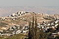
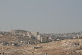
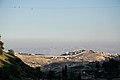
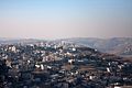
Category:As-Sawahira ash-Sharqiya
Jump to navigation
Jump to search
| Object location | | View all coordinates using: OpenStreetMap |
|---|
municipality type C in Jerusalem, State of Palestine | |||||
| Upload media | |||||
| Instance of | |||||
|---|---|---|---|---|---|
| Location | Quds Governorate, West Bank | ||||
 | |||||
Media in category "As-Sawahira ash-Sharqiya"
The following 21 files are in this category, out of 21 total.
-
 16-04-02-Jerusalem-RalfR-WAT 5972.jpg 4,288 × 2,848; 8.99 MB
-
 16-04-02-Jerusalem-RalfR-WAT 5982.jpg 4,288 × 2,848; 7.38 MB
-
 16-04-02-Jerusalem-RalfR-WAT 6006.jpg 4,288 × 2,848; 7.86 MB
-
 Israel - Jerusalem - Mount Zion - 02 (4261534587).jpg 4,272 × 2,848; 4.52 MB
-
 Israel - Jerusalem - Mount Zion - 03 (4261536735).jpg 4,272 × 2,365; 3.28 MB
-
 Israeli West Bank barrier in Jerusalem2.jpg 3,888 × 2,592; 1.39 MB
-
 Israeli West Bank barrier in Jerusalem3.jpg 3,888 × 2,592; 1.54 MB
-
 Jerus194.JPG 2,048 × 1,536; 534 KB
-
 Jerusalem (13318875505).jpg 5,528 × 3,274; 1.1 MB
-
 Jerusalem (13319032723).jpg 6,000 × 4,000; 1.35 MB
-
 Jerusalem (24502266649).jpg 5,184 × 3,456; 6.57 MB
-
 Jerusalem (24754686542).jpg 5,184 × 3,456; 5.38 MB
-
 Jerusalem (24779068031).jpg 5,184 × 3,456; 5.15 MB
-
 Jerusalem (30152390786).jpg 3,072 × 2,304; 3.35 MB
-
 Jerusalem (4763118993).jpg 2,048 × 1,154; 699 KB
-
 Jerusalem IMG 7019 (6190245135).jpg 3,888 × 2,592; 5.83 MB
-
 Jerusalem West Bank barrier IMG 5094.JPG 3,648 × 2,736; 3.79 MB
-
 Jerusalem. one wall here, the other one's there (24738988802).jpg 1,024 × 683; 130 KB
-
 March 2014 Israel 140331-D-VO565-022 (13902483265).jpg 2,048 × 1,367; 404 KB
-
 PikiWiki Israel 70573 mishkenot saananim.jpg 1,920 × 1,920; 1.29 MB
-
 Raffaespo - 2938624838.jpg 2,826 × 1,327; 2.22 MB


.jpg)
.jpg)


.jpg)
.jpg)
.jpg)
.jpg)
.jpg)
.jpg)
.jpg)
.jpg)

.jpg)
.jpg)

