Category:Arn Gill
Jump to navigation
Jump to search
Arn Gill is a beck (or small river) in a ravine in Langleydale, County Durham, England. See map here. The correct location N 54.61582 W 1.88413 (the Wikidata infobox is wrong). Note: "Arn" is Old Saxon for "eagle".
stream in United Kingdom | |||||
| Upload media | |||||
| Instance of | |||||
|---|---|---|---|---|---|
| Location | County Durham, North East England, England | ||||
 | |||||
Media in category "Arn Gill"
The following 8 files are in this category, out of 8 total.
-
 Arn Gill geograph-2232665-by-Peter-McDermott.jpg 3,888 × 2,391; 1.46 MB
-
 Billy Lane , Arn Gill - geograph.org.uk - 349927.jpg 640 × 409; 77 KB
-
 Cows in field on south side of Arn Gill geograph-3611761-by-Trevor-Littlewood.jpg 1,500 × 1,000; 1.16 MB
-

-
 Track above Arn Gill - geograph.org.uk - 1704734.jpg 640 × 480; 121 KB
-
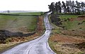
 Track alongside Arn Gill - geograph.org.uk - 1243985.jpg 640 × 480; 168 KB
-
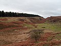 Upper valley of Arn Gill geograph-2711805-by-Trevor-Littlewood.jpg 1,500 × 1,125; 1.31 MB
-
 Upper valley of Arn Gill geograph-2711851-by-Trevor-Littlewood.jpg 1,500 × 941; 1.08 MB


