Category:Arminghall
Jump to navigation
Jump to search
English: Arminghall is a small village in the English county of Norfolk, around three miles (five kilometres) southeast of Norwich in the parish of Caistor St Edmund and Bixley. Most of the houses in the village are located close to the church, which lies just west of the B1332 road from Norwich to Poringland. Syfer Technology, an electronic components manufacturer, is based at Old Stoke Road, close to the River Tas. First Eastern Counties' 58 Service provides an hourly bus into Norwich via Trowse and out to Poringland, Brooke and Bungay. Timetable
village in Norfolk, United Kingdom  | |||||
| Upload media | |||||
| Instance of | |||||
|---|---|---|---|---|---|
| Location | Caistor St Edmund and Bixley, South Norfolk, Norfolk, East of England, England | ||||
 | |||||
Subcategories
This category has the following 3 subcategories, out of 3 total.
Media in category "Arminghall"
The following 86 files are in this category, out of 86 total.
-
 -2020-10-09 Arminghall Village Hall, Norfolk.jpg 4,608 × 3,072; 4.5 MB
-
 A brick wall enclosure - geograph.org.uk - 1501297.jpg 480 × 640; 154 KB
-
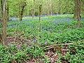
 A carpet of bluebells in Arminghall Wood - geograph.org.uk - 5361886.jpg 640 × 480; 545 KB
-
 A private bridleway - geograph.org.uk - 1378640.jpg 640 × 480; 102 KB
-
 A private bridleway - geograph.org.uk - 1378678.jpg 640 × 480; 115 KB
-
 A seat by the path - geograph.org.uk - 1378650.jpg 640 × 480; 98 KB
-
 A section of old brick wall, Arminghall - geograph.org.uk - 2349262.jpg 640 × 480; 338 KB
-
 A walk through Poringland Wood - geograph.org.uk - 1371358.jpg 640 × 480; 144 KB
-
 A wintry field boundary - geograph.org.uk - 1656884.jpg 640 × 514; 125 KB
-
 An overgrown heap of bricks, Arminghall - geograph.org.uk - 2349241.jpg 480 × 640; 349 KB
-
 Arminghall - geograph.org.uk - 117940.jpg 640 × 480; 204 KB
-
 Arminghall Lane ^ Arminghall Postbox - geograph.org.uk - 3756033.jpg 2,948 × 2,214; 1.02 MB
-
 Arminghall Lane, Arminghall - geograph.org.uk - 3413331.jpg 3,072 × 2,304; 1.31 MB
-
 Arminghall Lane, Arminghall - geograph.org.uk - 3756031.jpg 3,072 × 2,304; 1.77 MB
-
 Arminghall Lane, Arminghall - geograph.org.uk - 3756050.jpg 3,072 × 2,304; 1.95 MB
-
 Arminghall Lane, Arminghall - geograph.org.uk - 3756130.jpg 3,072 × 2,304; 736 KB
-
 Arminghall Lane, Arminghall - geograph.org.uk - 3756132.jpg 3,072 × 2,304; 1.97 MB
-
 Arminghall Postbox - geograph.org.uk - 3756038.jpg 2,304 × 3,072; 1.37 MB
-
 Arminghall Postbox - geograph.org.uk - 3756039.jpg 2,279 × 3,042; 1.6 MB
-
 Arminghall Postbox ^ Bus Shelter - geograph.org.uk - 3756037.jpg 2,241 × 2,992; 984 KB
-
 Arminghall pumping station - geograph.org.uk - 4876678.jpg 640 × 364; 331 KB
-
 Arminghall pumping station - geograph.org.uk - 4876680.jpg 640 × 360; 339 KB
-
 Arminghall pumping station - geograph.org.uk - 4876681.jpg 640 × 360; 307 KB
-
 Arminghall pumping station - geograph.org.uk - 4876683.jpg 640 × 360; 312 KB
-
 Arminghall Village Hall - geograph.org.uk - 3756065.jpg 2,304 × 3,072; 573 KB
-
 Arminghall Village sign - geograph.org.uk - 3756075.jpg 3,072 × 2,304; 1.8 MB
-
 Arminghall Village sign ^ seat - geograph.org.uk - 3756073.jpg 2,304 × 3,072; 1.92 MB
-
 Arminghall Wood in spring - geograph.org.uk - 1840706.jpg 640 × 480; 196 KB
-
 B1332 Bungay Road, Arminghall - geograph.org.uk - 3413325.jpg 3,072 × 2,304; 1.45 MB
-
 B1332 Bungay Road, Arminghall - geograph.org.uk - 3413328.jpg 3,072 × 2,304; 1.19 MB
-
 B1332 Bungay Road, Arminghall - geograph.org.uk - 3870048.jpg 3,072 × 2,304; 1.74 MB
-
 B1332 Bungay Road, Arminghall - geograph.org.uk - 3870064.jpg 3,072 × 2,304; 1.93 MB
-
 B1332 Bungay Road, Arminghall - geograph.org.uk - 4854155.jpg 2,692 × 2,132; 2.15 MB
-
 Bare hedgerow on a field's edge - geograph.org.uk - 1772116.jpg 640 × 480; 82 KB
-
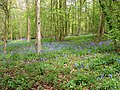
 Bluebells in Arminghall Wood - geograph.org.uk - 1840710.jpg 640 × 480; 212 KB
-
 Bluebells in Arminghall Wood - geograph.org.uk - 1840713.jpg 640 × 480; 207 KB
-
 Bluebells in Arminghall Wood - geograph.org.uk - 1840719.jpg 640 × 480; 215 KB
-
 Bluebells in Arminghall Wood - geograph.org.uk - 1840721.jpg 480 × 640; 221 KB
-
 Bluebells in Arminghall Wood - geograph.org.uk - 4467004.jpg 640 × 597; 663 KB
-
 Bluebells in Arminghall Wood - geograph.org.uk - 4467005.jpg 640 × 562; 679 KB
-
 Bluebells in Arminghall Wood - geograph.org.uk - 4467007.jpg 640 × 591; 728 KB
-
 Bluebells in Arminghall Wood - geograph.org.uk - 4467008.jpg 640 × 480; 572 KB
-
 Bluebells in Arminghall Wood - geograph.org.uk - 4467010.jpg 640 × 480; 598 KB
-
 Bluebells in Arminghall Wood - geograph.org.uk - 4467012.jpg 640 × 577; 685 KB
-
 Bluebells in Arminghall Wood - geograph.org.uk - 4467014.jpg 640 × 480; 601 KB
-
 Bluebells in Arminghall Wood - geograph.org.uk - 4467015.jpg 640 × 540; 617 KB
-
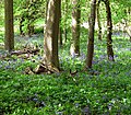
 Bluebells in Arminghall Wood - geograph.org.uk - 5361906.jpg 640 × 480; 546 KB
-
 Boudica's Way - approaching Caistor Lane - geograph.org.uk - 1378675.jpg 640 × 541; 130 KB
-
 Boudica's Way - geograph.org.uk - 1378624.jpg 640 × 480; 108 KB
-
 Boudica's Way - to Arminghall Lane - geograph.org.uk - 1378743.jpg 480 × 640; 143 KB
-
 Boudica's Way - to Stoke Road - geograph.org.uk - 1378740.jpg 480 × 640; 131 KB
-
 Church Close, Arminghall - geograph.org.uk - 3756053.jpg 3,072 × 2,304; 1.86 MB
-
 Entrance to the Arminghall car boot site - geograph.org.uk - 1670150.jpg 640 × 480; 120 KB
-
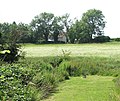
 Fields north-west of Arminghall - geograph.org.uk - 1772176.jpg 640 × 480; 102 KB
-
 Footbridge over ditch - geograph.org.uk - 1378681.jpg 640 × 480; 123 KB
-
 Footpath to Arminghall Wood - geograph.org.uk - 4466996.jpg 640 × 480; 519 KB
-
 House in Arminghall Lane - geograph.org.uk - 1370840.jpg 640 × 480; 89 KB
-
 K6 Telephone box - geograph.org.uk - 1370846.jpg 640 × 480; 85 KB
-
 Manor Farm, Arminghall - geograph.org.uk - 117935.jpg 640 × 480; 200 KB
-
 Moated site, Arminghall - geograph.org.uk - 2349229.jpg 640 × 480; 325 KB
-
 Norwich Road, Poringland - geograph.org.uk - 117941.jpg 640 × 480; 189 KB
-

-
 On Boudicca Way E of Highash Farm, Arminghall, Norfolk - geograph.org.uk - 5620917.jpg 5,184 × 2,920; 5.55 MB
-
 Path to Boudica's Way - geograph.org.uk - 1378618.jpg 640 × 480; 123 KB
-
 Private section of Arminghall Wood - geograph.org.uk - 5362032.jpg 640 × 480; 546 KB
-
 Remains of an old brick wall, Arminghall - geograph.org.uk - 2349236.jpg 640 × 480; 336 KB
-
 Remains of an old brick wall, Arminghall - geograph.org.uk - 2349239.jpg 640 × 480; 352 KB
-
 Remains of an old iron fence, Arminghall - geograph.org.uk - 2349233.jpg 640 × 565; 349 KB
-
 Roadsign, Arminghall Village sign ^ Hall - geograph.org.uk - 3756058.jpg 2,304 × 3,072; 2 MB
-
 Roadsign, Arminghall Village sign ^ Hall - geograph.org.uk - 3756064.jpg 3,072 × 2,304; 1.62 MB
-

-
 Site of the Arminghall car boot sale - geograph.org.uk - 1670169.jpg 640 × 444; 84 KB
-
 Spotted orchid in Arminghall Wood - geograph.org.uk - 1840726.jpg 640 × 528; 190 KB
-
 Spring in Arminghall Wood - geograph.org.uk - 5361899.jpg 640 × 480; 564 KB
-
 Stoke Road, Arminghall - geograph.org.uk - 3756134.jpg 3,072 × 2,304; 1.83 MB
-
 The A47 road north of Arminghall - geograph.org.uk - 1956448.jpg 640 × 449; 221 KB
-

-
 Tornado 60163 past Arminghall Henge - geograph.org.uk - 3260336.jpg 600 × 640; 366 KB
-
 Transformer beside Arminghall Lane - geograph.org.uk - 1370872.jpg 480 × 640; 133 KB
-

-

-

-
 Trees and pond, Manor Farm, Arminghall - geograph.org.uk - 117936.jpg 480 × 640; 263 KB
-
 View towards Manor Farm in Arminghall - geograph.org.uk - 1772184.jpg 640 × 480; 163 KB
-
 Village hall, Arminghall - geograph.org.uk - 117939.jpg 640 × 480; 231 KB
-
 Village sign, Arminghall - geograph.org.uk - 117938.jpg 480 × 640; 254 KB


