Category:Ards Borough Council
Jump to navigation
Jump to search
local authority in Northern Ireland | |||||
| Upload media | |||||
| Instance of | |||||
|---|---|---|---|---|---|
| Location |
| ||||
| |||||
Subcategories
This category has the following 7 subcategories, out of 7 total.
A
C
- Castle Yard Craft Village (4 F)
- Corrog Wood, County Down (10 F)
G
- The Gatepost, Portaferry (7 F)
R
- Roads in Ards Borough Council (31 F)
T
Media in category "Ards Borough Council"
The following 105 files are in this category, out of 105 total.
-
 A view from Scrabo - geograph.org.uk - 1324252.jpg 640 × 513; 382 KB
-
 A view from Scrabo - geograph.org.uk - 1324255.jpg 640 × 418; 323 KB
-
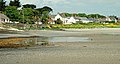
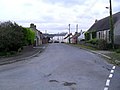 Ardmillan village - geograph.org.uk - 1554521.jpg 640 × 480; 87 KB
-
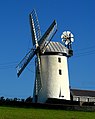
 Ballycopeland Windmill - geograph.org.uk - 995396.jpg 640 × 550; 287 KB
-
 Ballycopeland Windmill - geograph.org.uk - 995399.jpg 509 × 640; 294 KB
-
-
 Ballywalter Presbyterian Church - geograph.org.uk - 1038879.jpg 480 × 640; 64 KB
-
 Bindweed at Kiltonga - geograph.org.uk - 917834.jpg 640 × 438; 104 KB
-
 Blackberries, Killynether Wood - geograph.org.uk - 940059.jpg 549 × 517; 84 KB
-
 Bramble flower at Kiltonga - geograph.org.uk - 917844.jpg 640 × 407; 87 KB
-
 Cloughey Bay - geograph.org.uk - 837592.jpg 640 × 344; 74 KB
-
 Cycle Race - geograph.org.uk - 1457600.jpg 640 × 427; 89 KB
-
 Drumlin country (22) - geograph.org.uk - 817923.jpg 640 × 408; 80 KB
-
 Drumlin country (27) - geograph.org.uk - 1181667.jpg 640 × 317; 53 KB
-
 Drumlins, Strangford Lough - geograph.org.uk - 1299996.jpg 640 × 354; 71 KB
-
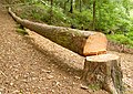 Felled tree, Killynether Wood - geograph.org.uk - 939995.jpg 632 × 450; 123 KB
-
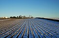
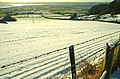
 Flooded furrows near Comber - geograph.org.uk - 1139257.jpg 640 × 386; 96 KB
-
 Flowerbed, Donaghadee - geograph.org.uk - 895560.jpg 598 × 421; 110 KB
-

-
 Former goods shed, Ballygowan - geograph.org.uk - 1554155.jpg 640 × 480; 83 KB
-
 Frozen field near Scrabo - geograph.org.uk - 1654702.jpg 640 × 418; 229 KB
-
 Frozen fields near Scrabo - geograph.org.uk - 1654704.jpg 640 × 382; 210 KB
-
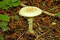
 Fungi, Corrog Wood - geograph.org.uk - 973315.jpg 640 × 480; 317 KB
-
 Fungus, Killynether Wood (1) - geograph.org.uk - 939843.jpg 533 × 354; 97 KB
-
 Fungus, Killynether Wood (2) - geograph.org.uk - 939872.jpg 640 × 419; 110 KB
-
 Fungus, Killynether Wood (3) - geograph.org.uk - 940011.jpg 640 × 417; 90 KB
-
 Fungus, Killynether Wood (4) - geograph.org.uk - 940044.jpg 640 × 425; 99 KB
-
 Gate near Newtownards - geograph.org.uk - 1150366.jpg 625 × 331; 106 KB
-
 Gate, Killynether Wood, Newtownards (1) - geograph.org.uk - 1208088.jpg 640 × 414; 110 KB
-
 Gate, Killynether Wood, Newtownards (2) - geograph.org.uk - 1208155.jpg 640 × 371; 102 KB
-
 Gate, Kiltonga, Newtownards - geograph.org.uk - 812057.jpg 640 × 431; 128 KB
-
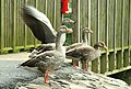 Geese at Kiltonga (3) - geograph.org.uk - 917853.jpg 640 × 434; 82 KB
-
 Glass Moss - geograph.org.uk - 930457.jpg 640 × 456; 38 KB
-
 Goose family, Kiltonga, Newtownards (2) - geograph.org.uk - 812023.jpg 640 × 399; 114 KB
-
 Goose family, Kiltonga, Newtownards (3) - geograph.org.uk - 812036.jpg 598 × 414; 107 KB
-
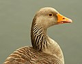 Goose, Kiltonga, Newtownards - geograph.org.uk - 812007.jpg 640 × 494; 47 KB
-

-
 Kirkistown Motor Racing Circuit - geograph.org.uk - 1093480.jpg 640 × 457; 42 KB
-
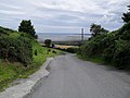
 Lane near Comber - geograph.org.uk - 1129290.jpg 632 × 373; 82 KB
-

-
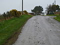
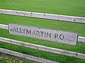
 Moat Road, Townhead - geograph.org.uk - 751112.jpg 640 × 480; 57 KB
-
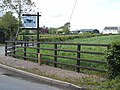 Neat sign at Drumreagh - geograph.org.uk - 751925.jpg 640 × 480; 77 KB
-
 Nettle flowers, Kiltonga - geograph.org.uk - 917906.jpg 640 × 436; 116 KB
-
 New Line Road near Donaghadee - geograph.org.uk - 740005.jpg 640 × 480; 73 KB
-
 Northern entrance to Holly Park - geograph.org.uk - 751940.jpg 640 × 480; 91 KB
-
 Number 18 Ardminnan Road - geograph.org.uk - 751037.jpg 640 × 480; 98 KB
-
 Old windmill near Kearney - geograph.org.uk - 751049.jpg 640 × 480; 60 KB
-
 Oliver's Close, Ballygalget - geograph.org.uk - 751024.jpg 640 × 480; 71 KB
-
 Path to Scrabo - geograph.org.uk - 1325826.jpg 640 × 444; 318 KB
-
 Path, Killynether Wood (3) - geograph.org.uk - 748980.jpg 634 × 396; 114 KB
-
 Path, Killynether Wood (4) - geograph.org.uk - 773693.jpg 640 × 392; 102 KB
-
 Path, Kiltonga, Newtownards - geograph.org.uk - 773430.jpg 640 × 391; 122 KB
-
 Path, Kiltonga, Newtownards - geograph.org.uk - 812068.jpg 614 × 390; 95 KB
-
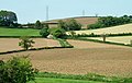
 Ploughed fields near Comber (2) - geograph.org.uk - 1129236.jpg 594 × 391; 102 KB
-
 Ploughed fields near Comber - geograph.org.uk - 1129190.jpg 553 × 426; 93 KB
-
 Ploughed fields near Scrabo, Newtownards - geograph.org.uk - 1207737.jpg 638 × 449; 100 KB
-
 Portaferry Road at Cunningburn (3) - geograph.org.uk - 762952.jpg 640 × 480; 422 KB
-
 Portavo Reservoir - geograph.org.uk - 1407505.jpg 640 × 400; 333 KB
-
 Post and sign, Corrog Wood - geograph.org.uk - 973307.jpg 480 × 640; 256 KB
-

-
 Quintin Bay Road near Tara - geograph.org.uk - 738522.jpg 640 × 480; 71 KB
-
 Raindrops, Killynether Wood - geograph.org.uk - 742030.jpg 640 × 383; 63 KB
-
 Red berries at Kiltonga - geograph.org.uk - 917914.jpg 640 × 389; 59 KB
-
 Road sign near Millisle - geograph.org.uk - 755722.jpg 640 × 388; 59 KB
-
 Road up to Scrabo - geograph.org.uk - 1404407.jpg 640 × 480; 70 KB
-
 Rubane village - geograph.org.uk - 1509918.jpg 640 × 480; 90 KB
-
 Ruined windmill near Greyabbey - geograph.org.uk - 762590.jpg 640 × 480; 357 KB
-
 Scrabo Golf Course - geograph.org.uk - 780487.jpg 640 × 445; 431 KB
-
 Scrabo snow scenes, Newtownards (2) - geograph.org.uk - 1150189.jpg 631 × 379; 91 KB
-
 Scrabo snow scenes, Newtownards (3) - geograph.org.uk - 1150221.jpg 640 × 392; 82 KB
-
 Scrabo snow scenes, Newtownards (4) - geograph.org.uk - 1150260.jpg 640 × 424; 93 KB
-
 Scrabo snow scenes, Newtownards (6) - geograph.org.uk - 1150321.jpg 640 × 375; 87 KB
-
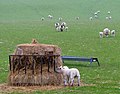 Sheep near Tara (1) - geograph.org.uk - 738512.jpg 640 × 501; 104 KB
-
 Sign at Craigarusky - geograph.org.uk - 1554571.jpg 640 × 480; 111 KB
-
 Split tree branch, Killynether Wood - geograph.org.uk - 748900.jpg 640 × 418; 121 KB
-
 Spring at Scrabo - geograph.org.uk - 742018.jpg 640 × 419; 72 KB
-

-
 Steps, Killynether Wood - geograph.org.uk - 939975.jpg 614 × 404; 101 KB
-
 Telephone Box, Ardmillan - geograph.org.uk - 1554560.jpg 640 × 480; 123 KB
-
 The Cunningburn Road near Greyabbey - geograph.org.uk - 807825.jpg 640 × 428; 135 KB
-
 The Drumfad Road near Carrowdore (1) - geograph.org.uk - 755578.jpg 587 × 399; 105 KB
-
 The Drumfad Road near Carrowdore (2) - geograph.org.uk - 755629.jpg 640 × 387; 98 KB
-
 The Mill Pond, Ardmillan - geograph.org.uk - 1554564.jpg 640 × 480; 88 KB
-
 The Moat Road near Newtownards - geograph.org.uk - 1654695.jpg 640 × 407; 223 KB
-
 The Moat Road near Scrabo - geograph.org.uk - 780517.jpg 640 × 480; 510 KB
-
 The Moat Road, Newtownards (3) - geograph.org.uk - 742566.jpg 640 × 410; 75 KB
-
 The Oyster Yard, Ardmillan - geograph.org.uk - 1554565.jpg 640 × 480; 86 KB
-
 The Portaferry Road, Greyabbey (2) - geograph.org.uk - 1127608.jpg 640 × 375; 93 KB
-
 The view from Scrabo (1) - geograph.org.uk - 1295419.jpg 640 × 388; 88 KB
-
 The view from Scrabo (3) - geograph.org.uk - 1295552.jpg 640 × 367; 112 KB
-
 The view from Scrabo (4) - geograph.org.uk - 1295615.jpg 620 × 397; 97 KB
-
 The view from Scrabo (6) - geograph.org.uk - 1295720.jpg 640 × 405; 97 KB
-
 The Woburn Road near Millisle - geograph.org.uk - 755690.jpg 567 × 370; 96 KB
-

-
 Trees and fields, Portavo - geograph.org.uk - 1407510.jpg 640 × 507; 394 KB
-
 Trees near Millisle - geograph.org.uk - 517460.jpg 640 × 480; 152 KB
-
 Unfriendly horses - geograph.org.uk - 662803.jpg 640 × 480; 85 KB
-
-

-
 Wall, Killynether Wood - geograph.org.uk - 546013.jpg 640 × 426; 116 KB
-
 Water tower, Portavo - geograph.org.uk - 1407503.jpg 640 × 460; 362 KB
-
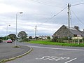
 Welcome to Newtownards - geograph.org.uk - 754364.jpg 612 × 436; 81 KB
-
 Whitespots Country Park, Newtownards (3) - geograph.org.uk - 539737.jpg 640 × 426; 161 KB
-
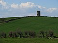
 Windmill Hill - geograph.org.uk - 751110.jpg 640 × 480; 58 KB
-
 Windmill near Kearney - geograph.org.uk - 562964.jpg 629 × 324; 53 KB


_with_Scrabo_Tower_and_hill_in_the_distance_-_geograph.org.uk_-_869639.jpg)


_-_geograph.org.uk_-_817923.jpg)
_-_geograph.org.uk_-_1181667.jpg)


_-_geograph.org.uk_-_939843.jpg)
_-_geograph.org.uk_-_939872.jpg)
_-_geograph.org.uk_-_940011.jpg)
_-_geograph.org.uk_-_940044.jpg)

_-_geograph.org.uk_-_1208088.jpg)
_-_geograph.org.uk_-_1208155.jpg)

_-_geograph.org.uk_-_917853.jpg)

_-_geograph.org.uk_-_812023.jpg)
_-_geograph.org.uk_-_812036.jpg)


_-_geograph.org.uk_-_748980.jpg)
_-_geograph.org.uk_-_773693.jpg)


_-_geograph.org.uk_-_1129236.jpg)


_-_geograph.org.uk_-_762952.jpg)


_-_geograph.org.uk_-_1150189.jpg)
_-_geograph.org.uk_-_1150221.jpg)
_-_geograph.org.uk_-_1150260.jpg)
_-_geograph.org.uk_-_1150321.jpg)
_-_geograph.org.uk_-_738512.jpg)


_-_geograph.org.uk_-_755578.jpg)
_-_geograph.org.uk_-_755629.jpg)


_-_geograph.org.uk_-_742566.jpg)

_-_geograph.org.uk_-_1127608.jpg)
_-_geograph.org.uk_-_1295419.jpg)
_-_geograph.org.uk_-_1295552.jpg)
_-_geograph.org.uk_-_1295615.jpg)
_-_geograph.org.uk_-_1295720.jpg)


_-_geograph.org.uk_-_539737.jpg)

