Category:Ardoch (civil parish)
Jump to navigation
Jump to search
Scottish parish in Perth and Kinross, Scotland, UK | |||||
| Upload media | |||||
| Instance of | |||||
|---|---|---|---|---|---|
| Named after | |||||
| Location |
| ||||
| Population |
| ||||
| Area |
| ||||
 | |||||
Subcategories
This category has the following 3 subcategories, out of 3 total.
Media in category "Ardoch (civil parish)"
The following 200 files are in this category, out of 463 total.
(previous page) (next page)-
 'Beannie' Farmhouse - geograph.org.uk - 4217196.jpg 5,455 × 3,637; 6.41 MB
-
 A 822 entering Braco - geograph.org.uk - 1875882.jpg 800 × 571; 172 KB
-
 A 9 near Greenloaning turning - geograph.org.uk - 2277775.jpg 800 × 572; 40 KB
-
 A break from the windscreens - geograph.org.uk - 5439506.jpg 1,024 × 683; 318 KB
-
 A coniferous plantation - geograph.org.uk - 3005525.jpg 640 × 360; 258 KB
-
 A dean, Glasingalbeg Burn - geograph.org.uk - 3243720.jpg 640 × 480; 365 KB
-
 A field off Sheriff Muir - geograph.org.uk - 3005523.jpg 640 × 360; 228 KB
-
 A replanted strip - geograph.org.uk - 5745947.jpg 1,024 × 683; 324 KB
-
 A822 approaching A9 Perth slip road - geograph.org.uk - 3068039.jpg 640 × 406; 63 KB
-
 A822 close to Redford - geograph.org.uk - 3068003.jpg 640 × 461; 47 KB
-
 A822 entering Braco - geograph.org.uk - 3068009.jpg 640 × 444; 92 KB
-
 A822 entering Greenloaning - geograph.org.uk - 3068036.jpg 640 × 453; 70 KB
-
 A822 Muir of Orchil - geograph.org.uk - 3430107.jpg 640 × 480; 330 KB
-
 A822 near Garrick - geograph.org.uk - 3430088.jpg 640 × 480; 285 KB
-
 A822 without the windscreen - geograph.org.uk - 3430093.jpg 640 × 480; 256 KB
-
 A9 at Upper Quoiggs junction - geograph.org.uk - 3067307.jpg 640 × 376; 43 KB
-
 A9 east from Blueton - geograph.org.uk - 3067320.jpg 640 × 378; 43 KB
-
 A9 entering Perth and Kinross - geograph.org.uk - 3067299.jpg 640 × 446; 58 KB
-
 A9 from Mains of Balhaldie bus stop - geograph.org.uk - 3067305.jpg 640 × 395; 37 KB
-
 A9 near Balhaldie - geograph.org.uk - 5915909.jpg 5,184 × 3,888; 5.16 MB
-
 A9 near Blueton Farm - geograph.org.uk - 6134148.jpg 800 × 533; 655 KB
-
 A9 north of Balhaldie - geograph.org.uk - 5741380.jpg 640 × 427; 354 KB
-
 A9 south of Greenloaning - geograph.org.uk - 5741402.jpg 640 × 427; 294 KB
-
 A9, Blueton - geograph.org.uk - 5439513.jpg 1,024 × 683; 232 KB
-
 A9, Buttergask - geograph.org.uk - 5757195.jpg 1,024 × 683; 364 KB
-
 A9, Strath Allan - geograph.org.uk - 5532566.jpg 1,024 × 683; 246 KB
-
 Abandoned Little Chef on the A9 - geograph.org.uk - 5942711.jpg 1,600 × 900; 403 KB
-
 Above the Knaick - geograph.org.uk - 4472727.jpg 800 × 450; 189 KB
-
 Altersie - geograph.org.uk - 5803232.jpg 1,024 × 683; 306 KB
-
 Approaching Greenloaning - geograph.org.uk - 5992874.jpg 1,024 × 732; 140 KB
-
 Approaching Netherton from the east - geograph.org.uk - 3035767.jpg 640 × 470; 36 KB
-
 Approaching road junction at Kinburn - geograph.org.uk - 3067321.jpg 640 × 389; 38 KB
-
 Arable at Topfauld Farm - geograph.org.uk - 5911321.jpg 1,600 × 1,067; 239 KB
-
 Arable land, Loig - geograph.org.uk - 1898709.jpg 640 × 369; 95 KB
-
 Arable land, Orchill - geograph.org.uk - 3429360.jpg 640 × 360; 229 KB
-
 Arable land, Orchill - geograph.org.uk - 3503721.jpg 640 × 360; 237 KB
-
 Ardoch Free Church - geograph.org.uk - 5696126.jpg 1,024 × 683; 327 KB
-
 Ardoch Free Church Tower, Braco - geograph.org.uk - 3862960.jpg 480 × 800; 90 KB
-
 Ardoch Free Church Tower, Braco - geograph.org.uk - 5600984.jpg 480 × 640; 108 KB
-
 Ardoch Parish Church - geograph.org.uk - 4218232.jpg 5,844 × 3,896; 6.49 MB
-
 Ardoch Parish Church, Braco - geograph.org.uk - 5600935.jpg 640 × 480; 102 KB
-
 Ardoch Roman Camp - geograph.org.uk - 1922803.jpg 640 × 361; 78 KB
-
 Ardoch Roman Camp - geograph.org.uk - 1922829.jpg 640 × 352; 71 KB
-
 Ardoch Roman Camp - geograph.org.uk - 2340549.jpg 640 × 481; 112 KB
-
 Ardoch Roman Camp - geograph.org.uk - 3503737.jpg 640 × 360; 223 KB
-
 Ardoch Roman Fort - geograph.org.uk - 5866039.jpg 1,600 × 1,066; 551 KB
-
 Ardoch Roman Fort - geograph.org.uk - 5866043.jpg 1,600 × 1,066; 428 KB
-
 Ardoch Roman Fort, near Braco - geograph.org.uk - 6111635.jpg 3,968 × 2,976; 2.33 MB
-
 Autumn border - geograph.org.uk - 4754720.jpg 3,695 × 3,254; 6.47 MB
-
 Autumn fruits (Ash tree) - geograph.org.uk - 4217608.jpg 4,026 × 2,719; 5.71 MB
-
 B8033 - geograph.org.uk - 5531006.jpg 1,024 × 683; 303 KB
-
 B8033, Braco - geograph.org.uk - 5532559.jpg 1,024 × 683; 452 KB
-
 B8033, Faulds - geograph.org.uk - 5531022.jpg 1,024 × 683; 306 KB
-
 B817 with view towards Ben Clach - geograph.org.uk - 4217188.jpg 6,000 × 4,000; 6.91 MB
-
 B827 junction from A822 - geograph.org.uk - 3068012.jpg 640 × 450; 82 KB
-
 B827 road to Comrie - geograph.org.uk - 5987451.jpg 1,600 × 1,200; 516 KB
-
 Bale cache at Rottearns - geograph.org.uk - 5336827.jpg 800 × 474; 219 KB
-
 Balhaldie Filling Station - geograph.org.uk - 3085112.jpg 640 × 398; 75 KB
-
 Barn at Wester Rottearns, Greenloaning - geograph.org.uk - 3511221.jpg 1,024 × 681; 97 KB
-
 Beannie farm - geograph.org.uk - 5987447.jpg 1,600 × 1,060; 384 KB
-
 Beauly - Denny construction entrance - geograph.org.uk - 4472740.jpg 800 × 450; 207 KB
-
 Beauly - Denny power line - geograph.org.uk - 4472728.jpg 800 × 450; 172 KB
-
 Beauly - Denny power line - geograph.org.uk - 4472747.jpg 800 × 450; 127 KB
-
 Beauly - Denny power line - geograph.org.uk - 5696596.jpg 1,024 × 683; 330 KB
-
 Beauly - Denny power line - geograph.org.uk - 5803254.jpg 1,024 × 576; 253 KB
-
 Beech trees mark an old hedge line on Nether Braco farm - geograph.org.uk - 5884613.jpg 1,600 × 1,067; 633 KB
-
 Beechwood on the B8033 - geograph.org.uk - 4235409.jpg 1,600 × 1,025; 703 KB
-

-
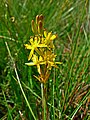 Bog Asphodel (Narthecium ossifragum) - geograph.org.uk - 1392416.jpg 480 × 640; 126 KB
-
 Bog in a forest clearing - geograph.org.uk - 909642.jpg 640 × 463; 176 KB
-
 Bog near Cambushinnie - geograph.org.uk - 5803241.jpg 1,024 × 576; 276 KB
-
 Bogs, Braes of Doune - geograph.org.uk - 1893353.jpg 640 × 359; 96 KB
-
 Bogs, Slymaback - geograph.org.uk - 1898635.jpg 640 × 359; 108 KB
-
 Bowling green, Braco - geograph.org.uk - 5696127.jpg 1,024 × 683; 321 KB
-
 Braco - Auchterarder road - geograph.org.uk - 5742096.jpg 1,024 × 683; 392 KB
-
 Braco - Braes of Doune road - geograph.org.uk - 1897682.jpg 640 × 359; 85 KB
-
 Bridge and road to Keirallan - geograph.org.uk - 5768836.jpg 1,600 × 1,067; 553 KB
-
 Bridge over Allt an t-Seilich - geograph.org.uk - 6223645.jpg 1,600 × 985; 388 KB
-
 Bridge over Millstone Burn - geograph.org.uk - 5863504.jpg 1,600 × 1,067; 600 KB
-
 Bridge over the A9 at Greenloaning - geograph.org.uk - 5741414.jpg 640 × 427; 347 KB
-
 Burn and peat bog - geograph.org.uk - 909639.jpg 463 × 640; 173 KB
-
 Bus Stop on the A9 south of Blackford - geograph.org.uk - 5741439.jpg 640 × 427; 356 KB
-
 Cambshinnie - geograph.org.uk - 5803239.jpg 1,024 × 683; 425 KB
-
 Cambushinne Hill - geograph.org.uk - 1893193.jpg 640 × 359; 102 KB
-
 Cambushinnie - geograph.org.uk - 5803237.jpg 1,024 × 683; 312 KB
-
 Cambushinnie Wood - geograph.org.uk - 5529883.jpg 1,024 × 683; 405 KB
-
 Cambushinnie Wood - geograph.org.uk - 5856586.jpg 1,600 × 1,067; 530 KB
-
 Carbon credit woodland - geograph.org.uk - 2053357.jpg 1,024 × 768; 114 KB
-
 Carbon credits at Over Ardoch - geograph.org.uk - 2053354.jpg 1,024 × 768; 162 KB
-
 Caring for the Countryside - geograph.org.uk - 5948661.jpg 4,820 × 3,214; 6.37 MB
-
 Carsebreck house - geograph.org.uk - 3277143.jpg 4,320 × 3,240; 5.09 MB
-
 Carsebreck house - geograph.org.uk - 3277146.jpg 4,320 × 3,240; 5 MB
-
 Carsebreck house - geograph.org.uk - 3277148.jpg 4,320 × 3,240; 5.02 MB
-
 Carsebreck house - geograph.org.uk - 3277151.jpg 9,445 × 6,275; 6.84 MB
-
 Carsebreck house - geograph.org.uk - 3277156.jpg 7,354 × 3,535; 6.47 MB
-
 Carsebreck house. Unlucky for some - geograph.org.uk - 3277141.jpg 4,320 × 3,240; 5.67 MB
-
 Castle gardens - geograph.org.uk - 4218082.jpg 6,000 × 4,000; 7.03 MB
-
 Castle Gardens - geograph.org.uk - 4218086.jpg 4,000 × 6,000; 5.48 MB
-
 Cattle grid, Sheriff Muir - geograph.org.uk - 3004735.jpg 640 × 360; 217 KB
-

-
 Cattle near Blueton - geograph.org.uk - 6229717.jpg 1,024 × 806; 183 KB
-
 Cattle, Blairmore - geograph.org.uk - 1893109.jpg 640 × 359; 79 KB
-
 Christmas tree plantation, Croftmore - geograph.org.uk - 5696141.jpg 1,024 × 683; 356 KB
-
 Christmas tree plantation, Feddal - geograph.org.uk - 5856571.jpg 1,600 × 1,067; 358 KB
-
 Christmas trees, Crofthead - geograph.org.uk - 5696139.jpg 1,024 × 683; 358 KB
-
 Christmas trees, Feddal - geograph.org.uk - 5532561.jpg 1,024 × 683; 345 KB
-
 Christmas trees, Feddal - geograph.org.uk - 5696557.jpg 1,024 × 683; 361 KB
-
 Clatteringford - geograph.org.uk - 3429402.jpg 640 × 360; 194 KB
-
 Clatteringford, a farm near Ardoch Roman Fort - geograph.org.uk - 5774512.jpg 1,600 × 1,067; 420 KB
-
 Clear fell - geograph.org.uk - 3471141.jpg 640 × 480; 280 KB
-
 Cleared forestry - geograph.org.uk - 5934535.jpg 1,600 × 1,067; 607 KB
-
 Cleared forestry at Greenscares - geograph.org.uk - 6223667.jpg 1,600 × 1,067; 565 KB
-
 Corriebeagh Burn - geograph.org.uk - 6223653.jpg 1,600 × 1,067; 574 KB
-
 Cottage at Beannie, Braco - geograph.org.uk - 4217197.jpg 4,803 × 3,167; 6.65 MB
-
 Crocket Burn - geograph.org.uk - 5803235.jpg 1,024 × 683; 397 KB
-
 Deer seat, Feddal - geograph.org.uk - 5696554.jpg 1,024 × 683; 443 KB
-
 Downhill to Greenloaning from Sherrifmuir - geograph.org.uk - 5863499.jpg 1,600 × 1,067; 403 KB
-
 Drystane Dyke - geograph.org.uk - 1589238.jpg 480 × 640; 83 KB
-
 Duck park - geograph.org.uk - 4217495.jpg 2,467 × 1,472; 2.04 MB
-
 Dun Roamin - geograph.org.uk - 4235240.jpg 1,062 × 1,600; 677 KB
-

-
 Earthworks, Ardoch Fort - geograph.org.uk - 6093412.jpg 1,024 × 768; 371 KB
-
 Earthworks, Ardoch Fort - geograph.org.uk - 6093415.jpg 1,024 × 768; 346 KB
-

-
 Edge of moorland - geograph.org.uk - 1897669.jpg 640 × 359; 87 KB
-
 Electrical installation - geograph.org.uk - 5599511.jpg 640 × 360; 38 KB
-
 Electricity installation - geograph.org.uk - 5617528.jpg 640 × 360; 50 KB
-
 Electricity transmission cables - geograph.org.uk - 5942032.jpg 4,732 × 3,155; 4.15 MB
-
 Entering Crieff on the A822 - geograph.org.uk - 4235228.jpg 1,600 × 1,062; 751 KB
-
 Entrance Drive - geograph.org.uk - 4218187.jpg 6,000 × 4,000; 5.32 MB
-
 Entrance to Coupans Kennels ^ Cattery - geograph.org.uk - 4235367.jpg 1,600 × 1,062; 583 KB
-
 Entrance to Easterton Farm - geograph.org.uk - 4234919.jpg 1,600 × 1,062; 989 KB
-
 Entrance to Easterton Farm - geograph.org.uk - 4234923.jpg 1,600 × 1,062; 765 KB
-
 Ewes and lambs near Gunnocks - geograph.org.uk - 3430077.jpg 640 × 360; 224 KB
-

-
 Fank above Red Moss - geograph.org.uk - 4472710.jpg 800 × 450; 176 KB
-
 Farm at Wester Feddal on the B8033 - geograph.org.uk - 4235360.jpg 1,600 × 1,074; 612 KB
-
 Farm buildings at Springbank - geograph.org.uk - 4706204.jpg 5,874 × 3,916; 5.24 MB
-
 Farm on the B817 - geograph.org.uk - 4217194.jpg 5,531 × 3,580; 5.12 MB
-
 Farm produce at Wester Feddal - geograph.org.uk - 2053352.jpg 1,024 × 768; 116 KB
-
 Farm road to Glenlichorn - geograph.org.uk - 6223678.jpg 1,600 × 1,067; 488 KB
-
 Farm road, Greenhill - geograph.org.uk - 3471149.jpg 640 × 480; 323 KB
-
 Farm sign - geograph.org.uk - 4217195.jpg 5,527 × 3,685; 6.17 MB
-
 Farm Track - geograph.org.uk - 2417165.jpg 1,600 × 1,200; 697 KB
-
 Farm track near Braco - geograph.org.uk - 5742082.jpg 1,024 × 683; 296 KB
-
 Farm Track near Glenlichorn - geograph.org.uk - 994377.jpg 640 × 480; 184 KB
-
 Farmland at Glenbank - geograph.org.uk - 6229713.jpg 1,024 × 785; 115 KB
-
 Farmland beside the River Knaik - geograph.org.uk - 5866081.jpg 1,600 × 1,040; 407 KB
-
 Faulds farm - geograph.org.uk - 2053349.jpg 1,024 × 768; 104 KB
-
 Faulds farm - geograph.org.uk - 5856577.jpg 1,600 × 1,017; 206 KB
-
 Feddal Road, Braco - geograph.org.uk - 1893051.jpg 640 × 359; 92 KB
-
 Feddal Road, Braco - geograph.org.uk - 4235231.jpg 1,600 × 1,062; 718 KB
-
 Felled forestry, from B827 - geograph.org.uk - 4436860.jpg 2,961 × 1,979; 2.77 MB
-
 Felled strip - geograph.org.uk - 3429390.jpg 640 × 360; 235 KB
-
 Field drain at Keirallan - geograph.org.uk - 5768839.jpg 1,600 × 1,067; 589 KB
-
 Field near Braco - geograph.org.uk - 5742089.jpg 1,024 × 683; 280 KB
-
 Field of Buttercups - geograph.org.uk - 1922811.jpg 640 × 361; 83 KB
-
 Field, Craighead - geograph.org.uk - 5803271.jpg 1,024 × 683; 241 KB
-
 Field, Tamano - geograph.org.uk - 5803276.jpg 1,024 × 683; 375 KB
-
 Field, Wester Feddal - geograph.org.uk - 5532556.jpg 1,024 × 683; 277 KB
-
 Field, Woodside of Balhaldie - geograph.org.uk - 6264473.jpg 1,024 × 576; 257 KB
-
 Fields along the dual carriageway - geograph.org.uk - 3031405.jpg 800 × 593; 51 KB
-
 Fields, Braco - geograph.org.uk - 3429409.jpg 640 × 346; 203 KB
-
 Fields, Woodside of Balhaldie - geograph.org.uk - 6264491.jpg 1,024 × 576; 193 KB
-
 Flashing nanny sign, Feddal - geograph.org.uk - 5696560.jpg 1,024 × 683; 437 KB
-
 Flooded B8033 - geograph.org.uk - 5531012.jpg 1,024 × 683; 245 KB
-
 Flooded ground, Greenloaning - geograph.org.uk - 3247148.jpg 640 × 480; 299 KB
-
 Flush bracket on Muirhead Trig pillar - geograph.org.uk - 6415059.jpg 1,024 × 768; 339 KB
-
 Flush bracket on trig point on Cromlet - geograph.org.uk - 6415054.jpg 4,000 × 3,000; 5.45 MB
-
 Follow my leader at Over Ardoch - geograph.org.uk - 2229385.jpg 2,238 × 1,658; 1.37 MB
-
 Footpath by River Knaik - geograph.org.uk - 5884636.jpg 1,600 × 1,067; 557 KB
-
 Forest edge - geograph.org.uk - 1897712.jpg 640 × 359; 85 KB
-
 Forest fence - geograph.org.uk - 6389312.jpg 1,024 × 683; 254 KB
-
 Forest Fire Break - geograph.org.uk - 5617522.jpg 640 × 360; 34 KB
-

-
 Front Street, Braco - geograph.org.uk - 4558300.jpg 3,504 × 2,336; 3.42 MB
-
 Front Street, Braco - geograph.org.uk - 4558310.jpg 3,504 × 2,336; 3.68 MB
-
 Froskin Burn - geograph.org.uk - 1897694.jpg 640 × 359; 103 KB
-
 Froskin Burn - geograph.org.uk - 1897701.jpg 640 × 359; 104 KB
-
 Gannochan - geograph.org.uk - 5742104.jpg 1,024 × 683; 337 KB
-
 Gap in the forest - geograph.org.uk - 909638.jpg 640 × 463; 139 KB
-
 Gas pipeline marker, Orchil - geograph.org.uk - 3429364.jpg 640 × 360; 221 KB
-
 Gate Lodge to Braco Castle - geograph.org.uk - 5618795.jpg 1,024 × 674; 171 KB
-
 Gentlecroft - geograph.org.uk - 4218196.jpg 5,282 × 3,592; 6.69 MB
-

-
 Geordie's Burn - geograph.org.uk - 3004399.jpg 640 × 360; 219 KB
-
 Golden Autumn - geograph.org.uk - 4217611.jpg 3,668 × 2,437; 6.06 MB
-
 Grassland, Faulds - geograph.org.uk - 1898696.jpg 640 × 359; 78 KB
-
 Grassland, Faulds - geograph.org.uk - 5531021.jpg 1,024 × 683; 329 KB
-
 Grassland, Feddal - geograph.org.uk - 1898685.jpg 640 × 359; 79 KB
-
 Gravel pit, Braco - geograph.org.uk - 1893064.jpg 640 × 359; 93 KB
-
 Grazing land, Strathallan - geograph.org.uk - 3471154.jpg 640 × 480; 245 KB
-
 Greenloaning junction off A9 - geograph.org.uk - 3067310.jpg 640 × 435; 40 KB
-
 Greenloaning to Sheriffmuir road - geograph.org.uk - 3471151.jpg 640 × 480; 339 KB
-
 Gully leading to River Cnaik, from B827 - geograph.org.uk - 4436882.jpg 3,504 × 2,336; 4.7 MB
-
 Harperstone - geograph.org.uk - 2937951.jpg 640 × 360; 217 KB
-
 Harperstone - geograph.org.uk - 6388348.jpg 1,024 × 683; 280 KB
-
 Harperstone Farm - geograph.org.uk - 2417153.jpg 1,600 × 1,200; 689 KB
-
 Head-dykes - geograph.org.uk - 3471145.jpg 640 × 480; 272 KB
-
 Hill pasture near Quoiggs - geograph.org.uk - 5863503.jpg 1,024 × 657; 146 KB


_-_geograph.org.uk_-_4217608.jpg)


_-_geograph.org.uk_-_1392416.jpg)


&filefrom=Hillside+with+forestry+-+geograph.org.uk+-+4217191.jpg#mw-category-media)