Category:Ardley
Jump to navigation
Jump to search
village and civil parish in Cherwell district, Oxfordshire, England  | |||||
| Upload media | |||||
| Instance of | |||||
|---|---|---|---|---|---|
| Location | Cherwell, Oxfordshire, South East England, England | ||||
| Population |
| ||||
| Area |
| ||||
 | |||||
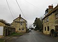
English: Ardley is a village and civil parish in Oxfordshire, England, about northwest of Bicester. The parish also includes the village of Fewcott that is now contiguous with Ardley.
Subcategories
This category has the following 3 subcategories, out of 3 total.
Media in category "Ardley"
The following 133 files are in this category, out of 133 total.
-
 980 Yard Skid - geograph.org.uk - 4672399.jpg 3,964 × 2,572; 1.72 MB
-
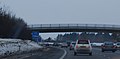
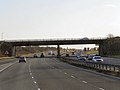
 A bridge over the M40 - geograph.org.uk - 4962455.jpg 1,500 × 1,125; 133 KB
-
 A stone stile, at the beginning of a footpath - geograph.org.uk - 2498751.jpg 2,058 × 1,692; 1.65 MB
-
 A43 near junction 10 M40 - geograph.org.uk - 2262420.jpg 640 × 460; 30 KB
-
 A43 towards Brackley and Northampton - geograph.org.uk - 6191729.jpg 1,024 × 684; 222 KB
-
 Water Pump - geograph.org.uk - 1033926.jpg 640 × 480; 159 KB
-
 Ardley and Fewcott Community Hall - geograph.org.uk - 3647148.jpg 1,500 × 999; 218 KB
-
 Ardley EfW, (energy from waste) - geograph.org.uk - 3987399.jpg 640 × 475; 44 KB
-
 Ardley Energy from Waste Facility - geograph.org.uk - 3719675.jpg 2,915 × 1,582; 791 KB
-
 Ardley Fox&Hounds & barn.JPG 2,900 × 1,450; 1.68 MB
-
 Ardley Fox&Hounds barn.JPG 2,900 × 1,450; 2 MB
-
 Ardley Fox&Hounds.JPG 3,000 × 1,500; 603 KB
-
 Ardley nature reserve - geograph.org.uk - 116978.jpg 640 × 480; 140 KB
-
 Ardley Road bridge over the M40 - geograph.org.uk - 2987600.jpg 640 × 480; 47 KB
-
 Ardley Road crosses the M40 - geograph.org.uk - 4962458.jpg 1,500 × 1,113; 140 KB
-
 Ardley station 2001.JPG 1,724 × 1,172; 1.67 MB
-
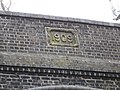 Ardley Tunnel Date Stone - geograph.org.uk - 1612545.jpg 640 × 480; 123 KB
-
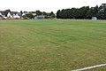 Ardley United football ground - geograph.org.uk - 3647144.jpg 1,500 × 999; 199 KB
-
 Ardley United's clubhouse and changing rooms - geograph.org.uk - 3647145.jpg 1,500 × 999; 198 KB
-
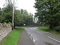
 Ardley-Somerton Road - geograph.org.uk - 6243603.jpg 1,600 × 1,067; 575 KB
-
 B4100 north of Green Farm - geograph.org.uk - 2836375.jpg 640 × 481; 37 KB
-
 B430 at entrance to Ardley Quarry - geograph.org.uk - 2836309.jpg 640 × 481; 45 KB
-
 B430 looking north - geograph.org.uk - 2836300.jpg 640 × 481; 39 KB
-
 B430 southbound - geograph.org.uk - 5445628.jpg 640 × 480; 70 KB
-
 Baynard's Green, bridleway ^ farm road - geograph.org.uk - 3887085.jpg 1,024 × 768; 145 KB
-
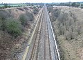
 Birmingham to Bicester Railway - geograph.org.uk - 345051.jpg 640 × 480; 237 KB
-
 Bridleway crosses the lines - geograph.org.uk - 5819295.jpg 1,600 × 1,066; 595 KB
-
 Bridleway to Trowpool - geograph.org.uk - 5819259.jpg 1,600 × 1,066; 630 KB
-
 Bridleway to Trowpool - geograph.org.uk - 5819260.jpg 1,600 × 1,066; 582 KB
-
 Bridleway to Trowpool - geograph.org.uk - 5819262.jpg 1,066 × 1,600; 344 KB
-
 Bridleway to Trowpool - geograph.org.uk - 5819297.jpg 1,600 × 1,066; 520 KB
-
 Cherwell , The M40 Northbound - geograph.org.uk - 6113535.jpg 6,000 × 4,000; 7.39 MB
-
 Disused Bridleway - geograph.org.uk - 4672364.jpg 4,000 × 2,664; 2.63 MB
-
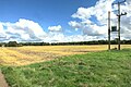
 Farmland - geograph.org.uk - 4354122.jpg 640 × 480; 65 KB
-
 Farmland near Ardley - geograph.org.uk - 4672359.jpg 1,600 × 1,066; 450 KB
-
 Field of poppies near Ardley - geograph.org.uk - 1267905.jpg 640 × 427; 93 KB
-
 Footbridge over the M40 - geograph.org.uk - 2461001.jpg 640 × 316; 27 KB
-
 Footbridge over the M40 motorway - geograph.org.uk - 3022736.jpg 640 × 480; 62 KB
-
 Footpath at Fewcott - geograph.org.uk - 4672582.jpg 3,772 × 2,664; 3.04 MB
-
 Footpath to Ardley - geograph.org.uk - 5819264.jpg 1,600 × 1,066; 635 KB
-
 Footpath to Bucknell - geograph.org.uk - 5819291.jpg 1,600 × 1,066; 495 KB
-
 Fritwell Railway - geograph.org.uk - 6194393.jpg 1,600 × 1,200; 812 KB
-
 Grass, Dead or Alive - geograph.org.uk - 4672579.jpg 1,600 × 1,066; 452 KB
-
 Houses in Fritwell Lane - geograph.org.uk - 3295365.jpg 640 × 480; 65 KB
-
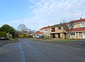 Houses on Somerton Rd - geograph.org.uk - 3295362.jpg 640 × 472; 58 KB
-
 Inside St. Mary, Ardley (i) - geograph.org.uk - 4787612.jpg 470 × 640; 45 KB
-
 Inside St. Mary, Ardley (ii) - geograph.org.uk - 4787614.jpg 480 × 640; 52 KB
-
 Inside St. Mary, Ardley (iii) - geograph.org.uk - 4787615.jpg 480 × 640; 60 KB
-
 Inside St. Mary, Ardley (iv) - geograph.org.uk - 4787616.jpg 464 × 640; 81 KB
-
 Inside St. Mary, Ardley (ix) - geograph.org.uk - 4787634.jpg 480 × 640; 40 KB
-
 Inside St. Mary, Ardley (v) - geograph.org.uk - 4787617.jpg 480 × 640; 30 KB
-
 Inside St. Mary, Ardley (vi) - geograph.org.uk - 4787618.jpg 469 × 640; 55 KB
-
 Inside St. Mary, Ardley (vii) - geograph.org.uk - 4787619.jpg 480 × 640; 49 KB
-
 Inside St. Mary, Ardley (viii) - geograph.org.uk - 4787621.jpg 479 × 640; 64 KB
-
 Inside St. Mary, Ardley (x) - geograph.org.uk - 4787635.jpg 480 × 640; 29 KB
-
 Inside St. Mary, Ardley (xi) - geograph.org.uk - 4787636.jpg 445 × 640; 39 KB
-
 Inside St. Mary, Ardley (xii) - geograph.org.uk - 4787638.jpg 480 × 640; 48 KB
-
 JurassicEchinoids.jpg 3,072 × 2,304; 2.66 MB
-
 Lake from the footpath - geograph.org.uk - 5819289.jpg 1,600 × 1,066; 398 KB
-
-
-
 M40 and A43 slip road - geograph.org.uk - 2537998.jpg 3,648 × 2,736; 1.77 MB
-
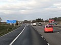
 M40 approaching junction 10 - geograph.org.uk - 3530605.jpg 3,850 × 1,989; 1.53 MB
-
 M40 approaching junction 10 - geograph.org.uk - 4230143.jpg 640 × 415; 70 KB
-
 M40 bridge carrying minor road - geograph.org.uk - 2537987.jpg 3,648 × 2,736; 1.71 MB
-
 M40 east of Ardley - geograph.org.uk - 2829670.jpg 640 × 481; 37 KB
-
 M40 east of Fritwell - geograph.org.uk - 2829668.jpg 640 × 481; 32 KB
-
 M40 heading north near Ardley - geograph.org.uk - 2987596.jpg 640 × 480; 41 KB
-
 M40 motorway - Ardley Road bridge - geograph.org.uk - 3022699.jpg 640 × 480; 61 KB
-
 M40 motorway near Woodlands Farm - geograph.org.uk - 3022696.jpg 640 × 480; 58 KB
-
 M40 motorway north of junction 10 - geograph.org.uk - 3022735.jpg 640 × 480; 60 KB
-
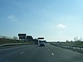
 M40 northbound - geograph.org.uk - 3223653.jpg 640 × 480; 32 KB
-
 M40 northbound - geograph.org.uk - 3223654.jpg 640 × 480; 35 KB
-
 M40 northbound - geograph.org.uk - 3223658.jpg 640 × 480; 34 KB
-
 M40 northbound - geograph.org.uk - 6191666.jpg 1,024 × 684; 242 KB
-
 M40 south at Junction 10 - geograph.org.uk - 2829669.jpg 640 × 481; 33 KB
-
 M40 southbound nearing junction 10 (3) - geograph.org.uk - 2212979.jpg 640 × 360; 227 KB
-
 M40 southbound nearing junction 10 (4) - geograph.org.uk - 2212982.jpg 640 × 400; 213 KB
-

-
 Northbound M40 near Ardley - geograph.org.uk - 3296928.jpg 640 × 480; 365 KB
-
 Northbound M40 near Baynard's Green - geograph.org.uk - 3296975.jpg 640 × 480; 368 KB
-
 Northbound M40, Ardley Road Bridge - geograph.org.uk - 3296935.jpg 640 × 480; 405 KB
-

-
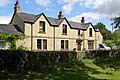
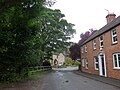
 Old House in Ardley - geograph.org.uk - 3295355.jpg 640 × 480; 76 KB
-
 Pile of gravel - geograph.org.uk - 4520961.jpg 640 × 311; 28 KB
-
 Quiet country path by the M40 - geograph.org.uk - 5819280.jpg 1,600 × 1,066; 579 KB
-
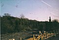
 Railway bridge, Ardley - geograph.org.uk - 116976.jpg 640 × 480; 128 KB
-
-

-
 Ancient doorway^ Not as old as it looks^ - geograph.org.uk - 1671350.jpg 840 × 1,516; 693 KB
-
 Sheep - geograph.org.uk - 345069.jpg 640 × 480; 248 KB
-
 Sheep - geograph.org.uk - 345073.jpg 640 × 480; 248 KB
-
 Somerton Road crosses the Chiltern Line - geograph.org.uk - 2416516.jpg 2,137 × 1,510; 1.23 MB
-
 Southbound M40, Bridge at Junction 10 - geograph.org.uk - 3296753.jpg 640 × 480; 327 KB
-

-

-
 Southbound M40, near Fritwell - geograph.org.uk - 3296734.jpg 640 × 480; 324 KB
-
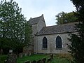
 St Mary’s Church, Ardley - geograph.org.uk - 2856705.jpg 2,816 × 2,112; 2.02 MB
-
 St. Mary, Ardley, banner - geograph.org.uk - 4787625.jpg 480 × 640; 34 KB
-
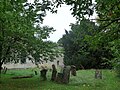 St. Mary, Ardley, churchyard (I) - geograph.org.uk - 4787088.jpg 640 × 480; 122 KB
-
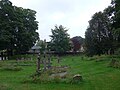
 St. Mary, Ardley, churchyard (II) - geograph.org.uk - 4787089.jpg 640 × 480; 69 KB
-
 St. Mary, Ardley, churchyard (III) - geograph.org.uk - 4787093.jpg 480 × 640; 47 KB
-
 St. Mary, Ardley, churchyard (IV) - geograph.org.uk - 4787095.jpg 640 × 480; 79 KB
-
 St. Mary, Ardley, churchyard (V) - geograph.org.uk - 4787096.jpg 640 × 480; 83 KB
-
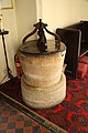
 St. Mary, Ardley, font - geograph.org.uk - 4787623.jpg 480 × 640; 49 KB
-
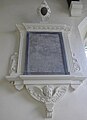
 St. Mary, Ardley, ledger slab - geograph.org.uk - 4787633.jpg 484 × 640; 67 KB
-
 St. Mary, Ardley, memorial (I) - geograph.org.uk - 4787626.jpg 480 × 640; 43 KB
-
 St. Mary, Ardley, memorial (II) - geograph.org.uk - 4787627.jpg 640 × 480; 46 KB
-
 St. Mary, Ardley, memorial (III) - geograph.org.uk - 4787628.jpg 640 × 480; 83 KB
-
 St. Mary, Ardley, memorial (IV) - geograph.org.uk - 4787629.jpg 640 × 480; 68 KB
-
 St. Mary, Ardley, memorial (IX) - geograph.org.uk - 4787642.jpg 480 × 640; 35 KB
-
 St. Mary, Ardley, memorial (V) - geograph.org.uk - 4787631.jpg 640 × 480; 69 KB
-
 St. Mary, Ardley, memorial (VI) - geograph.org.uk - 4787639.jpg 472 × 640; 56 KB
-
 St. Mary, Ardley, memorial (VII) - geograph.org.uk - 4787640.jpg 470 × 640; 34 KB
-
 St. Mary, Ardley, memorial (VIII) - geograph.org.uk - 4787641.jpg 463 × 640; 40 KB
-
 St. Mary, Ardley, notice board - geograph.org.uk - 4669675.jpg 640 × 480; 80 KB
-
 St. Mary, Ardley, pulpit - geograph.org.uk - 4787622.jpg 480 × 640; 48 KB
-
 St. Mary, Ardley, September 2015 - geograph.org.uk - 4669642.jpg 640 × 480; 93 KB
-
 St.Mary's church - geograph.org.uk - 1997217.jpg 640 × 426; 107 KB
-
 St.Mary's font - geograph.org.uk - 1997246.jpg 426 × 640; 86 KB
-
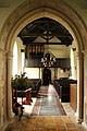
 St.Mary's nave - geograph.org.uk - 1997230.jpg 640 × 426; 82 KB
-
 St.Mary's nave - geograph.org.uk - 1997238.jpg 426 × 640; 94 KB
-
 Stubble Swede Fodder Field - geograph.org.uk - 3295391.jpg 640 × 480; 98 KB
-
 The Fox ^ Hounds, Ardley - geograph.org.uk - 5445623.jpg 640 × 480; 61 KB
-
 The M40 from the A43 at junction 10 - geograph.org.uk - 2655319.jpg 800 × 600; 196 KB
-
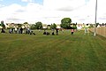 The sports field in Ardley - geograph.org.uk - 3647146.jpg 1,500 × 999; 156 KB
-
 The stand at Ardley United FC - geograph.org.uk - 3647141.jpg 1,500 × 999; 161 KB
-
 The White Lion - geograph.org.uk - 4353876.jpg 640 × 472; 60 KB
-
 Viridor's 24 MW waste to energy plant.jpg 5,616 × 3,744; 2.07 MB
-
 Bridleway to Stoke Lyne - geograph.org.uk - 398507.jpg 640 × 480; 82 KB
-
 Early closure - geograph.org.uk - 345065.jpg 640 × 480; 194 KB
-
 The Road to Ashgrove Farm - geograph.org.uk - 345054.jpg 640 × 480; 214 KB
-


_-_geograph.org.uk_-_3987399.jpg)


_-_geograph.org.uk_-_4787612.jpg)
_-_geograph.org.uk_-_4787614.jpg)
_-_geograph.org.uk_-_4787615.jpg)
_-_geograph.org.uk_-_4787616.jpg)
_-_geograph.org.uk_-_4787634.jpg)
_-_geograph.org.uk_-_4787617.jpg)
_-_geograph.org.uk_-_4787618.jpg)
_-_geograph.org.uk_-_4787619.jpg)
_-_geograph.org.uk_-_4787621.jpg)
_-_geograph.org.uk_-_4787635.jpg)
_-_geograph.org.uk_-_4787636.jpg)
_-_geograph.org.uk_-_4787638.jpg)


_-_geograph.org.uk_-_2212979.jpg)
_-_geograph.org.uk_-_2212982.jpg)


_-_geograph.org.uk_-_3296745.jpg)


_-_geograph.org.uk_-_4787088.jpg)
_-_geograph.org.uk_-_4787089.jpg)
_-_geograph.org.uk_-_4787093.jpg)
_-_geograph.org.uk_-_4787095.jpg)
_-_geograph.org.uk_-_4787096.jpg)


_-_geograph.org.uk_-_4787626.jpg)
_-_geograph.org.uk_-_4787627.jpg)
_-_geograph.org.uk_-_4787628.jpg)
_-_geograph.org.uk_-_4787629.jpg)
_-_geograph.org.uk_-_4787642.jpg)
_-_geograph.org.uk_-_4787631.jpg)
_-_geograph.org.uk_-_4787639.jpg)
_-_geograph.org.uk_-_4787640.jpg)
_-_geograph.org.uk_-_4787641.jpg)


