Category:Archaeological maps of Italy
Jump to navigation
Jump to search
Subcategories
This category has the following 3 subcategories, out of 3 total.
F
S
Media in category "Archaeological maps of Italy"
The following 16 files are in this category, out of 16 total.
-
 2b. Les têtes d’épingle en rouelle à décor de croix.jpg 1,949 × 1,484; 718 KB
-
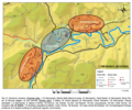 Ancient Novana Map.png 665 × 553; 626 KB
-
 Castiglione di San Martino (Elba).JPG 2,598 × 1,404; 235 KB
-
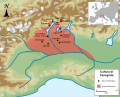 Cultura di Canegrate map.svg 558 × 447; 692 KB
-
 Mappa dell'Ager Novanensis.png 347 × 498; 388 KB
-
 Monte Castello (Elba).JPG 2,257 × 1,290; 208 KB
-
 MuraCiclopiche1.jpg 3,891 × 2,318; 2.64 MB
-
 Parco Archeologico Promontorio Saturo Schema.jpg 3,000 × 2,100; 1.49 MB
-
 Pianta del villaggio di Punta Milazzese, Panarea.jpg 1,906 × 2,790; 3.35 MB
-
 Pianta del villaggio di Punta Milazzese.jpg 824 × 1,187; 1.14 MB
-
 Pianta di Arpino.jpg 1,722 × 1,328; 833 KB
-
 Pianta saggi monte manganello.jpg 741 × 425; 196 KB
-
 Ritrovamenti archeologici a Comunanza.png 665 × 553; 649 KB
-
 SC P1.jpg 4,135 × 5,849; 1.26 MB
-
 SC P2.jpg 4,135 × 5,849; 2.35 MB
-
 Teatri greci di Sicilia.jpg 1,459 × 946; 124 KB


.JPG)


.JPG)


