Category:April 2008 Ireland photographs
Jump to navigation
Jump to search
Countries of Europe: Albania · Andorra · Armenia‡ · Austria · Azerbaijan‡ · Belarus · Belgium · Bosnia and Herzegovina · Bulgaria · Croatia · Cyprus‡ · Czech Republic · Denmark · Estonia · Finland · France‡ · Georgia‡ · Germany · Greece · Hungary · Iceland · Republic of Ireland · Italy · Kazakhstan‡ · Latvia · Lithuania · Luxembourg · Malta · Monaco · Montenegro · Netherlands‡ · North Macedonia · Norway · Poland · Portugal‡ · Romania · Russia‡ · Serbia · Slovakia · Slovenia · Spain‡ · Sweden · Switzerland · Turkey‡ · Ukraine · United Kingdom
Specific status: Gibraltar · Isle of Man · Jersey – Limited recognition: Kosovo
‡: partly located in Europe
Specific status: Gibraltar · Isle of Man · Jersey – Limited recognition: Kosovo
‡: partly located in Europe
English: Images taken in Ireland during this month of 2008 (not the date of the upload). With CatScan, this allows one to browse any Ireland-related category by year or month. Images should be placed directly in this category, not in subcategories. Note: Images from 2008 should be also added into the appropriate province, territory or city category of Category:2008 photographs of Ireland.
| Jan | Feb | Mar | Apr | May | Jun | Jul | Aug | Sep | Oct | Nov | Dec | ||
| ← | 61 | 129 | 107 | 117 | 406 | 98 | 328 | 929 | 120 | 127 | 55 | 92 | → |
|---|
Media in category "April 2008 Ireland photographs"
The following 117 files are in this category, out of 117 total.
-
 Francis Bacon's birthplace at 63 Baggot Street Dublin.jpg 323 × 800; 158 KB
-
 James Joyce Centre at 35 Great George's Street.jpg 532 × 800; 266 KB
-
 Dundrum église.jpg 3,159 × 2,234; 6.98 MB
-
 Galway's River - geograph.org.uk - 776841.jpg 637 × 425; 82 KB
-
 Blackstones Bridge - geograph.org.uk - 778326.jpg 637 × 425; 98 KB
-
 Contented sheep^ - geograph.org.uk - 778351.jpg 637 × 425; 120 KB
-
 South-west of Caragh Creek - geograph.org.uk - 778824.jpg 637 × 425; 96 KB
-
 Recovery of the TBM after tunnel completion on April 17, 2008.jpg 3,264 × 2,448; 521 KB
-
 Murphy's Prams, High Street, Dublin - geograph.org.uk - 1080631.jpg 640 × 480; 91 KB
-
 Chapel Royal, Dublin Castle - geograph.org.uk - 1080648.jpg 640 × 480; 86 KB
-
 Chapel Royal, Dublin Castle - geograph.org.uk - 1080653.jpg 640 × 480; 79 KB
-
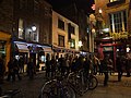 Temple Bar, Dublin - geograph.org.uk - 1080688.jpg 640 × 480; 87 KB
-
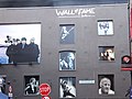 Wall of Fame, Dublin - geograph.org.uk - 1080677.jpg 640 × 480; 59 KB
-
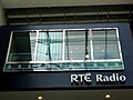 RTÉ Radio Studio - Dundrum Shopping Centre.jpg 1,280 × 960; 139 KB
-

-
 The Quays Bar, Dublin - geograph.org.uk - 1080696.jpg 640 × 480; 87 KB
-
 Dublin back alley - geograph.org.uk - 1080724.jpg 640 × 480; 83 KB
-
 Trinity College, Dublin - geograph.org.uk - 1080717.jpg 640 × 480; 72 KB
-
 Abandoned dwelling at Aghnameena - geograph.org.uk - 782163.jpg 640 × 479; 80 KB
-
 Aghnameena Townland - geograph.org.uk - 782156.jpg 640 × 479; 58 KB
-
 ALDI Supermarket - geograph.org.uk - 757711.jpg 640 × 480; 41 KB
-
 Altacanoo Townland - geograph.org.uk - 782355.jpg 640 × 479; 81 KB
-
 Altacanoo Townland - geograph.org.uk - 782357.jpg 640 × 479; 78 KB
-
 Approach to Carrauntoohil - geograph.org.uk - 777738.jpg 637 × 425; 71 KB
-
 Ashford Castle 2008.jpg 3,195 × 2,130; 2.76 MB
-
 Barratitoppy Townland - geograph.org.uk - 782189.jpg 640 × 479; 73 KB
-
 Barratitoppy Townland - geograph.org.uk - 782230.jpg 640 × 479; 93 KB
-
 Barratitoppy Townland - geograph.org.uk - 782234.jpg 640 × 479; 60 KB
-
 Barratitoppy Townland - geograph.org.uk - 782236.jpg 640 × 479; 73 KB
-
 Barratitoppy Townland - geograph.org.uk - 782245.jpg 640 × 479; 80 KB
-
 Barratitoppy Townland - geograph.org.uk - 782275.jpg 640 × 479; 61 KB
-
 Barratitoppy Townland - geograph.org.uk - 782326.jpg 640 × 479; 83 KB
-
 Barratitoppy Townland - geograph.org.uk - 782333.jpg 640 × 479; 75 KB
-
 Behy Bridge - geograph.org.uk - 774001.jpg 637 × 425; 122 KB
-
 Bridge and old mill - geograph.org.uk - 751219.jpg 640 × 426; 71 KB
-
 Bridge over Geerhameen River - geograph.org.uk - 781231.jpg 639 × 413; 119 KB
-
 Bridge over Owengariff River - geograph.org.uk - 777100.jpg 637 × 425; 88 KB
-
 Bridging the Gap - geograph.org.uk - 781396.jpg 637 × 425; 121 KB
-
 Burt church.jpg 1,840 × 1,232; 512 KB
-
 Caragh Creek - geograph.org.uk - 774795.jpg 637 × 425; 91 KB
-
 Caragh Creek - geograph.org.uk - 774801.jpg 637 × 425; 72 KB
-
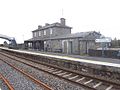 Carrick on Shannon railway station 1.jpg 640 × 480; 77 KB
-
 Carrowmore South Cross 2008.jpg 1,840 × 1,232; 658 KB
-
 Castletownroche.JPG 3,888 × 2,592; 1.94 MB
-
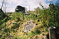
 Church and graveyard - geograph.org.uk - 786353.jpg 640 × 426; 66 KB
-
 Church of Ireland , Ramelton - geograph.org.uk - 772136.jpg 640 × 480; 103 KB
-
 Clonca Old Church 2008.jpg 1,840 × 993; 599 KB
-
 Cloncha cross church.jpg 1,840 × 1,232; 567 KB
-
 Concrete pillars on rocks - geograph.org.uk - 1273188.jpg 640 × 465; 101 KB
-
 Cooley Cross.jpg 1,840 × 1,232; 633 KB
-
 Cooly Early Ecclesiastical Site 2008.jpg 1,840 × 1,232; 709 KB
-
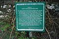 Cooly Early Ecclesiastical Site plaque.jpg 1,840 × 1,232; 706 KB
-
 DerrinturnPub.jpg 3,869 × 2,250; 940 KB
-
 Donagh Cross.jpg 1,840 × 1,232; 616 KB
-

-
 Drumcoobrady,Tydavnet - geograph.org.uk - 782097.jpg 640 × 479; 61 KB
-
 Dublin Cactus provisoire.jpg 1,998 × 3,024; 2.53 MB
-
 Entrance-Tully-Nally-Castle 02.jpg 2,816 × 2,112; 833 KB
-
 Flickr - europeanpeoplesparty - EPP LEADERS MEET IN DUBLIN 14 April 2008 (117).jpg 3,216 × 2,136; 4.68 MB
-
 Folly near Lord Brandon's Cottage - geograph.org.uk - 781222.jpg 425 × 637; 110 KB
-
 Gaddagh River - geograph.org.uk - 777746.jpg 637 × 425; 73 KB
-
 Gap Cottage - geograph.org.uk - 781377.jpg 637 × 425; 128 KB
-
 Gate Lodge near Marble Hill Strand - geograph.org.uk - 774532.jpg 640 × 480; 472 KB
-
 Gearhameen River - geograph.org.uk - 781244.jpg 637 × 425; 109 KB
-
 Glenbeigh church - geograph.org.uk - 774185.jpg 637 × 425; 112 KB
-
 Golden Island.JPG 640 × 480; 158 KB
-
 Greencastle 01.jpg 1,840 × 1,232; 650 KB
-
 Greencastle 02.jpg 1,840 × 1,232; 599 KB
-
 Grianan of Aileach 2008 (1).jpg 1,840 × 1,232; 683 KB
-
 Grianan of Aileach 2008 (2).jpg 1,792 × 1,161; 557 KB
-
 Hibernian Woodland - geograph.org.uk - 778332.jpg 637 × 425; 126 KB
-
 IE Glenveagh Castle 04.jpg 800 × 600; 192 KB
-
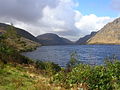 IE Lough Veagh 01.jpg 800 × 600; 184 KB
-
 IE Lough Veagh 02.jpg 800 × 600; 192 KB
-
 IE Lough Veagh 03.jpg 800 × 600; 195 KB
-
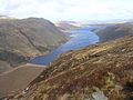 IE Lough Veagh 04.jpg 800 × 600; 175 KB
-
 Iskaheen old graveyard.jpg 1,840 × 1,232; 637 KB
-
 Iskaheen plaque.jpg 839 × 479; 60 KB
-
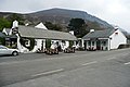 Kate Kearney's Cottage - geograph.org.uk - 781483.jpg 637 × 425; 64 KB
-
 Kerry airport - geograph.org.uk - 773972.jpg 635 × 471; 47 KB
-
 Kerry airport - geograph.org.uk - 773974.jpg 639 × 479; 49 KB
-
 Kilbeheny1.JPG 3,410 × 2,510; 1.12 MB
-
 Kildorrery2.JPG 2,630 × 1,505; 921 KB
-
 Kildorrery3.JPG 3,888 × 2,592; 1.67 MB
-
 Lough Caragh from Lickeen Wood - geograph.org.uk - 778293.jpg 637 × 425; 94 KB
-
 Low water near Lettmore - geograph.org.uk - 1273169.jpg 640 × 433; 103 KB
-
 Moville 2008.jpg 1,840 × 1,232; 1.5 MB
-
 Moville old graveyard.jpg 1,840 × 1,232; 899 KB
-
 O'Shea's Gully - geograph.org.uk - 777777.jpg 637 × 425; 75 KB
-
 Port na Blagh harbour - geograph.org.uk - 773415.jpg 640 × 565; 523 KB
-
 R522NorthCork.JPG 3,888 × 2,592; 6.43 MB
-
 R581NorthCork.JPG 3,888 × 2,592; 6.67 MB
-
 River Caragh - geograph.org.uk - 778240.jpg 637 × 425; 89 KB
-
 River Caragh - geograph.org.uk - 778245.jpg 637 × 425; 91 KB
-
 River Caragh - geograph.org.uk - 778316.jpg 637 × 425; 117 KB
-
 River Caragh - geograph.org.uk - 778317.jpg 637 × 425; 124 KB
-
 Road at Barratitoppy - geograph.org.uk - 782225.jpg 640 × 479; 50 KB
-
 Road at Barratitoppy - geograph.org.uk - 782241.jpg 640 × 479; 64 KB
-
 Road at Barratitoppy - geograph.org.uk - 782300.jpg 640 × 479; 60 KB
-
 Road at Tonystackan - geograph.org.uk - 782168.jpg 640 × 479; 70 KB
-
 Rosslare Europort railway station 1.jpg 640 × 480; 39 KB
-
 Saunder's Bridge - geograph.org.uk - 777019.jpg 640 × 426; 95 KB
-
 Shag off Dooaghs Beach - geograph.org.uk - 774819.jpg 634 × 416; 75 KB
-
 Source of the River Boyne - geograph.org.uk - 896681.jpg 640 × 480; 144 KB
-
 Statue of St Patrick - geograph.org.uk - 896737.jpg 388 × 640; 65 KB
-
-
 The Temple Bar, Dublin - geograph.org.uk - 1080683.jpg 640 × 480; 99 KB
-
 Through the Gap - geograph.org.uk - 781386.jpg 637 × 425; 122 KB
-
 Torc New Bridge - geograph.org.uk - 777117.jpg 637 × 425; 109 KB
-
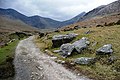
 Towards Lord Brandon's Cottage - geograph.org.uk - 781177.jpg 637 × 425; 99 KB
-
 Towards Lough Callee - geograph.org.uk - 777754.jpg 637 × 425; 76 KB
-
 Trim Castle - geograph.org.uk - 886108.jpg 640 × 480; 82 KB
-
 Tully Nally Castle or Packenham Hall Castle.jpg 2,816 × 2,112; 1.11 MB
-
 Tully-Nally-Castle 02.jpg 2,816 × 2,112; 1.12 MB
-
 Tully-Nally-Castle 03.jpg 2,816 × 2,112; 961 KB
-
 View from Blackstones Bridge - geograph.org.uk - 778319.jpg 640 × 412; 75 KB
-
 View from Blackstones Bridge - geograph.org.uk - 778322.jpg 637 × 425; 90 KB


.jpg)


.jpg)
.jpg)


