Category:April 2007 in Cornwall
Jump to navigation
Jump to search
Ceremonial counties of England: Bedfordshire · Berkshire · Buckinghamshire · Cambridgeshire · Cheshire · Cornwall · Cumbria · Derbyshire · Devon · Dorset · Durham · East Riding of Yorkshire · East Sussex · Essex · Gloucestershire · Greater London · Greater Manchester · Hampshire · Herefordshire · Hertfordshire · Isle of Wight · Kent · Lancashire · Leicestershire · Lincolnshire · Merseyside · Norfolk · North Yorkshire · Northamptonshire · Northumberland · Nottinghamshire · Oxfordshire · Rutland · Shropshire · Somerset · South Yorkshire · Staffordshire · Suffolk · Surrey · Tyne and Wear · Warwickshire · West Midlands · West Sussex · West Yorkshire · Wiltshire · Worcestershire
City-counties: Bristol ·
Former historic counties:
Other former counties:
City-counties: Bristol ·
Former historic counties:
Other former counties:
Deutsch: Bilder, die im April 2007 in Cornwall aufgenommen worden sind. Bitte beachten Sie, dass dies weder das Datum des Uploads noch das Datum des Scannens eines Fotos ist.
English: Images/pictures taken in Cornwall during April 2007. Note this is not the date of the upload, nor the date a photo was scanned.
Español: Fotografías o imágenes tomadas en Cornwall durante abril 2007. No es la fecha de subida ni escaneo, sino la fecha en que las fotografías o imágenes se crearon.
Esperanto: Bildoj faritaj en Cornwall en aprilo 2007. Tio ne estas la dato, kiam la bildoj estis alŝutitaj aŭ skanitaj.
Français : Photographies ou images prises en Cornwall durant avril 2007. Ce n'est pas la date du téléchargement ou du scan.
Galego: Fotografías ou imaxes tomadas en Cornwall durante abril 2007. Non é a data de subida nin escaneamento, senón a data na que se crearon as fotografías ou imaxes.
Italiano: Fotografie o immagini scattate a Cornwall nel aprile 2007. Nota bene: la data non si riferisce né a quella di upload né a quella in cui la foto è stata digitalizzata.
Norsk bokmål: Bilder tatt i Cornwall i løpet av april 2007. Merk at dette ikke er datoen for opplasting, eller når et bilde har blitt skannet.
Norsk nynorsk: Bilete teke i Cornwall i løpet av april 2007. Merk at dette ikkje er datoen for opplasting, eller når eit bilete har vorte skanna.
Русский: Изображения, сделанные в Cornwall в течение апрель 2007 (не дата загрузки изображения).
Українська: Зображення, зроблені в Cornwall протягом квітень 2007. Зауважте, що це не дата завантаження чи дата сканування фотографії.
| April 2006 | ← | April 2007 | → | April 2008 | |||||||
| Jan | Feb | Mar | Apr | May | Jun | Jul | Aug | Sep | Oct | Nov | Dec |
| 14 | 51 | 108 | 101 | 97 | 117 | 136 | 165 | 104 | 31 | 23 | 26 |
|---|---|---|---|---|---|---|---|---|---|---|---|
Media in category "April 2007 in Cornwall"
The following 101 files are in this category, out of 101 total.
-

-
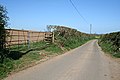 A Country Road - geograph.org.uk - 409280.jpg 640 × 427; 81 KB
-
 A country road in Spring - geograph.org.uk - 416155.jpg 640 × 427; 101 KB
-
 A field of cauliflower stumps. - geograph.org.uk - 386807.jpg 640 × 427; 75 KB
-
 A Glimpse of the River - geograph.org.uk - 408018.jpg 640 × 427; 160 KB
-
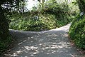 A junction of sunken lanes - geograph.org.uk - 421182.jpg 640 × 427; 136 KB
-
 A streams eye view of a ford - geograph.org.uk - 412016.jpg 640 × 427; 147 KB
-
 A view of Stoke Climsland Church - geograph.org.uk - 409157.jpg 640 × 427; 90 KB
-

-
 Across the fields to Trefinnick - geograph.org.uk - 404849.jpg 640 × 427; 106 KB
-
 Agricultural Landscape - geograph.org.uk - 409323.jpg 640 × 427; 114 KB
-
 Alderbeer - geograph.org.uk - 407351.jpg 640 × 426; 125 KB
-
 Aldercombe Barton - geograph.org.uk - 407241.jpg 640 × 426; 115 KB
-
 Alex Tor and cairn - geograph.org.uk - 418780.jpg 640 × 480; 97 KB
-
 An encounter with the main road - geograph.org.uk - 404837.jpg 640 × 427; 82 KB
-
 An Isolated Barn - geograph.org.uk - 421085.jpg 640 × 427; 141 KB
-

-
 Anglers at Upper Tamar Lake - geograph.org.uk - 404747.jpg 640 × 480; 171 KB
-
 Anglers on Upper Tamar Lake - geograph.org.uk - 410136.jpg 640 × 480; 73 KB
-
-
 Antony House 03.jpg 640 × 480; 101 KB
-
 Antony House, Torpoint - geograph.org.uk - 413850.jpg 640 × 480; 103 KB
-
 Approaching Kilkhampton from the east - geograph.org.uk - 421530.jpg 640 × 426; 97 KB
-
 Approaching Leigh Plantation - geograph.org.uk - 408026.jpg 640 × 427; 105 KB
-
 Asparagus Island at sunset - geograph.org.uk - 976939.jpg 640 × 480; 52 KB
-
 B3275 near Lower Hewas - geograph.org.uk - 388990.jpg 640 × 480; 98 KB
-
 B3275 west of New Mills - geograph.org.uk - 388970.jpg 640 × 480; 82 KB
-
 Barns at Little Comfort - geograph.org.uk - 421189.jpg 640 × 427; 134 KB
-

-
 Before a concert in Truro Cathedral - geograph.org.uk - 966925.jpg 640 × 480; 73 KB
-

-
 Blackbird collecting worms - geograph.org.uk - 418449.jpg 640 × 480; 106 KB
-
 Blackthorn blossom above Pelyn - geograph.org.uk - 1112261.jpg 640 × 480; 61 KB
-
 Bloody Cranesbill at Kynance - geograph.org.uk - 664701.jpg 640 × 480; 52 KB
-
 Bluebells on the Verge - geograph.org.uk - 409667.jpg 640 × 514; 196 KB
-
 Boat drawn up from Millook Haven - geograph.org.uk - 411295.jpg 640 × 480; 116 KB
-
 Bodmin Moor field boundary - geograph.org.uk - 418745.jpg 640 × 247; 30 KB
-

-
 Boundary stone - geograph.org.uk - 418833.jpg 640 × 328; 61 KB
-
 Bream Cove from Rosemullion Head - geograph.org.uk - 745947.jpg 640 × 480; 93 KB
-
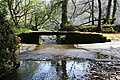
 Bridge over the River Inny at Bealsmill - geograph.org.uk - 416056.jpg 640 × 427; 104 KB
-
 BridgeAtFrogmoreCornwallGeograph.jpg 640 × 480; 149 KB
-
 Building Renovation at Lowleybridge - geograph.org.uk - 416165.jpg 640 × 427; 129 KB
-
 Building site, Bude - geograph.org.uk - 473644.jpg 640 × 426; 120 KB
-
 Cadson Bury Fort - geograph.org.uk - 411641.jpg 640 × 427; 102 KB
-
 Caerhays Castle from the car park - geograph.org.uk - 995349.jpg 640 × 480; 60 KB
-
 Cafe and toilets, Sandy Mouth - geograph.org.uk - 411082.jpg 640 × 480; 84 KB
-
 Cafe at Sandy Mouth - geograph.org.uk - 422589.jpg 640 × 426; 128 KB
-
 Calstock, Cothele House - geograph.org.uk - 415331.jpg 640 × 427; 226 KB
-
 Capped mine shafts on Newlyn Downs - geograph.org.uk - 399491.jpg 640 × 480; 85 KB
-

-
 Carbis Bay station - geograph.org.uk - 1724756.jpg 640 × 480; 80 KB
-
 Carn Lês Boel, West Cornwall - geograph.org.uk - 665808.jpg 640 × 480; 75 KB
-

-
 Cattle and blackthorn, Morwenstow - geograph.org.uk - 411999.jpg 640 × 480; 230 KB
-
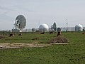 Cattle by GCHQ radio station - geograph.org.uk - 412255.jpg 640 × 480; 175 KB
-
 Caunter Beach, a wave-cut platform - geograph.org.uk - 405023.jpg 640 × 480; 272 KB
-

-
 Chapel Jane, near Gurnard's Head - geograph.org.uk - 660267.jpg 640 × 480; 116 KB
-
 Chimney Stack. - geograph.org.uk - 385044.jpg 480 × 640; 139 KB
-
 Churchyard and Pub - geograph.org.uk - 409704.jpg 640 × 427; 133 KB
-
 Cornish flag and fields with sheep - geograph.org.uk - 411206.jpg 480 × 640; 220 KB
-
 Cornwall 2007 (496504384).jpg 2,048 × 1,371; 681 KB
-

-
 Delford Bridge and ford - geograph.org.uk - 418805.jpg 640 × 342; 55 KB
-
 Downs View, Flexbury, Bude - geograph.org.uk - 410448.jpg 640 × 480; 87 KB
-
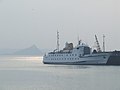 Ferry to the Scillies - geograph.org.uk - 1723303.jpg 640 × 480; 28 KB
-
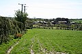
 Field near Lower Tregurra Farm. - geograph.org.uk - 405634.jpg 640 × 457; 63 KB
-
 Hayle banner Seals on the beach at Godrevy.jpg 2,450 × 350; 411 KB
-

-
 Lower Candra holiday homes^ - geograph.org.uk - 418787.jpg 640 × 480; 97 KB
-
 Middle Moor Cross, Bodmin Moor - geograph.org.uk - 419893.jpg 640 × 480; 86 KB
-
 Mother and Daughter ? (1556138782).jpg 2,551 × 999; 655 KB
-
 Pencabe and the harbour of Portscatho - geograph.org.uk - 996681.jpg 640 × 480; 76 KB
-
 Pink house, Portscatho (1429042137).jpg 2,060 × 1,584; 2.62 MB
-

-
 Saint Colan Church, Springtime. - geograph.org.uk - 388818.jpg 640 × 546; 244 KB
-
 Scilla verna Cornwall.jpg 500 × 500; 171 KB
-
 Shed and House on the road in Linkinhorne - geograph.org.uk - 409752.jpg 640 × 427; 100 KB
-
 Sheds at Rhude Cross, with post box. - geograph.org.uk - 410476.jpg 640 × 480; 112 KB
-
 St Nectan's Glen - geograph.org.uk - 596320.jpg 481 × 640; 126 KB
-
 The Brighton Cross Roundabout - geograph.org.uk - 385268.jpg 640 × 480; 64 KB
-
 The Bungalow on Maer Cliff - geograph.org.uk - 422474.jpg 640 × 426; 112 KB
-
 The Gallery Tea Rooms, Stratton - geograph.org.uk - 414527.jpg 640 × 426; 108 KB
-

-
 The path to Kynance - geograph.org.uk - 664692.jpg 640 × 480; 47 KB
-
 The Post Office in Bude - geograph.org.uk - 421274.jpg 426 × 640; 88 KB
-
 The Quay, Sennen Cove - geograph.org.uk - 629639.jpg 640 × 480; 112 KB
-

-
 Tractor near Stanbury - geograph.org.uk - 412263.jpg 500 × 640; 161 KB
-
 Tractor on Tackbear Road, Cornwall - geograph.org.uk - 405600.jpg 640 × 480; 207 KB
-
 Trevone Village - geograph.org.uk - 796206.jpg 640 × 480; 99 KB
-
 Yellow Iris (Iris pseudacorus) - geograph.org.uk - 415938.jpg 640 × 480; 41 KB
-
 Cattle at Moreton Pound Farm - geograph.org.uk - 410462.jpg 640 × 479; 180 KB
-
 Cattle by Stanbury - geograph.org.uk - 412268.jpg 640 × 480; 179 KB
-
 Cattle on pasture - geograph.org.uk - 405543.jpg 640 × 480; 174 KB
-
 Cattle on the Hillside - geograph.org.uk - 404950.jpg 640 × 428; 114 KB
-
 Milking cows at Herdacott - geograph.org.uk - 422928.jpg 640 × 426; 111 KB
-
 Newlyn Downs - geograph.org.uk - 411370.jpg 640 × 427; 42 KB
-
 Track leading into Gunveor Plantation - geograph.org.uk - 410321.jpg 640 × 480; 131 KB
-
 Woodland Clearing near Lamorran. - geograph.org.uk - 410332.jpg 640 × 480; 94 KB


.jpg)


.jpg)


_-_geograph.org.uk_-_415938.jpg)


.jpg)