Category:Annfield Plain
Jump to navigation
Jump to search
English: Annfield Plain is a village in County Durham, in England. It is situated on a plateau between the towns of Stanley, 4 km (2.5 miles) to the north-east, and Consett, 8 km (5 miles) to the west. According to the 2001 census, Annfield Plain has a population of 3,569[1]. Along with much of the surrounding area, Annfield Plain's history lies in coal mining. While the industry collapsed in the 1980s and 90s, its effects are still apparent both in the landscape and in folk memory.
village in County Durham, in England  | |||||
| Upload media | |||||
| Instance of | |||||
|---|---|---|---|---|---|
| Location | Stanley, County Durham, North East England, England | ||||
 | |||||
Subcategories
This category has the following 3 subcategories, out of 3 total.
Media in category "Annfield Plain"
The following 21 files are in this category, out of 21 total.
-
 "The ravines" at New Kyo - geograph.org.uk - 129203.jpg 640 × 480; 118 KB
-

-
 Annfield Plain bypass - geograph.org.uk - 3066865.jpg 4,608 × 3,456; 5.21 MB
-
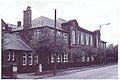 Annfield Plain Intermediate School.jpg 320 × 212; 50 KB
-
 Annfield Plain Junior School - geograph.org.uk - 3905170.jpg 640 × 480; 72 KB
-
 Annfield Plain Public Library - geograph.org.uk - 76480.jpg 640 × 440; 79 KB
-
 Grassed area in Annfield Plain - geograph.org.uk - 3781098.jpg 1,500 × 1,064; 2.23 MB
-
 Loud Hill Memorial. - geograph.org.uk - 222141.jpg 237 × 320; 58 KB
-
 Name- Robert Robson (19921587128).jpg 603 × 822; 285 KB
-
 Plainsman Annfield Plain.jpg 1,600 × 1,200; 216 KB
-
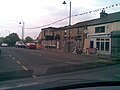
 Tesco, Annfield Plain - geograph.org.uk - 3905174.jpg 640 × 480; 61 KB
-
 Tower Road - geograph.org.uk - 337120.jpg 640 × 480; 104 KB
-
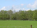
 Chapmans Well Nature Reserve - geograph.org.uk - 318793.jpg 640 × 480; 108 KB
-

-
 Gorecock Lane - geograph.org.uk - 106393.jpg 640 × 480; 69 KB
-
 Grazing land an Maiden Law - geograph.org.uk - 6667.jpg 640 × 480; 80 KB
-
 Greencroft Footbridge - geograph.org.uk - 106399.jpg 640 × 480; 76 KB
-
 Greencroft Pond - geograph.org.uk - 84071.jpg 640 × 480; 99 KB
-
 Loud Hill Water Works - geograph.org.uk - 106396.jpg 640 × 480; 76 KB
-
 Salt Storage Container - geograph.org.uk - 106404.jpg 640 × 480; 52 KB
-
 Sunniside Farm - geograph.org.uk - 536850.jpg 640 × 480; 89 KB


.jpg)


