Category:Annandale Way
Jump to navigation
Jump to search
Scottish hiking trail  | |||||
| Upload media | |||||
| Instance of |
| ||||
|---|---|---|---|---|---|
| Location | Dumfries and Galloway, Scotland | ||||
| Length |
| ||||
| Terminus | |||||
 | |||||
- Annandale Way — a hiking footpath in Scotland, in the Dumfries and Galloway council area.
Media in category "Annandale Way"
The following 26 files are in this category, out of 26 total.
-
 A701 from Annanhead Hill - geograph.org.uk - 1737133.jpg 800 × 530; 212 KB
-
 Annandale Way (50497005443).jpg 4,704 × 3,136; 8.76 MB
-

-
-

-
 Bridge over River Annan at Brydekirk.jpg 900 × 589; 143 KB
-
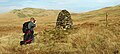 Cairn at start of Annandale Way - north end.jpg 900 × 403; 70 KB
-
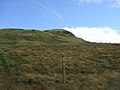
 Chalk Rig Edge - geograph.org.uk - 1507864.jpg 640 × 480; 59 KB
-
 Crown of Scotland - geograph.org.uk - 1507948.jpg 640 × 480; 55 KB
-
 Hoddom Castle from Repentance Tower.jpg 900 × 475; 112 KB
-
 Monument to the huntsman Joe Graham.jpg 900 × 455; 62 KB
-
 Peat Knowe - geograph.org.uk - 1507786.jpg 640 × 480; 58 KB
-
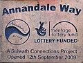
 Plaque marking the start (or end) of the Annandale Way - geograph.org.uk - 3942567.jpg 2,592 × 1,944; 1.46 MB
-
 Plaque on cairn at start of Annadale Way - north end.jpg 900 × 679; 147 KB
-
 River Annan approaching Annan town.jpg 900 × 380; 69 KB
-
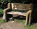 Sculpted seat by Castle Loch Lochmaben.jpg 900 × 718; 149 KB
-
 Spout Craig - geograph.org.uk - 1507926.jpg 640 × 480; 59 KB
-
 Stone set into cairn at north end of Annandale Way.jpg 900 × 563; 96 KB
-
 The Royal Four Towns Hall.jpg 900 × 675; 113 KB
-

-
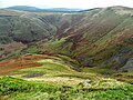 View down into Devil's Beef Tub from Great Hill.jpg 900 × 675; 127 KB
-
-

-
 View of Annandale from near Joe Graham monument.jpg 900 × 631; 119 KB
-
 View towards Corehead with Great Hill and Chalk Rig Edge beyond.jpg 900 × 419; 78 KB
-
 Where the River Annan runs into the Solway Firth.jpg 900 × 290; 47 KB

.jpg)


_of_the_Annandale_Way_-_geograph.org.uk_-_3942567.jpg)


