Category:Annaghmore
Jump to navigation
Jump to search
village in the United Kingdom  | |||||
| Upload media | |||||
| Instance of | |||||
|---|---|---|---|---|---|
| Location | Northern Ireland | ||||
 | |||||
English: Annaghmore is a small village and a townland of 777 acres in the Electoral Division of Annaghmore, in Civil Parish of Loughgall (ONeilland West portion), in the Barony of Oneilland West, in the County of Armagh
Subcategories
This category has the following 2 subcategories, out of 2 total.
A
- Annaghmore railway station (2 F)
- Ardress House (4 F)
Media in category "Annaghmore"
The following 42 files are in this category, out of 42 total.
-

-
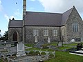 Annaghmore Parish Church - geograph.org.uk - 568813.jpg 640 × 480; 100 KB
-
 Annaghmore Parish Church - geograph.org.uk - 568815.jpg 480 × 640; 70 KB
-
 Annaghmore Road - geograph.org.uk - 5423605.jpg 3,500 × 2,625; 5.87 MB
-
 Annaghmore Road - geograph.org.uk - 5423606.jpg 3,000 × 2,250; 6.92 MB
-
 Apple orchard, Ardress - geograph.org.uk - 2483431.jpg 640 × 480; 93 KB
-
 Apple orchard, Ardress - geograph.org.uk - 2483433.jpg 640 × 480; 86 KB
-
 Ardress House (geograph 5175020).jpg 5,312 × 2,988; 5.46 MB
-
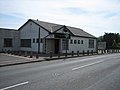
 Ardress Mission Hall - geograph.org.uk - 2483426.jpg 640 × 480; 48 KB
-
 Ardress West - geograph.org.uk - 2483419.jpg 640 × 480; 62 KB
-
 B131 Teagy Road - geograph.org.uk - 2483487.jpg 640 × 480; 44 KB
-
 B131 Teagy Road, Five Loan Ends - geograph.org.uk - 2483442.jpg 640 × 480; 46 KB
-
 Blackisland Road - geograph.org.uk - 2483422.jpg 640 × 480; 45 KB
-
 Blackisland Road - geograph.org.uk - 2483427.jpg 640 × 480; 79 KB
-
 Blackisland Road, Annaghmore - geograph.org.uk - 2483410.jpg 640 × 480; 49 KB
-
 Church hall, Annaghmore - geograph.org.uk - 2483405.jpg 640 × 480; 51 KB
-
 Coalisland canal - geograph.org.uk - 5423603.jpg 4,608 × 3,456; 7.84 MB
-
 Derrycoose Road - geograph.org.uk - 568812.jpg 640 × 480; 103 KB
-
 Derrygavard Road - geograph.org.uk - 2483435.jpg 640 × 480; 57 KB
-
 Derrygavard Road - geograph.org.uk - 2483437.jpg 640 × 480; 60 KB
-
 Moor Road - geograph.org.uk - 5423604.jpg 4,608 × 3,456; 7.16 MB
-
 Moss Road - geograph.org.uk - 2483439.jpg 640 × 480; 95 KB
-
 Moss Road, Annaghmore - geograph.org.uk - 2482909.jpg 640 × 480; 43 KB
-
 Plaque, Annaghmore Orange Hall - geograph.org.uk - 2483414.jpg 640 × 480; 72 KB
-
 Sandy Rampart, Derrycor - geograph.org.uk - 2483461.jpg 640 × 480; 50 KB
-
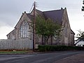
 St. Francis' Parish Church - geograph.org.uk - 2482916.jpg 640 × 480; 58 KB
-
 Teagy Road - geograph.org.uk - 2483488.jpg 640 × 480; 39 KB
-
 Teagy Townland - geograph.org.uk - 2483486.jpg 640 × 480; 52 KB
-
 Vallely's Bar - geograph.org.uk - 205194.jpg 640 × 480; 66 KB
-
 Ardress and Derrygavad Junction - geograph.org.uk - 568831.jpg 640 × 480; 80 KB
-
 Ardress Road Junction - geograph.org.uk - 568819.jpg 640 × 480; 103 KB
-
 Ardress West Fields - geograph.org.uk - 568832.jpg 640 × 480; 112 KB
-
 Carrowntemple Cross Slabs. - geograph.org.uk - 291833.jpg 640 × 480; 155 KB
-
 Derryhirk Road, Dungannon. - geograph.org.uk - 579280.jpg 640 × 480; 74 KB
-
 Farm Road - geograph.org.uk - 568762.jpg 640 × 480; 120 KB
-
 Fernagreevagh Bridge - geograph.org.uk - 568835.jpg 640 × 480; 102 KB
-
 Headstone in Toby Hole Graveyard - geograph.org.uk - 505113.jpg 640 × 480; 120 KB
-

-
-
 Pay to Pass - geograph.org.uk - 568837.jpg 640 × 480; 150 KB
-
 Summerisland Road, 4 miles from Moy. - geograph.org.uk - 579259.jpg 640 × 480; 75 KB
-


.jpg)


