Category:Andreaskloster (Köln)
Jump to navigation
Jump to search
| Object location | | View all coordinates using: OpenStreetMap |
|---|
Subcategories
This category has the following 3 subcategories, out of 3 total.
Media in category "Andreaskloster (Köln)"
The following 4 files are in this category, out of 4 total.
-
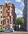
 2023-01-01 Wohn- und Geschäftshaus An den Dominikanern 9, Köln.jpg 2,803 × 3,737; 1.83 MB
-
 Bürogebäude Andreaskloster 16, Köln, Ansicht von An den Dominikanern-3821.jpg 3,034 × 2,846; 8.88 MB
-
 People at Köln (Germany) (23785681302).jpg 4,000 × 3,000; 4.89 MB
-
 Wohn- und Geschäftshaus An den Dominikanern 9, Köln-3820.jpg 2,657 × 3,238; 6.72 MB


_(23785681302).jpg)
