Category:Anderson, Dorset
Jump to navigation
Jump to search
English: Anderson is a village and civil parish in the North Dorset district of Dorset, England, with a population of 72(2001 census). The village is sometimes known as Winterborne Anderson, and is near Winterborne Zelston and Winterborne Kingston. It is about twelve miles by road from Poole.
village and civil parish in Dorset, UK  | |||||
| Upload media | |||||
| Instance of | |||||
|---|---|---|---|---|---|
| Location | Dorset, South West England, England | ||||
 | |||||
Subcategories
This category has the following 3 subcategories, out of 3 total.
A
- Anderson Manor, Dorset (5 F)
W
Media in category "Anderson, Dorset"
The following 61 files are in this category, out of 61 total.
-
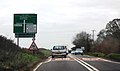 A31 approaching Red Post - geograph.org.uk - 2847485.jpg 640 × 378; 39 KB
-
 A31 eastbound - geograph.org.uk - 4427215.jpg 640 × 454; 41 KB
-
 Anderson, detail of Red Post - geograph.org.uk - 1752516.jpg 640 × 481; 50 KB
-

-
 Anderson, Red Post - geograph.org.uk - 500361.jpg 431 × 640; 90 KB
-
 Anderson, River Winterborne - geograph.org.uk - 1374175.jpg 480 × 640; 110 KB
-
 Anderson, River Winterborne - geograph.org.uk - 1374378.jpg 480 × 640; 165 KB
-
 Avenue to Anderson Manor - geograph.org.uk - 4662229.jpg 1,024 × 768; 338 KB
-
 Bridleway near Great Coll Wood - geograph.org.uk - 4689787.jpg 1,024 × 768; 321 KB
-
 Bridleway to Great Coll Wood - geograph.org.uk - 4690663.jpg 1,024 × 768; 227 KB
-
 Bridleway to Winterborne Kingston - geograph.org.uk - 4690660.jpg 1,024 × 768; 201 KB
-
 Charlton Downs - geograph.org.uk - 3339850.jpg 640 × 480; 92 KB
-
 Course of Roman Road - geograph.org.uk - 3340249.jpg 640 × 480; 95 KB
-
 Farm Track - geograph.org.uk - 335986.jpg 640 × 428; 113 KB
-
 Farm Track on Muston Down - geograph.org.uk - 3340234.jpg 640 × 480; 111 KB
-
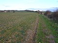
 Fields at Anderson - geograph.org.uk - 2787731.jpg 640 × 480; 80 KB
-
 Fields next to Muston Lane - geograph.org.uk - 3340268.jpg 640 × 480; 72 KB
-
 Fields north of A31 - geograph.org.uk - 2941935.jpg 640 × 480; 75 KB
-
 Gate on a bridleway to Great Coll Wood - geograph.org.uk - 4689799.jpg 1,024 × 768; 319 KB
-
 Grassland at Winterborne Tomson - geograph.org.uk - 4690665.jpg 1,024 × 768; 223 KB
-
 Hebridean sheep, Anderson - geograph.org.uk - 2239884.jpg 640 × 480; 85 KB
-
 Hebridean sheep, Anderson - geograph.org.uk - 2239891.jpg 640 × 480; 87 KB
-
 Houses at Anderson - geograph.org.uk - 2787746.jpg 640 × 464; 60 KB
-
 Lane to Whatcombe Down Dairy - geograph.org.uk - 407975.jpg 430 × 640; 89 KB
-
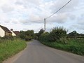 Marsh Lane, Anderson - geograph.org.uk - 2614382.jpg 640 × 480; 56 KB
-
 Marsh Lane, Anderson - geograph.org.uk - 2614391.jpg 640 × 480; 87 KB
-
 Marsh Lane, Anderson - geograph.org.uk - 2614400.jpg 640 × 445; 90 KB
-
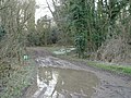 Muddy Puddle - geograph.org.uk - 330363.jpg 640 × 480; 128 KB
-
 Muston Lane - geograph.org.uk - 4662210.jpg 1,024 × 768; 298 KB
-
 Red Post - geograph.org.uk - 457518.jpg 640 × 480; 149 KB
-
 Red Post, Anderson - geograph.org.uk - 2614415.jpg 640 × 480; 47 KB
-
 Rush hour in Anderson - geograph.org.uk - 3642284.jpg 640 × 480; 97 KB
-
 Snowdrops in Rendezvous Plantation - geograph.org.uk - 329032.jpg 640 × 480; 147 KB
-
 The Red Post crossroads on A31 - geograph.org.uk - 4646212.jpg 1,600 × 1,200; 1.51 MB
-
 Track in High Coll Woods - geograph.org.uk - 5341925.jpg 640 × 427; 135 KB
-
 Tree down - geograph.org.uk - 4689790.jpg 1,024 × 768; 339 KB
-
 View towards Anderson - geograph.org.uk - 4690624.jpg 1,024 × 768; 155 KB
-
 After the Rain - geograph.org.uk - 337612.jpg 428 × 640; 133 KB
-
 Barns at Field Barn - geograph.org.uk - 425126.jpg 640 × 430; 240 KB
-
 Buildings on Charisworth Farm - geograph.org.uk - 424197.jpg 640 × 430; 88 KB
-

-
 Colourful fields of Thornicombe Farm - geograph.org.uk - 423585.jpg 640 × 430; 96 KB
-
 Course of Combs Ditch - geograph.org.uk - 424194.jpg 640 × 430; 137 KB
-
 Cows near Field Barn - geograph.org.uk - 425130.jpg 640 × 430; 271 KB
-
 Field Barn - geograph.org.uk - 425119.jpg 640 × 430; 290 KB
-
 Field Barn from the side - geograph.org.uk - 425137.jpg 640 × 430; 330 KB
-
 Field gate near Gorcombe Farm - geograph.org.uk - 454898.jpg 640 × 480; 121 KB
-
 Field of rape on Thornicombe Farm - geograph.org.uk - 423573.jpg 640 × 430; 131 KB
-
 Field of yellow rape - geograph.org.uk - 425159.jpg 640 × 430; 363 KB
-
 First Shoots - geograph.org.uk - 336917.jpg 640 × 428; 112 KB
-
 Footpath (bridleway) crossing field - geograph.org.uk - 423580.jpg 640 × 430; 154 KB
-
 Goschen - geograph.org.uk - 336018.jpg 640 × 428; 113 KB
-
 Green fields of Thornicombe Farm - geograph.org.uk - 423599.jpg 640 × 430; 117 KB
-
 On Muston Down - geograph.org.uk - 338521.jpg 640 × 428; 111 KB
-

-
 Shaded bridleway to Charlton Marshall - geograph.org.uk - 424202.jpg 430 × 640; 462 KB
-
 Southern Edge of Little Coll Wood - geograph.org.uk - 337592.jpg 640 × 428; 113 KB
-
 Track alongside Charisworth Farm - geograph.org.uk - 424190.jpg 430 × 640; 462 KB
-
 View across Charisworth Farm - geograph.org.uk - 424187.jpg 640 × 430; 81 KB
-
 Whatcombe Down Dairy - geograph.org.uk - 407838.jpg 640 × 430; 81 KB
-
 Whatcombe Down Dairy buildings - geograph.org.uk - 423604.jpg 640 × 430; 104 KB


_crossing_field_-_geograph.org.uk_-_423580.jpg)


_near_Thornicombe_Farm_-_geograph.org.uk_-_423583.jpg)


