Category:Ancient port (Anafi)
Jump to navigation
Jump to search
| Object location | | View all coordinates using: OpenStreetMap |
|---|
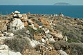
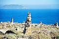
Katalimatsa. On the seabed and the foreshore there are traces of ancient port facilities found. Old beacons and navigation signs over an ancient port.
Subcategories
This category has only the following subcategory.
C
Media in category "Ancient port (Anafi)"
The following 28 files are in this category, out of 28 total.
-
 Ancient navigation signs above ancient port Anafi, 176361.jpg 5,423 × 3,615; 9.4 MB
-
 Ancient navigation signs above ancient port Anafi, 176364.jpg 5,303 × 3,535; 9.65 MB
-
 Ancient navigation signs above ancient port Anafi, 176370.jpg 5,348 × 3,565; 9.68 MB
-
 Ancient navigation signs above ancient port Anafi, 176373.jpg 5,472 × 3,648; 9.14 MB
-
 Ancient navigation signs above ancient port Anafi, 176374.jpg 5,301 × 3,534; 9.98 MB
-
 Ancient navigation signs above ancient port Anafi, 176375.jpg 4,929 × 3,286; 9.6 MB
-
 Ancient navigation signs above ancient port Anafi, 226094.jpg 5,663 × 3,768; 9.35 MB
-
 Ancient navigation signs above ancient port Anafi, 226095.jpg 5,987 × 3,983; 9.45 MB
-
 Ancient navigation signs above ancient port Anafi, 226097.jpg 6,048 × 4,024; 9.31 MB
-
 Ancient navigation signs above ancient port Anafi, 226098.jpg 5,808 × 3,865; 9.34 MB
-
 Ancient navigation signs above ancient port Anafi, 226099.jpg 6,048 × 4,024; 9.34 MB
-
 Ancient port, Anafi, 226087.jpg 6,018 × 4,005; 9.17 MB
-
 Ancient port, Anafi, 226087new.jpg 6,018 × 2,904; 5.63 MB
-
 Ancient port, Anafi, 226088.jpg 4,515 × 3,004; 9.3 MB
-
 Ancient ruins above the ancient port of Anafi, 176362.jpg 5,346 × 3,564; 8.98 MB
-
 Ancient ruins above the ancient port of Anafi, 176363.jpg 5,181 × 3,454; 9.32 MB
-
 Ancient ruins above the chapel above ancient port, Anafi, 17M1385.jpg 4,000 × 2,664; 4.19 MB
-
 Ancient ruins above the chapel above ancient port, Anafi, 17M1386.jpg 4,000 × 2,664; 7.06 MB
-
 Ancient ruins above the chapel above ancient port, Anafi, 17M1387.jpg 4,000 × 2,664; 2.53 MB
-
 Ancient ruins above the chapel above ancient port, Anafi, 226086.jpg 3,978 × 5,980; 9.57 MB
-
 Chapel between two groups of ancient navigational signs, 176360.jpg 4,425 × 2,950; 9.78 MB
-

-
 IMFJ anafi 02.jpg 600 × 400; 144 KB
-
 Near the ancient port, Anafi, 226089.jpg 5,843 × 3,888; 9.3 MB
-
 Near the ncient port, Anafi, 226093.jpg 5,598 × 3,725; 7.57 MB
-
 Near the ncient port, Anafi, 22M8442.jpg 3,901 × 2,601; 5.56 MB
-
 View of Kasteli from places above the ancient harbor, Anafi, 176371.jpg 5,223 × 3,482; 9.08 MB
-
 View of Roukounas from places above ancient harbor Anaf, 176372.jpg 5,472 × 3,648; 9.22 MB


