Category:Ancienne Chartreuse de la Part-Dieu, Gruyères
Jump to navigation
Jump to search
| Object location | | View all coordinates using: OpenStreetMap |
|---|
church building complex in Gruyères in the canton of Fribourg, Switzerland  | |||||
| Upload media | |||||
| Instance of | |||||
|---|---|---|---|---|---|
| Part of | |||||
| Location | Gruyères, Gruyère District, Canton of Fribourg, Switzerland | ||||
| Street address |
| ||||
| Heritage designation |
| ||||
 | |||||
Media in category "Ancienne Chartreuse de la Part-Dieu, Gruyères"
The following 7 files are in this category, out of 7 total.
-
 Blason de la Chartreuse de la Part-Dieu (Suisse) - alternatif.svg 603 × 763; 11 KB
-
 Blason de la Chartreuse de la Part-Dieu (Suisse).svg 603 × 763; 13 KB
-
 Chartreuse de la Part-Dieu.jpg 3,888 × 2,592; 1.41 MB
-
 La Part-Dieu Gruyères Nov 2011.jpg 4,752 × 3,168; 4.77 MB
-
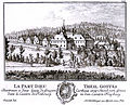 LaPartDieu1758.jpg 883 × 716; 697 KB
-
 PartDieuBulle.JPG 2,332 × 1,440; 3.1 MB
-

_-_alternatif.svg)
.svg)


