Category:Ancien cimetière de Villeurbanne
Jump to navigation
Jump to search
| Object location | | View all coordinates using: OpenStreetMap |
|---|
|
Ancien cimetière de Villeurbanne has an entry on OpenStreetMap (show). |
cemetery located in Rhône, in France  | |||||
| Upload media | |||||
| Instance of | |||||
|---|---|---|---|---|---|
| Location | Villeurbanne, Metropolis of Lyon, Auvergne-Rhône-Alpes, Metropolitan France, France | ||||
| Street address |
| ||||
| Located on street |
| ||||
| Architect |
| ||||
| Inception |
| ||||
| Different from | |||||
| official website | |||||
 | |||||
Subcategories
This category has the following 6 subcategories, out of 6 total.
C
G
Media in category "Ancien cimetière de Villeurbanne"
The following 27 files are in this category, out of 27 total.
-
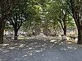
 Allée - ancien cimetière de Villeurbanne.jpg 4,032 × 3,024; 9.55 MB
-
 Allée dans l'ancien cimetière de Villeurbanne (mai 2020).jpg 4,032 × 3,024; 6.42 MB
-
-
 Cimetière des enfants (jardin papillon) au cimetière ancien de Villeurbanne).jpg 3,894 × 2,314; 9.54 MB
-
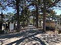
 Entrée du cimetière ancien de Villeurbanne.jpg 4,032 × 3,024; 7.16 MB
-
 Fontaine dans le cimetière ancien de Villeurbanne (mai 2020).jpg 3,024 × 4,032; 10.74 MB
-
 Le portail du cimetière ancien depuis le ciemtière lui même (Villeurbanne).jpg 4,032 × 3,024; 9.17 MB
-

-
 Mur du cimetière ancien de Villeurbanne le séparant de la station RTE.jpg 3,024 × 4,032; 5.45 MB
-
 Plaque "Les retraités gendarmerie à leur camarade" au cimetière ancien de Villeurbanne.jpg 4,032 × 3,024; 9.47 MB
-

-
 Plaque "Souvenir des voisins".jpg 4,032 × 3,024; 8.94 MB
-
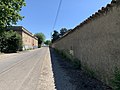 Rue de Pierrefrite (Villeurbanne) et le mur du cimetière ancien.jpg 4,032 × 3,024; 6.91 MB
-
 Tombe envahie par la végétation (cimetière ancien de Villeurbanne).jpg 3,024 × 4,032; 5.7 MB
-
 Un banc dans l'ancien cimetière de Villeurbanne (mai 2020).jpg 4,032 × 3,024; 9.85 MB
-
 Un bâtiment du cimetière ancien de Villeurbanne (mai 2020).jpg 4,032 × 3,024; 7.82 MB
-
 Une allée - cimetière ancien de Villeurbanne - mai 2020.jpg 4,032 × 3,024; 9.39 MB
-
 Une allée du cimetière ancien de Villeurbanne en mai 2020.jpg 4,032 × 3,024; 9.79 MB
-
 Une allée vers l'extrémité sud du cimetière ancien de Villeurbanne.jpg 4,019 × 2,011; 6.41 MB
-
 Une fontaine verte dans l'ancien cimetière de Villeurbanne en mai 2020.jpg 2,486 × 2,732; 4.87 MB
-
 Villeurbanne - Ancien cimetière - Allée 23, vers le nord.jpg 4,128 × 3,096; 5.47 MB
-
 Villeurbanne - Ancien cimetière - Allée derrière l'allée 7.jpg 4,128 × 3,096; 5.21 MB
-
 Villeurbanne - Ancien cimetière - Allée donnant sur les bâtiments à l'entrée.jpg 4,128 × 3,096; 3.79 MB
-
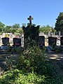
 Villeurbanne - Ancien cimetière - Carré de terrain vague entre les tombes.jpg 4,128 × 3,096; 6.35 MB
-
 Villeurbanne - Ancien cimetière - Mur longeant le poste électrique de Cusset.jpg 4,128 × 3,096; 5.53 MB
-
 Villeurbanne - Ancien cimetière, tombes contre le mur du poste électrique de Cusset.jpg 4,128 × 3,096; 6.16 MB
-


.jpg)
.jpg)
_au_cimeti%C3%A8re_ancien_de_Villeurbanne).jpg)
.jpg)
.jpg)
.jpg)


.jpg)

_et_le_mur_du_cimeti%C3%A8re_ancien.jpg)
.jpg)
.jpg)
.jpg)


