Category:Anantapur district
Jump to navigation
Jump to search
Anantapur (Telugu: అనంతపురం జిల్లా) is is one of the 13 districts of Andhra Pradesh, India. Anantapur is the district headquarter.14°40′48″N 77°36′0″E / 14.68°N 77.6°E
district of Andhra Pradesh, India .svg) | |||||
| Upload media | |||||
| Instance of | |||||
|---|---|---|---|---|---|
| Location |
| ||||
| Capital | |||||
| Population |
| ||||
| Area |
| ||||
| official website | |||||
 | |||||
Subcategories
This category has the following 8 subcategories, out of 8 total.
Pages in category "Anantapur district"
This category contains only the following page.
Media in category "Anantapur district"
The following 29 files are in this category, out of 29 total.
-
 Anantapuram Revenue Divisions.png 1,300 × 1,066; 246 KB
-
 Batrepalli Waterfalls.jpg 2,448 × 3,264; 1.07 MB
-
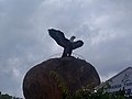 Eagle at Lepakshi.jpg 4,632 × 3,474; 350 KB
-
 GMC Anantapur Front Gate.jpg 3,472 × 4,624; 6.9 MB
-
 Gollapalli Reservoir.jpg 4,032 × 3,024; 1.63 MB
-
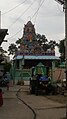
 Kalabhairava Temple Siddarampuram Village Anantapur.jpg 1,920 × 1,080; 976 KB
-
 KASEPALLI BANDI SILA JATHARA.jpg 720 × 540; 26 KB
-
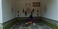
 KASEPALLI RAMALAYAM.jpg 539 × 960; 76 KB
-
 KASEPALLI SHIVALAYAM.jpg 600 × 399; 22 KB
-
 Legend of Bugga Ramalingeswara Swamy Temple Documentary.jpg 4,608 × 3,456; 16.95 MB
-
 Metta fields.JPG 2,592 × 1,944; 1.94 MB
-
 National park, Anantapur, Rayalaseema, Andhra Pradesh, India (2018) 1.jpg 4,000 × 2,000; 1.74 MB
-
 National park, Anantapur, Rayalaseema, Andhra Pradesh, India (2018) 10.jpg 4,000 × 2,000; 2.12 MB
-
 National park, Anantapur, Rayalaseema, Andhra Pradesh, India (2018) 11.jpg 4,000 × 2,000; 2.5 MB
-
 National park, Anantapur, Rayalaseema, Andhra Pradesh, India (2018) 12.jpg 4,000 × 2,000; 1.93 MB
-
 National park, Anantapur, Rayalaseema, Andhra Pradesh, India (2018) 13.jpg 4,000 × 2,000; 4.71 MB
-
 National park, Anantapur, Rayalaseema, Andhra Pradesh, India (2018) 14.jpg 2,000 × 4,000; 4.37 MB
-
 National park, Anantapur, Rayalaseema, Andhra Pradesh, India (2018) 15.jpg 4,000 × 2,000; 4.83 MB
-
 National park, Anantapur, Rayalaseema, Andhra Pradesh, India (2018) 2.jpg 4,000 × 2,000; 3.71 MB
-
 National park, Anantapur, Rayalaseema, Andhra Pradesh, India (2018) 3.jpg 4,000 × 2,000; 2.3 MB
-
 National park, Anantapur, Rayalaseema, Andhra Pradesh, India (2018) 4.jpg 4,000 × 2,000; 1.83 MB
-
 National park, Anantapur, Rayalaseema, Andhra Pradesh, India (2018) 5.jpg 4,000 × 2,000; 2.39 MB
-
 National park, Anantapur, Rayalaseema, Andhra Pradesh, India (2018) 6.jpg 4,000 × 2,000; 2.08 MB
-
 National park, Anantapur, Rayalaseema, Andhra Pradesh, India (2018) 7.jpg 4,000 × 2,000; 3.36 MB
-
 National park, Anantapur, Rayalaseema, Andhra Pradesh, India (2018) 8.jpg 4,000 × 2,000; 3.97 MB
-
 National park, Anantapur, Rayalaseema, Andhra Pradesh, India (2018) 9.jpg 4,000 × 2,000; 2.57 MB
-
 Sri Lakshmi Narayana Swami in Pamidi.jpg 1,280 × 800; 169 KB
-
 VINAYAKACHAVATHI NIMARJANAM.jpg 539 × 960; 126 KB
-
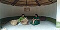
 పాలవాండ్లపల్లి దేవరిలు.jpg 720 × 1,600; 634 KB


_1.jpg)
_10.jpg)
_11.jpg)
_12.jpg)
_13.jpg)
_14.jpg)
_15.jpg)
_2.jpg)
_3.jpg)
_4.jpg)
_5.jpg)
_6.jpg)
_7.jpg)
_8.jpg)
_9.jpg)


