Category:Ambergate
Jump to navigation
Jump to search
village in United Kingdom  | |||||
| Upload media | |||||
| Instance of | |||||
|---|---|---|---|---|---|
| Location | Ripley, Amber Valley, Derbyshire, East Midlands, England | ||||
 | |||||
Subcategories
This category has the following 3 subcategories, out of 3 total.
A
- Ambergate railway station (12 F)
- St Anne's Church, Ambergate (3 F)
T
- Toadmoor Tunnel (3 F)
Media in category "Ambergate"
The following 62 files are in this category, out of 62 total.
-
 222007 , Amberhouse.jpg 3,000 × 1,399; 3.38 MB
-
 222012 , Fritchley.jpg 3,000 × 2,000; 4.36 MB
-
 A610 - View towards Sawmills - geograph.org.uk - 590540.jpg 640 × 480; 99 KB
-

-
 Ambergate - Hurt Arms - geograph.org.uk - 1552143.jpg 640 × 481; 62 KB
-
 Ambergate - Methodist Church - geograph.org.uk - 1552132.jpg 640 × 480; 80 KB
-
 Ambergate - Primary School - geograph.org.uk - 1552134.jpg 640 × 480; 87 KB
-
 Ambergate - The Hurt Arms - geograph.org.uk - 590530.jpg 640 × 480; 76 KB
-
 Ambergate - western railway viaduct over A6.jpg 2,272 × 1,704; 729 KB
-
 Ambergate 1880.jpg 600 × 350; 72 KB
-
 Ambergate bridges.jpg 640 × 480; 100 KB
-
 Ambergate Crich Stand Derbyshire England.jpg 1,068 × 845; 191 KB
-
 Ambergate Cricket Club - geograph.org.uk - 782281.jpg 640 × 480; 103 KB
-
 Ambergate Halfpenny Bridge Derbyshire England.jpg 1,073 × 845; 201 KB
-
 Ambergate Pony.jpg 640 × 480; 110 KB
-
 Ambergate railway bridge over River Derwent Derbyshire England.jpg 1,070 × 843; 204 KB
-
 Ambergate recreation ground - geograph.org.uk - 215805.jpg 640 × 480; 110 KB
-
 Ambergate, Crich Stand, Derbyshire, England-LCCN2002696659.jpg 3,670 × 2,780; 3.7 MB
-
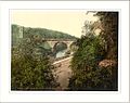
 Ambergate, Halfpenny Bridge, Derbyshire, England-LCCN2002696658.jpg 3,690 × 2,780; 3.65 MB
-
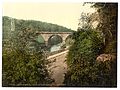 Ambergate, railway bridge over River Derwent, Derbyshire, England-LCCN2002696657.jpg 3,680 × 2,770; 3.6 MB
-
 Ambergate.jpg 800 × 600; 81 KB
-
 Bridge over the River Amber - geograph.org.uk - 1231166.jpg 640 × 475; 124 KB
-
 Bridleway through The Birches - geograph.org.uk - 784888.jpg 640 × 480; 126 KB
-
 Canal Cottages, Ambergate.jpg 3,648 × 2,736; 4.78 MB
-
 Flooded cricket pitch at Ambergate - geograph.org.uk - 1738597.jpg 640 × 480; 43 KB
-
 Footpath to the woods - geograph.org.uk - 782255.jpg 640 × 480; 113 KB
-
-
 Holly lane bridleway - geograph.org.uk - 784896.jpg 640 × 480; 119 KB
-
 Hurt Arms - Ambergate May 2009.jpg 3,648 × 2,736; 2.46 MB
-
 Lawn Farm - geograph.org.uk - 783898.jpg 640 × 480; 62 KB
-
 Mill leat - geograph.org.uk - 782273.jpg 640 × 480; 148 KB
-
 Newbridge Road - geograph.org.uk - 783645.jpg 640 × 480; 93 KB
-
 Newbridge road and railway - geograph.org.uk - 783877.jpg 640 × 480; 90 KB
-
-
 Parked cars - geograph.org.uk - 782301.jpg 640 × 480; 103 KB
-
 Path, Wireworks, Ambergate, Derbyshire (51529909850).jpg 4,160 × 3,120; 2.52 MB
-
 Picturesque Derbyshire. Chase Bridge, Amergate. (NBY 442335).jpg 3,600 × 2,348; 2.19 MB
-
-

-
 River Derwent - geograph.org.uk - 783882.jpg 640 × 480; 106 KB
-
 River Derwent, near Ambergate - geograph.org.uk - 1286350.jpg 640 × 480; 69 KB
-
 Road junction and field - geograph.org.uk - 784891.jpg 640 × 480; 96 KB
-
 Shining Cliff Woods pool - geograph.org.uk - 1155273.jpg 640 × 426; 93 KB
-
 Shining Cliff Woods pool - geograph.org.uk - 1155276.jpg 640 × 427; 126 KB
-
 The Birches, Toadmoor - geograph.org.uk - 1155308.jpg 427 × 640; 147 KB
-
 The Birches, Toadmoor - geograph.org.uk - 1155314.jpg 640 × 427; 145 KB
-
 The Birches, Toadmoor - geograph.org.uk - 1155318.jpg 427 × 640; 153 KB
-
 The Birches, Toadmoor - geograph.org.uk - 1155319.jpg 640 × 427; 147 KB
-
 The Chapel House - geograph.org.uk - 782290.jpg 640 × 480; 112 KB
-
 The River Derwent is hiding - geograph.org.uk - 1102603.jpg 640 × 426; 174 KB
-
 Toadmoor lane junction - geograph.org.uk - 782309.jpg 640 × 480; 94 KB
-
 View of Ambergate from West 22 11 2016.jpg 3,264 × 2,448; 1.43 MB
-
 View of Ambergate on a misty morning - geograph.org.uk - 1738638.jpg 640 × 480; 51 KB
-
 Wireworks Former workers houses, Ambergate, Derbyshire (51528990896).jpg 3,120 × 4,160; 4.42 MB
-
 Wireworks Former workers houses, Ambergate, Derbyshire (51529010811).jpg 3,120 × 4,160; 2.77 MB
-
 Wireworks Former workers houses, Ambergate, Derbyshire (51529930365).jpg 3,120 × 4,160; 2.56 MB
-
 Wireworks Project, Ambergate, Derbyshire (51528159822).jpg 4,160 × 3,120; 1.63 MB
-
 Across the valley - geograph.org.uk - 784901.jpg 640 × 480; 102 KB
-
 Ambergate Section of the Cromford Canal - geograph.org.uk - 590576.jpg 640 × 480; 156 KB
-
 Approaching The Hurt Arms - geograph.org.uk - 738596.jpg 640 × 480; 84 KB
-

-
 River Derwent , Ambergate - geograph.org.uk - 657702.jpg 640 × 480; 77 KB


.jpg)
.jpg)


.jpg)
.jpg)
.jpg)
.jpg)


_-_geograph.org.uk_-_590556.jpg)
