Category:Alyth (civil parish)
Jump to navigation
Jump to search
Scottish parish in Perth and Kinross, Scotland, UK | |||||
| Upload media | |||||
| Instance of | |||||
|---|---|---|---|---|---|
| Named after | |||||
| Location |
| ||||
| Population |
| ||||
| Area |
| ||||
 | |||||
Subcategories
This category has the following 2 subcategories, out of 2 total.
Media in category "Alyth (civil parish)"
The following 200 files are in this category, out of 827 total.
(previous page) (next page)-
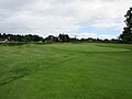
 1st hole Glenisla Golf Course, Barry Hill - geograph.org.uk - 5436773.jpg 5,184 × 3,888; 5.35 MB
-
 1st Tee, Alyth Golf Club - geograph.org.uk - 2130402.jpg 3,648 × 2,736; 2.39 MB
-
 2nd hole, Glenisla Golf Course, Kirk Spire - geograph.org.uk - 5436780.jpg 5,184 × 3,888; 5.42 MB
-
 3rd hole, Glenisla Golf Course, St Fink - geograph.org.uk - 5436787.jpg 5,184 × 3,888; 5.65 MB
-
 4th hole, Glenisla Golf Course, Lindsay's Hame - geograph.org.uk - 5436796.jpg 5,184 × 3,888; 6.05 MB
-
 5th hole, Glenisla Golf Course, Alyth Burn - geograph.org.uk - 5436803.jpg 5,184 × 3,888; 5.13 MB
-
 6th hole, Glenisla Golf Course, Johnny's Folly - geograph.org.uk - 5436813.jpg 5,184 × 3,888; 4.34 MB
-
 7th hole, Glenisla Golf Course, The Monster - geograph.org.uk - 5436819.jpg 5,184 × 3,888; 4.74 MB
-
 8th hole, Glenisla Golf Course, Devil's Elbow - geograph.org.uk - 5436825.jpg 5,184 × 3,888; 4.77 MB
-
 9th hole, Glenisla Golf Course, Pud's Dyke - geograph.org.uk - 5436832.jpg 5,184 × 3,888; 5.88 MB
-
 A few trees in a stubble field - geograph.org.uk - 5960396.jpg 2,000 × 1,330; 2.27 MB
-
 A field by Balendoch - geograph.org.uk - 4421963.jpg 800 × 533; 279 KB
-
 A windy day on top of the Hill of Alyth - geograph.org.uk - 3143668.jpg 800 × 600; 135 KB
-
 Abandoned combine harvester - geograph.org.uk - 1828311.jpg 640 × 427; 89 KB
-
 Airlie Street, Alyth - geograph.org.uk - 3128370.jpg 640 × 424; 65 KB
-
 Airlie Street, Alyth - geograph.org.uk - 3128374.jpg 640 × 424; 73 KB
-
 Airlie Street, Alyth - geograph.org.uk - 3128376.jpg 640 × 424; 57 KB
-
 Airlie Street, Alyth - geograph.org.uk - 4820915.jpg 800 × 600; 204 KB
-
 Albert Street, Alyth - geograph.org.uk - 3128385.jpg 640 × 424; 77 KB
-
 Alfred Anderson Memorial - geograph.org.uk - 3531832.jpg 488 × 640; 116 KB
-
 Alyth - geograph.org.uk - 2562215.jpg 4,000 × 3,000; 2.66 MB
-
 Alyth Bowling Green - geograph.org.uk - 5398732.jpg 5,184 × 3,888; 5.04 MB
-
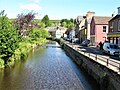
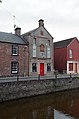
 Alyth Burn - geograph.org.uk - 1878250.jpg 640 × 480; 102 KB
-
 Alyth Burn - geograph.org.uk - 1900813.jpg 640 × 480; 97 KB
-
 Alyth Burn - geograph.org.uk - 3127286.jpg 640 × 424; 98 KB
-
 Alyth Burn - geograph.org.uk - 3127294.jpg 640 × 424; 69 KB
-
 Alyth Burn - geograph.org.uk - 3128365.jpg 640 × 424; 86 KB
-
 Alyth Burn - geograph.org.uk - 3128392.jpg 640 × 424; 86 KB
-
 Alyth Burn - geograph.org.uk - 3129904.jpg 424 × 640; 108 KB
-
 Alyth Burn - geograph.org.uk - 4024629.jpg 640 × 480; 308 KB
-
 Alyth Burn - geograph.org.uk - 4024638.jpg 640 × 480; 261 KB
-
 Alyth Burn - geograph.org.uk - 4820484.jpg 800 × 600; 327 KB
-
 Alyth Burn - geograph.org.uk - 4820900.jpg 800 × 600; 257 KB
-
 Alyth Burn - geograph.org.uk - 4821816.jpg 640 × 480; 105 KB
-
 Alyth Burn - geograph.org.uk - 5850617.jpg 5,184 × 3,888; 3.83 MB
-
 Alyth Burn - geograph.org.uk - 5949726.jpg 1,024 × 683; 372 KB
-
 Alyth Burn and Welton of Creuchies - geograph.org.uk - 3605338.jpg 640 × 480; 64 KB
-
 Alyth Burn and Welton of Creuchies - geograph.org.uk - 3605414.jpg 640 × 480; 106 KB
-
 Alyth Burn in Alyth - geograph.org.uk - 3290907.jpg 1,024 × 681; 248 KB
-
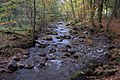 Alyth Burn in Den o' Alyth - geograph.org.uk - 2113000.jpg 800 × 533; 187 KB
-
 Alyth Burn in Den o' Alyth - geograph.org.uk - 2113011.jpg 800 × 534; 304 KB
-
 Alyth Burn in Den o' Alyth - geograph.org.uk - 2116178.jpg 533 × 800; 182 KB
-
 Alyth Burn in Den o' Alyth - geograph.org.uk - 2658268.jpg 800 × 534; 303 KB
-
 Alyth Burn in Den o' Alyth - geograph.org.uk - 3207908.jpg 1,024 × 681; 397 KB
-
 Alyth Burn in Den o' Alyth - geograph.org.uk - 3207914.jpg 1,024 × 681; 372 KB
-
 Alyth Burn in Den o' Alyth - geograph.org.uk - 3207916.jpg 1,024 × 681; 300 KB
-
 Alyth Burn in Den o' Alyth - geograph.org.uk - 3207934.jpg 682 × 1,024; 329 KB
-
 Alyth Burn in Den o' Alyth - geograph.org.uk - 3207935.jpg 1,024 × 682; 388 KB
-
 Alyth Burn in Den o' Alyth - geograph.org.uk - 3287894.jpg 1,024 × 682; 300 KB
-
 Alyth Burn in Den o' Alyth - geograph.org.uk - 3287905.jpg 1,024 × 681; 281 KB
-
 Alyth Burn in Den o' Alyth - geograph.org.uk - 3287918.jpg 1,024 × 682; 319 KB
-
 Alyth Burn in Den o' Alyth - geograph.org.uk - 3287922.jpg 1,024 × 681; 222 KB
-
 Alyth Burn in Den o' Alyth - geograph.org.uk - 3287923.jpg 681 × 1,024; 321 KB
-
 Alyth Burn in Den o' Alyth - geograph.org.uk - 3917242.jpg 1,024 × 680; 159 KB
-
 Alyth Burn in Den o' Alyth - geograph.org.uk - 4214215.jpg 1,024 × 681; 360 KB
-
 Alyth Burn in Den o' Alyth - geograph.org.uk - 4298691.jpg 1,024 × 681; 297 KB
-
 Alyth Burn in Den o' Alyth - geograph.org.uk - 4298692.jpg 1,024 × 681; 273 KB
-
 Alyth Burn in Den o' Alyth - geograph.org.uk - 4298701.jpg 1,024 × 681; 356 KB
-
 Alyth Burn in Den o' Alyth - geograph.org.uk - 4298706.jpg 1,024 × 681; 262 KB
-
 Alyth Burn in Den o' Alyth - geograph.org.uk - 4298708.jpg 1,024 × 681; 282 KB
-
 Alyth Burn in the Den o' Alyth - geograph.org.uk - 2658124.jpg 800 × 534; 299 KB
-
 Alyth Burn, Alyth - geograph.org.uk - 2184857.jpg 3,648 × 2,736; 2.39 MB
-
 Alyth Burn, Alyth - geograph.org.uk - 5816913.jpg 1,024 × 768; 271 KB
-
 Alyth Burn, Den o' Alyth - geograph.org.uk - 3920232.jpg 1,024 × 681; 290 KB
-
 Alyth Golf Course and Club House - geograph.org.uk - 3074848.jpg 2,592 × 1,944; 1.35 MB
-
 Alyth Golf Course, 10th hole - geograph.org.uk - 5439539.jpg 5,184 × 3,888; 7.43 MB
-
 Alyth Golf Course, 11th hole - geograph.org.uk - 5439543.jpg 5,184 × 3,888; 7.13 MB
-
 Alyth Golf Course, 12th hole - geograph.org.uk - 5439548.jpg 5,184 × 3,888; 7.01 MB
-
 Alyth Golf Course, 13th hole - geograph.org.uk - 5439552.jpg 5,184 × 3,888; 5.99 MB
-
 Alyth Golf Course, 14th hole - geograph.org.uk - 5439556.jpg 5,184 × 3,888; 6.57 MB
-
 Alyth Golf Course, 15th hole - geograph.org.uk - 5439559.jpg 5,184 × 3,888; 5.23 MB
-
 Alyth Golf Course, 16th hole - geograph.org.uk - 5439564.jpg 5,184 × 3,888; 5.63 MB
-
 Alyth Golf Course, 17th hole - geograph.org.uk - 5439568.jpg 5,184 × 3,888; 6.1 MB
-
 Alyth Golf Course, 18th hole - geograph.org.uk - 5439570.jpg 5,184 × 3,888; 6.79 MB
-
 Alyth Golf Course, 1st hole - geograph.org.uk - 5439491.jpg 5,184 × 3,888; 5.7 MB
-
 Alyth Golf Course, 2nd hole - geograph.org.uk - 5439499.jpg 5,184 × 3,888; 5.75 MB
-
 Alyth Golf Course, 3rd hole - geograph.org.uk - 5439503.jpg 5,184 × 3,888; 4.93 MB
-
 Alyth Golf Course, 4th hole - geograph.org.uk - 5439509.jpg 5,184 × 3,888; 6.93 MB
-
 Alyth Golf Course, 5th hole - geograph.org.uk - 5439516.jpg 5,184 × 3,888; 6.44 MB
-
 Alyth Golf Course, 6th hole - geograph.org.uk - 5439519.jpg 5,184 × 3,888; 6.36 MB
-
 Alyth Golf Course, 7th hole - geograph.org.uk - 5439528.jpg 5,184 × 3,888; 5.91 MB
-
 Alyth Golf Course, 8th hole - geograph.org.uk - 5439532.jpg 5,184 × 3,888; 5.1 MB
-
 Alyth Golf Course, 9th hole - geograph.org.uk - 5439537.jpg 5,184 × 3,888; 5.93 MB
-
 Alyth Hotel - geograph.org.uk - 4024634.jpg 640 × 480; 263 KB
-
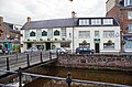 Alyth Hotel, Alyth - geograph.org.uk - 3127447.jpg 640 × 424; 85 KB
-
 Alyth Museum - geograph.org.uk - 3127308.jpg 424 × 640; 60 KB
-
 Alyth Parish Church - geograph.org.uk - 3120885.jpg 640 × 424; 60 KB
-
 Alyth Parish Church - geograph.org.uk - 3870193.jpg 640 × 488; 280 KB
-
 Alyth Parish Church - geograph.org.uk - 4302064.jpg 418 × 640; 55 KB
-
 Alyth Parish Church and gate - geograph.org.uk - 3124732.jpg 480 × 640; 55 KB
-

-
 Alyth Parish Church, Hall - geograph.org.uk - 3128373.jpg 424 × 640; 56 KB
-
 Alyth Parish Church, Interior - geograph.org.uk - 3125035.jpg 640 × 480; 130 KB
-
 Alyth Parish Church, Noticeboard - geograph.org.uk - 3120895.jpg 424 × 640; 76 KB
-
 Alyth Parish Church, Organ - geograph.org.uk - 3125024.jpg 640 × 480; 124 KB
-
 Alyth Parish Church, Organ - geograph.org.uk - 3125033.jpg 480 × 640; 66 KB
-
 Alyth Parish Church, Pulpit - geograph.org.uk - 3125021.jpg 480 × 640; 73 KB
-
 Alyth Parish Church, Pulpit - geograph.org.uk - 3125030.jpg 480 × 640; 92 KB
-
 Alyth Post Office - geograph.org.uk - 3128371.jpg 640 × 424; 71 KB
-
 Alyth War Memorial - geograph.org.uk - 3531822.jpg 480 × 640; 71 KB
-
 Alyth War Memorial - geograph.org.uk - 5816842.jpg 640 × 480; 96 KB
-
 Alyth, from Meigle Road - geograph.org.uk - 1999478.jpg 800 × 534; 104 KB
-
 Another break in the forest - geograph.org.uk - 1954097.jpg 1,500 × 1,125; 1.01 MB
-
 Approach to Glencarse Junction on A90 - geograph.org.uk - 2759587.jpg 2,196 × 1,484; 466 KB
-
 Arable land, Hallyards - geograph.org.uk - 4409580.jpg 800 × 533; 209 KB
-
 Arable land, New Alyth - geograph.org.uk - 4820470.jpg 800 × 600; 237 KB
-
 Arched Gateway - geograph.org.uk - 2643429.jpg 480 × 640; 80 KB
-
 Ardormie - geograph.org.uk - 1091811.jpg 640 × 426; 98 KB
-
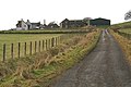 Ardormie - geograph.org.uk - 1091814.jpg 640 × 426; 87 KB
-
 Ardormie Farm - geograph.org.uk - 5370257.jpg 5,184 × 3,888; 5.42 MB
-
 Ardormie farm house - geograph.org.uk - 2982250.jpg 2,048 × 1,536; 729 KB
-
 Ardormie Hill - geograph.org.uk - 2302844.jpg 640 × 480; 235 KB
-
 Ardormie Hill - geograph.org.uk - 2304398.jpg 640 × 480; 239 KB
-
 Ardormie Hill, remains of the wood - geograph.org.uk - 2304380.jpg 640 × 480; 261 KB
-
 Autumn beech leaves, Den o' Alyth - geograph.org.uk - 1112181.jpg 426 × 640; 158 KB
-
 Autumn beech tree in Den o' Alyth - geograph.org.uk - 3207924.jpg 1,024 × 681; 430 KB
-
 Autumn sycamores, Leitfie, near Alyth - geograph.org.uk - 1011365.jpg 640 × 426; 174 KB
-
 Aylth Burn, Den o' Aylth - geograph.org.uk - 1540152.jpg 640 × 480; 182 KB
-
 B542, Alyth - geograph.org.uk - 2629901.jpg 640 × 481; 76 KB
-
 B954 - geograph.org.uk - 4411053.jpg 800 × 533; 166 KB
-
 B954 Bridge of Crathies - geograph.org.uk - 5369230.jpg 5,184 × 3,888; 5.2 MB
-
 B954, north of Alyth - geograph.org.uk - 4821824.jpg 800 × 600; 247 KB
-
 Back of an icecream cabinet - geograph.org.uk - 4820911.jpg 600 × 800; 188 KB
-
 Balduff Hill - geograph.org.uk - 2304324.jpg 640 × 359; 175 KB
-
 Balduff Hill - geograph.org.uk - 2304343.jpg 640 × 480; 253 KB
-
 Bales at Milton - geograph.org.uk - 3592855.jpg 640 × 480; 85 KB
-
 Bales, Leitfie, near Alyth - geograph.org.uk - 1006757.jpg 640 × 426; 67 KB
-
 Balloch and Bruceton road - geograph.org.uk - 5950873.jpg 1,024 × 683; 302 KB
-
 Balloch by Alyth - geograph.org.uk - 4820904.jpg 800 × 600; 176 KB
-
 Balloch Farm near Alyth - geograph.org.uk - 1900943.jpg 640 × 480; 73 KB
-
 Balwhyme from Hill of Alyth - geograph.org.uk - 3143679.jpg 800 × 600; 110 KB
-
 Balwhyme, Hill of Alyth - geograph.org.uk - 2004300.jpg 800 × 534; 211 KB
-
 Bamff Lodge - geograph.org.uk - 3605381.jpg 640 × 480; 115 KB
-
 Bamff Road heading in Alyth - geograph.org.uk - 5966620.jpg 2,000 × 1,500; 2.87 MB
-
 Bamff Wynd, Alyth - geograph.org.uk - 3122908.jpg 640 × 480; 106 KB
-
 Bank Street, Alyth - geograph.org.uk - 3126490.jpg 640 × 424; 51 KB
-
 Bank Street, Alyth - geograph.org.uk - 3126493.jpg 424 × 640; 53 KB
-
 Bankhead, Alyth - geograph.org.uk - 1101327.jpg 640 × 426; 52 KB
-
 Bardmony - geograph.org.uk - 4821902.jpg 800 × 600; 170 KB
-
 Bardmony House - geograph.org.uk - 2498045.jpg 800 × 533; 130 KB
-
 Bardmony House - geograph.org.uk - 2498049.jpg 800 × 533; 133 KB
-
 Barley field near Bogside - geograph.org.uk - 3605495.jpg 640 × 480; 81 KB
-

-

-
 Barry Hill - geograph.org.uk - 3063761.jpg 2,816 × 2,112; 2.01 MB
-
 Barry Hill - geograph.org.uk - 3605509.jpg 640 × 480; 90 KB
-
 Barry Hill, Alyth - geograph.org.uk - 1238586.jpg 640 × 426; 121 KB
-
 Battery for electric fence, Buchal, near Alyth - geograph.org.uk - 3721269.jpg 1,024 × 681; 280 KB
-
 Beaver dam and drowned trees - geograph.org.uk - 2963180.jpg 3,264 × 2,448; 5.43 MB
-
 Beaver dam on a burn at Bamff - geograph.org.uk - 2962509.jpg 3,264 × 2,448; 6.25 MB
-
 Beaver lodge at Bamff - geograph.org.uk - 2963200.jpg 3,264 × 2,448; 5.35 MB
-
 Beaver pond, Bamff - geograph.org.uk - 3552265.jpg 1,024 × 681; 230 KB
-
 Bee hives south of New Alyth - geograph.org.uk - 5960428.jpg 2,000 × 1,500; 3.65 MB
-
 Beech leaf carpet in Den o' Alyth - geograph.org.uk - 2658254.jpg 533 × 800; 316 KB
-

-
 Beech leaves on woodland floor - geograph.org.uk - 5967579.jpg 2,000 × 1,500; 4.07 MB
-
 Beech leaves, Den o' Alyth - geograph.org.uk - 3559000.jpg 1,024 × 906; 202 KB
-

-
 Beech trees, Den o' Aylth - geograph.org.uk - 1540165.jpg 640 × 480; 199 KB
-
 Beech woodland in Den o' Alyth - geograph.org.uk - 3207936.jpg 1,024 × 681; 369 KB
-
 Beech woodland in Den o' Alyth - geograph.org.uk - 4214209.jpg 681 × 1,024; 331 KB
-
 Beech woodland in Den o' Alyth - geograph.org.uk - 4214211.jpg 1,024 × 681; 369 KB
-
 Beech woodland, Den o' Alyth - geograph.org.uk - 3207894.jpg 682 × 1,024; 418 KB
-
 Beech woodland, Den o' Alyth - geograph.org.uk - 3207898.jpg 1,024 × 682; 380 KB
-
 Beech woodland, Den o' Alyth - geograph.org.uk - 3870177.jpg 640 × 480; 377 KB
-
 Beech woodland, Den o'Alyth - geograph.org.uk - 3605377.jpg 640 × 480; 125 KB
-
 Beech woods in Den o' Alyth - geograph.org.uk - 2658229.jpg 800 × 534; 355 KB
-
 Beech woods in Den o' Alyth - geograph.org.uk - 2658261.jpg 800 × 533; 373 KB
-
 Beeches in an 'arm' of the Den of Alyth - geograph.org.uk - 4217991.jpg 1,024 × 681; 350 KB
-
 Beeches in an 'arm' of the Den of Alyth - geograph.org.uk - 4217994.jpg 1,024 × 681; 353 KB
-
 Beeches in Den o' Alyth - geograph.org.uk - 2113008.jpg 534 × 800; 323 KB
-
 Beeches in Den o' Alyth - geograph.org.uk - 2113014.jpg 427 × 640; 133 KB
-
 Behind Alyth - geograph.org.uk - 4820889.jpg 800 × 600; 188 KB
-
 Bench Mark, Alyth - geograph.org.uk - 2630212.jpg 480 × 640; 93 KB
-
 Bench Mark, Gauldswell Farm - geograph.org.uk - 2629695.jpg 479 × 640; 66 KB
-
 Bend in the track - geograph.org.uk - 2982279.jpg 2,048 × 1,536; 1.03 MB
-
 Berry fields, Cairns of Aberbothrie - geograph.org.uk - 3870480.jpg 640 × 480; 284 KB
-
 Berry fields, Cairns of Aberbothrie - geograph.org.uk - 3870484.jpg 640 × 480; 276 KB
-
 Between Barry and Loyal - geograph.org.uk - 4821896.jpg 800 × 600; 155 KB
-
 Birch trees on west side of minor road - geograph.org.uk - 5966126.jpg 2,000 × 1,500; 2.83 MB
-
 Birch woodland at Mount Blair Lodge in Glen Shee - geograph.org.uk - 3803335.jpg 1,024 × 681; 380 KB
-
 Black Water - geograph.org.uk - 1953254.jpg 1,500 × 1,125; 855 KB
-
 Blackbird Inn, New Alyth - geograph.org.uk - 3870214.jpg 640 × 480; 242 KB
-
 Boathouse and Drumore Loch - geograph.org.uk - 1953288.jpg 1,500 × 1,125; 934 KB
-
 Boathouse on Drumore Loch - geograph.org.uk - 3594252.jpg 640 × 480; 80 KB
-
 Bogside - geograph.org.uk - 5967524.jpg 2,000 × 1,500; 2.81 MB
-
 Bogside junction - geograph.org.uk - 3063578.jpg 2,816 × 2,112; 1.21 MB
-
 Bothrie Farm, Aberbothrie - geograph.org.uk - 2184899.jpg 3,648 × 2,736; 2.39 MB
-
 Boulder in the Alyth Burn, Den o' Alyth - geograph.org.uk - 4214219.jpg 1,024 × 681; 145 KB
-
 Boulder in the heather - geograph.org.uk - 2001605.jpg 1,500 × 1,125; 669 KB
-
 Boulders beside path near summit of Mount Blair - geograph.org.uk - 5964868.jpg 2,000 × 1,500; 2.57 MB
-
 Boulders in Den o' Alyth - geograph.org.uk - 3287934.jpg 1,024 × 682; 403 KB
-
 Boulders in the Alyth Burn, Den o' Alyth - geograph.org.uk - 3287928.jpg 1,024 × 681; 291 KB
-
 Brewlands Bridge to Blacklunans road - geograph.org.uk - 5915954.jpg 5,184 × 3,888; 7.38 MB
-
 Bridge at Pitcrocknie, Alyth - geograph.org.uk - 2130367.jpg 3,648 × 2,736; 2.41 MB
-
 Bridge near East Tullyfergus - geograph.org.uk - 1538658.jpg 640 × 480; 199 KB
-
 Bridge of Crathies, east side - geograph.org.uk - 5369226.jpg 5,184 × 3,888; 5.97 MB
-
 Bridge of Crathies, west side - geograph.org.uk - 5369234.jpg 5,184 × 3,888; 5.44 MB
-
 Bridge of Tully - geograph.org.uk - 5850549.jpg 5,184 × 3,888; 7.03 MB
-
 Bridge over Alyth Burn in Den o' Alyth - geograph.org.uk - 2658257.jpg 534 × 800; 323 KB


&filefrom=Bridge+over+Alyth+Burn+in+Den+o%27+Alyth+-+geograph.org.uk+-+2658258.jpg#mw-category-media)