Category:Alness
Jump to navigation
Jump to search
town in Ross and Cromarty, Highland, Scotland, UK  | |||||
| Upload media | |||||
| Instance of | |||||
|---|---|---|---|---|---|
| Location |
| ||||
| Located in or next to body of water | |||||
| Population |
| ||||
 | |||||
English: Alness is a town in Ross and Cromarty, Highland, Scotland. The name is pronounced (roughly) Al'-niss by some Ross-shire residents and Oll-ness' by others. It lies near the Cromarty Firth, with the town of Invergordon to the east and the village of Evanton to the southwest.
Gàidhlig: 'S e baile beag ann an Siorrachd Rois a tha ann Alanais. Ann an 2001 bha 5,815 a' fuireach ann.
Nederlands: Alness ( Schots-Gaelisch: Anas) is een town in de Schotse council Highland in het Lieutenancy area Ross and Cromarty ten westen van Invergordon.
Norsk bokmål: Alness ( Skotsk gælisk: Alanais) er en by i Skottland. Den ligger i regionen Highland.
Subcategories
This category has the following 6 subcategories, out of 6 total.
A
- Alness railway station (13 F)
- Alness Railway Viaduct (8 F)
D
- Dalmore distillery (14 F)
S
- Station Hotel, Alness (4 F)
T
- Teaninich Castle (2 F)
- Teaninich Distillery (7 F)
Media in category "Alness"
The following 92 files are in this category, out of 92 total.
-
 10 Davis Drive - geograph.org.uk - 1672297.jpg 3,968 × 2,976; 4.75 MB
-
 A cat puts its life on the line - geograph.org.uk - 1703593.jpg 3,072 × 2,304; 1.98 MB
-
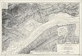 Admiralty Chart No 1890 Cromarty Firth - west sheet, Published 1924.jpg 9,900 × 6,778; 33.73 MB
-
 Alness Academy - geograph.org.uk - 2713466.jpg 1,280 × 856; 131 KB
-
 Alness Bowling Club - geograph.org.uk - 1234680.jpg 640 × 413; 59 KB
-
 Alness Heritage Centre - geograph.org.uk - 1234738.jpg 640 × 415; 114 KB
-
 Alness High St. - panoramio.jpg 2,996 × 3,155; 5.45 MB
-
 Alness High Street - geograph.org.uk - 46297.jpg 600 × 380; 61 KB
-
 Alness High Street - geograph.org.uk - 913641.jpg 640 × 480; 75 KB
-
 Alness High Street Looking East - geograph.org.uk - 61564.jpg 640 × 480; 137 KB
-
 Alness Morrisons - geograph.org.uk - 2089609.jpg 1,000 × 750; 211 KB
-
 Alness Old Parish Church (ruin) and graveyard (geograph 5803564).jpg 3,776 × 2,520; 4.06 MB
-
 Alness Parish Church - geograph.org.uk - 1234671.jpg 640 × 494; 76 KB
-
 Alness Point - geograph.org.uk - 778554.jpg 640 × 400; 188 KB
-
 Alness Point - geograph.org.uk - 780188.jpg 640 × 455; 115 KB
-
 Alness Point - geograph.org.uk - 780194.jpg 640 × 458; 87 KB
-
 Alness Point Business Park - geograph.org.uk - 780159.jpg 640 × 480; 95 KB
-
 Alness Point Business Park - geograph.org.uk - 780166.jpg 640 × 456; 83 KB
-
 Alness Point Business Park - geograph.org.uk - 780168.jpg 640 × 480; 130 KB
-
 Alness Point Business Park - geograph.org.uk - 780174.jpg 640 × 457; 83 KB
-
 Alness River - geograph.org.uk - 46440.jpg 600 × 399; 94 KB
-
 Alness River - geograph.org.uk - 51703.jpg 600 × 401; 70 KB
-
 Catalina flying boat propeller in Mitchell Lane, Alness - geograph.org.uk - 1702737.jpg 1,200 × 1,600; 284 KB
-
 Coastline Alness Point - geograph.org.uk - 778698.jpg 640 × 425; 187 KB
-
 College building at Alness Point Business Park (geograph 4865483).jpg 1,024 × 576; 163 KB
-
 Crannich Farm - geograph.org.uk - 58698.jpg 640 × 480; 95 KB
-
 Cromarty Firth by Dalmore Pier - geograph.org.uk - 6343648.jpg 1,600 × 900; 411 KB
-
 Cromarty Firth near Alness Point - geograph.org.uk - 6019859.jpg 1,600 × 900; 261 KB
-
 Cromarty Firth towards Cromarty from Dalmore Pier - geograph.org.uk - 6062781.jpg 1,600 × 1,063; 614 KB
-
 Cromarty Firth west of Dalmore Pier - geograph.org.uk - 6062789.jpg 1,600 × 900; 360 KB
-
 Dalmore Conventicle Stone, Alness (geograph 1864555).jpg 427 × 640; 75 KB
-
 Dalmore House - geograph.org.uk - 1234773.jpg 640 × 403; 55 KB
-

-
 Entrance to Alness Academy - geograph.org.uk - 1235846.jpg 640 × 411; 100 KB
-
 Exploration oil rigs in the Cromarty Firth - geograph.org.uk - 6020185.jpg 1,600 × 900; 338 KB
-
 Flooded saltings near Dalmore Pier - geograph.org.uk - 6343650.jpg 1,600 × 1,200; 453 KB
-
 Highland Archaeology Festival Event - geograph.org.uk - 5938917.jpg 640 × 368; 54 KB
-
 Jetty in Alness Bay - geograph.org.uk - 5539365.jpg 1,600 × 1,076; 273 KB
-
 Joining the A9 east of Alness. - geograph.org.uk - 225854.jpg 640 × 427; 94 KB
-
 Lookout Post - geograph.org.uk - 51701.jpg 600 × 389; 48 KB
-
 Masonic Lodge, Alness (geograph 5203272).jpg 1,280 × 857; 1,007 KB
-
 Millennium Garden - geograph.org.uk - 1234806.jpg 640 × 424; 84 KB
-
 O.S 1GL Bolt- Alness, Established Church Ruin (geograph 7048029).jpg 1,024 × 768; 295 KB
-

-
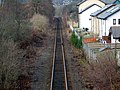
 Railway through Alness - geograph.org.uk - 1703677.jpg 3,072 × 2,304; 2.45 MB
-
 Relics of war on the shoreline at Alness Point - geograph.org.uk - 5255467.jpg 1,024 × 768; 200 KB
-
 Road to Invergordon, at Belloport Pier - geograph.org.uk - 6019878.jpg 1,024 × 768; 377 KB
-
 Rosskeen Church of Scotland (geograph 5197297).jpg 1,280 × 857; 1.12 MB
-
 Royal Bank of Scotland, right - geograph.org.uk - 976727.jpg 640 × 480; 90 KB
-
 Safeway supermarket, Alness - geograph.org.uk - 2345125.jpg 1,600 × 1,200; 299 KB
-
 Saltings by Dalmore Pier - geograph.org.uk - 6019872.jpg 1,600 × 1,200; 458 KB
-
 Sea Defences Alness Point - geograph.org.uk - 5873493.jpg 800 × 500; 121 KB
-
 Slipway on Alness Point - geograph.org.uk - 778626.jpg 640 × 400; 134 KB
-
 Steps to nowhere^ - geograph.org.uk - 666960.jpg 640 × 427; 285 KB
-
 Teaninich Beach - geograph.org.uk - 5864824.jpg 1,024 × 443; 144 KB
-
 Teaninich Beach - geograph.org.uk - 5864837.jpg 1,024 × 640; 211 KB
-
 Teaninich Distillery - panoramio.jpg 4,272 × 2,848; 3.37 MB
-
 The Bank Square, Alness - geograph.org.uk - 1235876.jpg 640 × 426; 65 KB
-
 The Dalmore Finesse - geograph.org.uk - 5301001.jpg 640 × 400; 74 KB
-
 Variable Pitch Memorial - geograph.org.uk - 2556147.jpg 2,304 × 3,456; 1.02 MB
-
 War Memorial Alness (geograph 4951526).jpg 1,024 × 768; 631 KB
-
 War memorial and High Street, Alness - geograph.org.uk - 1703787.jpg 1,600 × 1,200; 312 KB
-
 WW2 Lookout Post - geograph.org.uk - 5298227.jpg 640 × 480; 80 KB
-
 Alness - geograph.org.uk - 48257.jpg 640 × 427; 90 KB
-
 Alness - geograph.org.uk - 48265.jpg 640 × 427; 83 KB
-
 Alness Golf Course - geograph.org.uk - 61485.jpg 640 × 480; 98 KB
-
 Alness Point. - geograph.org.uk - 1405084.jpg 640 × 480; 163 KB
-
 Alness Point. - geograph.org.uk - 1405088.jpg 640 × 480; 134 KB
-
 Alness Weir - geograph.org.uk - 1414131.jpg 640 × 427; 118 KB
-
 Clashnabuiac - geograph.org.uk - 155647.jpg 640 × 409; 58 KB
-
 Contullich - geograph.org.uk - 155652.jpg 640 × 480; 101 KB
-
 Culcraggie - geograph.org.uk - 155319.jpg 640 × 480; 101 KB
-
 Culcraggie woodland - geograph.org.uk - 155648.jpg 640 × 480; 140 KB
-
 Dalnacloich - geograph.org.uk - 506864.jpg 640 × 426; 68 KB
-
 Dalnacloich Farm - geograph.org.uk - 506865.jpg 640 × 426; 75 KB
-
 Dalreoch Wood - geograph.org.uk - 155661.jpg 640 × 480; 114 KB
-
 Farmland on Cnoc Navie - geograph.org.uk - 135304.jpg 640 × 480; 100 KB
-
 Field of rapeseed at Newmore Mains - geograph.org.uk - 421186.jpg 640 × 480; 91 KB
-
 Footbridge over the Allt Dubhach - geograph.org.uk - 759404.jpg 640 × 427; 221 KB
-
 Glaick - geograph.org.uk - 506868.jpg 640 × 426; 47 KB
-
 Glaick - geograph.org.uk - 506872.jpg 640 × 426; 57 KB
-
 Jcn. to Culcairn Farm - geograph.org.uk - 421200.jpg 640 × 480; 85 KB
-
 Millcraig Farm, Alness - geograph.org.uk - 421209.jpg 640 × 480; 61 KB
-
 Minor road to Alness - geograph.org.uk - 506876.jpg 640 × 426; 83 KB
-
 Moultavie field - geograph.org.uk - 155659.jpg 640 × 480; 94 KB
-
 Novar Forest - geograph.org.uk - 155730.jpg 640 × 480; 143 KB
-
 Oil Rigs and Road Junctions - geograph.org.uk - 11789.jpg 576 × 432; 29 KB
-
 Overgrown Path - geograph.org.uk - 506875.jpg 640 × 426; 107 KB
-
 Road through Newmore Wood - geograph.org.uk - 681816.jpg 640 × 480; 448 KB
-
 Teaninich Industrial Estate - geograph.org.uk - 51704.jpg 600 × 401; 53 KB
-
 View looking East - geograph.org.uk - 46343.jpg 600 × 399; 67 KB
-
 Westford Cemetery - geograph.org.uk - 51706.jpg 600 × 388; 72 KB


_and_graveyard_(geograph_5803564).jpg)


.jpg)


.jpg)


.jpg)

.jpg)


.jpg)


.jpg)


