Category:All Saints, East Budleigh
Jump to navigation
Jump to search
| Object location | | View all coordinates using: OpenStreetMap |
|---|
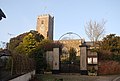
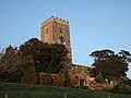
historic church in East Budleigh, East Devon, Devon, England  | |||||
| Upload media | |||||
| Instance of | |||||
|---|---|---|---|---|---|
| Dedicated to | |||||
| Location | East Budleigh, East Devon, Devon, South West England, England | ||||
| Diocese | |||||
| Heritage designation |
| ||||
| Inception |
| ||||
| Religion or worldview | |||||
 | |||||
Subcategories
This category has only the following subcategory.
A
Media in category "All Saints, East Budleigh"
The following 6 files are in this category, out of 6 total.
-
 All Saints' Church, East Budleigh - geograph.org.uk - 1112377.jpg 640 × 430; 71 KB
-
 All Saints, East Budleigh (31250093460).jpg 3,612 × 2,693; 2.69 MB
-
 All Saints, East Budleigh (31585467876).jpg 1,181 × 1,508; 493 KB
-
 East Budleigh All Saints fro SW GeoUK 117978.jpg 2,056 × 1,526; 251 KB
-
 East Budleigh Church - geograph.org.uk - 117978.jpg 640 × 480; 76 KB
-
 East Budleigh Church from below - geograph.org.uk - 1081639.jpg 480 × 640; 57 KB
.jpg)
.jpg)


