Category:Alfreton
Jump to navigation
Jump to search
town and civil parish in Amber Valley, Derbyshire, England  | |||||
| Upload media | |||||
| Instance of | |||||
|---|---|---|---|---|---|
| Location | Amber Valley, Derbyshire, East Midlands, England | ||||
 | |||||
Subcategories
This category has the following 8 subcategories, out of 8 total.
A
- Alfreton Bus Station (1 F)
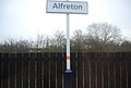
- Alfreton railway station (16 F)
- Alfreton Tunnels (3 F)
- Alfreton War Memorial (6 F)
M
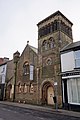
- St Martin's church, Alfreton (6 F)
P
Media in category "Alfreton"
The following 200 files are in this category, out of 265 total.
(previous page) (next page)-
 "The Station", Alfreton - geograph.org.uk - 6201062.jpg 4,899 × 3,622; 3.24 MB
-
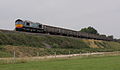
 158788 Padley Wood.jpg 2,000 × 1,372; 2.24 MB
-
 158791 Padley Wood crop.jpg 2,229 × 1,421; 1.84 MB
-
 158791 Padley Wood.jpg 3,234 × 2,156; 3.97 MB
-
 16 Church Street, Alfreton (geograph 7354767).jpg 1,024 × 768; 202 KB
-
 66419 , Amberhouse.jpg 3,245 × 1,890; 1.32 MB
-
 A pair of houses built in 1924, Alfreton - geograph.org.uk - 5601871.jpg 1,024 × 768; 172 KB
-
 A view of Alfreton Railway Station - geograph.org.uk - 6201047.jpg 4,958 × 3,667; 4.57 MB
-
 A38 approaching B600 junction - geograph.org.uk - 4324193.jpg 640 × 437; 75 KB
-
 A38 approaching B6179 junction - geograph.org.uk - 4567738.jpg 640 × 323; 112 KB
-
-

-
 A61 towards Chesterfield - geograph.org.uk - 1833875.jpg 640 × 480; 79 KB
-
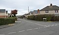 Addison Drive from Byron Avenue, Alfreton - geograph.org.uk - 5601954.jpg 1,024 × 614; 115 KB
-
 Alfreton & South Normanton station geograph-2398345-by-Ben-Brooksbank.jpg 2,394 × 1,410; 676 KB
-
 Alfreton - Abraham Lincoln Library - geograph.org.uk - 2024232.jpg 1,600 × 1,200; 523 KB
-
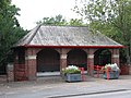 Alfreton - Alma Watchorn Park shelter - geograph.org.uk - 2024247.jpg 1,600 × 1,200; 448 KB
-
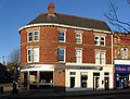 Alfreton - Barclays Bank - geograph.org.uk - 3246480.jpg 1,600 × 1,213; 568 KB
-
 Alfreton - Broadbents on King Street - geograph.org.uk - 1753051.jpg 1,600 × 1,200; 459 KB
-
-

-

-
 Alfreton - former Post Office - geograph.org.uk - 3246438.jpg 1,600 × 1,340; 614 KB
-
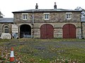 Alfreton - Former Stableblock To Alfreton Hall - 20101114135949.jpg 4,000 × 3,000; 2.15 MB
-
 Alfreton - former town hall - geograph.org.uk - 3246441.jpg 1,600 × 1,211; 599 KB
-
 Alfreton - Four Horseshoes - geograph.org.uk - 3246469.jpg 1,600 × 1,142; 565 KB
-
 Alfreton - geograph.org.uk - 4045456.jpg 3,000 × 3,214; 1.59 MB
-
 Alfreton - George Hotel - geograph.org.uk - 1753062.jpg 1,600 × 1,200; 315 KB
-
 Alfreton - NatWest Bank - geograph.org.uk - 1753082.jpg 1,600 × 1,200; 441 KB
-
 Alfreton - New Life Church - geograph.org.uk - 2024197.jpg 1,600 × 1,226; 423 KB
-
 Alfreton - south side of Church Street - geograph.org.uk - 1753071.jpg 1,600 × 1,200; 441 KB
-

-
 Alfreton - Sundial 15 Metres South East Of Porch To St Martin's Porch - 20181224123755.jpg 3,648 × 5,472; 4.36 MB
-
 Alfreton - terrace on Grange Street - geograph.org.uk - 1740524.jpg 1,600 × 1,200; 429 KB
-

-
 Alfreton - The Station Public House - geograph.org.uk - 822918.jpg 640 × 480; 64 KB
-
 Alfreton - Waggon and Horses - geograph.org.uk - 3246473.jpg 1,600 × 1,180; 601 KB
-
 Alfreton - Watchorn Church tower - geograph.org.uk - 2024240.jpg 1,200 × 1,600; 450 KB
-
 Alfreton - Watchorn School and Church.jpg 2,090 × 1,579; 1.43 MB
-
 Alfreton - Watchorn School entrance - geograph.org.uk - 2024223.jpg 1,600 × 1,200; 476 KB
-
 Alfreton 0 Miles signpost.jpg 2,304 × 3,072; 736 KB
-

-
 Alfreton Brook - geograph.org.uk - 5591087.jpg 2,272 × 1,704; 1.33 MB
-
 Alfreton Brook - geograph.org.uk - 6195677.jpg 640 × 480; 134 KB
-
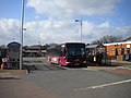
 Alfreton bus station - geograph.org.uk - 4432492.jpg 1,024 × 768; 123 KB
-
 Alfreton cemetery - geograph.org.uk - 1833886.jpg 640 × 480; 76 KB
-
 Alfreton Christian Centre - geograph.org.uk - 4432470.jpg 1,024 × 768; 148 KB
-
 Alfreton Fire Station - geograph.org.uk - 145694.jpg 640 × 480; 61 KB
-
 Alfreton foresters house.jpg 3,996 × 2,640; 5.05 MB
-
 Alfreton Hall (8235884878).jpg 3,370 × 2,652; 4.99 MB
-
 Alfreton Hall - geograph.org.uk - 5591068.jpg 1,458 × 1,094; 585 KB
-
 Alfreton Hall summer.jpg 960 × 640; 162 KB
-
 Alfreton Hall.jpg 600 × 350; 100 KB
-
 Alfreton High St 677145 11f1ca81.jpg 640 × 480; 77 KB
-
 Alfreton High Street - geograph.org.uk - 5534037.jpg 1,024 × 683; 756 KB
-
 Alfreton House - geograph.org.uk - 1833889.jpg 640 × 480; 108 KB
-
 Alfreton House 2010.jpg 4,000 × 3,000; 2.88 MB
-
 Alfreton house of confinement.jpg 4,912 × 3,264; 3.57 MB
-
 Alfreton House.jpg 640 × 473; 312 KB
-
 Alfreton house.jpg 3,072 × 2,304; 1.25 MB
-
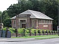
 Alfreton Market Hall - geograph.org.uk - 1211540.jpg 640 × 480; 56 KB
-
 Alfreton new life church.jpg 3,264 × 4,912; 2.24 MB
-
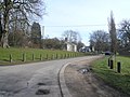
 Alfreton Park 1 - geograph.org.uk - 1480197.jpg 640 × 480; 255 KB
-
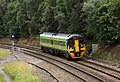
 Alfreton railway station platforms - geograph.org.uk - 5702066.jpg 1,024 × 768; 139 KB
-
 Alfreton railway station, Derbyshire - geograph.org.uk - 4079165.jpg 1,024 × 768; 185 KB
-
 Alfreton Station - geograph.org.uk - 1833896.jpg 640 × 480; 81 KB
-
 Alfreton Station - geograph.org.uk - 4290591.jpg 640 × 430; 86 KB
-
 Alfreton Station - geograph.org.uk - 4290592.jpg 640 × 430; 47 KB
-
 Alfreton Station - geograph.org.uk - 4290594.jpg 640 × 430; 57 KB
-
 Alfreton Station, from the footbridge - geograph.org.uk - 5601039.jpg 1,024 × 768; 186 KB
-
 Alfreton Town FC - The Impact Arena - geograph-1084383.jpg 640 × 480; 97 KB
-
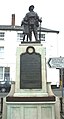 Alfreton War Memorial, Derbyshire - geograph.org.uk - 2730877.jpg 1,211 × 2,247; 541 KB
-
 Alfreton water treatment works - geograph.org.uk - 230426.jpg 640 × 477; 96 KB
-
 Alfreton, Derbyshire ... blacked out post box. (6401698249).jpg 2,678 × 3,048; 5.17 MB
-
 Alfreton, Derbyshire ... new Post Office. (6401726845).jpg 3,953 × 2,844; 6.04 MB
-
 Alfreton, Derbyshire ... the old post office is now a clothing store. (6401704537).jpg 4,316 × 3,141; 7.38 MB
-
 Alfreton, King Street - geograph.org.uk - 5534041.jpg 1,024 × 732; 758 KB
-
 Alfreton, Nottingham Road and The Victoria Inn - geograph.org.uk - 5534031.jpg 1,024 × 819; 921 KB
-
 Alfreton-Lane-Snow.jpg 4,000 × 3,000; 2.34 MB
-
 Alfreton-Snow-Hedges.jpg 3,996 × 2,248; 4.76 MB
-
 AlfretonSouthNormantonBUA2011.png 919 × 790; 808 KB
-
 Arrow straight track over Alfreton Park - geograph.org.uk - 6201091.jpg 3,888 × 5,184; 5.96 MB
-
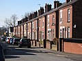
 Arthur Street, Alfreton - geograph.org.uk - 5698291.jpg 1,024 × 768; 130 KB
-
 Barclays Bank, Alfreton branch - geograph.org.uk - 6195662.jpg 640 × 480; 72 KB
-
 Bench Mark on St Martin's Church - geograph.org.uk - 1746234.jpg 686 × 1,024; 251 KB
-
 Bend in Arthur Street, Alfreton - geograph.org.uk - 5702016.jpg 1,024 × 768; 161 KB
-
 Building new houses off Meadow Lane, Alfreton - geograph.org.uk - 5601862.jpg 1,024 × 768; 129 KB
-
 Bus in Alfreton bus station - geograph.org.uk - 4432480.jpg 1,024 × 768; 132 KB
-
 Bus stop on Mansfield Road, Alfreton - geograph.org.uk - 5601903.jpg 1,024 × 768; 206 KB
-
 Car park and cycle racks, Alfreton station - geograph.org.uk - 6087085.jpg 1,600 × 1,200; 993 KB
-
 Car Park View near Alfreton Park - geograph.org.uk - 725102.jpg 640 × 480; 108 KB
-
 Catherine Street, Alfreton - geograph.org.uk - 1833895.jpg 640 × 480; 61 KB
-
 Charles Street, Alfreton - geograph.org.uk - 5702019.jpg 1,024 × 768; 121 KB
-
 Chesterfield Road, Alfreton - geograph.org.uk - 2117853.jpg 640 × 480; 75 KB
-
 Chesterfield Road, Alfreton - geograph.org.uk - 4333976.jpg 1,600 × 967; 581 KB
-
 Chippy and take-away, Mansfield Road, Alfreton - geograph.org.uk - 2585634.jpg 2,430 × 1,824; 689 KB
-
 Church of Saint Martin in Alfreton - geograph.org.uk - 3145277.jpg 4,000 × 3,000; 2.48 MB
-
 Church of St Martin - geograph.org.uk - 6195670.jpg 640 × 480; 89 KB
-
 Church of St Martin of Tours, Alfreton - geograph.org.uk - 6201085.jpg 5,013 × 3,759; 4.27 MB
-
 Church on Derby Road, Alfreton - geograph.org.uk - 4333806.jpg 1,600 × 1,062; 464 KB
-
 Colliery Row, Alfreton - geograph.org.uk - 5601853.jpg 1,024 × 615; 130 KB
-
 Cranes at Cotes Park - geograph.org.uk - 1563704.jpg 640 × 482; 78 KB
-
 Derbyshire UK parish map highlighting Alfreton.svg 888 × 1,308; 2.34 MB
-
 Detached house, Prospect Street, Alfreton - geograph.org.uk - 5601938.jpg 1,024 × 768; 174 KB
-
 Detail of Alfreton War Memorial - geograph.org.uk - 6201077.jpg 3,717 × 4,014; 2.75 MB
-
 Ellen Mary Countess of Shrewsbury.jpg 800 × 1,154; 228 KB
-
 Ellen Morewood by Romney (sq cropped).jpg 337 × 337; 48 KB
-
 Ellen Morewood by Romney.jpg 800 × 1,228; 212 KB
-
 Elsie Cottages, Prospect Street, Alfreton - geograph.org.uk - 5601919.jpg 1,024 × 768; 143 KB
-
 Entrance to Pond Wood - geograph.org.uk - 5591079.jpg 2,220 × 1,665; 1.43 MB
-

-

-
 Ewart Watchorn Recreation Ground - geograph.org.uk - 2694257.jpg 3,648 × 2,736; 4.21 MB
-
 Farm track from Ufton Fields Farm - geograph.org.uk - 2695413.jpg 3,648 × 2,736; 3.96 MB
-
 Farm track near Alfreton Park - geograph.org.uk - 2695436.jpg 3,648 × 2,736; 3.81 MB
-
 Farm track north of Alfreton Park - geograph.org.uk - 2693810.jpg 3,648 × 2,736; 4.48 MB
-
 Farmland near Alfreton - geograph.org.uk - 1833876.jpg 640 × 480; 62 KB
-
 Farmland near Alfreton - geograph.org.uk - 4290587.jpg 640 × 430; 40 KB
-
 Fast food shops on Mansfield Road, Alfreton - geograph.org.uk - 6201620.jpg 3,413 × 2,736; 2.22 MB
-
 Flying the flag in Milton Avenue, Alfreton - geograph.org.uk - 5601958.jpg 1,024 × 768; 146 KB
-
 Footbridge, Alfreton Station - geograph.org.uk - 5602124.jpg 1,024 × 768; 166 KB
-
 Footpath junction, Alfreton - geograph.org.uk - 2193898.jpg 1,024 × 768; 49 KB
-
 Footpath past the church - geograph.org.uk - 5591058.jpg 2,267 × 1,700; 1.15 MB
-
 Footpath View towards Wren Wood - geograph.org.uk - 725106.jpg 640 × 480; 105 KB
-
 Former Lodge, Church Street, Alfreton.jpg 6,000 × 4,000; 6.32 MB
-
 Four Horseshoes on King Street, Alfreton - geograph.org.uk - 4333848.jpg 1,600 × 1,062; 712 KB
-
 George Morewood by Romney.jpg 800 × 1,255; 220 KB
-
 Grange Street, Alfreton - geograph.org.uk - 4432503.jpg 1,024 × 768; 129 KB
-
 Hallway travelodge alfreton.jpg 3,648 × 5,472; 5.03 MB
-
 Hay crop near Long Plantation - geograph.org.uk - 2693816.jpg 3,648 × 2,736; 4.57 MB
-
 High Street, Alfreton - geograph.org.uk - 6258260.jpg 3,648 × 2,736; 2.74 MB
-
 House building and church re-roofing - geograph.org.uk - 2694265.jpg 3,648 × 2,736; 4.35 MB
-
 Houses at the north end of Meadow Lane - geograph.org.uk - 5601845.jpg 1,024 × 768; 109 KB
-
 Houses off Gladstone Road Alfreton - geograph.org.uk - 2010651.jpg 800 × 601; 153 KB
-

-
-

-
 Houses on the west side of Meadow Lane, Alfreton - geograph.org.uk - 5601866.jpg 1,024 × 768; 149 KB
-
 Houses on the west side of Meadow Lane, Alfreton - geograph.org.uk - 5601896.jpg 1,024 × 768; 168 KB
-

-
 Impact Arena, home of Alfreton Town FC - geograph.org.uk - 2694430.jpg 3,648 × 2,736; 3.91 MB
-
 Job Centre Plus building, Alfreton - geograph.org.uk - 3020908.jpg 640 × 480; 67 KB
-
 King Street junction and war memorial - geograph.org.uk - 2689149.jpg 2,736 × 3,648; 2.87 MB
-
 King Street, Alfreton - geograph.org.uk - 2098219.jpg 1,280 × 856; 151 KB
-
 King Street, Alfreton - geograph.org.uk - 4432446.jpg 1,024 × 768; 144 KB
-
 Kitchen showroom, Mansfield Road, Alfreton - geograph.org.uk - 2582045.jpg 3,648 × 2,736; 4.46 MB
-
 Late autumn tree, Byron Avenue, Alfreton - geograph.org.uk - 5601950.jpg 1,024 × 768; 212 KB
-
 Limes Avenue, Alfreton - geograph.org.uk - 2117873.jpg 640 × 480; 94 KB
-
 Main building, Alfreton railway station - geograph.org.uk - 5702057.jpg 1,024 × 768; 106 KB
-
 Mansfield Road Bridge - geograph.org.uk - 4290595.jpg 640 × 354; 64 KB
-
 Mansfield Road in Alfreton - geograph.org.uk - 2899428.jpg 3,182 × 2,312; 1.3 MB
-
 Mansfield Road leaving Alfreton - geograph.org.uk - 5702033.jpg 1,024 × 768; 155 KB
-
 Mansfield Road near the eastern end of Alfreton - geograph.org.uk - 5702030.jpg 1,024 × 768; 124 KB
-
 Mansfield Road Therapy Centre, Alfreton - geograph.org.uk - 5601994.jpg 1,024 × 768; 152 KB
-
 Mansfield Road, Alfreton - geograph.org.uk - 1833892.jpg 640 × 480; 55 KB
-
 Mansfield Road, Alfreton - geograph.org.uk - 2582049.jpg 3,648 × 2,736; 4.57 MB
-
 Marshall Street, Alfreton - geograph.org.uk - 4432496.jpg 1,024 × 768; 168 KB
-
 Meadow Lane in Alfreton - geograph.org.uk - 2910128.jpg 3,296 × 2,472; 1.02 MB
-

-
 Meadow Lane, Alfreton, looking south - geograph.org.uk - 5601841.jpg 1,024 × 768; 177 KB
-
 Meadow near the Alfreton Brook - geograph.org.uk - 2693820.jpg 3,648 × 2,736; 4.72 MB
-
 Memorial to George Morewood (1719-1792) - geograph.org.uk - 6201661.jpg 3,801 × 5,067; 2.71 MB
-
 Miners' Arms, Park Street, Alfreton - geograph.org.uk - 2694279.jpg 3,648 × 2,736; 4.86 MB
-
 Modern houses - geograph.org.uk - 5827367.jpg 2,000 × 1,333; 2.4 MB
-
 Muddy corner behind St Martin's parish church, Alfreton - geograph.org.uk - 6258268.jpg 3,648 × 2,736; 3.14 MB
-

-
 New Street, Alfreton - geograph.org.uk - 4432455.jpg 1,024 × 768; 117 KB
-
 North end of Hardy Street, Alfreton - geograph.org.uk - 5698197.jpg 1,024 × 768; 153 KB
-
 Nottingham Road (B600), Alfreton - geograph.org.uk - 5601943.jpg 1,024 × 768; 135 KB
-
 Nottingham-Derby-Mansfield-Alfreton-Belper-Heage-Crich-BUA-2011.jpg 952 × 952; 988 KB
-
 Nr 17 Church Street Alfreton.jpg 4,761 × 3,571; 8.51 MB
-
 Old colliery winding wheel - geograph.org.uk - 6195667.jpg 640 × 495; 132 KB
-
 Old colliery winding wheel - geograph.org.uk - 6196848.jpg 640 × 480; 117 KB
-
 Open land, north of Leys School, Alfreton - geograph.org.uk - 5601966.jpg 1,024 × 768; 209 KB
-
 Path running east from Milton Avenue, Alfreton - geograph.org.uk - 5601977.jpg 1,024 × 768; 218 KB
-
 Path towards Alfreton - geograph.org.uk - 6258273.jpg 5,120 × 3,840; 7.58 MB
-
 Patience Mary Palmer Morewodd.jpg 800 × 981; 176 KB
-
 Pedestrian zone, Alfreton - geograph.org.uk - 3015637.jpg 800 × 600; 187 KB
-
 Platform 1 - Alfreton Railway Station - geograph.org.uk - 2239904.jpg 2,608 × 1,952; 1.23 MB
-

-
 Preston Avenue, Alfreton - geograph.org.uk - 5601946.jpg 1,024 × 768; 149 KB
-
 Public open space, Meadow Lane industrial estate - geograph.org.uk - 5601836.jpg 1,024 × 768; 162 KB
-
 Quiet footpath - geograph.org.uk - 5591051.jpg 2,264 × 1,698; 1.12 MB
-
 Rodger's Lane, Alfreton - geograph.org.uk - 1833883.jpg 640 × 480; 59 KB
-
 Roundabout, Bishop Street, Alfreton - geograph.org.uk - 1833881.jpg 640 × 480; 67 KB
-
 Salcombe Road, looking north-west - geograph.org.uk - 5601070.jpg 1,024 × 768; 123 KB
-
 Salcombe Road, looking west - geograph.org.uk - 5601074.jpg 1,024 × 768; 136 KB
-
 School playing fields, Alfreton - geograph.org.uk - 2117846.jpg 640 × 480; 73 KB
-
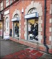
 Shopping Precinct - geograph.org.uk - 1211519.jpg 640 × 480; 71 KB
-
 South end of Wood Street, Alfreton - geograph.org.uk - 5702023.jpg 1,024 × 768; 126 KB
-
-
 Speed camera, Mansfield Road, Alfreton - geograph.org.uk - 5601906.jpg 1,024 × 768; 125 KB
-
 St Martin's Church - geograph.org.uk - 2695459.jpg 2,736 × 3,648; 2.56 MB
-
 St Martin's parish church, Alfreton - geograph.org.uk - 6258265.jpg 3,648 × 2,736; 2.6 MB
-
 Sub Station and Pylon. - geograph.org.uk - 303115.jpg 640 × 480; 113 KB
-
 Taylors, Corn Stores,1922 - geograph.org.uk - 2582058.jpg 2,467 × 2,207; 899 KB
-
 Terraced houses - Mansfield Road, Alfreton - geograph.org.uk - 6201056.jpg 4,890 × 3,341; 3.01 MB
-
 Tesco Superstore - geograph.org.uk - 1211513.jpg 640 × 480; 48 KB
-
 The Alfreton Brook - geograph.org.uk - 2693876.jpg 3,648 × 2,736; 4.14 MB
-
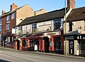
 The Blue Bell, Alfreton - geograph.org.uk - 1373132.jpg 640 × 426; 73 KB


.jpg)


.jpg)


.jpg)
.jpg)
.jpg)


.jpg)


_-_geograph.org.uk_-_6201661.jpg)


,_Alfreton_-_geograph.org.uk_-_5601943.jpg)


_-_geograph.org.uk_-_823331.jpg)


