Category:Aldeby
Jump to navigation
Jump to search
English: Aldeby is a village and civil parish in the English county of Norfolk. It is bounded to the south by the River Waveney, on the other side of which is Suffolk. The village is about five miles (8 km) by road from Beccles.
Norsk bokmål: Aldeby er en landsby og et verdslig sogn i Norfolk i England. Det ligger ved elven Waveney med Suffolk på den andre siden, omkring 8 km fra Beccles.
village and civil parish in Norfolk, UK  | |||||
| Upload media | |||||
| Instance of | |||||
|---|---|---|---|---|---|
| Location | South Norfolk, Norfolk, East of England, England | ||||
| Area |
| ||||
| Said to be the same as | Aldeby (Wikimedia duplicated page, civil parish) | ||||
 | |||||
Subcategories
This category has the following 3 subcategories, out of 3 total.
A
- Aldeby railway station (4 F)
- Aldeby War Memorial (3 F)
M
Media in category "Aldeby"
The following 200 files are in this category, out of 567 total.
(previous page) (next page)-
 100 degree panorama over Stanley Carrs - geograph.org.uk - 3939045.jpg 4,355 × 1,080; 1.16 MB
-

-
 A country road leading to The Shrublands - geograph.org.uk - 3113798.jpg 3,264 × 2,448; 1.43 MB
-
 A crop of maize at Stanley Hills - geograph.org.uk - 3741919.jpg 640 × 480; 291 KB
-
 A cutting on the dismantled East Suffolk line - geograph.org.uk - 4406145.jpg 2,592 × 1,944; 1.59 MB
-

-
 A job well done - geograph.org.uk - 3115704.jpg 3,264 × 2,448; 1.37 MB
-
 A lane full of tractor - geograph.org.uk - 5548061.jpg 640 × 480; 51 KB
-
 A tranquil scene on the River Waveney - geograph.org.uk - 2126457.jpg 640 × 480; 140 KB
-
 A view across the county border - geograph.org.uk - 1948982.jpg 640 × 480; 251 KB
-
 A view from Stanley Hills - geograph.org.uk - 3930522.jpg 640 × 480; 150 KB
-
 Abandoned Orchard - geograph.org.uk - 1892282.jpg 800 × 531; 175 KB
-
 Aldeby Hall - geograph.org.uk - 4311753.jpg 768 × 1,024; 216 KB
-
 Aldeby House - geograph.org.uk - 3491796.jpg 640 × 595; 353 KB
-
 Aldeby Landfill Site - geograph.org.uk - 5449393.jpg 3,648 × 2,736; 2.19 MB
-
 Aldeby Landfill site sign - geograph.org.uk - 3962491.jpg 2,304 × 3,072; 1.41 MB
-
 Aldeby new war memorial - geograph.org.uk - 5931300.jpg 1,701 × 3,024; 2.2 MB
-
 Aldeby pastures - geograph.org.uk - 3042505.jpg 3,408 × 1,842; 2 MB
-
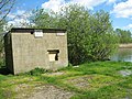
 Aldeby ROC post - geograph.org.uk - 3930512.jpg 747 × 656; 218 KB
-
 Aldeby ROC post - geograph.org.uk - 3930513.jpg 800 × 641; 286 KB
-
 Aldeby ROC post - geograph.org.uk - 3930516.jpg 800 × 600; 383 KB
-
 Aldeby Telephone Exchange - geograph.org.uk - 3961551.jpg 3,072 × 2,304; 1.08 MB
-
 Aldeby Telephone Exchange - geograph.org.uk - 3961565.jpg 3,072 × 2,304; 1.4 MB
-
 Aldeby Village Sign - geograph.org.uk - 1947557.jpg 3,456 × 2,592; 2.89 MB
-
 Aldeby Village sign - geograph.org.uk - 3962338.jpg 2,260 × 3,017; 1.72 MB
-
 Aldeby Village sign - geograph.org.uk - 3962340.jpg 3,072 × 2,304; 924 KB
-
 Aldeby Village sign ^ Rectory Road - geograph.org.uk - 3962359.jpg 3,072 × 2,304; 1.05 MB
-
 Aldeby War Memorial - geograph.org.uk - 4398201.jpg 1,024 × 768; 428 KB
-
 AldebySign.jpg 551 × 1,024; 133 KB
-
 Aldely Hall Fisheries sign - geograph.org.uk - 3972584.jpg 2,304 × 3,072; 1.05 MB
-
 Alders by drainage ditch, Aldeby - geograph.org.uk - 3491813.jpg 640 × 480; 203 KB
-
 Alders in Stanley Carrs - geograph.org.uk - 3930566.jpg 480 × 640; 309 KB
-
 Altar ^ Window of St.Mary the Virgin Church - geograph.org.uk - 3972287.jpg 2,251 × 3,004; 799 KB
-
 Another drainage ditch - geograph.org.uk - 1947734.jpg 640 × 480; 76 KB
-
 Approaching Aldeby - geograph.org.uk - 977325.jpg 640 × 477; 94 KB
-
 Approaching Burgh St Peter, on Rectory Road - geograph.org.uk - 4406036.jpg 2,592 × 1,944; 1.1 MB
-

-
 Barn and sheds by Low Farm, Wheatacre - geograph.org.uk - 3398157.jpg 640 × 480; 107 KB
-
 Barn at Priory Farm - geograph.org.uk - 3047059.jpg 3,651 × 2,256; 2.56 MB
-
 Beccles Lane, Waterloo - geograph.org.uk - 3972912.jpg 3,072 × 2,304; 955 KB
-
 Beccles Road sign - geograph.org.uk - 3968067.jpg 3,011 × 2,262; 2.39 MB
-
 Beccles Road sign - geograph.org.uk - 3972540.jpg 3,072 × 2,304; 2.78 MB
-
 Beccles Road ^ The Street Post Office George VI Postbox - geograph.org.uk - 3968081.jpg 2,914 × 2,189; 913 KB
-
 Beccles Road ^ The Street Post Office George VI Postbox - geograph.org.uk - 3972525.jpg 2,939 × 2,305; 1.22 MB
-
 Beccles Road, Aldeby - geograph.org.uk - 3962244.jpg 3,072 × 2,304; 1.22 MB
-
 Beccles Road, Aldeby - geograph.org.uk - 3968068.jpg 2,914 × 2,189; 1.08 MB
-
 Beccles Road, Aldeby - geograph.org.uk - 3968071.jpg 3,072 × 2,304; 964 KB
-
 Beccles Road, Aldeby - geograph.org.uk - 3968183.jpg 3,072 × 2,304; 916 KB
-
 Beccles Road, Aldeby - geograph.org.uk - 3968184.jpg 3,072 × 2,304; 1.23 MB
-
 Beccles Road, Aldeby - geograph.org.uk - 3972261.jpg 3,072 × 2,304; 983 KB
-
 Beccles Road, Aldeby - geograph.org.uk - 3972554.jpg 3,072 × 2,304; 1.17 MB
-
 Beccles Road, Aldeby - geograph.org.uk - 3972559.jpg 3,072 × 2,304; 1.58 MB
-
 Beccles Road, Aldeby - geograph.org.uk - 3972580.jpg 3,072 × 2,304; 1.23 MB
-
 Beccles Road, Aldeby - geograph.org.uk - 3972863.jpg 3,072 × 2,304; 1.52 MB
-
 Beehive by Sandy Lane - geograph.org.uk - 3398130.jpg 640 × 480; 166 KB
-

-
 Bend in Stanley Hills Road - geograph.org.uk - 5549219.jpg 640 × 480; 91 KB
-
 Bier in Aldeby church - geograph.org.uk - 5081375.jpg 3,072 × 2,304; 1.72 MB
-
 Big sky over Long Dam Level - geograph.org.uk - 1948878.jpg 624 × 640; 164 KB
-
 Bin day in Aldeby - geograph.org.uk - 3742037.jpg 640 × 480; 230 KB
-
 Birch trees by Stanley Hills - geograph.org.uk - 3930554.jpg 480 × 640; 261 KB
-

-
 Birches beside the footpath - geograph.org.uk - 3930552.jpg 640 × 480; 230 KB
-

-

-
 Blue Flower - geograph.org.uk - 1892248.jpg 800 × 531; 79 KB
-
 Boat on the River Waveney - geograph.org.uk - 1947488.jpg 640 × 480; 82 KB
-
 Bridge over railway cutting, Aldeby - geograph.org.uk - 3398196.jpg 640 × 480; 114 KB
-
 Bridleway gate on Low Common Lane - geograph.org.uk - 3398012.jpg 640 × 480; 171 KB
-
 Burgh Road sign - geograph.org.uk - 3969459.jpg 3,072 × 2,304; 1.95 MB
-
 Burgh Road, Aldeby - geograph.org.uk - 3969465.jpg 3,072 × 2,304; 1.12 MB
-
 Burrows Green sign - geograph.org.uk - 3968584.jpg 3,011 × 2,262; 990 KB
-
 Burrows Green, Aldeby - geograph.org.uk - 3968575.jpg 3,072 × 2,304; 1.82 MB
-
 Buttercups and Forget-Me-Nots - geograph.org.uk - 1891676.jpg 531 × 800; 101 KB
-
 Car Park - geograph.org.uk - 1892065.jpg 800 × 531; 153 KB
-

-

-
 Cattle grid on Sandy Lane - geograph.org.uk - 3398178.jpg 640 × 480; 126 KB
-

-
 Cattle pastures by Sutton's Farm, Aldeby - geograph.org.uk - 3491824.jpg 640 × 480; 258 KB
-
 Cattle pastures in Wheatacre Marshes - geograph.org.uk - 3398106.jpg 640 × 480; 128 KB
-
 Cattle pen and sheds - and cattle - geograph.org.uk - 1948848.jpg 640 × 480; 160 KB
-

-
 Centre of communication, Aldeby - geograph.org.uk - 4398190.jpg 1,024 × 768; 208 KB
-
 Church Cottage, Aldeby - geograph.org.uk - 1946943.jpg 640 × 480; 162 KB
-
 Church Lane sign - geograph.org.uk - 3961711.jpg 3,072 × 2,304; 1.44 MB
-
 Church Lane sign - geograph.org.uk - 3969141.jpg 3,029 × 2,276; 2.39 MB
-
 Church Lane towards Aldeby - geograph.org.uk - 5548004.jpg 640 × 480; 55 KB
-
 Church Lane, Aldeby - geograph.org.uk - 3961705.jpg 3,072 × 2,304; 916 KB
-
 Church Lane, Aldeby - geograph.org.uk - 3968261.jpg 3,072 × 2,304; 1.5 MB
-
 Church Lane, Aldeby - geograph.org.uk - 3968279.jpg 3,072 × 2,304; 1.86 MB
-
 Church Lane, Aldeby - geograph.org.uk - 3968570.jpg 3,072 × 2,304; 1.02 MB
-
 Church Lane, Aldeby - geograph.org.uk - 3969134.jpg 3,072 × 2,304; 761 KB
-
 Church Lane, Aldeby - geograph.org.uk - 3969318.jpg 3,072 × 2,304; 999 KB
-
 Church Lane, Aldeby - geograph.org.uk - 3969328.jpg 2,948 × 2,214; 926 KB
-
 Church Road sign - geograph.org.uk - 3969368.jpg 3,029 × 2,276; 2.03 MB
-
 Church Road sign - geograph.org.uk - 3972218.jpg 3,049 × 2,290; 1.58 MB
-
 Church Road sign - geograph.org.uk - 3972282.jpg 3,072 × 2,304; 1.34 MB
-
 Church Road, Aldeby - geograph.org.uk - 3969366.jpg 3,072 × 2,304; 1.52 MB
-
 Church Road, Aldeby - geograph.org.uk - 3969372.jpg 3,072 × 2,304; 994 KB
-
 Church Road, Aldeby - geograph.org.uk - 3969373.jpg 2,983 × 2,241; 1.13 MB
-
 Church Road, Aldeby - geograph.org.uk - 3972217.jpg 3,072 × 2,304; 1.67 MB
-
 Church Road, Aldeby - geograph.org.uk - 3972219.jpg 3,072 × 2,304; 1.93 MB
-
 Church Road, Aldeby - geograph.org.uk - 3972223.jpg 3,072 × 2,304; 1.11 MB
-
 Cock of the farm - geograph.org.uk - 593831.jpg 640 × 480; 180 KB
-

-
 Common Road, Aldeby - geograph.org.uk - 3962689.jpg 3,072 × 2,304; 1.95 MB
-
 Common Road, Burgh St. Peter - geograph.org.uk - 3962629.jpg 3,072 × 2,304; 2.03 MB
-
 Communications centre, Aldeby - geograph.org.uk - 5583695.jpg 640 × 480; 67 KB
-
 Copse at Waterheath - geograph.org.uk - 4273050.jpg 640 × 480; 133 KB
-
 Cottage in Aldeby - geograph.org.uk - 5548069.jpg 640 × 480; 52 KB
-
 Cottages in The Street in Aldeby - geograph.org.uk - 1946919.jpg 480 × 640; 141 KB
-
 Cottages in The Street, Aldeby - geograph.org.uk - 1946917.jpg 640 × 474; 174 KB
-
 Country Cottage - geograph.org.uk - 1947568.jpg 640 × 480; 66 KB
-
 Country road alongside farmland in Waterheath - geograph.org.uk - 3115691.jpg 3,264 × 2,448; 1.89 MB
-

-
 Crabtree Lane sign - geograph.org.uk - 3972901.jpg 2,983 × 2,241; 1.4 MB
-
 Crabtree Lane, Aldeby - geograph.org.uk - 3962227.jpg 3,072 × 2,304; 1.65 MB
-
 Crabtree Lane, Aldeby - geograph.org.uk - 3972870.jpg 3,072 × 2,304; 1.93 MB
-
 Crop field near The Grove - geograph.org.uk - 5548005.jpg 640 × 480; 59 KB
-
 Crop field off Lily Lane, Aldeby - geograph.org.uk - 5548057.jpg 640 × 480; 63 KB
-
 Crop field towards Woodlands - geograph.org.uk - 5548003.jpg 640 × 480; 70 KB
-
 Crop field, Stanley Hills - geograph.org.uk - 5549211.jpg 640 × 480; 55 KB
-
 Crop fields beside Stanley Hills Road - geograph.org.uk - 3930493.jpg 640 × 412; 156 KB
-

-
 Curious cattle - geograph.org.uk - 1948862.jpg 640 × 480; 180 KB
-

-
 Dismantled East Suffolk Line - geograph.org.uk - 1891496.jpg 800 × 531; 127 KB
-
 Dismantled Railway - geograph.org.uk - 1891394.jpg 800 × 531; 142 KB
-

-
 Disused landing stage and pump house - geograph.org.uk - 3930573.jpg 640 × 480; 222 KB
-
 Disused pump house - geograph.org.uk - 3930576.jpg 640 × 446; 126 KB
-

-
 Disused railway - geograph.org.uk - 397539.jpg 640 × 477; 98 KB
-
 Disused railway - geograph.org.uk - 977317.jpg 640 × 477; 86 KB
-
 Disused sand pit on Stanley Hills - geograph.org.uk - 3930548.jpg 640 × 480; 171 KB
-
 Ditch in fields south of Somerleyton - geograph.org.uk - 3419870.jpg 640 × 480; 217 KB
-

-

-
 Drainage channel - geograph.org.uk - 1947489.jpg 640 × 480; 57 KB
-
 Drainage Channel - geograph.org.uk - 1947666.jpg 640 × 480; 80 KB
-
 Drainage Channel and Marshes - geograph.org.uk - 1947511.jpg 640 × 480; 61 KB
-
 Drainage channel in Long Dam Level - geograph.org.uk - 1949023.jpg 480 × 640; 201 KB
-
 Drainage channels in Long Dam Level - geograph.org.uk - 1948994.jpg 640 × 480; 192 KB
-
 Drainage ditch - geograph.org.uk - 1947481.jpg 640 × 480; 86 KB
-
 Drainage Ditch - geograph.org.uk - 1947519.jpg 640 × 480; 84 KB
-
 Drainage ditch - geograph.org.uk - 1947725.jpg 640 × 480; 78 KB
-
 Drainage ditch - geograph.org.uk - 1947731.jpg 640 × 480; 80 KB
-
 Drainage ditch beside Landspring Dyke - geograph.org.uk - 3419825.jpg 640 × 480; 211 KB
-

-

-
 Drainage ditch in Long Dam level - geograph.org.uk - 1948886.jpg 640 × 480; 243 KB
-

-

-

-

-

-
 Drainage Pipe - geograph.org.uk - 1947528.jpg 640 × 480; 118 KB
-
 Dun Cow Road Postbox - geograph.org.uk - 3962603.jpg 2,304 × 3,072; 1.99 MB
-
 Dun Cow Road Postbox - geograph.org.uk - 3962609.jpg 2,304 × 3,072; 2.14 MB
-
 Dun Cow Road sign - geograph.org.uk - 3962520.jpg 3,029 × 2,276; 2.18 MB
-
 Dun Cow Road sign - geograph.org.uk - 3962634.jpg 3,011 × 2,262; 2.29 MB
-
 Dun Cow Road ^ Dun Cow Road Postbox - geograph.org.uk - 3962601.jpg 3,072 × 2,304; 1.69 MB
-
 Dun Cow Road ^ Dun Cow Road Postbox - geograph.org.uk - 3962681.jpg 3,072 × 2,304; 1.56 MB
-
 Dun Cow Road, Aldeby - geograph.org.uk - 3962513.jpg 3,072 × 2,304; 1.44 MB
-
 Dun Cow Road, Aldeby - geograph.org.uk - 5583691.jpg 2,460 × 1,711; 1,020 KB
-
 Dun Cow Road, Burgh St.Peter - geograph.org.uk - 3962545.jpg 3,072 × 2,304; 1.57 MB
-
 East Suffolk Embankment - geograph.org.uk - 1891505.jpg 800 × 531; 131 KB
-
 East Suffolk Line Crossing House - geograph.org.uk - 1891410.jpg 800 × 531; 162 KB
-
 East Suffolk Line Crossing Keepers house - geograph.org.uk - 1891420.jpg 800 × 531; 153 KB
-
 Elizabeth II postbox on Dun Cow Road, Aldeby - geograph.org.uk - 5583689.jpg 2,109 × 2,313; 1.1 MB
-
 Elms Road sign - geograph.org.uk - 3968016.jpg 3,072 × 2,304; 2.08 MB
-
 Elms Road, Aldeby - geograph.org.uk - 3968013.jpg 3,072 × 2,304; 828 KB
-
 Elms Road, Waterloo - geograph.org.uk - 3973182.jpg 3,072 × 2,304; 945 KB
-

-
 Entrance to Aldeby Landfill site - geograph.org.uk - 3962487.jpg 2,857 × 2,146; 1.03 MB
-
 Entrance to Aldely Hall Fisheries - geograph.org.uk - 3972598.jpg 3,072 × 2,304; 2.17 MB
-
 Entrance to College Farm, Burgh St Peter - geograph.org.uk - 2215991.jpg 640 × 480; 120 KB
-

-
 Entrance to Sutton's Farm, Aldeby - geograph.org.uk - 3491835.jpg 640 × 480; 170 KB
-
 Entrance to the Open Space - geograph.org.uk - 1891580.jpg 800 × 531; 221 KB
-
 Entrance to Three Gates Farm Wood - geograph.org.uk - 1892267.jpg 800 × 531; 183 KB
-

-

-

-

-
 Farm buildings near Low Farm, Aldeby - geograph.org.uk - 3508116.jpg 3,648 × 2,052; 2.61 MB
-
 Farm Track - geograph.org.uk - 1947160.jpg 640 × 480; 76 KB
-
 Farm track off Lily Lane - geograph.org.uk - 5548056.jpg 640 × 480; 52 KB
-
 Farm track through Wheat Field, near Mill House, Aldeby - geograph.org.uk - 5449413.jpg 3,648 × 2,255; 2.82 MB
-
 Farmland and Aldeby Church - geograph.org.uk - 1892298.jpg 800 × 531; 132 KB
-
 Farmland near Pond Farm - geograph.org.uk - 5548011.jpg 640 × 480; 69 KB
-
 Farmland West of Aldeby - geograph.org.uk - 1891586.jpg 800 × 531; 132 KB
-
 Farmland West of Aldeby - geograph.org.uk - 1891616.jpg 800 × 531; 156 KB
-
 Farmland west of Aldeby - geograph.org.uk - 977322.jpg 640 × 477; 93 KB
-

-
 Field boundary track - geograph.org.uk - 3930527.jpg 640 × 480; 165 KB
-
 Field by Lily Lane, Aldeby - geograph.org.uk - 3491774.jpg 640 × 440; 154 KB
-
 Field entrance gate at Waterheath - geograph.org.uk - 4273049.jpg 640 × 480; 177 KB
-
 Field of Barley - geograph.org.uk - 1947140.jpg 640 × 480; 71 KB


