Category:Aerial photographs of airports in Kentucky
Jump to navigation
Jump to search
States of the United States: Alabama · Alaska · Arizona · Arkansas · California · Colorado · Connecticut · Delaware · Florida · Georgia · Hawaii · Idaho · Illinois · Indiana · Iowa · Kansas · Kentucky · Louisiana · Maine · Maryland · Massachusetts · Michigan · Minnesota · Mississippi · Missouri · Montana · Nebraska · Nevada · New Hampshire · New Jersey · New Mexico · New York · North Carolina · North Dakota · Ohio · Oklahoma · Oregon · Pennsylvania · Rhode Island · South Carolina · South Dakota · Tennessee · Texas · Utah · Vermont · Virginia · Washington · West Virginia · Wisconsin · Wyoming
Puerto Rico
Puerto Rico
English: Aerial photographs of airports in the state of Kentucky, United States
Media in category "Aerial photographs of airports in Kentucky"
The following 10 files are in this category, out of 10 total.
-
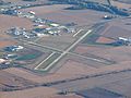 Barkley Regional Airport.jpg 4,000 × 3,000; 2.63 MB
-
 Blue Grass Airport, USGS 1m Ortho, annotated.jpg 3,600 × 3,900; 2.98 MB
-
 Blue Grass Airport, USGS 1m Ortho.png 1,043 × 868; 1.27 MB
-
 Blue Grass Airport, USGS Urban Ortho, approx crash site.jpg 1,563 × 1,069; 766 KB
-
 Blue Grass Airport, USGS Urban Ortho, approx crash site.xcf 1,563 × 1,069; 4.79 MB
-
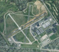
 Godman AAF Kentucky - 29 Mar 1998-USGS.jpg 753 × 609; 166 KB
-
 KLEX Blue Grass Airport.jpg 7,200 × 7,800; 6.78 MB
-
 KLEX USGS Comair Paths.jpg 3,600 × 3,900; 2.42 MB
-
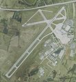
 Klou (USGS).jpg 829 × 739; 284 KB
-
 Ksdf.jpg 454 × 541; 165 KB


.jpg)
