Category:Aerial photographs of Queensland
Jump to navigation
Jump to search
States of Australia: New South Wales · Queensland · South Australia · Tasmania · Victoria · Western Australia
Internal territories of Australia: Australian Capital Territory · Northern Territory
External territories of Australia:
Internal territories of Australia: Australian Capital Territory · Northern Territory
External territories of Australia:
Subcategories
This category has the following 25 subcategories, out of 25 total.
A
B
- Aerial photographs of Bundaberg (20 F)
C
G
- Aerial photographs of Gold Coast (41 F)
- Aerial views of Gordonvale (2 F)
M
R
Media in category "Aerial photographs of Queensland"
The following 197 files are in this category, out of 197 total.
-
 A view from the heavens (29872415050).jpg 5,961 × 3,974; 10.72 MB
-
 Abrevadero Queensland.jpg 2,952 × 2,000; 5.56 MB
-
 Aerial Geography (9561221537).jpg 1,600 × 1,200; 818 KB
-
 Aerial panorama from Mount Mee lookout. June 2023.jpg 8,192 × 3,310; 9.47 MB
-
 Aerial panorama of Lake Baroon. June 2023.jpg 8,192 × 3,314; 5.72 MB
-
 Aerial panorama of Maleny facing Lake Baroon. 2023 (cropped).jpg 4,404 × 2,636; 2.87 MB
-
 Aerial panorama of Maleny facing Lake Baroon. 2023.jpg 8,192 × 3,302; 5.99 MB
-
 Aerial panorama of Maleny facing the hinterland. 2023.jpg 8,192 × 3,302; 6.05 MB
-
 Aerial panorama of Mooloolaba (cropped).jpg 4,356 × 2,646; 2.62 MB
-
 Aerial panorama of Mooloolaba.jpg 8,192 × 3,308; 5.4 MB
-
 Aerial panorama of the Australia Zoo along Steve Irwin Way. 2023.jpg 8,192 × 3,302; 6.24 MB
-
 Aerial panorama of the Australia Zoo. 2023.jpg 8,192 × 3,322; 6.39 MB
-
 Aerial perspective of Mooloolaba's network of waterways.jpg 8,192 × 3,308; 5.58 MB
-
 Aerial Photo of Noosa Spit Recreation Reserve.jpg 1,800 × 1,200; 819 KB
-
 Aerial photograph of Hervey Bay looking north, 12 July 1967.jpg 3,000 × 2,359; 1.92 MB
-
 Aerial photograph of Mudgeeraba State School, 2023 01.jpg 2,047 × 600; 92 KB
-
 Aerial photograph of Mudgeeraba State School, 2023 02.jpg 2,047 × 600; 136 KB
-
 Aerial photograph of Mudgeeraba State School, 2023 03.jpg 3,958 × 1,160; 363 KB
-
 Aerial photograph, Kawana Waters State College, 2024.jpg 1,191 × 609; 173 KB
-
 Aerial view of Flagstone State School, 2024.jpg 2,048 × 600; 334 KB
-
 Aerial view of Highfields State School, 2021.jpg 1,349 × 600; 314 KB
-
 Aerial View of Miles Historical VIllage.jpg 640 × 403; 60 KB
-
 Aerial view of Norley Station, June 1946.jpg 1,000 × 773; 80 KB
-
-
 Aerial view of Yarrabah Mission Station, circa 1972.jpg 3,000 × 3,062; 4.51 MB
-
 Aerial view over Mackay, 2009.jpg 4,272 × 2,403; 3.24 MB
-
 Aerial view, Freshwater State School, 2019.jpg 275 × 183; 14 KB
-
 Aerial view, Sandgate State School, 2011.jpg 500 × 333; 129 KB
-
 Aerial vista of Sunshine Coast University and its surrounds. 2023.jpg 8,192 × 3,320; 6.23 MB
-
 Aerostock coolum beach aerial photo.jpg 12,827 × 5,301; 23.46 MB
-
 Albert River Queensland.jpg 1,024 × 713; 95 KB
-
 Australia - Brisbane Wivenhoe Dam From the air - panoramio.jpg 1,024 × 768; 170 KB
-
 Australia lady elliot arial.jpg 2,592 × 1,944; 2.24 MB
-
 Australia lei lagoon.jpg 2,592 × 1,003; 1.07 MB
-
 Australia lei lighthouse.jpg 2,592 × 1,944; 2.03 MB
-
 Back Plains State School, 2023 01.jpg 2,048 × 600; 603 KB
-
 Back Plains State School, 2023 02.jpg 2,048 × 600; 651 KB
-
 Barcaldine Airport overview Vabre.jpg 1,024 × 683; 543 KB
-
 Bell, Queensland.jpg 900 × 718; 686 KB
-
 Birdsville Overhead.jpg 750 × 536; 195 KB
-
 Bowenville.jpg 1,024 × 768; 139 KB
-
 Burdekin River (13)-01(1).jpg 3,101 × 2,325; 1.69 MB
-
 Charters Towers Aerial View - panoramio.jpg 1,663 × 921; 490 KB
-
 Charters Towers Airport overview Vabre.jpg 1,024 × 683; 648 KB
-
 Conway National Park 01.jpg 1,280 × 960; 77 KB
-
 Conway National Park 02.jpg 1,280 × 960; 72 KB
-
 Costa Queensland.jpg 4,036 × 2,675; 9.9 MB
-
 CSIRO ScienceImage 1336 Rainforest Canopy.jpg 2,657 × 1,801; 5.78 MB
-
 CSIRO ScienceImage 1337 Rainforest Canopy.jpg 2,657 × 1,778; 5.21 MB
-
 CSIRO ScienceImage 1371 Rainforest Canopy.jpg 2,657 × 1,796; 5.21 MB
-
 CSIRO ScienceImage 1593 Rainforest Canopy.jpg 1,820 × 2,657; 4.99 MB
-
 CSIRO ScienceImage 1594 Rainforest Canopy.jpg 1,808 × 2,657; 4.63 MB
-
 CSIRO ScienceImage 1595 Rainforest Canopy.jpg 1,823 × 2,657; 5.38 MB
-

-
 Dauan Island (Landsat).png 512 × 256; 205 KB
-
 Dayboro aerial panorama. June 2023.jpg 8,192 × 3,302; 6.58 MB
-
 Dayboro and surrounds from above. June 2023.jpg 8,192 × 3,302; 6.16 MB
-
 Dent Island Lightstation, 2007.jpg 2,592 × 1,944; 1.15 MB
-
 Fantome Island - aerial 1 (2012).jpg 1,000 × 699; 146 KB
-
 Fantome Island - aerial 2 (2012).jpg 778 × 544; 104 KB
-
 Flight from Sydney to Cairns. Over Queensland (483670) (9443427948).jpg 3,660 × 2,056; 1.42 MB
-
 Freshwater Bay in September 1999.jpg 1,268 × 1,012; 532 KB
-
 Gladstone Power Station 1.jpg 3,736 × 2,604; 5.75 MB
-
 Gladstone Power Station 2.jpg 3,980 × 2,540; 8.7 MB
-
 Gladstone Power Station 3.jpg 2,383 × 3,461; 9.14 MB
-
 Goods Island Aerial, 1999 cropped.jpg 209 × 157; 25 KB
-
 Goods Island Aerial, 1999.jpg 640 × 439; 79 KB
-
 Green Island and Saint Helena Island, Queensland, Australia.jpg 3,264 × 2,448; 1.58 MB
-
 Henning Island.jpg 960 × 1,280; 76 KB
-
 Heron Island Aérea.jpg 4,288 × 2,848; 9.48 MB
-
 Heron Island, Australia - View of Island from helicopter.JPG 816 × 616; 280 KB
-
 Home view.jpg 1,330 × 874; 190 KB
-
 Incendio Queensland.jpg 4,288 × 2,848; 12.44 MB
-
 Injune, Queensland.jpg 2,454 × 1,470; 3.01 MB
-
 Ipswich-QLD-Australia-City-Skyline-Aerial-Shot-CBD-and-surrounds.jpg 4,384 × 2,625; 1.35 MB
-
 Iron Pot Mountain, Yeppoon.jpg 1,512 × 1,056; 939 KB
-
 Jackson, Queensland.jpg 1,940 × 1,810; 2.84 MB
-
 Keppel Bay 1.jpg 4,110 × 2,596; 8.21 MB
-
 Keppel Bay 2.jpg 2,753 × 1,848; 3.52 MB
-
 Keppel Bay 3.jpg 4,288 × 2,848; 12.38 MB
-
 Keppel Bay 4.jpg 4,032 × 2,688; 9.36 MB
-
 Keppel Bay 5.jpg 4,288 × 2,684; 9.17 MB
-
 Keppel Bay 6.jpg 4,014 × 2,595; 8.61 MB
-
 Keppel Bay 7.jpg 3,836 × 2,740; 8.34 MB
-
 Keppel Bay 8.jpg 4,288 × 2,848; 9.99 MB
-
 Lady Eliot Island - Flickr - GregTheBusker.jpg 3,072 × 2,304; 2.35 MB
-
 Lady Elliot Island - Flickr - GregTheBusker.jpg 2,637 × 1,023; 780 KB
-
 Lady Elliot Island.jpg 1,216 × 912; 238 KB
-
 Lake Baroon top down. June 2023.jpg 4,032 × 2,268; 3.16 MB
-
 Looking towards Surfers Paradise from Mudgeeraba, 2023.jpg 2,048 × 600; 413 KB
-
 Meandro - panoramio.jpg 1,872 × 2,816; 1.3 MB
-
 Moreton Bay, ca. 1933 (7877942052).jpg 1,000 × 755; 200 KB
-
 Moreton Bay.jpg 4,068 × 2,764; 13.2 MB
-
 Mount Lindesay Aerial 2.jpg 2,055 × 1,464; 410 KB
-
 Mount Lindesay Queensland.jpg 924 × 625; 87 KB
-
 Mount Mitchell1.jpg 1,698 × 1,089; 357 KB
-
 Mourilyan Harbour port facilities, 2023.jpg 1,000 × 450; 142 KB
-
 Mt Quincan aerial view.jpg 2,048 × 1,536; 1.25 MB
-
 Médanos Isla Curtis 1.jpg 4,288 × 2,848; 9.95 MB
-
 Médanos Isla Curtis 2.jpg 3,884 × 2,532; 8.59 MB
-
 Médanos Isla Curtis 3.jpg 4,100 × 2,628; 8.88 MB
-
 Médanos Isla Curtis 4.jpg 4,288 × 2,848; 10.72 MB
-
 Médanos Isla Curtis 5.jpg 4,288 × 2,848; 11.22 MB
-
 Médanos Isla Curtis 6.jpg 4,288 × 2,848; 12.06 MB
-
 Médanos Isla Curtis 7.jpg 4,288 × 2,848; 11.41 MB
-
 Médanos Isla Curtis 8.jpg 4,288 × 2,848; 9.8 MB
-
 Noosa District State High School, aerial view, 2013.jpg 254 × 180; 64 KB
-
 Normanton State School, 2023 01.jpg 275 × 183; 11 KB
-
 Normanton State School, 2023 02.jpg 300 × 168; 11 KB
-
 Normanton State School, 2023 03.jpg 570 × 380; 59 KB
-
-
 Part of Great Barrier Reef from Helicopter.jpg 1,632 × 1,232; 710 KB
-
 Peak-of-Brampton-Island-72-degree-2-image-panorama.jpg 2,498 × 1,204; 1.62 MB
-
 ProserpineAerial.jpg 720 × 960; 139 KB
-

-
-
 Rolleston, Queensland.jpg 2,754 × 2,070; 4.99 MB
-
 Roma Overhead.jpg 750 × 536; 218 KB
-
 Rosslyn Bay 1.jpg 3,966 × 2,572; 9.99 MB
-
 Rosslyn Bay 2.jpg 4,176 × 2,728; 10.63 MB
-
 Southport State High School Aerial Photograph.jpg 5,472 × 3,648; 18.35 MB
-
 Springfield Central - Bird's Eye View.jpg 4,500 × 3,000; 5.8 MB
-
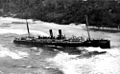
 SS Maheno shipwreck flyover.jpg 848 × 1,280; 293 KB
-
 StateLibQld 1 104948 Cooma (ship).jpg 1,000 × 652; 97 KB
-
 StateLibQld 1 110172 Maheno (ship).jpg 1,000 × 618; 91 KB
-
 StateLibQld 1 111444 Murgon from the air, 1938.jpg 1,000 × 729; 148 KB
-
 StateLibQld 1 111976 Brynhyfryd mansion at Blackstone, Ipswich, ca. 1930.jpg 1,000 × 743; 137 KB
-
 StateLibQld 1 112956 Aerial view of Gordonvale in 1937.jpg 1,000 × 736; 120 KB
-
 StateLibQld 1 116120 Cotton ginnery at Eagle Farm, ca. 1925.jpg 1,000 × 748; 137 KB
-
 StateLibQld 1 116284 Ranelagh (ship).jpg 1,000 × 747; 127 KB
-
-
-

-
 StateLibQld 1 120540 Maheno (ship).jpg 1,000 × 816; 144 KB
-
 StateLibQld 1 121540 Charters Towers from the air, ca. 1922.jpg 1,000 × 629; 110 KB
-
 StateLibQld 1 121564 Aerial view of Warwick, 1932.jpg 1,000 × 746; 138 KB
-
 StateLibQld 1 128687 Aerial view of Carmila, ca. 1920s.jpg 1,000 × 562; 48 KB
-

-
 StateLibQld 1 150419 Aerial view of Beenleigh, 1954.jpg 1,000 × 781; 136 KB
-
 StateLibQld 1 150927 Aerial view of Allora, Queensland, 1951.jpg 1,000 × 820; 111 KB
-
 StateLibQld 1 152519 General view of Mount Morgan, ca. 1923.jpg 1,000 × 630; 122 KB
-
 StateLibQld 1 153511 Aerial view of Bowen, North Queensland, 1954.jpg 1,000 × 785; 155 KB
-

-
 StateLibQld 1 164503 Aerial view of Goomeri, ca. 1945.jpg 1,000 × 752; 159 KB
-

-
 StateLibQld 1 188475 View of the town of Hughenden, ca. 1925.jpg 1,000 × 371; 62 KB
-
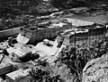 StateLibQld 1 190575 Somerset Dam during construction, July 1938.jpg 1,000 × 765; 176 KB
-
 StateLibQld 1 196283 Panorama of Port Douglas, Queensland, ca. 1927.jpg 1,000 × 186; 38 KB
-
 StateLibQld 1 198719 Aerial view of Charleville, 1947.jpg 1,000 × 744; 122 KB
-
 StateLibQld 1 208041 Town of Kingaroy from the air, 1951.jpg 1,000 × 777; 151 KB
-
 StateLibQld 1 212292 Aerial view of Kingaroy, 1939.jpg 1,000 × 735; 120 KB
-
 StateLibQld 1 233092 Aerial photograph of Warwick, Queensland, 1929.jpg 1,000 × 769; 162 KB
-

-
 StateLibQld 1 253538 Aerial view of Burleigh Heads, ca. 1952.jpg 737 × 1,000; 144 KB
-
 StateLibQld 1 259012 Aerial view of Dalby, ca. 1930.jpg 1,000 × 677; 84 KB
-
 StateLibQld 1 270237 Aerial view of Cleveland, ca. 1920.jpg 769 × 1,000; 139 KB
-
 StateLibQld 1 270789 Elevated view of Irvinebank, ca. 1912.jpg 635 × 1,000; 80 KB
-

-
 StateLibQld 1 294031 Tweed Heads, New South Wales, ca. 1930.jpg 1,000 × 574; 70 KB
-
 StateLibQld 1 294395 Tweed Heads, ca. 1929.jpg 1,000 × 647; 176 KB
-
 StateLibQld 1 295103 Aerial photograph of Ularunda Station, ca. 1933.jpg 1,000 × 738; 126 KB
-

-
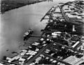
 StateLibQld 1 297447 View of the wharves at Townsville, ca. 1916.jpg 1,000 × 739; 66 KB
-
 StateLibQld 1 297823 View of the beach at Yeppoon, Queensland ca. 1936.jpg 1,000 × 753; 105 KB
-
 StateLibQld 1 298327 View of Tweed Heads, ca. 1930.jpg 1,000 × 567; 84 KB
-
 StateLibQld 1 298371 Aerial view of Tweed Heads, ca. 1925.jpg 1,000 × 675; 125 KB
-
 StateLibQld 1 298563 View of Tweed Heads, ca. 1940.jpg 1,000 × 585; 95 KB
-
 StateLibQld 1 298663 View of Tweed Heads from Razorback, ca. 1924.jpg 1,000 × 569; 57 KB
-
 StateLibQld 1 393761 Burdekin River at Sellheim, ca. 1925.jpg 1,000 × 630; 72 KB
-
 StateLibQld 1 394173 Aerial view of Bunya Mountains, ca. 1910.jpg 1,000 × 757; 121 KB
-
 StateLibQld 1 40007 Aerial view of Springsure district, 1930.jpg 1,000 × 734; 120 KB
-
 StateLibQld 1 89692 Aerial view of Bowen, ca. 1926.jpg 1,000 × 738; 123 KB
-

-
 StateLibQld 1 89720 Aerial view of the Charters Towers showgrounds, ca. 1905.jpg 1,000 × 637; 115 KB
-

-

-

-

-

-

-
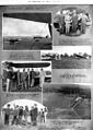
 StateLibQld 2 206761 Fuel supplies at Charleville Airport, Queensland, 1934.jpg 1,000 × 756; 123 KB
-

-

-

-
 StateLibQld 2 245707 Aerial view of Roma Street towards Milton, ca. 1889.jpg 1,000 × 814; 99 KB
-

-
 StateLibQld 2 292983 Aerial view of the beach at Yeppoon, Queensland, 1933.jpg 1,000 × 609; 101 KB
-

-
 StateLibQld Aerial view of Woody Point, Queensland, 1950.jpg 1,000 × 730; 111 KB
-
 Sweers Island 02.jpg 3,264 × 2,448; 2.1 MB
-
 Texas, Qld - aerial.jpg 1,070 × 1,052; 253 KB
-
 Toowoomba.png 746 × 614; 1.14 MB
-
 Vergemont QLD 4730, Australia - panoramio.jpg 3,264 × 2,448; 1.58 MB
-

-
 Westmoreland uranium.jpg 1,000 × 750; 710 KB
-
 Woolooga aerial.jpg 2,410 × 2,088; 1.32 MB
-
 Yuleba, Queensland.jpg 2,239 × 1,912; 3.66 MB
.jpg)

.jpg)
.jpg)
.jpg)


-01(1).jpg)


.png)

.jpg)
.jpg)
_(9443427948).jpg)


.jpg)


.jpg)
.jpg)


.jpg)


.jpg)


