Category:Aerial photographs of Haarlemmermeer
Jump to navigation
Jump to search
Subcategories
This category has the following 5 subcategories, out of 5 total.
*
- Aerial photographs of Hoofddorp (36 F)
- Aerial photographs of Spaarndam (23 F)
- Aerial photographs of Vijfhuizen (11 F)
Media in category "Aerial photographs of Haarlemmermeer"
The following 39 files are in this category, out of 39 total.
-
 Aerial photograph of Den Ruygen Hoek 7 FEB 2019 - 1.jpg 5,472 × 3,080; 3.34 MB
-
 Aerial photograph of Den Ruygen Hoek 7 FEB 2019 - 2.jpg 5,472 × 3,080; 3.47 MB
-
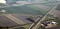
 Aerial photograph of Exit 2 Schiphol-08MAR2019-1.jpg 5,472 × 3,080; 3.07 MB
-
 Aerial photograph of Hoofdvaartviaduct HSL Zuid 20130606.jpg 2,718 × 1,311; 669 KB
-
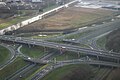
 Aerial photograph of KnooppuntBadhoevedorpNov2018.jpg 3,264 × 2,448; 2.91 MB
-
 Aerial view near Schiphol Airport 01.jpg 4,032 × 3,024; 2.09 MB
-
 Aerial view near Schiphol Airport 02.jpg 4,032 × 3,024; 1.82 MB
-
 Aerial view near Schiphol Airport 03.jpg 4,032 × 3,024; 1.94 MB
-
 Aerial view near Schiphol Airport 04.jpg 4,032 × 3,024; 1.75 MB
-
 BadhoevedorpAerialViewFromSW.jpg 2,816 × 2,112; 978 KB
-
 BadhoevedorpMar2017.jpg 1,971 × 2,850; 1.13 MB
-
 Halfweg - luchtfoto 9 oktober 2016.jpg 2,548 × 1,698; 2.54 MB
-
 Halfweg en Zwanenburg.jpg 3,648 × 2,736; 5.79 MB
-
 IJweg-JUN2017.jpg 5,472 × 3,080; 870 KB
-
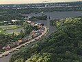
 Junction Rottepolderplein.jpg 5,278 × 3,509; 1.43 MB
-
 Knooppunt De Hoek.JPG 2,592 × 1,944; 1.98 MB
-
 Knooppunt Raasdorp en Boesingheliede.jpg 3,648 × 2,736; 4.33 MB
-
 Luchtfoto 1963, Inventarisnummer NL-HlmNHA Hmr 09324.JPG 2,721 × 2,066; 2.05 MB
-
 Luchtfoto van Badhoevedorp, Inventarisnummer NL-HlmNHA Hmr 06686.JPG 2,992 × 2,121; 2.02 MB
-

-

-
 N205 and N232 junction.jpg 5,760 × 3,830; 1.44 MB
-
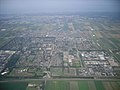 Nieuw-Vennep.JPG 2,592 × 1,944; 1.97 MB
-
 Nieuwe Meer seen towards west aerial 01.jpg 3,264 × 2,448; 1.42 MB
-
 NieuwVennepApr2015.jpg 2,254 × 1,373; 760 KB
-

-

-
 NIMH - 2011 - 1083 - Aerial photograph of Fort Schiphol, The Netherlands - 1920 - 1940.jpg 3,500 × 2,543; 2.24 MB
-
 NIMH - 2011 - 2873 - Aerial photograph of Cruquius, The Netherlands.jpg 3,500 × 2,558; 2.21 MB
-
 NIMH - 2011 - 2930 - Aerial photograph of Haarlemmerliede, The Netherlands.jpg 3,500 × 2,476; 1.77 MB
-
 NIMH - 2011 - 3605 - Aerial photograph of Haarlemmermeer, The Netherlands.jpg 2,048 × 3,500; 2.09 MB
-
 NIMH - 2011 - 3606 - Aerial photograph of Haarlemmermeer, The Netherlands.jpg 3,500 × 2,733; 2.82 MB
-
 NIMH - 2011 - 3703 - Aerial photograph of Haarlemmermeer, The Netherlands.jpg 3,500 × 2,145; 2.15 MB
-
 NIMH - 2011 9505 - Aerial photograph of Spaarndam - Vijfhuizen, The Netherlands.jpg 4,000 × 2,556; 1.27 MB
-
 Park rijk - panoramio.jpg 2,448 × 3,264; 2.83 MB
-
 Rijksweg 200 and the Ringvaart.jpg 5,488 × 3,649; 3.72 MB
-
 Rottepolderplein.jpeg 600 × 450; 51 KB
-
 Schiphol airport 01.jpg 5,142 × 3,365; 15.67 MB
-
 SchipholApr2016-1b.jpg 2,643 × 1,775; 1.23 MB


,_NL-HlmNHA_54010155.JPG)


