Category:Administrative maps of Africa
Jump to navigation
Jump to search
Subcategories
This category has the following 5 subcategories, out of 5 total.
+
A
E
R
Media in category "Administrative maps of Africa"
The following 72 files are in this category, out of 72 total.
-
 Administrative Boundaries - Africa - DPLA - d1a82b01a0e85d34ed02076a902fb56f.jpg 8,788 × 9,321; 7.97 MB
-
 Africa - DPLA - 0433beede0e3b1bf440b0f3aa4e79c8d.jpg 2,152 × 2,615; 6.94 MB
-
 Africa - DPLA - 0d5d3b9e36550eb258b8ab12bb66ab10.jpg 2,125 × 2,637; 7.72 MB
-
 Africa - DPLA - 1b1195329aec7c191574d04b3b346c72 (page 1).jpg 2,146 × 2,638; 7.29 MB
-
 Africa - DPLA - 1b1195329aec7c191574d04b3b346c72 (page 2).jpg 2,143 × 2,654; 7.21 MB
-
 Africa - DPLA - 3ed52280b94eab9d475d06daafe1f5e2.jpg 2,145 × 2,626; 7.11 MB
-
 Africa - DPLA - 4d09bdce057f47a4c10b1da417e2af7c.jpg 2,138 × 2,642; 7.32 MB
-
 Africa - DPLA - 6ceba089406d5ce6ed2c70c783a0d0f9.jpg 2,151 × 2,645; 6.88 MB
-
 Africa - DPLA - 6d193e0ce7e1cc62a3f2326589864bbb.jpg 2,159 × 2,648; 6.29 MB
-
 Africa - DPLA - 6de10ba560f6dbae5bb106ef0f41e27e.jpg 2,004 × 2,437; 5.64 MB
-
 Africa - DPLA - 81bd787a021c9ea33f45ff8933d11dac.jpg 2,152 × 2,629; 6.04 MB
-
 Africa - DPLA - 997136e458f49e013de89a74119d1e50.jpg 2,145 × 2,632; 7.21 MB
-
 Africa - DPLA - bbc9897bec2fa05e42444c1402131e48.jpg 2,148 × 2,651; 7.21 MB
-
 Africa - DPLA - bfd25525cc1e9d29045735891905f033.jpg 2,134 × 2,632; 6.26 MB
-
 Africa - DPLA - c1b1a12c19abc3ceaa63da1e6f7c0bd5.jpg 2,143 × 2,642; 7.73 MB
-
 Africa Input Administrative Boundaries (5457147061).jpg 2,525 × 3,209; 918 KB
-
 Algeria Input Administrative Boundaries (5457755778).jpg 2,525 × 3,209; 630 KB
-
 Angola Input Administrative Boundaries (5457147111).jpg 2,525 × 3,209; 612 KB
-
 Benin Input Administrative Boundaries (5457147729).jpg 2,525 × 3,209; 585 KB
-
 Botswana Input Administrative Boundaries (5457754564).jpg 2,525 × 3,209; 591 KB
-
 Burkina Faso Input Administrative Boundaries (5457753974).jpg 2,525 × 3,209; 730 KB
-
 Burundi Input Administrative Boundaries (5457147637).jpg 2,525 × 3,209; 661 KB
-
 Cameroon Input Administrative Boundaries (5457755278).jpg 2,525 × 3,209; 555 KB
-
 Cape Verde Input Administrative Boundaries (5457149083).jpg 2,525 × 3,209; 562 KB
-
 Central African Republic Input Administrative Boundaries (5457754622).jpg 2,525 × 3,209; 628 KB
-
 Chad Input Administrative Boundaries (5457156227).jpg 2,524 × 3,209; 583 KB
-
 Comoros Input Administrative Boundaries (5457148783).jpg 2,525 × 3,209; 613 KB
-
 Congo Input Administrative Boundaries (5457148879).jpg 2,550 × 3,209; 628 KB
-
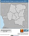 Democratic Republic of Congo Input Administrative Boundaries (5457148823).jpg 2,525 × 3,208; 703 KB
-
 Djibouti Input Administrative Boundaries (5457755606).jpg 2,525 × 3,209; 558 KB
-
 Egypt Input Administrative Boundaries (5457149703).jpg 2,550 × 3,209; 719 KB
-
 Equatorial Guinea Input Administrative Boundaries (5457150745).jpg 2,525 × 3,209; 579 KB
-
 Eritrea Input Administrative Boundaries (5457149747).jpg 2,525 × 3,209; 610 KB
-
 Gabon Input Administrative Boundaries (5457150257).jpg 2,550 × 3,209; 633 KB
-
 Gambia Input Administrative Boundaries (5457756880).jpg 2,524 × 3,209; 592 KB
-
 Ghana Input Administrative Boundaries (5457150445).jpg 2,525 × 3,209; 704 KB
-
 Guinea Bissau Input Administrative Boundaries (5457756742).jpg 2,524 × 3,209; 632 KB
-
 Guinea Input Administrative Boundaries (5457150711).jpg 2,524 × 3,209; 675 KB
-
 Ivory Coast Input Administrative Boundaries (5457148705).jpg 2,525 × 3,209; 758 KB
-
 Kenya Input Administrative Boundaries (5457152047).jpg 2,524 × 3,209; 887 KB
-
 Lesotho Input Administrative Boundaries (5457152599).jpg 2,524 × 3,209; 599 KB
-
 Liberia Input Administrative Boundaries (5457152425).jpg 2,524 × 3,209; 637 KB
-
 Libyan Arab Jamahiriya Input Administrative Boundaries (5457758614).jpg 2,524 × 3,220; 608 KB
-
 Madagascar Input Administrative Boundaries (5457152983).jpg 2,524 × 3,209; 753 KB
-
 Malawi Input Administrative Boundaries (5457759700).jpg 2,524 × 3,209; 745 KB
-
 Mali Input Administrative Boundaries (5457153177).jpg 2,550 × 3,209; 676 KB
-
 Mauritania Input Administrative Boundaries (5457153427).jpg 2,524 × 3,209; 646 KB
-
 Mauritius Input Administrative Boundaries (5457759646).jpg 2,524 × 3,209; 655 KB
-
 Mayotte Input Administrative Boundaries (5457759772).jpg 2,524 × 3,209; 573 KB
-
 Morocco Input Administrative Boundaries (5457758934).jpg 2,524 × 3,209; 604 KB
-
 Mozambique Input Administrative Boundaries (5457153379).jpg 2,524 × 3,209; 740 KB
-
 Namibia Input Administrative Boundaries (5457153687).jpg 2,524 × 3,209; 634 KB
-
 Niger Input Administrative Boundaries (5457759910).jpg 2,524 × 3,209; 621 KB
-
 Nigeria Input Administrative Boundaries (5457760004).jpg 2,524 × 3,209; 790 KB
-
 Reunion Input Administrative Boundaries (5457761160).jpg 2,524 × 3,209; 539 KB
-
 Rwanda Input Administrative Boundaries (5457155137).jpg 2,524 × 3,209; 676 KB
-
 Sao Tome and Principe Input Administrative Boundaries (5457155709).jpg 2,524 × 3,209; 529 KB
-
 Senegal Input Administrative Boundaries (5457155279).jpg 2,524 × 3,209; 683 KB
-
 Seychelles Input Administrative Boundaries (5457156099).jpg 2,524 × 3,209; 538 KB
-
 Sierra Leone Input Administrative Boundaries (5457155417).jpg 2,524 × 3,209; 665 KB
-
 Somalia Input Administrative Boundaries (5457155525).jpg 2,524 × 3,209; 610 KB
-
 St. Helena Input Administrative Boundaries (5457761632).jpg 2,524 × 3,209; 562 KB
-
 Sudan Input Administrative Boundaries (5457155231).jpg 2,529 × 3,209; 656 KB
-
 Swaziland Input Administrative Boundaries (5457156063).jpg 2,524 × 3,209; 567 KB
-
 Togo Input Administrative Boundaries (5457156257).jpg 2,524 × 3,209; 571 KB
-
 Trinidad and Tobago Input Administrative Boundaries (5457762928).jpg 2,524 × 3,209; 582 KB
-
 Uganda Input Administrative Boundaries (5457156881).jpg 2,525 × 3,209; 941 KB
-
 United Republic of Tanzania Input Administrative Boundaries (5457156819).jpg 2,524 × 3,219; 709 KB
-
 Zambia Input Administrative Boundaries (5457157775).jpg 2,524 × 3,209; 643 KB
-
 Zaradbnd (5457157737).jpg 2,529 × 3,208; 706 KB
-
 Zimbabwe Input Administrative Boundaries (5457764036).jpg 2,524 × 3,209; 648 KB
-
 خريطة عسكرية وإدارية للمغرب 1921.jpg 8,075 × 6,641; 7.89 MB


.jpg)
.jpg)


.jpg)
.jpg)
.jpg)
.jpg)
.jpg)
.jpg)
.jpg)
.jpg)
.jpg)
.jpg)
.jpg)
.jpg)
.jpg)
.jpg)
.jpg)
.jpg)
.jpg)
.jpg)
.jpg)
.jpg)
.jpg)
.jpg)
.jpg)
.jpg)
.jpg)
.jpg)
.jpg)
.jpg)
.jpg)
.jpg)
.jpg)
.jpg)
.jpg)
.jpg)
.jpg)
.jpg)
.jpg)
.jpg)
.jpg)
.jpg)
.jpg)
.jpg)
.jpg)
.jpg)
.jpg)
.jpg)
.jpg)
.jpg)
.jpg)
.jpg)
.jpg)
.jpg)
.jpg)
.jpg)
.jpg)
.jpg)
