Category:Abrahamschacht
Jump to navigation
Jump to search
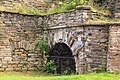
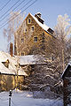
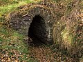
English: "Abraham" shaft in Freiberg.
Deutsch: Der „Abrahamschacht“ in Freiberg.
| Object location | | View all coordinates using: OpenStreetMap |
|---|
| (Wikidata) |
bridge in Germany  | |||||
| Upload media | |||||
| Instance of | |||||
|---|---|---|---|---|---|
| Location | Freiberg, Mittelsachsen, Saxony, Germany | ||||
| Street address |
| ||||
| Heritage designation | |||||
| Inception |
| ||||
 | |||||
Media in category "Abrahamschacht"
The following 19 files are in this category, out of 19 total.
-
 20181106600DR Freiberg Abrahamschacht Schachtweg.jpg 3,351 × 2,328; 5.12 MB
-
 20181106605DR Freiberg Abrahamschacht Schachtweg.jpg 3,416 × 2,608; 5.98 MB
-
 20181110200DR Freiberg Abrahamschacht Schachtweg.jpg 3,648 × 2,490; 6.46 MB
-
 2021 Freiberg Abrahamschacht Erzbahntunnel.jpg 3,543 × 2,362; 6.26 MB
-
 Abrahamschacht 1.jpg 500 × 378; 112 KB
-
 Abrahamschacht Erzbahntunnel Freiberg 2021.jpg 3,543 × 2,362; 7.31 MB
-
 Abrahamschacht Freiberg Bergschmiede.jpg 2,948 × 2,211; 2.42 MB
-
 Abrahamschacht.jpg 3,024 × 4,032; 2.37 MB
-
 Abrahamschacht1.jpg 2,465 × 1,849; 3.02 MB
-
 Abrahamschacht2.jpg 1,817 × 2,725; 2.97 MB
-
 Abrahamschachtwinter.jpg 2,304 × 3,456; 4.74 MB
-
 Freiberg Abrahamschacht Bergschmiede Treibehaus.jpg 3,543 × 2,657; 4.5 MB
-
 Freiberg Abrahamschacht Erzbahntunnel 2021.jpg 3,543 × 2,657; 7.82 MB
-
 Freiberg Abrahamschacht Erzbahntunnel.jpg 2,939 × 2,205; 3.26 MB
-
 Freiberg Abrahamschacht Scheidebank Treibehaus.jpg 3,543 × 2,362; 6.13 MB
-
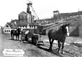 Freiberg Gesteinstransport 1900.jpg 2,000 × 1,408; 486 KB
-
 Freiberg Oberer Erzbahntunnel.jpg 3,014 × 2,261; 5.35 MB
-
 Himmelfahrt (Abrahamschacht) mit Guthaus (Mitte).jpg 3,091 × 1,936; 5.18 MB
-
 Sächsische Volkstrachten und Bauernhäuser (1896) 07 1.jpg 2,650 × 3,205; 3.37 MB


_mit_Guthaus_(Mitte).jpg)
_07_1.jpg)