Category:Abinger Common
Jump to navigation
Jump to search
English: Abinger Common is a village in Surrey, England. Abinger Common was inhabited in the stone-age, and is supposed to be the oldest village in England. The church dates back to Norman times and is the second oldest Parish church in Surrey. The headquarters of the Lutyens Trust is based in the village at Goddards (designed by Sir Edwin Lutyens). Outside the church there is a three-person stocks. To the west of the village is Oxmoor Copse which is an Area of Outstanding Natural Beauty.
village in Surrey, England | |||||
| Upload media | |||||
| Instance of | |||||
|---|---|---|---|---|---|
| Location | Mole Valley, Surrey, South East England, England | ||||
| |||||
Subcategories
This category has the following 4 subcategories, out of 4 total.
Media in category "Abinger Common"
The following 31 files are in this category, out of 31 total.
-
 Abinger Common - geograph.org.uk - 2638854.jpg 640 × 430; 147 KB
-
 Abinger Common - geograph.org.uk - 2638856.jpg 640 × 430; 154 KB
-
 Abinger Common - geograph.org.uk - 2640507.jpg 640 × 430; 156 KB
-
 Abinger Common Fields.jpg 320 × 214; 36 KB
-
 Abinger Lane, Abinger Common - geograph.org.uk - 1285502.jpg 640 × 480; 404 KB
-
 Abinger Lane, Abinger Common - geograph.org.uk - 2774587.jpg 1,600 × 1,200; 555 KB
-
 Abinger Manor, Abinger Common - geograph.org.uk - 2774584.jpg 1,600 × 1,200; 588 KB
-
 AbingerCommon.PNG 1,181 × 780; 1.93 MB
-
 Abingerstocks.jpg 3,072 × 2,048; 2.45 MB
-
 Barn in Abinger Common - geograph.org.uk - 2640645.jpg 640 × 430; 74 KB
-
 Cottage, Abinger Common Rd - geograph.org.uk - 2640545.jpg 640 × 430; 110 KB
-
 Donkey Lane, Abinger Common - geograph.org.uk - 2774501.jpg 1,600 × 1,200; 571 KB
-
 Ellix Wood, Abinger Common - geograph.org.uk - 2774771.jpg 1,600 × 1,200; 625 KB
-
 Entering Abinger Common - geograph.org.uk - 2640611.jpg 640 × 430; 100 KB
-
 Entering Abinger Common - geograph.org.uk - 2774766.jpg 1,600 × 1,200; 550 KB
-
 Evelyn Cottages, Abinger Common - geograph.org.uk - 2640644.jpg 640 × 430; 67 KB
-
 Evelyn Hall, Abinger Common - geograph.org.uk - 2640651.jpg 640 × 430; 97 KB
-
 House at Abinger Common.jpg 2,264 × 1,480; 725 KB
-
 House in Abinger Common - geograph.org.uk - 2640639.jpg 640 × 430; 93 KB
-
 Leith Hill Road, Abinger Common - geograph.org.uk - 3026471.jpg 800 × 600; 117 KB
-
 Old well on Hollow Lane, Abinger Common (geograph 4823255).jpg 2,028 × 1,508; 1,000 KB
-
 Sheep by Sutton Lane, Abinger Common - geograph.org.uk - 2774577.jpg 1,600 × 1,200; 566 KB
-
 Sheep by Sutton Lane, Abinger Common - geograph.org.uk - 2774581.jpg 1,600 × 1,200; 603 KB
-
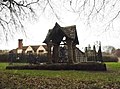
 St James's Well - geograph.org.uk - 710228.jpg 480 × 640; 123 KB
-
 St. James's Well, Abinger Common - geograph.org.uk - 648899.jpg 640 × 480; 65 KB
-
 Sutton Lane, Abinger Common - geograph.org.uk - 2774574.jpg 1,600 × 1,200; 592 KB
-
 Telephone Kiosk, Abinger Common - geograph.org.uk - 2640636.jpg 640 × 430; 106 KB
-
 The Stocks, Abinger Common - geograph.org.uk - 2640658.jpg 640 × 430; 137 KB
-
 Village sign, Abinger Common - geograph.org.uk - 2640664.jpg 430 × 640; 68 KB
-
 Well, Abinger Common, Surrey - geograph.org.uk - 30480.jpg 640 × 417; 149 KB
-
 Wild flowers on Abinger Common - geograph.org.uk - 3580252.jpg 4,320 × 2,432; 3.83 MB


.jpg)


