Category:Aberdeen Harbour
Jump to navigation
Jump to search

| Object location | | View all coordinates using: OpenStreetMap |
|---|
|
Parts include:
|
Quays:
|
Buildings:
|
maritime port in Aberdeen, Scotland, UK  | |||||
| Upload media | |||||
| Instance of | |||||
|---|---|---|---|---|---|
| Location | Aberdeen, Aberdeen City, Scotland | ||||
| Has part(s) |
| ||||
| official website | |||||
 | |||||
Subcategories
This category has the following 8 subcategories, out of 8 total.
A
- Aberdeen Boat Club (3 F)
- Aberdeen Lifeboat Station (3 F)
M
N
R
- Round House (Aberdeen Harbour) (20 F)
S
- Shore Porters Society (6 F)
Media in category "Aberdeen Harbour"
The following 200 files are in this category, out of 383 total.
(previous page) (next page)-

-
 2006 Aberdeen (4000791954).jpg 2,272 × 1,704; 746 KB
-
 3rd Aug 2012- Abdn Harbour 2.JPG 4,288 × 3,216; 3.5 MB
-
 3rd Sep 2012-Pocra Quay 2.JPG 3,216 × 4,288; 1.98 MB
-

-
 A Northlink ferry at Jamieson's Quay in Aberdeen Harbour - geograph.org.uk - 4479277.jpg 4,608 × 3,456; 3.23 MB
-
 A small boat dock - geograph.org.uk - 948415.jpg 640 × 480; 110 KB
-

-

-

-
 Abercrombie Jetty (17090050341).jpg 5,760 × 3,840; 12.76 MB
-
 Aberdeen - New Aberdene from the Block house.png 1,157 × 717; 1.05 MB
-
 Aberdeen 16.jpg 4,080 × 3,072; 5.44 MB
-
 Aberdeen banner Harbour.jpg 2,800 × 400; 345 KB
-
 Aberdeen beach and ships waiting off shore.jpg 5,296 × 2,976; 3.48 MB
-
 Aberdeen Breakwater (1500047990).jpg 2,048 × 1,536; 550 KB
-
 Aberdeen docks.jpg 1,632 × 1,224; 185 KB
-
 Aberdeen FogHorn (20338217273).jpg 5,760 × 3,840; 13.08 MB
-
 Aberdeen from above - geograph.org.uk - 4283.jpg 640 × 479; 63 KB
-

-
 Aberdeen Harbour (2498099454).jpg 5,969 × 1,504; 2.28 MB
-
 Aberdeen Harbour (53596301645).jpg 3,648 × 3,648; 8.35 MB
-
 Aberdeen harbour - geograph.org.uk - 1248055.jpg 640 × 426; 79 KB
-
 Aberdeen Harbour - geograph.org.uk - 1272837.jpg 640 × 480; 96 KB
-
 Aberdeen harbour - geograph.org.uk - 318364.jpg 600 × 399; 28 KB
-
 Aberdeen harbour - geograph.org.uk - 321460.jpg 426 × 640; 51 KB
-
 Aberdeen Harbour - geograph.org.uk - 3462256.jpg 1,024 × 685; 163 KB
-
 Aberdeen Harbour - geograph.org.uk - 608133.jpg 640 × 426; 75 KB
-
 Aberdeen Harbour - geograph.org.uk - 61975.jpg 587 × 332; 35 KB
-
 Aberdeen Harbour - geograph.org.uk - 650098.jpg 600 × 435; 61 KB
-
 Aberdeen Harbour - geograph.org.uk - 84595.jpg 640 × 427; 86 KB
-
 Aberdeen Harbour - geograph.org.uk - 948420.jpg 640 × 435; 55 KB
-
 Aberdeen Harbour - geograph.org.uk - 995785.jpg 640 × 429; 69 KB
-
 Aberdeen Harbour - panoramio.jpg 4,608 × 3,072; 12.54 MB
-
 Aberdeen Harbour Board Ensign.svg 1,200 × 600; 2 KB
-
 Aberdeen Harbour Entrance - geograph.org.uk - 1351393.jpg 640 × 427; 54 KB
-
 Aberdeen Harbour Entrance - panoramio.jpg 5,542 × 3,694; 14.07 MB
-
 Aberdeen Harbour from Air.jpg 1,564 × 338; 150 KB
-
-
 Aberdeen Harbour from Greyhope Road - geograph.org.uk - 105758.jpg 640 × 480; 90 KB
-

-

-
 Aberdeen Harbour from Torry Battery. - geograph.org.uk - 116367.jpg 426 × 633; 78 KB
-
 Aberdeen Harbour from Torry point - panoramio.jpg 3,264 × 2,448; 905 KB
-
 Aberdeen harbour in snow - March 2006 - Flickr - watty.jpg 750 × 500; 205 KB
-
 Aberdeen harbour mouth - geograph.org.uk - 3973233.jpg 2,048 × 1,536; 758 KB
-
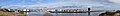 Aberdeen Harbour Panorama.jpg 24,885 × 3,392; 8.84 MB
-
 Aberdeen harbour scene - geograph.org.uk - 4775853.jpg 2,542 × 1,591; 1.7 MB
-
 Aberdeen Harbour Scotland.jpg 3,072 × 2,304; 2.82 MB
-
 Aberdeen Harbour viewed from Wind Tower.jpg 4,000 × 3,000; 3.99 MB
-
 Aberdeen Harbour, 1992 - geograph.org.uk - 3291209.jpg 1,176 × 781; 400 KB
-
 Aberdeen Harbour, Aberdeen.jpg 1,280 × 960; 467 KB
-

-
 Aberdeen port - geograph.org.uk - 447576.jpg 640 × 480; 88 KB
-
 Aberdeen Quayside.jpg 1,156 × 838; 255 KB
-
 Aberdeen Shore Lane.jpg 2,433 × 1,828; 694 KB
-
 Aberdeen, Scotland (3) (10368990404).jpg 3,456 × 2,304; 2.61 MB
-
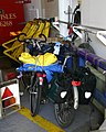 Aberdeen-Hafen-02-Fahrraeder-2009-gje.jpg 2,040 × 2,552; 1.95 MB
-
 Aberdeen-Hafen-06-Autoqueueing-2009-gje.jpg 3,072 × 2,048; 2.1 MB
-
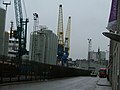
 Aberdeen-Hafen-08-Laderampe-2009-gje.jpg 3,069 × 1,980; 2.01 MB
-
 Aberdeen-Hafen-10-Laderampe-2009-gje.jpg 3,072 × 2,048; 2.09 MB
-
 Aberdeen-Hafen-12-Moewe-2009-gje.jpg 3,072 × 2,048; 1.56 MB
-
 Aberdeen-Hafen-14-Panorama-2009-gje.jpg 5,292 × 2,150; 2.91 MB
-
 Aberdeen-Hafen-16-Auslaufen-2009-gje.jpg 2,997 × 1,762; 1.77 MB
-
 Aberdeen-Hafen-20-Bruecke-Regenbogen-2009-gje.jpg 3,072 × 2,048; 1.83 MB
-
 Aberdeen-Hafen-30-Ablegen-2009-gje.jpg 3,072 × 2,048; 2.26 MB
-
 Aberdeen-Hafen-32-Hafen-2009-gje.jpg 3,072 × 2,048; 2.28 MB
-
 Aberdeen-Hafen-34-Schiffe-2009-gje.jpg 3,072 × 2,048; 2.34 MB
-
 Aberdeen-Hafen-38-Schiff-2009-gje.jpg 3,072 × 2,048; 2.35 MB
-
 Aberdeen-Hafen-40-Ketten-2009-gje.jpg 3,072 × 2,048; 1.97 MB
-
 Aberdeen-Hafen-42-2009-gje.jpg 3,072 × 2,048; 2.08 MB
-
 Aberdeen-Hafen-44-Hafenausfahrt-2009-gje.jpg 3,072 × 2,048; 2.01 MB
-
 Aberdeen-Hafen-46-Hafenausfahrt-2009-gje.jpg 3,069 × 1,887; 1.91 MB
-
 Aberdeen-Harbour-Skyline.jpg 3,246 × 1,298; 2.74 MB
-
 Aberdeenharbour.jpg 1,280 × 960; 175 KB
-
 Admiralty Chart No 1446 Aberdeen Harbour, Published 1843.jpg 10,880 × 8,073; 20.47 MB
-
 AH Varazze (33818649232).jpg 3,872 × 2,581; 5.05 MB
-
 AH Varazze (33935289506).jpg 3,873 × 2,582; 6.99 MB
-
 AH Varazze (33935320486).jpg 3,872 × 2,581; 6.18 MB
-
 Alamosborg (33374150534).jpg 3,873 × 2,582; 6.09 MB
-
 Alamosborg (34085464641).jpg 3,873 × 2,582; 6.55 MB
-
 Alamosborg (34175549796).jpg 3,872 × 2,581; 5.41 MB
-
 Atlantic Merlin (35865092453).jpg 3,873 × 2,582; 6.1 MB
-
 Atlantic Merlin (36504967072).jpg 3,872 × 2,581; 7.12 MB
-
 Atlantic Merlin (36674413055).jpg 3,872 × 2,581; 5.54 MB
-
 Bannermans Bridge (geograph 2916145).jpg 2,520 × 1,680; 416 KB
-
 BB Troll - Geograph-3973007-by-James-Allan.jpg 2,048 × 1,536; 1.48 MB
-
 BBC Citrine (35749611911).jpg 3,872 × 2,581; 6.91 MB
-
 BBC Citrine (35749630301).jpg 3,872 × 2,581; 6.94 MB
-
 BBC Citrine (35749647521).jpg 3,872 × 2,581; 5.27 MB
-
 BBC Citrine (35840097856).jpg 3,872 × 2,581; 6.29 MB
-
 BBC Citrine (35880917105).jpg 3,872 × 2,581; 5.99 MB
-
 BBC Kibo (36495655974).jpg 3,872 × 2,581; 5.53 MB
-
 BBC Kibo (36520615283).jpg 3,873 × 2,582; 5.73 MB
-
 BBC Kibo (36935970090).jpg 3,872 × 2,581; 6.33 MB
-
 BBC Kibo (37160681652).jpg 3,872 × 2,581; 5.69 MB
-
 BBC Maryland (35263950693).jpg 3,873 × 2,582; 5.96 MB
-
 BBC Maryland (35683373740).jpg 3,872 × 2,581; 6.38 MB
-
 BBC Maryland (35683433870).jpg 3,873 × 2,582; 5.47 MB
-
 BBC Maryland (35903202412).jpg 3,872 × 2,581; 5.59 MB
-
 BBC Maryland (36032242566).jpg 3,872 × 2,581; 5.53 MB
-
 BBC Sapphire (33048192644).jpg 3,872 × 2,581; 6.55 MB
-
 BBC Sapphire (33114925283).jpg 3,872 × 2,581; 7.4 MB
-
 BBC Sapphire (33542804840).jpg 3,872 × 2,581; 6.03 MB
-
 BBC Sapphire (33735294742).jpg 3,872 × 2,581; 6.13 MB
-
 BBC Sapphire (33770663242).jpg 3,872 × 2,581; 7.07 MB
-
 BBC Sapphire (33797990481).jpg 3,872 × 2,581; 6.74 MB
-
 BBC Sapphire (33850796156).jpg 3,873 × 2,582; 6.35 MB
-
 BBC Sapphire (33928040415).jpg 3,872 × 2,581; 6.62 MB
-
 BBC Tennessee (33900805591).jpg 3,872 × 2,581; 4.89 MB
-
 BBC Tennessee (33989762156).jpg 3,872 × 2,581; 6.05 MB
-
 BBC Tennessee (33989776456).jpg 3,872 × 2,581; 5.52 MB
-
 Bergen Nordic (32627999493).jpg 3,873 × 2,582; 6.31 MB
-
 Bergen Nordic (32628067793).jpg 3,872 × 2,581; 6.2 MB
-
 Bibby Polaris (35574078940).jpg 3,873 × 2,582; 6.89 MB
-
 Bibby Polaris (35574186310).jpg 3,872 × 2,581; 5.88 MB
-
 Bibby Polaris (35830569521).jpg 3,872 × 2,581; 6.35 MB
-
 Bibby Polaris (35962927745).jpg 3,872 × 2,581; 6.74 MB
-
 BOA Jarl (30469513280).jpg 5,622 × 3,748; 13.56 MB
-
 BOA Jarl (30770070395).jpg 5,608 × 3,739; 13.8 MB
-
 Bonay (35368104570).jpg 3,872 × 2,581; 6.08 MB
-
 Bonay (35368113740).jpg 3,872 × 2,581; 4.86 MB
-
 Brage Trader (35767911924).jpg 3,872 × 2,581; 6.55 MB
-
 Brage Trader (36603356475).jpg 3,873 × 2,582; 6.11 MB
-
 Brage Trader (36603371145).jpg 3,872 × 2,581; 6.07 MB
-
 Breakwater (1425169826).jpg 2,048 × 1,521; 435 KB
-
 Breakwater (14625802237).jpg 4,320 × 2,880; 6.86 MB
-
 Breakwater Torry side of harbour - geograph.org.uk - 700325.jpg 640 × 480; 82 KB
-
 Breakwaters - geograph.org.uk - 908966.jpg 640 × 426; 42 KB
-

-
 Buoy at the entrance to Aberdeen harbour - geograph.org.uk - 2011639.jpg 800 × 534; 154 KB
-
 Buoy outside Aberdeen Harbour - geograph.org.uk - 3794381.jpg 640 × 426; 259 KB
-
 By Fittie - geograph.org.uk - 487679.jpg 640 × 480; 70 KB
-
 Caledonian Vanguard (33973247280).jpg 3,872 × 2,581; 6.7 MB
-
 Caledonian Vanguard (33973271470).jpg 3,872 × 2,581; 5.9 MB
-
 Caledonian Vanguard (34316321416).jpg 3,872 × 2,581; 5.42 MB
-
 Captain William James Erskine.jpg 1,374 × 1,149; 1.28 MB
-
 Carrickfergus (33804583941).jpg 3,872 × 2,581; 7.18 MB
-
 Chart shop by Aberdeen Harbour - geograph.org.uk - 560244.jpg 640 × 480; 102 KB
-
 Coastal footpath - geograph.org.uk - 447580.jpg 640 × 480; 119 KB
-
 Coastal Path signpost - geograph.org.uk - 948429.jpg 640 × 465; 62 KB
-
 Commemorative plaque to John Abercrombie - wider view.jpg 3,354 × 2,268; 5.1 MB
-
 Commemorative plaque to Provost John Abercrombie.jpg 1,083 × 839; 688 KB
-
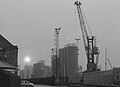
 Cranes at Aberdeen Harbour - geograph.org.uk - 3291213.jpg 1,174 × 784; 458 KB
-
 Cultra (33934620685).jpg 3,872 × 2,581; 7.01 MB
-
 Daan (32612468844).jpg 3,872 × 2,581; 6.91 MB
-
 Daan (33415054366).jpg 3,872 × 2,581; 8.61 MB
-
 Daroja (33713851254).jpg 3,872 × 2,581; 6.39 MB
-
 Daroja (33713874714).jpg 3,872 × 2,581; 7.19 MB
-
 Daroja (34556334845).jpg 3,872 × 2,581; 6.57 MB
-
 Deep Arctic (32803952254).jpg 3,872 × 2,581; 6.27 MB
-
 Dry dock, Aberdeen - geograph.org.uk - 1248044.jpg 640 × 426; 69 KB
-
 EDT Jane (33414380506).jpg 3,872 × 2,581; 5.91 MB
-
 Eilsum (34664667700).jpg 3,872 × 2,581; 6.16 MB
-
 Eilsum (35012219506).jpg 3,872 × 2,581; 6.79 MB
-
 Eilsum (35052400725).jpg 3,873 × 2,582; 6.25 MB
-
 Entering the Port (1800039450).jpg 2,584 × 1,948; 2.71 MB
-
-
 Entrance to Aberdeen Harbour.jpg 500 × 223; 17 KB
-

-

-
 Esvagt Chastine (33383182816).jpg 5,760 × 3,840; 15.11 MB
-
 Esvagt Dee (34082247180).jpg 3,873 × 2,582; 6.44 MB
-
 Esvagt Dee (34307246762).jpg 3,872 × 2,581; 7.62 MB
-
 Esvagt Dee (34467022005).jpg 3,873 × 2,582; 7.53 MB
-
 Esvagt Sigma (34988992973).jpg 3,873 × 2,582; 7.44 MB
-
 Esvagt Sigma (35629600312).jpg 3,872 × 2,581; 5.93 MB
-
 Far Serenade (35115549082).jpg 3,872 × 2,581; 7.06 MB
-
 Far Serenade (35115566382).jpg 3,872 × 2,581; 5.72 MB
-
 Far Serenade (35115588762).jpg 3,873 × 2,582; 5.56 MB
-
 Far Spica (35786725933).jpg 3,873 × 2,582; 5.98 MB
-
 Far Spica (36458458621).jpg 3,872 × 2,581; 6.34 MB
-
 Far Spica (36458472441).jpg 3,872 × 2,581; 5.35 MB
-
 Fastnet Sentinel (33215908623).jpg 3,872 × 2,581; 6.75 MB
-
 Fastnet Sentinel (33642974720).jpg 3,872 × 2,581; 5.62 MB
-
 Fastnet Sentinel (33898601291).jpg 3,872 × 2,581; 6.8 MB
-
 Fishing Boat Leaving Aberdeen Harbour. - geograph.org.uk - 115650.jpg 634 × 432; 128 KB
-
 Footdee - geograph.org.uk - 465877.jpg 640 × 409; 53 KB
-
 Footdee, Aberdeen - geograph.org.uk - 1248060.jpg 640 × 426; 71 KB
-
 Forth Fisher (34321861442).jpg 3,872 × 2,581; 6.06 MB
-
 Forth Fisher (34351261991).jpg 3,872 × 2,581; 6.09 MB
-
 FS Balmoral (34482318411).jpg 3,872 × 2,581; 5.96 MB
-
 Fugro Venturer (34354026044).jpg 3,873 × 2,582; 7.12 MB
-
 Fugro Venturer (34354039644).jpg 3,872 × 2,581; 7.09 MB
-
 Grampian Commander 2.jpg 4,032 × 3,024; 1.61 MB
-
 Grampian Discovery (36935873920).jpg 3,872 × 2,581; 6.79 MB
-
 Grampian Discovery (37160621302).jpg 3,872 × 2,581; 7.06 MB
-
 Grampian Discovery (37333777455).jpg 3,873 × 2,582; 7.54 MB
-
 Harbour (1424289317).jpg 2,048 × 1,194; 383 KB
-
 Harbour 1880, Aberdeen City Archives.jpg 3,228 × 2,187; 5.48 MB
-
 Harbour Breakwater (1500200714).jpg 2,028 × 1,134; 396 KB
-
 Harbour Entrance (1799217819).jpg 2,656 × 1,536; 2.05 MB
-
 Harbour Lights (16359860191).jpg 5,760 × 3,840; 18.47 MB
-
 Harbour Master's Station, Footdee - geograph.org.uk - 595624.jpg 640 × 480; 63 KB
-
 Harbour Oil Tanks - geograph.org.uk - 1574996.jpg 640 × 426; 38 KB
-
 Havila Crusader (33608384454).jpg 3,872 × 2,581; 7.44 MB
-
 Havila Crusader (34065748870).jpg 3,872 × 2,581; 5.49 MB
-
 Havila Crusader (34450438855).jpg 3,872 × 2,581; 7.38 MB
-
 Havila Venus (33902264313).jpg 3,872 × 2,581; 6.76 MB
-
 Havila Venus (34327466930).jpg 3,872 × 2,581; 6.68 MB

.jpg)


.jpg)


.jpg)

.jpg)


.jpg)


_(10368990404).jpg)


.jpg)
.jpg)
.jpg)
.jpg)
.jpg)
.jpg)
.jpg)
.jpg)
.jpg)
.jpg)

.jpg)
.jpg)
.jpg)
.jpg)
.jpg)
.jpg)
.jpg)
.jpg)
.jpg)
.jpg)
.jpg)
.jpg)
.jpg)
.jpg)
.jpg)
.jpg)
.jpg)
.jpg)
.jpg)
.jpg)
.jpg)
.jpg)
.jpg)
.jpg)
.jpg)
.jpg)
.jpg)
.jpg)
.jpg)
.jpg)
.jpg)
.jpg)
.jpg)
.jpg)
.jpg)
.jpg)
.jpg)
.jpg)
.jpg)
.jpg)


.jpg)
.jpg)
.jpg)

.jpg)


.jpg)
.jpg)
.jpg)
.jpg)
.jpg)
.jpg)
.jpg)

.jpg)
.jpg)
.jpg)
.jpg)
.jpg)


.jpg)
.jpg)
.jpg)
.jpg)
.jpg)
.jpg)
.jpg)
.jpg)
.jpg)
.jpg)
.jpg)
.jpg)
.jpg)
.jpg)
.jpg)


.jpg)
.jpg)
.jpg)
.jpg)
.jpg)

.jpg)
.jpg)
.jpg)
.jpg)

.jpg)
.jpg)
.jpg)


.jpg)
.jpg)
.jpg)
.jpg)
.jpg)
.jpg)