Category:Abandoned quarries in England
Jump to navigation
Jump to search
Subcategories
This category has the following 5 subcategories, out of 5 total.
Media in category "Abandoned quarries in England"
The following 23 files are in this category, out of 23 total.
-
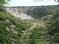
 Carfury Quarry (1).jpg 3,024 × 4,032; 5.97 MB
-
 Disused chalk pit, north-east of Wetwang (geograph 6827956).jpg 1,600 × 1,200; 719 KB
-
 Disused limestone quarry at Miller's Dale - geograph.org.uk - 2829515.jpg 2,403 × 1,803; 1.48 MB
-
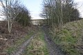
 Disused pit (geograph 3998517).jpg 1,024 × 768; 277 KB
-
 Disused pit (geograph 6837458).jpg 1,024 × 768; 267 KB
-
 Disused pit near Wetwang (geograph 4818204).jpg 1,200 × 799; 582 KB
-
 Disused Quarry , Miller's Dale - geograph.org.uk - 3003443.jpg 1,600 × 1,064; 536 KB
-
 Disused quarry - geograph.org.uk - 1637409.jpg 640 × 480; 93 KB
-
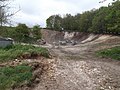
 Disused quarry - geograph.org.uk - 3734609.jpg 3,648 × 2,736; 3.67 MB
-
 Disused quarry in Miller's Dale - geograph.org.uk - 2289856.jpg 1,024 × 769; 350 KB
-
 Disused quarry off Thornhills Beck Lane - geograph.org.uk - 4426555.jpg 2,000 × 1,500; 1.16 MB
-
 Easington Quarry sidings - geograph.org.uk - 1476625.jpg 640 × 481; 93 KB
-
 East face of Kirtlington quarry geograph org uk.jpg 2,560 × 1,443; 2.54 MB
-
 Everthorpe Quarry - geograph.org.uk - 827608.jpg 640 × 440; 108 KB
-
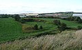
 Former quarry in Skiftings Clump (geograph 4458517).jpg 1,024 × 768; 380 KB
-

-
 Ironstone Quarry, Hengistbury Head - geograph.org.uk - 10331.jpg 640 × 481; 139 KB
-
 Miller's Dale Quarry - geograph.org.uk - 2404057.jpg 640 × 427; 91 KB
-
 Miller's Dale Quarry - geograph.org.uk - 2849466.jpg 3,872 × 2,592; 5.17 MB
-
-
 Pyecombe, Wolstonbury hill chalk pit - geograph.org.uk - 644029.jpg 640 × 480; 89 KB
-
 Trees growing in a disused chalk pit, Garton Field (geograph 6835851).jpg 1,600 × 1,200; 510 KB
-
 Whitecliff Quarry, Old Railway Tunnel. - panoramio.jpg 2,816 × 2,112; 2.37 MB
.jpg)
.jpg)

.jpg)
.jpg)
.jpg)


.jpg)


.jpg)
