Category:A Historical Geography of the British Colonies (1888) by Charles P. Lucas
Jump to navigation
Jump to search
English: A Historical Geography of the British Colonies. (1895) by Charles Prestwood Lucas
Title: A Historical Geography of the British Colonies (of the British Empire)
Author: LUCAS, Charles Prestwood - Sir, K.C.B
Shelfmark: "British Library HMNTS X.808/10831.", "British Library HMNTS 10004.dd.2.", "British Library OC T 35983"
Place of Publishing: Oxford
Date of Publishing: 1888
Publisher: Clarendon Press
Issuance: monographic
Identifier: 002275791
| This category includes images from a book scanned for the British Library Mechanical Curator collection.
The full set of images from the book is available on Flickr. |
Media in category "A Historical Geography of the British Colonies (1888) by Charles P. Lucas"
The following 50 files are in this category, out of 50 total.
-
 A Historical Geography of the British Colonies (I).jpg 604 × 948; 331 KB
-
 Map of Heligoland (1888).jpg 1,883 × 1,179; 815 KB
-
 Map of Mediterranean Dependencies (1888).jpg 1,873 × 1,289; 1.23 MB
-
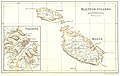 Map of Maltese Islands and Valetta (1888).jpg 3,713 × 2,351; 3.05 MB
-
 Map of Cyprus (1888).jpg 1,889 × 1,205; 989 KB
-
 Map of the South Coast of Asia and Indean Oceanshewing the British Dependencies (1888).jpg 1,903 × 1,257; 1.21 MB
-
 Map shewing British Dependencies of Aden and Perim (1888).jpg 1,887 × 1,239; 1.14 MB
-
 Map of Ceylon (1888).jpg 1,219 × 1,929; 1.28 MB
-
 Map of The Far East (1888).jpg 1,193 × 1,883; 1.19 MB
-
 Map shewing the British Dependencies Malaysia Peninsula and Singapore (1888).jpg 1,261 × 1,917; 1.25 MB
-
 Map of Singapore (1888).jpg 1,793 × 1,271; 842 KB
-
 Map of North Borneo, HongKong and Labuan (1888).jpg 1,865 × 1,207; 1.03 MB
-
 Map of North Borneo (1888).jpg 1,163 × 1,177; 633 KB
-
 Map of HongKong (1888).jpg 781 × 629; 278 KB
-
 Map of Labuan (1888).jpg 789 × 653; 220 KB
-
 Map of Mauritius (1888).jpg 1,177 × 1,825; 918 KB
-
 Map of the Atlantic to illustrate European colonisation in America (1888).jpg 1,935 × 1,249; 1.28 MB
-
 Map of The Bermudas (1888).jpg 1,927 × 1,253; 1.23 MB
-
 Map of West Indies and Central America (1888).jpg 1,929 × 1,251; 1.35 MB
-
 Map of The Bahamas (1888).jpg 1,921 × 1,217; 1.11 MB
-
 Map of Jamaica (1888).jpg 1,937 × 1,255; 1.39 MB
-
 Map of Antigua, Barbados, St.Kitts and Dominica (1888).jpg 1,935 × 1,201; 1.43 MB
-
 Map of Antigua (1888).jpg 983 × 625; 381 KB
-
 Map of Barbados (1888).jpg 627 × 1,009; 386 KB
-
 Map of St.Kitts and Nevis (1888).jpg 981 × 651; 357 KB
-
 Map of Dominica (1888).jpg 651 × 981; 391 KB
-
 Map of St.Lucia, St. Vincent, Tobago and Grenada (1888).jpg 1,239 × 1,947; 1.54 MB
-
 Map of St.Vincent (1888).jpg 1,233 × 1,909; 1.25 MB
-
 Map of St.Lucia (1888).jpg 1,259 × 1,923; 1.35 MB
-
 Map of Tobago (1888).jpg 1,929 × 1,253; 1.06 MB
-
 Map of Grenada (1888).jpg 1,241 × 1,963; 1.2 MB
-
 Map of Trinidad (1888).jpg 1,940 × 1,268; 1.07 MB
-
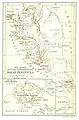
 Map of British Guiana (1888).jpg 1,225 × 1,957; 1.19 MB
-
 Map of British Honduras (1888).jpg 1,229 × 1,953; 1.2 MB
-
 Map of Falkland Islands and the Straits of Magellan (1888).jpg 1,235 × 1,953; 1.4 MB
-
 Map of Falkland Islands (1888).jpg 2,350 × 1,927; 2.34 MB
-
 Grenada (16588977231).jpg 477 × 813; 128 KB
-

-

-

-

-

-

-

-

-

-

-

-

-

.jpg)
.jpg)
.jpg)
.jpg)
.jpg)
.jpg)
.jpg)
.jpg)
.jpg)
.jpg)
.jpg)
.jpg)
.jpg)
.jpg)
.jpg)
.jpg)
.jpg)
.jpg)
.jpg)
.jpg)
.jpg)
.jpg)
.jpg)
.jpg)
.jpg)
.jpg)
.jpg)
.jpg)
.jpg)
.jpg)
.jpg)
.jpg)
.jpg)
.jpg)
.jpg)
.jpg)
.jpg)
%27_(11194908213).jpg)
%27_(15967972314).jpg)
%27_(16564151426).jpg)
%27_(11194755343).jpg)
%27_(16402878558).jpg)
%27_(16403072500).jpg)
%27_(16588898251).jpg)
%27_(16588898771).jpg)
%27_(11192964455).jpg)
%27_(16404324749).jpg)
%27_(16564195936).jpg)
%27_(16588977231).jpg)
%27_(16588978701).jpg)