Category:A941 road (Scotland)
Jump to navigation
Jump to search

A road in Moray and Aberdeenshire, Scotland, UK, between Lossiemouth and Rhynie (A97)   | |||||
| Upload media | |||||
| Instance of | |||||
|---|---|---|---|---|---|
| Location | Moray, Scotland | ||||
| Transport network |
| ||||
| Has part(s) |
| ||||
| Length |
| ||||
| Terminus | |||||
 | |||||
Media in category "A941 road (Scotland)"
The following 37 files are in this category, out of 37 total.
-
 A bend in the A941 - geograph.org.uk - 1034265.jpg 640 × 469; 82 KB
-
 A941 - geograph.org.uk - 341420.jpg 640 × 427; 235 KB
-
 A941 and Auchmair - geograph.org.uk - 1034615.jpg 640 × 480; 103 KB
-
 A941 approaching Blackwater Bridge - geograph.org.uk - 1034573.jpg 640 × 480; 115 KB
-
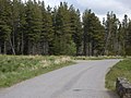
 A941 approaching The Cabrach - geograph.org.uk - 1034403.jpg 640 × 480; 51 KB
-
 A941 at Moss of Essie - geograph.org.uk - 1034214.jpg 640 × 441; 61 KB
-
 A941 bridge over the Allt Gauch - geograph.org.uk - 1034539.jpg 640 × 478; 118 KB
-
 A941 entering Elgin - geograph.org.uk - 1528323.jpg 640 × 430; 39 KB
-
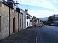
 A941 in Dufftown - geograph.org.uk - 526636.jpg 640 × 482; 77 KB
-
 A941 near Auchmair - geograph.org.uk - 1034475.jpg 640 × 480; 73 KB
-
 A941 west of Bruntland - geograph.org.uk - 1034143.jpg 640 × 476; 81 KB
-

-
-
 Approach to Cowford Bridge - geograph.org.uk - 1034250.jpg 640 × 480; 95 KB
-
 Bend in A941 - geograph.org.uk - 1338900.jpg 640 × 480; 148 KB
-
 Bridge at Bridgend - geograph.org.uk - 1229147.jpg 427 × 640; 98 KB
-
 Bridge at Bridgend - geograph.org.uk - 380983.jpg 640 × 480; 96 KB
-
 Bridge over Burn of Bank - geograph.org.uk - 1034486.jpg 640 × 480; 72 KB
-
 Bridgend - geograph.org.uk - 341433.jpg 640 × 427; 254 KB
-
 Cabrach junction - geograph.org.uk - 379955.jpg 640 × 480; 111 KB
-
 Dandaleith station site geograph-3402386-by-Ben-Brooksbank.jpg 2,394 × 1,272; 2.42 MB
-
 Descent to Blackwater bridge - geograph.org.uk - 381032.jpg 640 × 480; 77 KB
-
 Dufftown Clock Tower (A941) - geograph.org.uk - 526638.jpg 640 × 482; 81 KB
-
 Dufftown Post Office - geograph.org.uk - 526648.jpg 640 × 482; 101 KB
-
 Houses by A941 - geograph.org.uk - 1528278.jpg 640 × 492; 59 KB
-
 Lay-by on A941 - geograph.org.uk - 1528281.jpg 640 × 487; 65 KB
-

-
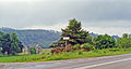
 Moray-Aberdeenshire border - geograph.org.uk - 381476.jpg 640 × 480; 90 KB
-
 Picts manning the barricades - geograph.org.uk - 1338963.jpg 542 × 346; 37 KB
-
 Road junction at Dandaleith - geograph.org.uk - 1528201.jpg 640 × 480; 113 KB
-
 Road sign on the A941 - geograph.org.uk - 1346304.jpg 640 × 454; 55 KB
-
 Sheepfold by Essie road. - geograph.org.uk - 1033253.jpg 640 × 437; 94 KB
-
 The A941 at Dufftown - geograph.org.uk - 1620301.jpg 640 × 480; 95 KB
-
 UK road A941.PNG 597 × 184; 7 KB
-
 View towards The Buck - geograph.org.uk - 1034470.jpg 640 × 480; 51 KB
-
 Netherglen Quarry on the A941. - geograph.org.uk - 204940.jpg 640 × 427; 93 KB
-
 On the A941 north east of Scar Hill - geograph.org.uk - 204942.jpg 640 × 427; 69 KB


_-_geograph.org.uk_-_526638.jpg)


