Category:A3066 road (England)
Jump to navigation
Jump to search

road in England | |||||
| Upload media | |||||
| Instance of | |||||
|---|---|---|---|---|---|
| Location |
| ||||
| Transport network |
| ||||
| |||||
Subcategories
This category has the following 2 subcategories, out of 2 total.
B
- Beaminster Tunnel (6 F)
T
- The Greyhound, Beaminster (14 F)
Media in category "A3066 road (England)"
The following 16 files are in this category, out of 16 total.
-
 A3066 South of Misterton - geograph.org.uk - 551631.jpg 640 × 427; 77 KB
-
 Beaminster, Bridport road - geograph.org.uk - 922629.jpg 640 × 427; 166 KB
-
 Beaminster, former White Hart Hotel - geograph.org.uk - 1383374.jpg 480 × 640; 65 KB
-
 Beaminster, Hogshill Street - geograph.org.uk - 922647.jpg 640 × 427; 164 KB
-

-
 Beaminster, Horn Hill - geograph.org.uk - 1369693.jpg 640 × 480; 59 KB
-
 Beaminster, post office - geograph.org.uk - 1369607.jpg 640 × 480; 76 KB
-
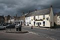 Beaminster, The Square - geograph.org.uk - 922596.jpg 640 × 427; 151 KB
-
 Beaminster, towards Hogshill Street - geograph.org.uk - 922595.jpg 640 × 427; 158 KB
-
 Beaminster, White Hart - geograph.org.uk - 1369615.jpg 640 × 480; 81 KB
-
 Beaminster, White Hart Yard - geograph.org.uk - 922642.jpg 640 × 427; 182 KB
-

-
 Gore Cross Business Park - geograph.org.uk - 1030024.jpg 640 × 426; 60 KB
-
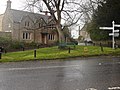 Haselbury Plucknett Village Green - geograph.org.uk - 807330.jpg 640 × 480; 105 KB
-
 Mosterton, Admiral Hood - geograph.org.uk - 1369371.jpg 640 × 480; 67 KB
-
 UK road A3066.PNG 597 × 184; 10 KB


