Category:A1 road in London
Jump to navigation
Jump to search
the section of A1 road in Greater London  | |||||
| Upload media | |||||
| Instance of | |||||
|---|---|---|---|---|---|
| Location |
| ||||
 | |||||
Subcategories
This category has the following 8 subcategories, out of 8 total.
Media in category "A1 road in London"
The following 44 files are in this category, out of 44 total.
-
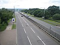
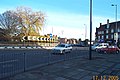
 102 to Brent Cross - geograph.org.uk - 401249.jpg 640 × 480; 124 KB
-
 A1 and A1000.png 600 × 433; 53 KB
-
 A1 Barnet Bypass - geograph.org.uk - 1079703.jpg 640 × 412; 140 KB
-
 A1 Falloden Way in Hampstead - geograph.org.uk - 2285011.jpg 640 × 480; 78 KB
-
 A1 Great North Way north of Hendon - geograph.org.uk - 475104.jpg 640 × 480; 78 KB
-
 A1 in London 1923.jpg 289 × 424; 55 KB
-
 A1 road near Mill Hill - geograph.org.uk - 2507482.jpg 640 × 480; 66 KB
-
 A1 sign towards the Angel - geograph.org.uk - 5839458.jpg 640 × 480; 123 KB
-
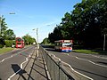
 A1 Upper Street, Islington - geograph.org.uk - 5986622.jpg 1,024 × 768; 318 KB
-
 A1 Upper Street, Islington - geograph.org.uk - 5986722.jpg 1,024 × 768; 304 KB
-
 A1 Watford Way - geograph.org.uk - 1752814.jpg 1,600 × 1,118; 653 KB
-
 A1-A1000 junction.JPG 1,937 × 1,432; 1.82 MB
-
 A1-A406 junction.JPG 3,264 × 2,305; 2.26 MB
-
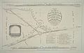 Archway plan.jpg 800 × 507; 54 KB
-
 Aylmer Road - geograph.org.uk - 958812.jpg 640 × 427; 114 KB
-
 Barnet Way, Mill Hill - geograph.org.uk - 2736266.jpg 1,600 × 1,200; 581 KB
-
 Barnet Way, Mill Hill - geograph.org.uk - 2736292.jpg 1,600 × 1,200; 687 KB
-
 Barnet Way, Mill Hill - geograph.org.uk - 2736296.jpg 1,600 × 1,200; 546 KB
-
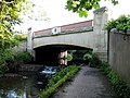
 Bridge over the River Brent, Hendon - geograph.org.uk - 4378760.jpg 2,304 × 1,728; 803 KB
-
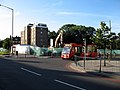 Demolished^ - geograph.org.uk - 493790.jpg 640 × 480; 104 KB
-
 Falloden Way, Hampstead Garden Suburb - geograph.org.uk - 2456652.jpg 1,600 × 1,200; 550 KB
-
 Footbridge over A1 - geograph.org.uk - 3378916.jpg 640 × 428; 96 KB
-
 Footpath by the A1 - geograph.org.uk - 3246795.jpg 640 × 480; 115 KB
-
 Gate on Falloden Way - geograph.org.uk - 838517.jpg 412 × 640; 288 KB
-
 Highgate Archway Company seal.jpg 386 × 291; 80 KB
-
 Lyttelton Road - geograph.org.uk - 1140919.jpg 540 × 640; 209 KB
-
 Lyttelton Road - geograph.org.uk - 438840.jpg 640 × 480; 116 KB
-
 Lyttelton Road - geograph.org.uk - 859269.jpg 640 × 427; 178 KB
-
 Lyttelton Road - geograph.org.uk - 937162.jpg 640 × 448; 134 KB
-
 Lyttelton Road - geograph.org.uk - 937449.jpg 640 × 404; 117 KB
-
 Lyttelton Road at The Bishops Avenue - geograph.org.uk - 3874177.jpg 1,200 × 798; 417 KB
-
 Lyttelton Road, East Finchley - geograph.org.uk - 960577.jpg 640 × 480; 110 KB
-
 Mill Hill, Apex Corner, NW7 - geograph.org.uk - 92471.jpg 640 × 425; 83 KB
-
 Multicolour Houses - geograph.org.uk - 403449.jpg 640 × 445; 116 KB
-
 Snap^ - geograph.org.uk - 937154.jpg 477 × 640; 150 KB
-
 The A1 at Moat Mount - geograph.org.uk - 3561593.jpg 2,560 × 1,920; 1.52 MB
-
 The A1 Crossing Dollis Brook - geograph.org.uk - 452970.jpg 640 × 480; 139 KB
-
 The A1 Falloden Way - geograph.org.uk - 2481330.jpg 1,600 × 1,200; 556 KB
-
 The A1, Lyttelton Road - geograph.org.uk - 3874173.jpg 1,200 × 798; 398 KB
-
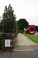
 The Fairway Bus Stop - geograph.org.uk - 3561608.jpg 2,560 × 1,920; 1.23 MB
-
 The Great North Way going over Dollis Brook - geograph.org.uk - 3527431.jpg 1,600 × 1,200; 655 KB
-
 The North A1 sign - geograph.org.uk - 5839461.jpg 640 × 480; 79 KB
-
 This Stop - Belvedere Court - geograph.org.uk - 937405.jpg 427 × 640; 140 KB
-
 Widecombe Way and Norrice Lea - geograph.org.uk - 937159.jpg 640 × 405; 138 KB


