Category:2 Jagiellońska Street in Jelenia Góra
Jump to navigation
Jump to search
| Object location | | View all coordinates using: OpenStreetMap |
|---|
 | |||||
| Upload media | |||||
| Instance of | |||||
|---|---|---|---|---|---|
| Location | |||||
| Street address |
| ||||
| Heritage designation |
| ||||
| Inception |
| ||||
 | |||||
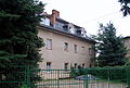
Polski: Jelenia Góra Cieplice Śląskie-Zdrój, ul. Jagiellońska 2 - dawny pałacyk miejski Roemischa, obecnie dom sanatoryjny
Media in category "2 Jagiellońska Street in Jelenia Góra"
The following 9 files are in this category, out of 9 total.
-
 Dawny pałacyk miejski Roemischa w Cieplicach.adrrdga22.JPG 2,272 × 1,704; 1,000 KB
-
 Jelenia Góra - Cieplice, ul. Jagiellońska 2 DSC 0031-001.JPG 3,419 × 2,293; 3.39 MB
-
 Jelenia Góra - Cieplice, ul. Jagiellońska 2 DSC 0034-001.JPG 3,399 × 2,281; 3.97 MB
-
 Jelenia Góra - Cieplice, ul. Jagiellońska 2 DSC 0036-001.JPG 2,195 × 3,282; 4 MB
-
 Jelenia Góra - Cieplice, ul. Jagiellońska 2 DSC 0040-001.JPG 2,226 × 3,326; 2.94 MB
-
 Pałac Römischa (1).jpg 4,032 × 3,024; 3.03 MB
-
 Pałac Römischa (2).jpg 3,971 × 2,978; 3.12 MB
-
 Pałac Römischa (3).jpg 4,032 × 3,024; 4.38 MB
-
 Pałacyk miejski Römischa w Jeleniej Górze-Cieplicach.jpg 4,422 × 2,880; 7.53 MB


.jpg)
.jpg)
.jpg)