Category:21st-century maps of Uganda
Jump to navigation
Jump to search
Countries of Africa: Algeria · Angola · Benin · Botswana · Burkina Faso · Burundi · Cameroon · Cape Verde · Central African Republic · Chad · Comoros · Democratic Republic of the Congo · Republic of the Congo · Djibouti · Egypt‡ · Equatorial Guinea · Eritrea · Eswatini · Ethiopia · Gabon · The Gambia · Ghana · Guinea · Guinea-Bissau · Ivory Coast · Kenya · Lesotho · Liberia · Libya · Madagascar · Malawi · Mali · Mauritania · Morocco · Mozambique · Namibia · Niger · Nigeria · Rwanda · São Tomé and Príncipe · Senegal · Sierra Leone · Somalia · South Africa · South Sudan · Sudan · Tanzania · Togo · Tunisia · Uganda · Zambia · Zimbabwe
Other areas: Western Sahara
‡: partly located in Africa
Other areas: Western Sahara
‡: partly located in Africa
Media in category "21st-century maps of Uganda"
The following 6 files are in this category, out of 6 total.
-
 PAT - Uganda.gif 860 × 975; 296 KB
-
 RAMSAR UGANDA.jpg 2,224 × 2,262; 1.8 MB
-
 Uganda district map 2020.svg 512 × 355; 8.04 MB
-
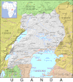
 Uganda large map.jpg 997 × 1,178; 276 KB
-
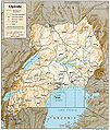
 Uganda Physiography.jpg 1,999 × 2,464; 1.42 MB
-
 Uganda. LOC 2005631139.tif 2,405 × 3,110; 21.4 MB


