Category:2013 maps of Canada
Jump to navigation
Jump to search
Countries of North America: Canada · Costa Rica · Cuba · Guatemala · Honduras · Jamaica · Mexico · United States of America‡
‡: partly located in North America
‡: partly located in North America
| ← 2010 2011 2012 2013 2014 2015 2016 2017 2018 2019 → |
English: Maps of Canada from 2013 or related to Canada in 2013
Français : Les cartes du Canada de 2013 ou se rapportant au Canada en 2013
Media in category "2013 maps of Canada"
The following 17 files are in this category, out of 17 total.
-
 Alberta flood rainfall map 19-22 June 2013.png 1,740 × 1,604; 1.21 MB
-
 BC Election 2013.svg 2,370 × 1,704; 159 KB
-
 Calgary CTrain Map.png 3,465 × 2,639; 93 KB
-
 Canada pictorial.jpg 3,026 × 1,919; 2.88 MB
-
 ECDM 20131223 World Events.pdf 1,625 × 1,125; 337 KB
-
 Edmonton City Council election, 2013 results by ward.svg 612 × 824; 61 KB
-
 Edmonton wards 2013.jpg 1,714 × 2,034; 858 KB
-
 Inco Railway open street map.png 698 × 664; 266 KB
-
 Lac megantic affected area.png 1,191 × 847; 238 KB
-
 LGBT Flag map of Prince Edward Island.png 2,000 × 1,463; 32 KB
-
 Ripleys Aquarium Toronto map.png 1,018 × 674; 809 KB
-
 Stnplot 20130620.gif 1,088 × 783; 70 KB
-
 Strathcona County Council election, 2013 results by ward.svg 612 × 891; 49 KB
-
 Strathcona County wards 2013.jpg 1,656 × 2,576; 794 KB
-
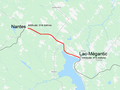 Trajectory of runaway train from Nantes to Lac-Megantic.png 898 × 675; 139 KB
-
 VIA Rail Ocean.svg 800 × 552; 354 KB
-
 Wood Buffalo wards 2013.jpg 1,279 × 2,573; 908 KB


