Category:2010s maps of Finland
Jump to navigation
Jump to search
Countries of Europe: Albania · Armenia‡ · Austria · Belarus · Belgium · Bosnia and Herzegovina · Bulgaria · Croatia · Cyprus‡ · Denmark · Estonia · Finland · France‡ · Georgia‡ · Germany · Greece · Hungary · Iceland · Republic of Ireland · Italy · Kazakhstan‡ · Latvia · Lithuania · Luxembourg · Moldova · Montenegro · Netherlands‡ · Norway · Poland · Portugal‡ · Romania · Russia‡ · Serbia · Slovakia · Slovenia · Spain‡ · Sweden · Switzerland · Turkey‡ · Ukraine · United Kingdom
Limited recognition: Kosovo
‡: partly located in Europe
Limited recognition: Kosovo
‡: partly located in Europe
Subcategories
This category has the following 2 subcategories, out of 2 total.
Media in category "2010s maps of Finland"
The following 5 files are in this category, out of 5 total.
-
 Suomen väestöntiheys vuonna 2016.svg 2,208 × 3,456; 374 KB
-
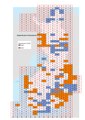 Digitaaliset Maastokartat 50 000 2018-2019.pdf 1,754 × 2,481; 7.54 MB
-
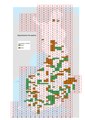 Digitaaliset Peruskartat 2018-2019.pdf 1,754 × 2,481; 7.55 MB
-
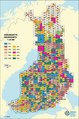
 Maastokartta 50 000 1.1.2018.pdf 1,114 × 1,679; 4.31 MB
-
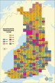
 Peruskartta 25 000 kattavuus 1.1.2018.pdf 1,114 × 1,679; 6.19 MB
