Category:2007 in water transport in the United Kingdom
Jump to navigation
Jump to search
Countries of Europe: Denmark · Finland · France‡ · Germany · Hungary · Netherlands‡ · Norway · Romania · Russia‡ · Spain‡ · Sweden · Turkey‡ · Ukraine · United Kingdom
‡: partly located in Europe
‡: partly located in Europe
Subcategories
This category has the following 2 subcategories, out of 2 total.
L
W
Media in category "2007 in water transport in the United Kingdom"
The following 115 files are in this category, out of 115 total.
-
 Trowlock Island vi.jpg 3,072 × 2,304; 2.83 MB
-
 Trowlock Island vii.jpg 3,072 × 2,304; 3 MB
-
 Terras Lock.jpg 1,024 × 1,366; 755 KB
-
 A muddy foreshore, Grays - geograph.org.uk - 636520.jpg 640 × 482; 121 KB
-
 A tight squeeze on the Shropshire Union - geograph.org.uk - 597458.jpg 640 × 480; 252 KB
-
 A weekend at Ardglass harbour - geograph.org.uk - 322211.jpg 640 × 426; 142 KB
-
 A10 over River Wissey - geograph.org.uk - 508400.jpg 640 × 575; 97 KB
-
 Anchor Statue, Brompton - geograph.org.uk - 518982.jpg 640 × 480; 135 KB
-
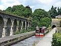 Aqueduct, viaduct and tunnel at Chirk - geograph.org.uk - 1293097.jpg 640 × 480; 104 KB
-

-

-

-
 Aylestone Mill Lock - geograph.org.uk - 752778.jpg 640 × 480; 130 KB
-
 Barby-Oxford Canal - geograph.org.uk - 462057.jpg 640 × 480; 129 KB
-
 Beadnell Harbour - geograph.org.uk - 428266.jpg 640 × 427; 81 KB
-
 Beadnell Harbour - geograph.org.uk - 428727.jpg 640 × 427; 53 KB
-
 Beadnell Harbour - geograph.org.uk - 498852.jpg 480 × 640; 80 KB
-
 Blakeney Harbour - geograph.org.uk - 661462.jpg 640 × 429; 48 KB
-
 Blakeney Harbour - geograph.org.uk - 661465.jpg 640 × 429; 75 KB
-
 Blakeney Harbour Boat - geograph.org.uk - 661461.jpg 640 × 429; 48 KB
-

-
 Boats at Boal Quay - geograph.org.uk - 524902.jpg 640 × 480; 78 KB
-
 Boats at Cadgwith - geograph.org.uk - 635278.jpg 640 × 480; 108 KB
-
 Boats in Padstow harbour - geograph.org.uk - 462874.jpg 640 × 480; 69 KB
-
 Boats in tandem, River Thames, Hurley - geograph.org.uk - 597023.jpg 640 × 480; 123 KB
-
 Boats on the river Ouse, from Lendal. - geograph.org.uk - 529329.jpg 640 × 440; 84 KB
-
 Bracebridge Lock, Chesterfield Canal - geograph.org.uk - 453328.jpg 640 × 480; 106 KB
-
 Bringing back the catch - geograph.org.uk - 449467.jpg 640 × 426; 62 KB
-
 Bulk Chemical Carrier and Jetty - geograph.org.uk - 636533.jpg 640 × 480; 76 KB
-
 Bulk Liquid Reception Jetty, Grays - geograph.org.uk - 636514.jpg 466 × 640; 66 KB
-
 Busy Ardglass harbour - geograph.org.uk - 542279.jpg 640 × 426; 82 KB
-
 Canal basin at Dunhampstead - geograph.org.uk - 466798.jpg 640 × 480; 146 KB
-
 Canal basin at Ulverston - geograph.org.uk - 496605.jpg 640 × 480; 80 KB
-
 Canal Basin, Near the Royal Armouries - geograph.org.uk - 336937.jpg 640 × 426; 63 KB
-
 Canal moorings - geograph.org.uk - 495575.jpg 640 × 451; 132 KB
-
 Chesterfield Canal - geograph.org.uk - 451513.jpg 640 × 480; 91 KB
-
 Covenham Reservoir Sailing Club - geograph.org.uk - 322302.jpg 640 × 480; 79 KB
-
 Coventry Canal, Huddlesford - geograph.org.uk - 563332.jpg 640 × 480; 73 KB
-
 Departure from Lymington - geograph.org.uk - 601734.jpg 640 × 477; 68 KB
-
 Deserted Jetty - geograph.org.uk - 711414.jpg 640 × 426; 56 KB
-
 Diglis Lock, Worcester - geograph.org.uk - 613692.jpg 640 × 426; 59 KB
-
 Down to the new jetties - geograph.org.uk - 549311.jpg 640 × 480; 59 KB
-
 Dry Dock, Langley Mill - geograph.org.uk - 551206.jpg 640 × 428; 107 KB
-
 Dry Dock, Little Hallingbury Marina - geograph.org.uk - 501960.jpg 480 × 640; 95 KB
-

-
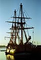 Endeavour (2047406259) (2).jpg 537 × 792; 80 KB
-
 Falmouth Docks - geograph.org.uk - 465517.jpg 640 × 228; 26 KB
-
 Falmouth Docks - geograph.org.uk - 465524.jpg 640 × 480; 61 KB
-
 Falmouth harbour - geograph.org.uk - 462651.jpg 640 × 480; 50 KB
-
 Felixstowe waterfront on a quiet day - geograph.org.uk - 591055.jpg 640 × 480; 75 KB
-
 Ferry landing at Burnham - geograph.org.uk - 516960.jpg 640 × 480; 77 KB
-
 Ferry, Orford Ness - geograph.org.uk - 535535.jpg 640 × 480; 64 KB
-

-

-

-
 Grand Union Canal. - geograph.org.uk - 468932.jpg 640 × 480; 127 KB
-
 Harbour wall at Portscatho - geograph.org.uk - 561818.jpg 640 × 480; 143 KB
-

-
 HertfordBasin.jpg 2,048 × 1,536; 622 KB
-

-

-
 Kings Lock - geograph.org.uk - 366174.jpg 640 × 404; 164 KB
-

-

-
 Lock 56, Forest Locks - geograph.org.uk - 453822.jpg 640 × 480; 85 KB
-
 Lock and School, Stone, Staffordshire - geograph.org.uk - 604354.jpg 640 × 480; 133 KB
-
 Lock keeper's cottage at Astwood Lock - geograph.org.uk - 503504.jpg 640 × 480; 110 KB
-

-
-
 Low tide at Portscatho harbour - geograph.org.uk - 561803.jpg 628 × 466; 113 KB
-
 Lymington Marina - geograph.org.uk - 906931.jpg 640 × 480; 42 KB
-
 Midland Metro over Tame Valley Canal.jpg 2,592 × 1,944; 1.31 MB
-
 Mousehole Harbour - geograph.org.uk - 1342606.jpg 640 × 480; 57 KB
-
 Mousehole Harbour - geograph.org.uk - 1424827.jpg 640 × 480; 109 KB
-
 Mousehole Harbour at Christmas - geograph.org.uk - 653912.jpg 640 × 427; 65 KB
-
 Muddy foreshore, Seahouses harbour - geograph.org.uk - 410668.jpg 640 × 426; 121 KB
-
 Narrow boat, Stratford Upon Avon - geograph.org.uk - 403045.jpg 640 × 480; 86 KB
-
 Narrow-boat, on the Avon - geograph.org.uk - 394000.jpg 640 × 430; 96 KB
-
 Narrowboats - geograph.org.uk - 433040.jpg 640 × 480; 102 KB
-
 Narrowboats and flotsam - geograph.org.uk - 505580.jpg 640 × 480; 82 KB
-
 Narrowboats on the Grand Union Canal - geograph.org.uk - 325919.jpg 640 × 480; 113 KB
-
 New Cross Bridge - geograph.org.uk - 334359.jpg 600 × 450; 220 KB
-
 Old River Ouse - geograph.org.uk - 593029.jpg 640 × 479; 128 KB
-

-
 Padstow Harbour - geograph.org.uk - 462876.jpg 640 × 480; 57 KB
-
 Padstow Harbour - geograph.org.uk - 462897.jpg 640 × 294; 29 KB
-
 Padstow harbour - geograph.org.uk - 690287.jpg 640 × 427; 244 KB
-
 Portscatho - geograph.org.uk - 561816.jpg 640 × 480; 143 KB
-
 Portscatho Harbour - geograph.org.uk - 553984.jpg 640 × 428; 106 KB
-
 Regent's Canal - geograph.org.uk - 588770.jpg 640 × 480; 137 KB
-
 River Thames, Cross Ness lighthouse - geograph.org.uk - 574923.jpg 640 × 480; 92 KB
-
 Saltford Marina - geograph.org.uk - 547659.jpg 640 × 426; 146 KB
-
 Sennen Cove - geograph.org.uk - 449460.jpg 640 × 426; 88 KB
-
 Shotley Marina and Lock control tower - geograph.org.uk - 659105.jpg 640 × 480; 48 KB
-
 Slipway - geograph.org.uk - 542303.jpg 640 × 480; 76 KB
-
 St Mawes - geograph.org.uk - 477442.jpg 640 × 427; 165 KB
-
 Staithes Harbour - geograph.org.uk - 699980.jpg 640 × 430; 71 KB
-
 Staithes, North Yorkshire - geograph.org.uk - 1099745.jpg 640 × 480; 102 KB
-

-
 Stoke-on-Trent - Cockshutts Lock - geograph.org.uk - 609403.jpg 640 × 480; 93 KB
-
 Stourport Basin - geograph.org.uk - 499488.jpg 640 × 461; 115 KB
-
 Tardebigge New Wharf - geograph.org.uk - 522939.jpg 640 × 428; 110 KB
-
 Tenby Harbour - geograph.org.uk - 411384.jpg 640 × 460; 76 KB
-
 The Basingstoke Canal - geograph.org.uk - 546473.jpg 640 × 480; 189 KB
-
 The inner harbour, Penzance - geograph.org.uk - 450052.jpg 640 × 425; 67 KB
-
 The Quay, Sennen Cove - geograph.org.uk - 629639.jpg 640 × 480; 112 KB
-
 The Sea France arrival at Dover - geograph.org.uk - 1188463.jpg 640 × 426; 65 KB
-

-

-
 Vessels at Rest - geograph.org.uk - 493711.jpg 640 × 480; 77 KB
-
 Walberswick Ferry - geograph.org.uk - 631103.jpg 640 × 481; 88 KB
-
 Weymouth inshore lifeboat house.jpg 1,024 × 768; 211 KB
-
 Woolverstone Marina - geograph.org.uk - 553051.jpg 520 × 640; 83 KB
-
 Yacht leaving Christchurch Harbour - geograph.org.uk - 493691.jpg 640 × 480; 100 KB
-
 Yachts at Lymington - geograph.org.uk - 601732.jpg 640 × 477; 67 KB


_(2).jpg)


